


Summary
Yarrow Point is a town in King County, Washington, United States. The population was 1,134 at the 2020 census.
Yarrow Point, Washington | |
|---|---|
 Yarrow Point Town Hall | |
 Location of Yarrow Point, Washington | |
| Coordinates: 47°38′39″N 122°13′0″W / 47.64417°N 122.21667°W | |
| Country | United States |
| State | Washington |
| County | King |
| Government | |
| • Mayor | Katy Harris[1] |
| Area | |
| • Total | 0.80 sq mi (2.08 km2) |
| • Land | 0.37 sq mi (0.95 km2) |
| • Water | 0.44 sq mi (1.14 km2) |
| Elevation | 125 ft (38 m) |
| Population | |
| • Total | 1,134 |
| • Density | 3,139.34/sq mi (1,211.34/km2) |
| Time zone | UTC-8 (Pacific (PST)) |
| • Summer (DST) | UTC-7 (PDT) |
| ZIP code | 98004 |
| Area code | 425 |
| FIPS code | 53-80150 |
| GNIS feature ID | 1510418[4] |
| Website | ci.yarrow-point.wa.us |
Based on per capita income, one of the more reliable measures of affluence, Yarrow Point ranks fifth of 522 areas in the state of Washington to be ranked.
History edit
Before the arrival of settlers the Duwamish set up two longhouses along Yarrow Bay, although most of the tribe lived in the area occupied by the present day cities of Renton and Seattle.[5] The town was named by newspaper publisher Leigh S. J. Hunt, who lived there from 1886 to 1895, after the Yarrow flower.[6] Yarrow Point was officially incorporated on June 15, 1959.
Geography edit
Yarrow Point occupies a peninsula near the eastern edge of Lake Washington, lying between the lake's Cozy Cove and Yarrow Bay and nearly all of it north of Washington State Route 520. It is bordered by Hunts Point on the west, Clyde Hill on the south, and by Kirkland on the east.
According to the United States Census Bureau, the town has a total area of 0.36 square miles (0.93 km2).[7]
Politics edit
| Year | Republican | Democratic | Third Parties |
|---|---|---|---|
| 2020 | 26.29% 209 | 70.69% 562 | 3.02% 24 |
| 2016 | 29.83% 207 | 58.93% 409 | 11.24% 78 |
On the national level, Yarrow Point previously leaned toward the Republican Party. In 2004, Republican George W. Bush received 52 percent of the vote here, defeating Democrat John Kerry, who received around 47 percent. However, in the 2016 presidential election, of the 694 residents who voted, 58.93% voted for Hillary Clinton and 29.83% for Donald Trump.[9] The town moved further into the Democratic column in the 2020 presidential election, as 70.69% of those who voted voted for Joe Biden, while 26.29% voted for Donald Trump. [citation needed]
Demographics edit
| Census | Pop. | Note | %± |
|---|---|---|---|
| 1960 | 766 | — | |
| 1970 | 1,101 | 43.7% | |
| 1980 | 1,064 | −3.4% | |
| 1990 | 962 | −9.6% | |
| 2000 | 1,008 | 4.8% | |
| 2010 | 1,001 | −0.7% | |
| 2020 | 1,134 | 13.3% | |
| 2021 (est.) | 1,117 | [10] | −1.5% |
| U.S. Decennial Census[11] | |||
2010 census edit
As of the 2010 census,[12] there were 1,001 people, 374 households, and 299 families living in the town. The population density was 2,780.6 inhabitants per square mile (1,073.6/km2). There were 407 housing units at an average density of 1,130.6 per square mile (436.5/km2). The racial makeup of the town was 86.4% White, 0.1% African American, 0.2% Native American, 8.8% Asian, 0.7% from other races, and 3.8% from two or more races. Hispanic or Latino of any race were 1.6% of the population.
There were 374 households, of which 39.8% had children under the age of 18 living with them, 72.5% were married couples living together, 5.6% had a female householder with no husband present, 1.9% had a male householder with no wife present, and 20.1% were non-families. 17.4% of all households were made up of individuals, and 10.4% had someone living alone who was 65 years of age or older. The average household size was 2.68 and the average family size was 3.04.
The median age in the town was 46.8 years. 27.7% of residents were under the age of 18; 3.6% were between the ages of 18 and 24; 15.7% were from 25 to 44; 33.5% were from 45 to 64; and 19.6% were 65 years of age or older. The gender makeup of the town was 49.6% male and 50.4% female.
2000 census edit
As of the 2000 census, there were 1,008 people, 379 households, and 308 families living in the town. The population density was 2,720.3 people per square mile (1,051.9/km2). There were 393 housing units at an average density of 1,060.6 per square mile (410.1/km2). The racial makeup of the town was 93.65% White, 0.79% African American, 3.17% Asian, 0.69% from other races, and 1.69% from two or more races. Hispanic or Latino of any race were 1.98% of the population.
There were 379 households, out of which 34.6% had children under the age of 18 living with them, 78.4% were married couples living together, 1.6% had a female householder with no husband present, and 18.5% were non-families. 15.3% of all households were made up of individuals, and 7.7% had someone living alone who was 65 years of age or older. The average household size was 2.66 and the average family size was 2.96.
In the town, the population was spread out, with 25.9% under the age of 18, 3.7% from 18 to 24, 20.9% from 25 to 44, 30.9% from 45 to 64, and 18.7% who were 65 years of age or older. The median age was 45 years. For every 100 females, there were 102.0 males. For every 100 females age 18 and over, there were 95.5 males.
The median income for a household in the town was $117,940, and the median income for a family was $126,075. Males had a median income of $100,000 versus $52,500 for females. The per capita income for the town was $72,135. About 1.6% of families and 3.4% of the population were below the poverty line, including 6.4% of those under age 18 and none of those age 65 or over.
Education edit
The city is in the Bellevue School District.[13]
Residents are zoned to: Clyde Hill Elementary School,[14] Chinook Middle School,[15] and Bellevue High School.[16]
Notable people edit
- Chris Ballew, musician[17]
Gallery edit
-
 Yarrow Point Water Fountain
 -
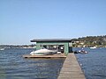
 On NE 42nd Pl. looking east near a dock
 -
 At a dock at the end of NE 42nd Pl. in Yarrow Point.


References edit
- ^ "Town Mayor and Council". Town of Yarrow Point. Retrieved March 26, 2022.
- ^ "2019 U.S. Gazetteer Files". United States Census Bureau. Retrieved August 7, 2020.
- ^ "Census Bureau profile: Yarrow Point, Washington". United States Census Bureau. May 2023. Retrieved March 13, 2024.
- ^ "Yarrow Point". Geographic Names Information System. United States Geological Survey, United States Department of the Interior.
- ^ Neiwert, David (2005). Strawberry Days. Palgrave Macmillan. p. 28. ISBN 978-1403967923.
- ^ Hitchman, Robert (1985). Place Names of Washington. Washington State Historical Society. p. 339. ISBN 0-917048-57-1.
- ^ "US Gazetteer files 2010". United States Census Bureau. Retrieved December 19, 2012.
- ^ King County Elections
- ^ "2016 General - Election Results by precinct (Complete eCanvass dataset) | King County | Open Data".
- ^ "City and Town Population Totals: 2020-2021". United States Census Bureau. August 11, 2022. Retrieved August 11, 2022.
- ^ United States Census Bureau. "Census of Population and Housing". Retrieved July 31, 2013.
- ^ "U.S. Census website". United States Census Bureau. Retrieved December 19, 2012.
- ^ U.S. Census Bureau Geography Division (December 21, 2020). 2020 Census – School District Reference Map: King County, WA (PDF) (Map). 1:80,000. U.S. Census Bureau. p. 2. Retrieved August 3, 2022.
- ^ "Bellevue School District Elementary School Attendance Area (2019)" (PDF). Bellevue School District. Retrieved August 3, 2022.
- ^ "Bellevue School District Middle School Attendance Area (2019)" (PDF). Bellevue School District. Retrieved August 3, 2022.
- ^ "Bellevue School District High School Attendance Area (2019)" (PDF). Bellevue School District. Retrieved August 3, 2022.
- ^ Casey McNerthney (November 16, 2016). "Presidents of the United States of America - band behind 'Lump' and 'Peaches' - announces retirement". KIRO-TV.
External links edit
- Town of Yarrow Point