
KNOWPIA
WELCOME TO KNOWPIA

Yarsky District 
Summary
Yarsky District (Russian: Я́рский райо́н; Udmurt: Яр ёрос, Jar joros) is an administrative[1] and municipal[7] district (raion), one of the twenty-five in the Udmurt Republic, Russia. It is located in the northwest of the republic. The area of the district is 1,524.3 square kilometers (588.5 sq mi).[3] Its administrative center is the rural locality (a settlement) of Yar.[2] Population: 15,286 (2010 Russian census);[5] 18,880 (2002 Census);[9] 20,595 (1989 Soviet census).[10] The population of Yar accounts for 43.2% of the district's total population.[5]
Yarsky District
Ярский район | |
|---|---|
| Other transcription(s) | |
| • Udmurt | Яр ёрос |
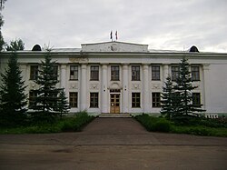 Yarsky District Administration building in Yar | |
 Flag  Coat of arms | |
 Location of Yarsky District in the Udmurt Republic | |
| Coordinates: 58°14′42″N 51°30′11″E / 58.245°N 51.503°E | |
| Country | Russia |
| Federal subject | Udmurt Republic[1] |
| Established | 15 July 1929 |
| Administrative center | Yar[2] |
| Area | |
| • Total | 1,524.3 km2 (588.5 sq mi) |
| Population | |
| • Total | 15,286 |
| • Estimate (2018)[6] | 13,419 (−12.2%) |
| • Density | 10/km2 (26/sq mi) |
| • Urban | 43.2%[4] |
| • Rural | 56.8% |
| Administrative structure | |
| • Administrative divisions | 11 selsoviet |
| • Inhabited localities | 68 rural localities |
| Municipal structure | |
| • Municipally incorporated as | Yarsky Municipal District[7] |
| • Municipal divisions[7] | 0 urban settlements, 10 rural settlements |
| Time zone | UTC+4 (MSK+1 |
| OKTMO ID | 94652000 |
| Website | http://www.yar.udmurt.ru/ |
References edit
Notes edit
- ^ a b Constitution of the Udmurt Republic
- ^ a b Law #46-RZ
- ^ a b "Yarsky" (in Russian). Federal State Statistics Service, Russian Federation. Retrieved August 27, 2016.
- ^ The work settlement of Yar, the only urban locality in the district, was demoted in status to that of a rural locality in November 2011
- ^ a b c Russian Federal State Statistics Service (2011). Всероссийская перепись населения 2010 года. Том 1 [2010 All-Russian Population Census, vol. 1]. Всероссийская перепись населения 2010 года [2010 All-Russia Population Census] (in Russian). Federal State Statistics Service.
- ^ "26. Численность постоянного населения Российской Федерации по муниципальным образованиям на 1 января 2018 года". Federal State Statistics Service. Retrieved January 23, 2019.
- ^ a b c Law #83-RZ
- ^ "Об исчислении времени". Официальный интернет-портал правовой информации (in Russian). June 3, 2011. Retrieved January 19, 2019.
- ^ Federal State Statistics Service (May 21, 2004). Численность населения России, субъектов Российской Федерации в составе федеральных округов, районов, городских поселений, сельских населённых пунктов – районных центров и сельских населённых пунктов с населением 3 тысячи и более человек [Population of Russia, Its Federal Districts, Federal Subjects, Districts, Urban Localities, Rural Localities—Administrative Centers, and Rural Localities with Population of Over 3,000] (XLS). Всероссийская перепись населения 2002 года [All-Russia Population Census of 2002] (in Russian).
- ^ Всесоюзная перепись населения 1989 г. Численность наличного населения союзных и автономных республик, автономных областей и округов, краёв, областей, районов, городских поселений и сёл-райцентров [All Union Population Census of 1989: Present Population of Union and Autonomous Republics, Autonomous Oblasts and Okrugs, Krais, Oblasts, Districts, Urban Settlements, and Villages Serving as District Administrative Centers]. Всесоюзная перепись населения 1989 года [All-Union Population Census of 1989] (in Russian). Институт демографии Национального исследовательского университета: Высшая школа экономики [Institute of Demography at the National Research University: Higher School of Economics]. 1989 – via Demoscope Weekly.
Sources edit
- Верховный Совет Удмуртской Республики. №663-XII 7 декабря 1994 г. «Конституция Удмуртской Республики», в ред. Закона №37-РЗ от 9 октября 2009 г «О внесении поправок к Конституции Удмуртской Республики». Опубликован: "Известия Удмуртской Республики", №№198-199, 27 декабря 1994 г. (Supreme Council of the Udmurt Republic. #663-XII December 7, 1994 Constitution of the Udmurt Republic, as amended by the Law #37-RZ of October 9, 2009 On Amending the Constitution of the Udmurt Republic. ).
- Государственный Совет Удмуртской Республики. Закон №83-РЗ от 8 декабря 2004 г. «Об установлении границ муниципальных образований и наделении соответствующим статусом муниципальных образований на территории Ярского района Удмуртской Республики», в ред. Закона №3-РЗ от 4 марта 2011 г. «О внесении изменений в Закон Удмуртской Республики "Об установлении границ муниципальных образований и наделении соответствующим статусом муниципальных образований на территории Ярского района Удмуртской Республики" и статью 5 Закона Удмуртской Республики "Об административно-территориальном устройстве Удмуртской Республики"». Вступил в силу с 1 января 2005 г. Опубликован: "Сельская правда", №4, 21 января 2005 г. (State Council of the Udmurt Republic. Law #83-RZ of December 8, 2004 On Establishing the Borders of the Municipal Formations and Granting the Status to the Municipal Formations on the Territory of Yarsky District of the Udmurt Republic, as amended by the Law #3-RZ of March 4, 2011 On Amending the Law of the Udmurt Republic "On Establishing the Borders of the Municipal Formations and Granting the Status to the Municipal Formations on the Territory of Yarsky District of the Udmurt Republic" and Article 5 of the Law of the Udmurt Republic "On the Administrative-Territorial Structure of the Udmurt Republic". Effective as of January 1, 2005.).
- Государственный Совет Удмуртской Республики. Закон №46-РЗ от 19 октября 2006 г. «Об административно-территориальном устройстве Удмуртской Республики», в ред. Закона №60-РЗ от 12 октября 2012 г. «О внесении изменений в отдельные Законы Удмуртской Республики». Вступил в силу через десять дней после официального опубликования. Опубликован: "Известия Удмуртской Республики", №185, 12 декабря 2006 г. (State Council of the Udmurt Republic. Law #46-RZ of October 19, 2006 On the Administrative-Territorial Structure of the Udmurt Republic, as amended by the Law #60-RZ of October 12, 2012 On Amending Various Laws of the Udmurt Republic. Effective as of the day which is ten days after the official publication.).