


Summary
Yei Airport is an airport serving Yei in South Sudan.
Yei Airport | |||||||||||
|---|---|---|---|---|---|---|---|---|---|---|---|
| Summary | |||||||||||
| Airport type | Public, Civilian | ||||||||||
| Owner | Civil Aviation Authority of South Sudan | ||||||||||
| Serves | Yei, South Sudan | ||||||||||
| Location | Yei, | ||||||||||
| Elevation AMSL | 2,726 ft / 831 m | ||||||||||
| Coordinates | 04°07′57″N 30°43′17″E / 4.13250°N 30.72139°E | ||||||||||
| Map | |||||||||||
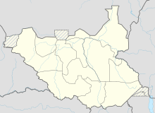 Yei Airport | |||||||||||
| Runways | |||||||||||
| |||||||||||
Location edit
Yei Airport (IATA: n/a, ICAO: HSYE) is located in Yei County in Yei River State, in the city of Yei, in the southwestern part of South Sudan, near the International borders with Uganda and the Democratic Republic of the Congo. The airport is located northeast of the central business district, on the road to Juba.
This location lies approximately 135 kilometres (84 mi), by air, southwest of Juba International Airport, the largest airport in South Sudan.[1] The geographic coordinates of this airport are: 4° 7' 57.00"N, 30° 43' 17.00"E (Latitude: 4.132500; Longitude: 30.721390). Yei Airport is situated 831 metres (2,726 ft) above sea level.[2] The airport has a single unpaved runway, the dimensions of which are not publicly known at this time.
Airlines and destinations edit
| Airlines | Destinations |
|---|---|
| Eagle Air | Arua, Entebbe[3] |
See also edit
References edit
- ^ "Distance between Juba () (Airport) and Yambari (Al Wilayah al Istiwa'iyah) (Sudan)". distancecalculator.globefeed.com. Retrieved 2018-08-26.
- ^ "Maps, Weather, Videos, and Airports for Yei, Sudan". www.fallingrain.com. Retrieved 2018-08-26.
- ^ Eagle Air (1 August 2014). "Eagle Air Scheduled Flight Times Effective 1 August 2014". Entebbe: Eagle Air. Archived from the original on 14 October 2016. Retrieved 16 November 2016.
External links edit
- Location of Yei Airport At Google Maps
4°07′57″N 30°43′17″E / 4.132500°N 30.721390°E