
KNOWPIA
WELCOME TO KNOWPIA

Zanjan County 
Summary
Zanjan County (Persian: شهرستان زنجان) is in Zanjan province, Iran. Its capital is the city of Zanjan.[3]
Zanjan County
Persian: شهرستان زنجان | |
|---|---|
County | |
 Location of Zanjan County in Zanjan province (top, green) | |
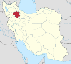 Location of Zanjan province in Iran | |
| Coordinates: 36°51′N 48°10′E / 36.850°N 48.167°E[1] | |
| Country | |
| Province | Zanjan |
| Capital | Zanjan |
| Districts | Central, Qareh Poshtelu, Zanjanrud |
| Population (2016)[2] | |
| • Total | 521,302 |
| Time zone | UTC+3:30 (IRST) |
| Zanjan County can be found at GEOnet Names Server, at this link, by opening the Advanced Search box, entering "-3197431" in the "Unique Feature Id" form, and clicking on "Search Database". | |
At the 2006 National Census, the county's population was 442,728 in 113,883 households.[4] The following census in 2011 counted 486,495 people in 137,832 households.[5] At the 2016 census, there were 521,302 in 159,020 households.[2]
Administrative divisions edit
The population history and structural changes of Zanjan County's administrative divisions over three consecutive censuses are shown in the following table. The latest census shows three districts, 13 rural districts, and three cities.[2]
| Administrative Divisions | 2006[4] | 2011[5] | 2016[2] |
|---|---|---|---|
| Central District | 395,149 | 442,924 | 482,025 |
| Bonab RD | 11,782 | 13,665 | 14,146 |
| Bughda Kandi RD | 8,586 | 8,442 | 7,133 |
| Mojezat RD | 12,448 | 12,247 | 10,195 |
| Qoltuq RD | 5,284 | 4,632 | 3,530 |
| Taham RD | 3,336 | 3,555 | 2,578 |
| Zanjanrud-e Bala RD | 11,912 | 13,532 | 13,572 |
| Zanjan (city) | 341,801 | 386,851 | 430,871 |
| Qareh Poshtelu District | 17,153 | 16,516 | 15,969 |
| Qareh Poshtelu-e Bala RD | 13,915 | 11,917 | 5,147 |
| Qareh Poshtelu-e Pain RD | 3,238 | 2,654 | 2,324 |
| Soharin RD | 6,349 | ||
| Armaghankhaneh (city) | 1,945 | 2,149 | |
| Zanjanrud District | 30,426 | 27,055 | 23,307 |
| Chaypareh-ye Bala RD | 4,379 | 4,162 | 4,033 |
| Chaypareh-ye Pain RD | 4,732 | 4,178 | 3,797 |
| Qanibeyglu RD | 9,629 | 8,413 | 6,674 |
| Zanjanrud-e Pain RD | 11,686 | 10,302 | 8,348 |
| Nik Pey (city) | 455 | ||
| Total | 442,728 | 486,495 | 521,302 |
| RD: Rural District | |||
Wikimedia Commons has media related to Zanjan County.
References edit
- ^ OpenStreetMap contributors (2 March 2024). "Zanjan County" (Map). OpenStreetMap. Retrieved 2 March 2024.
- ^ a b c d "Census of the Islamic Republic of Iran, 1395 (2016)". AMAR (in Persian). The Statistical Center of Iran. p. 19. Archived from the original (Excel) on 27 April 2022. Retrieved 19 December 2022.
- ^ Habibi, Hassan (7 July 1369). "Approval of the organization and chain of citizenship of elements and units of country divisions of Zanjan province, centered in Zanjan city". Lamtakam (in Persian). Ministry of Interior, Council of Ministers. Archived from the original on 16 December 2023. Retrieved 16 December 2023.
- ^ a b "Census of the Islamic Republic of Iran, 1385 (2006)". AMAR (in Persian). The Statistical Center of Iran. p. 19. Archived from the original (Excel) on 20 September 2011. Retrieved 25 September 2022.
- ^ a b "Census of the Islamic Republic of Iran, 1390 (2011)". Syracuse University (in Persian). The Statistical Center of Iran. p. 19. Archived from the original (Excel) on 21 January 2023. Retrieved 19 December 2022.