


Summary
Zheleznogorsky District (Russian: Железного́рский райо́н) is an administrative[1] and municipal[6] district (raion), one of the twenty-eight in Kursk Oblast, Russia. It is located in the north of the oblast. The area of the district is 991 square kilometers (383 sq mi).[2] Its administrative center is the town of Zheleznogorsk (which is not administratively a part of the district).[1] Population: 15,478 (2021 Census);[8] 16,289 (2010 Russian census);[3] 18,192 (2002 Census);[9] 19,571 (1989 Soviet census).[10]
Zheleznogorsky District
Железногорский район | |
|---|---|
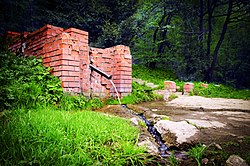 Artesian spring, Zheleznogorsky District | |
 Coat of arms | |
 Location of Zheleznogorsky District in Kursk Oblast | |
| Coordinates: 52°20′N 35°22′E / 52.333°N 35.367°E | |
| Country | Russia |
| Federal subject | Kursk Oblast[1] |
| Established | 30 July 1928 |
| Administrative center | Zheleznogorsk[1] |
| Area | |
| • Total | 991 km2 (383 sq mi) |
| Population | |
| • Total | 16,289 |
| • Estimate (2018)[4] | 15,564 (−4.5%) |
| • Density | 16/km2 (43/sq mi) |
| • Urban | 12.1% |
| • Rural | 87.9% |
| Administrative structure | |
| • Administrative divisions | 1 Work settlements, 18 Selsoviets |
| • Inhabited localities[1] | 1 Urban-type settlements[5], 110 rural localities |
| Municipal structure | |
| • Municipally incorporated as | Zheleznogorsky Municipal District[6] |
| • Municipal divisions[6] | 1 urban settlements, 17 rural settlements |
| Time zone | UTC+3 (MSK |
| OKTMO ID | 38610000 |
| Website | http://zhel.rkursk.ru/ |
Geography edit
Zheleznogorsky District is located in the northwest of Kursk Oblast, on the border with Oryol Oblast to the north. The terrain is hilly plain averaging 200 meters above sea level; the district lies on the Orel-Kursk plateau of the Central Russian Upland. The main river in the district is the Svapa River, which flows to the west through the district; it is a tributary in the Dniepr River basin. The district is 50 km southwest of the city of Kursk, and 400 km southwest of Moscow. The area measures 40 km (north-south), and 30 km (west-east). The administrative center is the town of Zheleznogorsk.[2]
The district is bordered on the north by Oryol Oblast, on the east by Fatezhsky District, on the south by Konyshyovsky District, and on the west by Dmitriyevsky District.
Administrative and municipal status edit
Within the framework of administrative divisions, Zheleznogorsky District is one of the twenty-eight in the oblast.[1] The town of Zheleznogorsk serves as its administrative center, despite being incorporated separately as a town of oblast significance—an administrative unit with the status equal to that of the districts.[1]
As a municipal division, the district is incorporated as Zheleznogorsky Municipal District.[6] The town of oblast significance of Zheleznogorsk is incorporated separately from the district as Zheleznogorsk Urban Okrug.[6]
References edit
Notes edit
- ^ a b c d e f g Resolution #489
- ^ a b c "General Information" (in Russian). Zheleznogorsky District. Retrieved August 31, 2016.
- ^ a b Russian Federal State Statistics Service (2011). Всероссийская перепись населения 2010 года. Том 1 [2010 All-Russian Population Census, vol. 1]. Всероссийская перепись населения 2010 года [2010 All-Russia Population Census] (in Russian). Federal State Statistics Service.
- ^ "26. Численность постоянного населения Российской Федерации по муниципальным образованиям на 1 января 2018 года". Federal State Statistics Service. Retrieved January 23, 2019.
- ^ The count of urban-type settlements may include the work settlements, the resort settlements, the suburban (dacha) settlements, as well as urban-type settlements proper.
- ^ a b c d e Law #48-ZKO
- ^ "Об исчислении времени". Официальный интернет-портал правовой информации (in Russian). June 3, 2011. Retrieved January 19, 2019.
- ^ Russian Federal State Statistics Service. Всероссийская перепись населения 2020 года. Том 1 [2020 All-Russian Population Census, vol. 1] (XLS) (in Russian). Federal State Statistics Service.
- ^ Federal State Statistics Service (May 21, 2004). Численность населения России, субъектов Российской Федерации в составе федеральных округов, районов, городских поселений, сельских населённых пунктов – районных центров и сельских населённых пунктов с населением 3 тысячи и более человек [Population of Russia, Its Federal Districts, Federal Subjects, Districts, Urban Localities, Rural Localities—Administrative Centers, and Rural Localities with Population of Over 3,000] (XLS). Всероссийская перепись населения 2002 года [All-Russia Population Census of 2002] (in Russian).
- ^ Всесоюзная перепись населения 1989 г. Численность наличного населения союзных и автономных республик, автономных областей и округов, краёв, областей, районов, городских поселений и сёл-райцентров [All Union Population Census of 1989: Present Population of Union and Autonomous Republics, Autonomous Oblasts and Okrugs, Krais, Oblasts, Districts, Urban Settlements, and Villages Serving as District Administrative Centers]. Всесоюзная перепись населения 1989 года [All-Union Population Census of 1989] (in Russian). Институт демографии Национального исследовательского университета: Высшая школа экономики [Institute of Demography at the National Research University: Higher School of Economics]. 1989 – via Demoscope Weekly.
Sources edit
- Губернатор Курской области. Постановление №489 от 6 ноября 2008 г. «Об утверждении реестра административно-территориальных единиц населённых пунктов Курской области», в ред. Постановления №26-пг от 29 января 2013 г. «О внесении изменений и дополнений в Постановление Губернатора Курской области от 06.11.2008 №489 "Об утверждении реестра административно-территориальных единиц населённых пунктов Курской области"». Вступил в силу 6 ноября 2008 г. (Governor of Kursk Oblast. Resolution #489 of November 6, 2008 On the Adoption of the Registry of the Administrative-Territorial Units and Inhabited Localities of Kursk Oblast, as amended by the Resolution #26-pg of January 29, 2013 On Amending and Supplementing Resolution #489 of the Governor of Kursk Oblast of November 6, 2008 "On the Adoption of the Registry of the Administrative-Territorial Units and Inhabited Localities of Kursk Oblast". Effective as of November 6, 2008.).
- Курская областная Дума. Закон №48-ЗКО от 21 октября 2004 г. «О муниципальных образованиях Курской области», в ред. Закона №65-ЗКО от 23 августа 2011 г. «О внесении изменений и дополнений в Закон Курской области "О границах муниципальных образований Курской области", Закон Курской области "О муниципальных образованиях Курской области"». Вступил в силу со дня официального опубликования. Опубликован: "Курская правда", №214, 30 октября 2004 г. (Kursk Oblast Duma. Law #48-ZKO of October 21, 2004 On the Municipal Formations of Kursk Oblast, as amended by the Law #65-ZKO of August 23, 2011 On Amending and Supplementing the Law of Kursk Oblast "On the Borders of the Municipal Formations of Kursk Oblast", Law of Kursk Oblast "On the Municipal Formations of Kursk Oblast". Effective as of the day of the official publication.).
External links edit
- Zheleznogorsky District on Google Maps
- Zheleznogorsky District on OpenStreetMap