
KNOWPIA
WELCOME TO KNOWPIA

Aramil 
Summary
Aramil (Russian: Арами́ль) is a town in Sysertsky District of Sverdlovsk Oblast, Russia, located on the Iset River (Ob's basin), 25 kilometers (16 mi) southeast of Yekaterinburg, the administrative center of the oblast. Population: 14,221 (2010 Russian census);[3] 15,076 (2002 Census);[10] 13,584 (1989 Soviet census).[11]
Aramil
Арамиль | |
|---|---|
 View of Aramil | |
 Flag  Coat of arms | |
Location of Aramil .mw-parser-output .locmap .od{position:absolute}.mw-parser-output .locmap .id{position:absolute;line-height:0}.mw-parser-output .locmap .l0{font-size:0;position:absolute}.mw-parser-output .locmap .pv{line-height:110%;position:absolute;text-align:center}.mw-parser-output .locmap .pl{line-height:110%;position:absolute;top:-0.75em;text-align:right}.mw-parser-output .locmap .pr{line-height:110%;position:absolute;top:-0.75em;text-align:left}.mw-parser-output .locmap .pv>div{display:inline;padding:1px}.mw-parser-output .locmap .pl>div{display:inline;padding:1px;float:right}.mw-parser-output .locmap .pr>div{display:inline;padding:1px;float:left}html.skin-theme-clientpref-night .mw-parser-output .od,html.skin-theme-clientpref-night .mw-parser-output .od .pv>div,html.skin-theme-clientpref-night .mw-parser-output .od .pl>div,html.skin-theme-clientpref-night .mw-parser-output .od .pr>div{background:#000;color:#fff}html.skin-theme-clientpref-night .mw-parser-output .locmap{filter:grayscale(0.6)}@media(prefers-color-scheme:dark){html.skin-theme-clientpref-os .mw-parser-output .locmap{filter:grayscale(0.6)}html.skin-theme-clientpref-os .mw-parser-output .od,html.skin-theme-clientpref-os .mw-parser-output .od .pv>div,html.skin-theme-clientpref-os .mw-parser-output .od .pl>div,html.skin-theme-clientpref-os .mw-parser-output .od .pr>div{background:#000;color:#fff}}  Aramil Location of Aramil 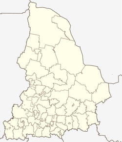 Aramil Aramil (Sverdlovsk Oblast) | |
| Coordinates: 56°42′N 60°50′E / 56.700°N 60.833°E | |
| Country | Russia |
| Federal subject | Sverdlovsk Oblast[1] |
| Administrative district | Sysertsky District[1] |
| Town | Aramil[1] |
| Founded | 1675 |
| Town status since | 1966[2] |
| Elevation | 220 m (720 ft) |
| Population | |
| • Total | 14,221 |
| • Estimate (2018)[4] | 15,321 (+7.7%) |
| • Capital of | town of Aramil[5] |
| • Urban okrug | Aramilsky Urban Okrug[6] |
| • Capital of | Aramilsky Urban Okrug[7] |
| Time zone | UTC+5 (MSK+2 |
| Postal code(s)[9] | 624000, 624003 |
| OKTMO ID | 65729000001 |
| Website | www |
History edit
It was established in 1675 as a sloboda near the source of the Aramil River.[citation needed] Town status was granted to it in 1966.[2]
Administrative and municipal status edit
Within the framework of the administrative divisions, it is, together with two rural localities, incorporated within Sysertsky District as the Town of Aramil.[1] As a municipal division, the Town of Aramil is incorporated as Aramilsky Urban Okrug.[6][1]
References edit

Notes edit
- ^ a b c d e f Order #120-P
- ^ a b Энциклопедия Города России. Moscow: Большая Российская Энциклопедия. 2003. p. 22. ISBN 5-7107-7399-9.
- ^ a b Russian Federal State Statistics Service (2011). Всероссийская перепись населения 2010 года. Том 1 [2010 All-Russian Population Census, vol. 1]. Всероссийская перепись населения 2010 года [2010 All-Russia Population Census] (in Russian). Federal State Statistics Service.
- ^ "26. Численность постоянного населения Российской Федерации по муниципальным образованиям на 1 января 2018 года". Federal State Statistics Service. Retrieved January 23, 2019.
- ^ Государственный комитет Российской Федерации по статистике. Комитет Российской Федерации по стандартизации, метрологии и сертификации. №ОК 019-95 1 января 1997 г. «Общероссийский классификатор объектов административно-территориального деления. Код 65 241 503», в ред. изменения №278/2015 от 1 января 2016 г.. (State Statistics Committee of the Russian Federation. Committee of the Russian Federation on Standardization, Metrology, and Certification. #OK 019-95 January 1, 1997 Russian Classification of Objects of Administrative Division (OKATO). Code 65 241 503, as amended by the Amendment #278/2015 of January 1, 2016. ).
- ^ a b Law #85-OZ
- ^ Федеральная служба государственной статистики. Федеральное агентство по технологическому регулированию и метрологии. №ОК 033-2013 1 января 2014 г. «Общероссийский классификатор территорий муниципальных образований. Код 65 628 104». (Federal State Statistics Service. Federal Agency on Technological Regulation and Metrology. #OK 033-2013 January 1, 2014 Russian Classification of Territories of Municipal Formations. Code 65 628 104. ).
- ^ "Об исчислении времени". Официальный интернет-портал правовой информации (in Russian). June 3, 2011. Retrieved January 19, 2019.
- ^ Почта России. Информационно-вычислительный центр ОАСУ РПО. (Russian Post). Поиск объектов почтовой связи (Postal Objects Search) (in Russian)
- ^ Federal State Statistics Service (May 21, 2004). Численность населения России, субъектов Российской Федерации в составе федеральных округов, районов, городских поселений, сельских населённых пунктов – районных центров и сельских населённых пунктов с населением 3 тысячи и более человек [Population of Russia, Its Federal Districts, Federal Subjects, Districts, Urban Localities, Rural Localities—Administrative Centers, and Rural Localities with Population of Over 3,000] (XLS). Всероссийская перепись населения 2002 года [All-Russia Population Census of 2002] (in Russian).
- ^ Всесоюзная перепись населения 1989 г. Численность наличного населения союзных и автономных республик, автономных областей и округов, краёв, областей, районов, городских поселений и сёл-райцентров [All Union Population Census of 1989: Present Population of Union and Autonomous Republics, Autonomous Oblasts and Okrugs, Krais, Oblasts, Districts, Urban Settlements, and Villages Serving as District Administrative Centers]. Всесоюзная перепись населения 1989 года [All-Union Population Census of 1989] (in Russian). Институт демографии Национального исследовательского университета: Высшая школа экономики [Institute of Demography at the National Research University: Higher School of Economics]. 1989 – via Demoscope Weekly.
Sources edit
- Областная Дума Законодательного Собрания Свердловской области. Закон №85-ОЗ от 12 июля 2007 г. «О границах муниципальных образований, расположенных на территории Свердловской области», в ред. Закона №107-ОЗ от 29 октября 2013 г. «Об упразднении отдельных населённых пунктов, расположенных на территории города Ивделя, и о внесении изменений в Приложение 39 к Закону Свердловской области "О границах муниципальных образований, расположенных на территории Свердловской области"». Вступил в силу через 10 дней после официального опубликования. Опубликован: "Областная газета", №232–249, 17 июля 2007 г. (Oblast Duma of the Legislative Assembly of Sverdlovsk Oblast. Law #85-OZ of July 12, 2007 On the Borders of the Municipal Formations on the Territory of Sverdlovsk Oblast, as amended by the Law #107-OZ of October 29, 2013 On Abolishing Several Inhabited Localities on the Territory of the Town of Ivdul and on Amending the Law of Sverdlovsk Oblast "On the Borders of the Municipal Formations on the Territory of Sverdlovsk Oblast". Effective as of the day which is 10 days after the official publication.).
External links edit
- Official website of Aramil (in Russian)
- Directory of organizations in Aramil (in Russian)