
KNOWPIA
WELCOME TO KNOWPIA

Balud 
Summary
Balud, officially the Municipality of Balud, is a 4th class municipality in the province of Masbate, Philippines. According to the 2020 census, it has a population of 40,155 people.[3]
Balud | |
|---|---|
| Municipality of Balud | |
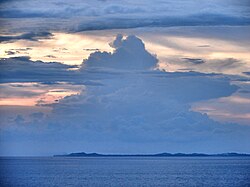 Silhouette of Jintotolo Island | |
 Flag  Seal | |
 Map of Masbate with Balud highlighted | |
OpenStreetMap .mw-parser-output .locmap .od{position:absolute}.mw-parser-output .locmap .id{position:absolute;line-height:0}.mw-parser-output .locmap .l0{font-size:0;position:absolute}.mw-parser-output .locmap .pv{line-height:110%;position:absolute;text-align:center}.mw-parser-output .locmap .pl{line-height:110%;position:absolute;top:-0.75em;text-align:right}.mw-parser-output .locmap .pr{line-height:110%;position:absolute;top:-0.75em;text-align:left}.mw-parser-output .locmap .pv>div{display:inline;padding:1px}.mw-parser-output .locmap .pl>div{display:inline;padding:1px;float:right}.mw-parser-output .locmap .pr>div{display:inline;padding:1px;float:left}html.skin-theme-clientpref-night .mw-parser-output .od,html.skin-theme-clientpref-night .mw-parser-output .od .pv>div,html.skin-theme-clientpref-night .mw-parser-output .od .pl>div,html.skin-theme-clientpref-night .mw-parser-output .od .pr>div{background:#000;color:#fff}html.skin-theme-clientpref-night .mw-parser-output .locmap{filter:grayscale(0.6)}@media(prefers-color-scheme:dark){html.skin-theme-clientpref-os .mw-parser-output .locmap{filter:grayscale(0.6)}html.skin-theme-clientpref-os .mw-parser-output .od,html.skin-theme-clientpref-os .mw-parser-output .od .pv>div,html.skin-theme-clientpref-os .mw-parser-output .od .pl>div,html.skin-theme-clientpref-os .mw-parser-output .od .pr>div{background:#000;color:#fff}}  Balud Location within the Philippines | |
| Coordinates: 12°02′13″N 123°11′37″E / 12.03686°N 123.19351°E | |
| Country | Philippines |
| Region | Bicol Region |
| Province | Masbate |
| District | 2nd district |
| Barangays | 32 (see Barangays) |
| Government | |
| • Type | Sangguniang Bayan |
| • Mayor | Rodolfo Estrella Jr. |
| • Vice Mayor | Felimon C. Abelita III |
| • Representative | Elisa T. Kho |
| • Municipal Council | Members |
| • Electorate | 28,042 voters (2022) |
| Area | |
| • Total | 231.00 km2 (89.19 sq mi) |
| Elevation | 24 m (79 ft) |
| Highest elevation | 356 m (1,168 ft) |
| Lowest elevation | 0 m (0 ft) |
| Population (2020 census)[3] | |
| • Total | 40,155 |
| • Density | 170/km2 (450/sq mi) |
| • Households | 9,039 |
| Economy | |
| • Income class | 4th municipal income class |
| • Poverty incidence | 31.72 |
| • Revenue | ₱ 167.7 million (2020) |
| • Assets | ₱ 355 million (2020) |
| • Expenditure | ₱ 136 million (2020) |
| • Liabilities | ₱ 130.4 million (2020) |
| Service provider | |
| • Electricity | Masbate Electric Cooperative (MASELCO) |
| Time zone | UTC+8 (PST) |
| ZIP code | 5412 |
| PSGC | 054103000 |
| IDD : area code | +63 (0)56 |
| Native languages | Hiligaynon Capiznon Tagalog |
Balud is 68 kilometres (42 mi) from Masbate City.
Etymology edit
The name Balud came from the name of the Pink-bellied imperial pigeon (Ducula poliocephala).
History edit
Balud was created as a municipality through Executive Order No. 244 signed by President Elpidio Quirino on July 18, 1949.[5]
Geography edit
Barangays edit
Balud is politically subdivided into 32 barangays. [6] Each barangay consists of puroks and some have sitios.
- Baybay (Lumocab)
- Bongcanaway
- Mabuhay (Bongcanaway III)
- Calumpang
- Cantil
- Casamongan
- Dao
- Danao
- Guinbanwahan
- Ilaya
- Jangan
- Jintotolo
- Mapili
- Mapitogo
- Pajo
- Palani
- Panguiranan
- Panubigan
- Poblacion (Balud)
- Pulanduta
- Quinayangan Diotay
- Quinayangan Tonga
- Salvacion
- Sampad
- San Andres (Quinayangan Dacu)
- San Antonio
- Sapatos
- Talisay
- Tonga
- Ubo
- Victory
- Villa Alvarez
Climate edit
| Climate data for Balud, Masbate | |||||||||||||
|---|---|---|---|---|---|---|---|---|---|---|---|---|---|
| Month | Jan | Feb | Mar | Apr | May | Jun | Jul | Aug | Sep | Oct | Nov | Dec | Year |
| Mean daily maximum °C (°F) | 29 (84) |
29 (84) |
31 (88) |
32 (90) |
32 (90) |
31 (88) |
30 (86) |
30 (86) |
30 (86) |
30 (86) |
29 (84) |
29 (84) |
30 (86) |
| Mean daily minimum °C (°F) | 23 (73) |
22 (72) |
23 (73) |
23 (73) |
25 (77) |
25 (77) |
24 (75) |
25 (77) |
24 (75) |
24 (75) |
24 (75) |
23 (73) |
24 (75) |
| Average precipitation mm (inches) | 39 (1.5) |
34 (1.3) |
42 (1.7) |
36 (1.4) |
73 (2.9) |
109 (4.3) |
118 (4.6) |
108 (4.3) |
129 (5.1) |
136 (5.4) |
112 (4.4) |
89 (3.5) |
1,025 (40.4) |
| Average rainy days | 12.6 | 9.7 | 12.0 | 13.0 | 20.5 | 25.3 | 26.2 | 24.8 | 25.2 | 25.9 | 21.9 | 17.9 | 235 |
| Source: Meteoblue[7] | |||||||||||||
Demographics edit
|
| |||||||||||||||||||||||||||||||||||||||
| Source: Philippine Statistics Authority[8][9][10][11] | ||||||||||||||||||||||||||||||||||||||||
In the 2020 census, the population of Balud, Masbate, was 40,155 people,[3] with a density of 170 inhabitants per square kilometre or 440 inhabitants per square mile.
Economy edit
References edit
- ^ Municipality of Balud | (DILG)
- ^ "2015 Census of Population, Report No. 3 – Population, Land Area, and Population Density" (PDF). Philippine Statistics Authority. Quezon City, Philippines. August 2016. ISSN 0117-1453. Archived (PDF) from the original on May 25, 2021. Retrieved July 16, 2021.
- ^ a b c Census of Population (2020). "Region V (Bicol Region)". Total Population by Province, City, Municipality and Barangay. Philippine Statistics Authority. Retrieved 8 July 2021.
- ^ "PSA Releases the 2018 Municipal and City Level Poverty Estimates". Philippine Statistics Authority. 15 December 2021. Retrieved 22 January 2022.
- ^ "Executive Order No. 244, s. 1949". Official Gazette of the Republic of the Philippines. 18 July 1949. Archived from the original on 14 May 2019. Retrieved 31 January 2023.
{{cite web}}: CS1 maint: bot: original URL status unknown (link) - ^ "Province: Masbate". PSGC Interactive. Quezon City, Philippines: Philippine Statistics Authority. Retrieved 12 November 2016.
- ^ "Balud: Average Temperatures and Rainfall". Meteoblue. Retrieved 23 June 2020.
- ^ Census of Population (2015). "Region V (Bicol Region)". Total Population by Province, City, Municipality and Barangay. Philippine Statistics Authority. Retrieved 20 June 2016.
- ^ Census of Population and Housing (2010). "Region V (Bicol Region)" (PDF). Total Population by Province, City, Municipality and Barangay. National Statistics Office. Retrieved 29 June 2016.
- ^ Censuses of Population (1903–2007). "Region V (Bicol Region)". Table 1. Population Enumerated in Various Censuses by Province/Highly Urbanized City: 1903 to 2007. National Statistics Office.
{{cite encyclopedia}}: CS1 maint: numeric names: authors list (link) - ^ "Province of Masbate". Municipality Population Data. Local Water Utilities Administration Research Division. Retrieved 17 December 2016.
- ^ "Poverty incidence (PI):". Philippine Statistics Authority. Retrieved December 28, 2020.
- ^ "Estimation of Local Poverty in the Philippines" (PDF). Philippine Statistics Authority. 29 November 2005.
- ^ "2003 City and Municipal Level Poverty Estimates" (PDF). Philippine Statistics Authority. 23 March 2009.
- ^ "City and Municipal Level Poverty Estimates; 2006 and 2009" (PDF). Philippine Statistics Authority. 3 August 2012.
- ^ "2012 Municipal and City Level Poverty Estimates" (PDF). Philippine Statistics Authority. 31 May 2016.
- ^ "Municipal and City Level Small Area Poverty Estimates; 2009, 2012 and 2015". Philippine Statistics Authority. 10 July 2019.
- ^ "PSA Releases the 2018 Municipal and City Level Poverty Estimates". Philippine Statistics Authority. 15 December 2021. Retrieved 22 January 2022.
External links edit
- Philippine Standard Geographic Code
- 2000 Philippine Census Information
- Local Governance Performance Management System