
KNOWPIA
WELCOME TO KNOWPIA

Brownlee, Nebraska 
Summary
Brownlee is an unincorporated community and census-designated place in Cherry County, Nebraska, United States.[2] As of the 2010 census it had a population of 15.[4] It is located on the North Loup River, 5 miles (8 km) west of U.S. Route 83 in the Sandhills region of the state.
Brownlee, Nebraska | |
|---|---|
 | |
 Brownlee, Nebraska  Brownlee, Nebraska | |
| Coordinates: 42°18′N 100°36′W / 42.3°N 100.6°W | |
| Country | |
| State | |
| County | Cherry |
| Area | |
| • Total | 0.11 sq mi (0.28 km2) |
| • Land | 0.11 sq mi (0.28 km2) |
| • Water | 0.00 sq mi (0.00 km2) |
| Elevation | 2,871 ft (875 m) |
| Population (2020) | |
| • Total | 13 |
| • Density | 122.64/sq mi (47.19/km2) |
| ZIP code | 69166[3] |
| Area code | 308 |
| FIPS code | 31-06680 |
| GNIS feature ID | 2583877[2] |
History edit
Brownlee was given the maiden name of the founder's grandmother.[5]
-
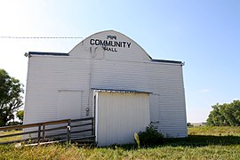 Community Hall
 -
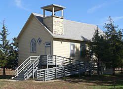 Brownlee church


Demographics edit
| Census | Pop. | Note | %± |
|---|---|---|---|
| 2010 | 15 | — | |
| 2020 | 13 | −13.3% | |
| U.S. Decennial Census[6] | |||
References edit
- ^ "ArcGIS REST Services Directory". United States Census Bureau. Retrieved September 19, 2022.
- ^ a b c U.S. Geological Survey Geographic Names Information System: Brownlee, Nebraska
- ^ "Brownlee NE ZIP Code". zipdatamaps.com. 2024. Retrieved February 5, 2024.
- ^ "Geographic Identifiers: 2010 Demographic Profile Data (G001): Brownlee CDP, Nebraska". U.S. Census Bureau, American actfinder. Archived from the original on February 12, 2020. Retrieved October 15, 2014.
- ^ Federal Writers' Project (1938). Origin of Nebraska place names. Lincoln, NE: Works Progress Administration. p. 7.
- ^ "Census of Population and Housing". Census.gov. Retrieved June 4, 2016.
Wikimedia Commons has media related to Brownlee, Nebraska.
42°17′17″N 100°37′33″W / 42.28806°N 100.62583°W