


Summary
Chyormoz (Russian: Чёрмоз, Russian pronunciation: [ˈtɕɵrməs]) is a town in Ilyinsky District of Perm Krai, Russia, located on the shores of the Kama Reservoir, 102 kilometers (63 mi) north of Perm, the administrative center of the krai. Population: 3,861 (2010 Russian census);[2] 4,376 (2002 Census);[7] 5,907 (1989 Soviet census).[8].
Chyormoz
Чёрмоз | |
|---|---|
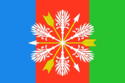 Flag  Coat of arms | |
Location of Chyormoz .mw-parser-output .locmap .od{position:absolute}.mw-parser-output .locmap .id{position:absolute;line-height:0}.mw-parser-output .locmap .l0{font-size:0;position:absolute}.mw-parser-output .locmap .pv{line-height:110%;position:absolute;text-align:center}.mw-parser-output .locmap .pl{line-height:110%;position:absolute;top:-0.75em;text-align:right}.mw-parser-output .locmap .pr{line-height:110%;position:absolute;top:-0.75em;text-align:left}.mw-parser-output .locmap .pv>div{display:inline;padding:1px}.mw-parser-output .locmap .pl>div{display:inline;padding:1px;float:right}.mw-parser-output .locmap .pr>div{display:inline;padding:1px;float:left}html.skin-theme-clientpref-night .mw-parser-output .od,html.skin-theme-clientpref-night .mw-parser-output .od .pv>div,html.skin-theme-clientpref-night .mw-parser-output .od .pl>div,html.skin-theme-clientpref-night .mw-parser-output .od .pr>div{background:#000;color:#fff}html.skin-theme-clientpref-night .mw-parser-output .locmap{filter:grayscale(0.6)}@media(prefers-color-scheme:dark){html.skin-theme-clientpref-os .mw-parser-output .locmap{filter:grayscale(0.6)}html.skin-theme-clientpref-os .mw-parser-output .od,html.skin-theme-clientpref-os .mw-parser-output .od .pv>div,html.skin-theme-clientpref-os .mw-parser-output .od .pl>div,html.skin-theme-clientpref-os .mw-parser-output .od .pr>div{background:#000;color:#fff}}  Chyormoz Location of Chyormoz 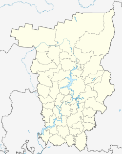 Chyormoz Chyormoz (Perm Krai) | |
| Coordinates: 58°47′N 56°10′E / 58.783°N 56.167°E | |
| Country | Russia |
| Federal subject | Perm Krai[1] |
| Administrative district | Ilyinsky District[1] |
| Founded | 1701 |
| Town status since | 1943 |
| Elevation | 125 m (410 ft) |
| Population | |
| • Total | 3,861 |
| • Estimate (2018)[3] | 3,457 (−10.5%) |
| • Municipal district | Ilyinsky Municipal District[4] |
| • Urban settlement | Chyormozskoye Urban Settlement[4] |
| • Capital of | Chyormozskoye Urban Settlement[4] |
| Time zone | UTC+5 (MSK+2 |
| Postal code(s)[6] | 617040 |
| Dialing code(s) | +7 34276 |
| OKTMO ID | 57759000006 |
History edit

It was founded in 1701. In 1763 baron Nikolay Stroganov founded a steel mill in Chyormoz, which was later sold to Ivan Lazarev. In 1943 Chyormoz was granted town status. In 1956, the mill was closed, as it was in a flood zone of the Kama Reservoir.[9]
Administrative and municipal status edit
Within the framework of administrative divisions, Chyormoz is subordinated to Ilyinsky District.[1] As a municipal division, the town of Chyormoz, together with twelve rural localities, is incorporated within Ilyinsky Municipal District as Chyormozskoye Urban Settlement.[4]
Before 1959 the town was the seat of Chyormozsky District.[9]
References edit
Notes edit
- ^ a b c d Law #416-67
- ^ a b Russian Federal State Statistics Service (2011). Всероссийская перепись населения 2010 года. Том 1 [2010 All-Russian Population Census, vol. 1]. Всероссийская перепись населения 2010 года [2010 All-Russia Population Census] (in Russian). Federal State Statistics Service.
- ^ "26. Численность постоянного населения Российской Федерации по муниципальным образованиям на 1 января 2018 года". Federal State Statistics Service. Retrieved January 23, 2019.
- ^ a b c d Law #1731-353
- ^ "Об исчислении времени". Официальный интернет-портал правовой информации (in Russian). June 3, 2011. Retrieved January 19, 2019.
- ^ Почта России. Информационно-вычислительный центр ОАСУ РПО. (Russian Post). Поиск объектов почтовой связи (Postal Objects Search) (in Russian)
- ^ Federal State Statistics Service (May 21, 2004). Численность населения России, субъектов Российской Федерации в составе федеральных округов, районов, городских поселений, сельских населённых пунктов – районных центров и сельских населённых пунктов с населением 3 тысячи и более человек [Population of Russia, Its Federal Districts, Federal Subjects, Districts, Urban Localities, Rural Localities—Administrative Centers, and Rural Localities with Population of Over 3,000] (XLS). Всероссийская перепись населения 2002 года [All-Russia Population Census of 2002] (in Russian).
- ^ Всесоюзная перепись населения 1989 г. Численность наличного населения союзных и автономных республик, автономных областей и округов, краёв, областей, районов, городских поселений и сёл-райцентров [All Union Population Census of 1989: Present Population of Union and Autonomous Republics, Autonomous Oblasts and Okrugs, Krais, Oblasts, Districts, Urban Settlements, and Villages Serving as District Administrative Centers]. Всесоюзная перепись населения 1989 года [All-Union Population Census of 1989] (in Russian). Институт демографии Национального исследовательского университета: Высшая школа экономики [Institute of Demography at the National Research University: Higher School of Economics]. 1989 – via Demoscope Weekly.
- ^ a b "Historical and geographical reference" (PDF). chermoz.ru (in Russian). Retrieved March 28, 2022.
Sources edit
- Законодательное собрание Пермской области. Закон №416-67 от 28 февраля 1996 г. «Об административно-территориальном устройстве Пермского края», в ред. Закона №504-ПК от 9 июля 2015 г. «О внесении изменений в Закон Пермской области "Об административно-территориальном устройстве Пермского края"». Вступил в силу с момента опубликования. Опубликован: "Звезда", №38, 12 марта 1996 г. (Legislative Assembly of Perm Oblast. Law #416-67 of February 28, 1996 On the Administrative-Territorial Structure of Perm Krai, as amended by the Law #504-PK of July 9, 2015 On Amending the Law of Perm Oblast "On the Administrative-Territorial Structure of Perm Krai". Effective as of the moment of publication.).
- Законодательное собрание Пермской области. Закон №1731-353 от 10 ноября 2004 г. «Об утверждении границ и о наделении статусом муниципальных образований Ильинского района Пермского края», в ред. Закона №273-ПК от 14 декабря 2013 г. «О внесении изменений в отдельные Законы Пермской области, Коми-Пермяцкого автономного округа, Пермского края». Вступил в силу через десять дней со дня официального опубликования. Опубликован: "Бюллетень Законодательного Собрания и администрации Пермской области", №12, I часть, 9 декабря 2004 г. (Legislative Assembly of Perm Oblast. Law #1731-353 of November 10, 2004 On Establishing the Borders and on Granting the Status to the Municipal Formations of Ilyinsky District of Perm Krai, as amended by the Law #273-PK of December 14, 2013 On Amending Various Laws of Perm Oblast, Komi-Permyak Autonomous Okrug, Perm Krai. Effective as of the day which is ten days following the day of the official publication.).
External links edit
- Official website of Chyormoz (in Russian)
- Chyormoz Business Directory (in Russian)