


Summary
Dankov (Russian: Данко́в) is a town and the administrative center of Dankovsky District in Lipetsk Oblast, Russia, located on the Don River 86 kilometers (53 mi) northwest of Lipetsk, the administrative center of the oblast. Population: 19,726 (2021 Census);[8] 21,064 (2010 Russian census);[2] 23,249 (2002 Census);[9] 24,659 (1989 Soviet census).[10] It was previously known as Donkov.
Dankov
Данков | |
|---|---|
 Mira Street in Dankov | |
 Coat of arms | |
Location of Dankov .mw-parser-output .locmap .od{position:absolute}.mw-parser-output .locmap .id{position:absolute;line-height:0}.mw-parser-output .locmap .l0{font-size:0;position:absolute}.mw-parser-output .locmap .pv{line-height:110%;position:absolute;text-align:center}.mw-parser-output .locmap .pl{line-height:110%;position:absolute;top:-0.75em;text-align:right}.mw-parser-output .locmap .pr{line-height:110%;position:absolute;top:-0.75em;text-align:left}.mw-parser-output .locmap .pv>div{display:inline;padding:1px}.mw-parser-output .locmap .pl>div{display:inline;padding:1px;float:right}.mw-parser-output .locmap .pr>div{display:inline;padding:1px;float:left}html.skin-theme-clientpref-night .mw-parser-output .od,html.skin-theme-clientpref-night .mw-parser-output .od .pv>div,html.skin-theme-clientpref-night .mw-parser-output .od .pl>div,html.skin-theme-clientpref-night .mw-parser-output .od .pr>div{background:#000;color:#fff}html.skin-theme-clientpref-night .mw-parser-output .locmap{filter:grayscale(0.6)}@media(prefers-color-scheme:dark){html.skin-theme-clientpref-os .mw-parser-output .locmap{filter:grayscale(0.6)}html.skin-theme-clientpref-os .mw-parser-output .od,html.skin-theme-clientpref-os .mw-parser-output .od .pv>div,html.skin-theme-clientpref-os .mw-parser-output .od .pl>div,html.skin-theme-clientpref-os .mw-parser-output .od .pr>div{background:#000;color:#fff}}  Dankov Location of Dankov 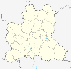 Dankov Dankov (Lipetsk Oblast) | |
| Coordinates: 53°15′N 39°08′E / 53.250°N 39.133°E | |
| Country | Russia |
| Federal subject | Lipetsk Oblast[1] |
| Administrative district | Dankovsky District[1] |
| Town under district jurisdiction | Dankov[1] |
| Founded | late 14th century |
| Town status since | 1959 |
| Elevation | 140 m (460 ft) |
| Population | |
| • Total | 21,064 |
| • Estimate (2018)[3] | 19,017 (−9.7%) |
| • Capital of | Dankovsky District,[1] Dankov Town Under District Jurisdiction[1] |
| • Municipal district | Dankovsky Municipal District[4] |
| • Urban settlement | Dankov Urban Settlement[4] |
| • Capital of | Dankovsky Municipal District,[5] Dankov Urban Settlement[4] |
| Time zone | UTC+3 (MSK |
| Postal code(s)[7] | 399850–399854, 399859 |
| OKTMO ID | 42609101001 |
| Website | web |
History edit
The fort of Donkov was founded by the Princes of Ryazan in the late 14th century and took its name from the Don River.[citation needed] The fort stood on the left bank of the Don, about 34 kilometers (21 mi) from the modern town, until 1568, when it was destroyed by the Crimean Tatars. It was then restored on a better fortified location but was again relocated in 1618. It is shown as Donko in Mercator's Atlas (1596),[11] and as Donkagorod in Resania in Joan Blaeu's map of 1645.[12]
By the 18th century, its spelling changed from Donkov to Dankov. The town was chartered by Catherine the Great but was demoted in status to that of a rural locality between 1796 and 1804 and again between 1924 and 1959.[citation needed]
Administrative and municipal status edit
Within the framework of administrative divisions, Dankov serves as the administrative center of Dankovsky District.[1] As an administrative division, it is incorporated within Dankovsky District as Dankov Town Under District Jurisdiction.[1] As a municipal division, Dankov Town Under District Jurisdiction is incorporated within Dankovsky Municipal District as Dankov Urban Settlement.[4]
References edit

Notes edit
- ^ a b c d e f g h Law #382-OZ
- ^ a b Russian Federal State Statistics Service (2011). Всероссийская перепись населения 2010 года. Том 1 [2010 All-Russian Population Census, vol. 1]. Всероссийская перепись населения 2010 года [2010 All-Russia Population Census] (in Russian). Federal State Statistics Service.
- ^ "26. Численность постоянного населения Российской Федерации по муниципальным образованиям на 1 января 2018 года". Federal State Statistics Service. Retrieved January 23, 2019.
- ^ a b c d Law #126-OZ
- ^ Федеральная служба государственной статистики. Федеральное агентство по технологическому регулированию и метрологии. №ОК 033-2013 1 января 2014 г. «Общероссийский классификатор территорий муниципальных образований. Код 42 609». (Federal State Statistics Service. Federal Agency on Technological Regulation and Metrology. #OK 033-2013 January 1, 2014 Russian Classification of Territories of Municipal Formations. Code 42 609. ).
- ^ "Об исчислении времени". Официальный интернет-портал правовой информации (in Russian). June 3, 2011. Retrieved January 19, 2019.
- ^ Почта России. Информационно-вычислительный центр ОАСУ РПО. (Russian Post). Поиск объектов почтовой связи (Postal Objects Search) (in Russian)
- ^ Russian Federal State Statistics Service. Всероссийская перепись населения 2020 года. Том 1 [2020 All-Russian Population Census, vol. 1] (XLS) (in Russian). Federal State Statistics Service.
- ^ Federal State Statistics Service (May 21, 2004). Численность населения России, субъектов Российской Федерации в составе федеральных округов, районов, городских поселений, сельских населённых пунктов – районных центров и сельских населённых пунктов с населением 3 тысячи и более человек [Population of Russia, Its Federal Districts, Federal Subjects, Districts, Urban Localities, Rural Localities—Administrative Centers, and Rural Localities with Population of Over 3,000] (XLS). Всероссийская перепись населения 2002 года [All-Russia Population Census of 2002] (in Russian).
- ^ Всесоюзная перепись населения 1989 г. Численность наличного населения союзных и автономных республик, автономных областей и округов, краёв, областей, районов, городских поселений и сёл-райцентров [All Union Population Census of 1989: Present Population of Union and Autonomous Republics, Autonomous Oblasts and Okrugs, Krais, Oblasts, Districts, Urban Settlements, and Villages Serving as District Administrative Centers]. Всесоюзная перепись населения 1989 года [All-Union Population Census of 1989] (in Russian). Институт демографии Национального исследовательского университета: Высшая школа экономики [Institute of Demography at the National Research University: Higher School of Economics]. 1989 – via Demoscope Weekly.
- ^ Taurica Chresonesus, Nostra aetate Przecopsca et Gazara dicitur in Atlas sive Cosmographicae Meditationes de Fabrica Mundi et Fabricati Fugura (1596).
- ^ Russiæ, vulgo Moscovia, pars australis in Theatrum Orbis Terrarum, sive Atlas Novus in quo Tabulæ et Descriptiones Omnium Regionum, Editæ a Guiljel et Ioanne Blaeu, 1645.
Sources edit
- Липецкий областной Совет депутатов. Закон №382-ОЗ от 28 апреля 2010 г. «Об административно-территориальном устройстве Липецкой области и порядке его изменения», в ред. Закона №343-ОЗ от 5 декабря 2014 г. «О внесении изменений в некоторые Законы Липецкой области в связи с объединением сельских поселений Добринский сельсовет и Сафоновский сельсовет Добринского муниципального района Липецкой области». Вступил в силу по истечении 10 дней со дня официального опубликования. Опубликован: "Липецкая газета", №88, 7 мая 2010 г. (Lipetsk Oblast Council of Deputies. Law #382-OZ of April 28, 2010 On the Administrative-Territorial Structure of Lipetsk Oblast and on the Procedures for Its Change, as amended by the Law #343-OZ of December 5, 2014 On Amending Various Laws of Lipetsk Oblast Due to the Merger of the Rural Settlements of Dobrinsky Selsoviet and Safonovsky Selsoviet in Dobrinsky Municipal District of Lipetsk Oblast. Effective as of the day which is 10 days after the day of the official publication.).
- Липецкий областной Совет депутатов. Закон №126-ОЗ от 23 сентября 2004 г. «Об установлении границ муниципальных образований Липецкой области», в ред. Закона №343-ОЗ от 5 декабря 2014 г. «О внесении изменений в некоторые Законы Липецкой области в связи с объединением сельских поселений Добринский сельсовет и Сафоновский сельсовет Добринского муниципального района Липецкой области». Вступил в силу 26 сентября 2004 г. Опубликован: "Липецкая газета", №188, 25 сентября 2004 г. (Lipetsk Oblast Council of Deputies. Law #126-OZ of September 23, 2004 On Establishing the Borders of the Municipal Formations in Lipetsk Oblast, as amended by the Law #343-OZ of December 5, 2014 On Amending Various Laws of Lipetsk Oblast Due to the Merger of the Rural Settlements of Dobrinsky Selsoviet and Safonovsky Selsoviet in Dobrinsky Municipal District of Lipetsk Oblast. Effective as of the day of the official publication.).
External links edit
- Official website of Dankov (in Russian)
- Dankov Business Directory (in Russian)