


Summary
Dumalneg, officially the Municipality of Dumalneg (Ilocano: Ili ti Dumalneg; Filipino: Bayan ng Dumalneg), is a 5th class municipality in the province of Ilocos Norte, Philippines. According to the 2020 census, it has a population of 3,087 people.[3]
Dumalneg | |
|---|---|
| Municipality of Dumalneg | |
 Flag  Seal | |
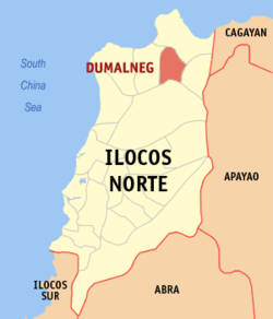 Map of Ilocos Norte with Dumalneg highlighted | |
 Dumalneg Location within the Philippines | |
| Coordinates: 18°31′18″N 120°48′42″E / 18.521667°N 120.811542°E | |
| Country | Philippines |
| Region | Ilocos Region |
| Province | Ilocos Norte |
| District | 1st district |
| Barangays | 4 (see Barangays) |
| Government | |
| • Type | Sangguniang Bayan |
| • Mayor | Francisco R. Espiritu Jr. |
| • Vice Mayor | Fraincess Kwyn Espiritu |
| • Representative | Ferdinand Alexander Araneta Marcos III |
| • Municipal Council | Members |
| • Electorate | 2,067 voters (2022) |
| Area | |
| • Total | 88.48 km2 (34.16 sq mi) |
| Elevation | 241 m (791 ft) |
| Highest elevation | 995 m (3,264 ft) |
| Lowest elevation | 0 m (0 ft) |
| Population (2020 census)[3] | |
| • Total | 3,087 |
| • Density | 35/km2 (90/sq mi) |
| • Households | 687 |
| Economy | |
| • Income class | 5th municipal income class |
| • Poverty incidence | 7.18 |
| • Revenue | ₱ 61.29 million (2020) |
| • Assets | ₱ 206.7 million (2020) |
| • Expenditure | ₱ 49.8 million (2020) |
| • Liabilities | ₱ 31.05 million (2020) |
| Service provider | |
| • Electricity | Ilocos Norte Electric Cooperative (INEC) |
| Time zone | UTC+8 (PST) |
| ZIP code | 2921 |
| PSGC | 012810000 |
| IDD : area code | +63 (0)77 |
| Native languages | Ilocano Tagalog |
Until 2013 when the writ of execution was issued, Dumalneg was composed of only a single barangay of the same name. On August 10, 2012, the Supreme Court ruled in favor of Dumalneg in its territorial dispute with neighboring Bangui over the jurisdiction of Barangay San Isidro.[5]
Geography edit
Dumalneg is border by Pagudpud in the north; Adams in the east; Vintar in the south and Bangui in the west. It has a land area of 88.48 km2 and it is a land-locked municipality. Nearly all parts of Dumalneg are mountainous. Only the starting of Dumalneg is well inhabited.
Barangays edit
Dumalneg is politically divided in 4 barangays. Each barangay consists of puroks and some have sitios.
- Cabaritan
- Kalaw
- Quibel
- San Isidro
The former Barangay Dumalneg was split into Barangay Cabaritan, Barangay Kalaw, and Barangay Quibel in pursuant to Republic Act No. 10955, which was ratified through a plebiscite conducted by the COMELEC on March 24, 2018.[6]
Climate edit
| Climate data for Dumalneg, Ilocos Norte | |||||||||||||
|---|---|---|---|---|---|---|---|---|---|---|---|---|---|
| Month | Jan | Feb | Mar | Apr | May | Jun | Jul | Aug | Sep | Oct | Nov | Dec | Year |
| Mean daily maximum °C (°F) | 26 (79) |
28 (82) |
30 (86) |
32 (90) |
31 (88) |
31 (88) |
30 (86) |
30 (86) |
30 (86) |
29 (84) |
28 (82) |
26 (79) |
29 (85) |
| Mean daily minimum °C (°F) | 20 (68) |
20 (68) |
21 (70) |
23 (73) |
25 (77) |
25 (77) |
25 (77) |
25 (77) |
24 (75) |
23 (73) |
22 (72) |
21 (70) |
23 (73) |
| Average precipitation mm (inches) | 55 (2.2) |
41 (1.6) |
37 (1.5) |
41 (1.6) |
184 (7.2) |
215 (8.5) |
261 (10.3) |
256 (10.1) |
245 (9.6) |
216 (8.5) |
142 (5.6) |
129 (5.1) |
1,822 (71.8) |
| Average rainy days | 14.1 | 11.1 | 11.8 | 12.5 | 21.8 | 25.2 | 25.5 | 24.9 | 23.8 | 18.2 | 16.4 | 17.0 | 222.3 |
| Source: Meteoblue[7] | |||||||||||||
Demographics edit
| Year | Pop. | ±% p.a. |
|---|---|---|
| 1939 | 322 | — |
| 1948 | 454 | +3.89% |
| 1960 | 554 | +1.67% |
| 1970 | 435 | −2.39% |
| 1975 | 570 | +5.57% |
| 1980 | 602 | +1.10% |
| 1990 | 828 | +3.24% |
| 1995 | 1,109 | +5.63% |
| 2000 | 1,486 | +6.47% |
| 2007 | 1,716 | +2.00% |
| 2010 | 1,814 | +2.04% |
| 2015 | 2,947 | +9.68% |
| 2020 | 3,087 | +0.92% |
| Source: Philippine Statistics Authority[8][9][10] | ||
In the 2020 census, the population of Dumalneg was 3,087 people,[3] with a density of 35 inhabitants per square kilometre or 91 inhabitants per square mile.
Dumalneg's population is predominantly made up of Ilocano and Apayao people.[11]
Economy edit
Transportation edit
There are few jeepneys that are going to Dumalneg. Tricycles are the main transportation to the town. Dumalneg is a landlocked town, and the only way to get there is via the Dumalneg Road, starting on the highway in Barangay Lanao, Bangui, to the Town's Proper.
Government edit
Local government edit
Dumalneg, belonging to the first congressional district of the province of Ilocos Norte, is governed by a mayor designated as its local chief executive and by a municipal council as its legislative body in accordance with the Local Government Code. The mayor, vice mayor, and the councilors are elected directly by the people through an election which is being held every three years.
Elected officials edit
| Position | Name |
|---|---|
| Congressman | Ria Christina G. Fariñas |
| Mayor | Lairvee G. Espiritu |
| Vice-Mayor | Francisco R. Espiritu Jr. |
| Councilors | Estrelia T. Bacong |
| Alexander R. Bunay | |
| Sheryll L. Asipil | |
| Alejo M. Laguitan Jr. | |
| Karlene C. Alawag | |
| Jaime A. Agreda | |
| Mavie Mae B. Cadiz | |
| Santos P. Cascayan Jr. |
Tourism edit
There are few attractions in Dumalneg. Mainly the Bolo River, locally known as "Ar-ar-o", the place where peoples of Bangui and Pagudpud also going in the said river. Also the view of the mountains of Vintar are considered also the town's attraction.
References edit
- ^ Municipality of Dumalneg | (DILG)
- ^ "2015 Census of Population, Report No. 3 – Population, Land Area, and Population Density" (PDF). Philippine Statistics Authority. Quezon City, Philippines. August 2016. ISSN 0117-1453. Archived (PDF) from the original on May 25, 2021. Retrieved July 16, 2021.
- ^ a b c Census of Population (2020). "Region I (Ilocos Region)". Total Population by Province, City, Municipality and Barangay. Philippine Statistics Authority. Retrieved 8 July 2021.
- ^ "PSA Releases the 2018 Municipal and City Level Poverty Estimates". Philippine Statistics Authority. 15 December 2021. Retrieved 22 January 2022.
- ^ "One Barangay Transferred to Another Municipality in the Second Quarter of 2011". National Statistical Coordination Board. Web. 19 Sep 2013.
- ^ "12 New Barangays Established in the First Quarter of 2018". Philippine Statistics Authority. Web. 8 Feb 2019.
- ^ "Dumalneg: Average Temperatures and Rainfall". Meteoblue. Retrieved 4 March 2020.
- ^ Census of Population (2015). "Region I (Ilocos Region)". Total Population by Province, City, Municipality and Barangay. Philippine Statistics Authority. Retrieved 20 June 2016.
- ^ Census of Population and Housing (2010). "Region I (Ilocos Region)" (PDF). Total Population by Province, City, Municipality and Barangay. National Statistics Office. Retrieved 29 June 2016.
- ^ "Province of Ilocos Norte". Municipality Population Data. LWUA Research Division. Retrieved 3 October 2013.
- ^ Wallace, Ben J. (2006). The changing village environment in Southeast Asia: applied anthropology and environmental reclamation in the northern Philippines. Psychology Press. p. 36. ISBN 978-0-415-36484-3.
- ^ "Poverty incidence (PI):". Philippine Statistics Authority. Retrieved December 28, 2020.
- ^ "Estimation of Local Poverty in the Philippines" (PDF). Philippine Statistics Authority. 29 November 2005.
- ^ "2003 City and Municipal Level Poverty Estimates" (PDF). Philippine Statistics Authority. 23 March 2009.
- ^ "City and Municipal Level Poverty Estimates; 2006 and 2009" (PDF). Philippine Statistics Authority. 3 August 2012.
- ^ "2012 Municipal and City Level Poverty Estimates" (PDF). Philippine Statistics Authority. 31 May 2016.
- ^ "Municipal and City Level Small Area Poverty Estimates; 2009, 2012 and 2015". Philippine Statistics Authority. 10 July 2019.
- ^ "PSA Releases the 2018 Municipal and City Level Poverty Estimates". Philippine Statistics Authority. 15 December 2021. Retrieved 22 January 2022.
- ^ "2019 National and Local Elections" (PDF). Commission on Elections. Retrieved March 10, 2022.
External links edit
- Philippine Standard Geographic Code
- Philippine Census Information
- Local Governance Performance Management System Archived 2012-05-02 at the Wayback Machine