


Summary
Erskine Barracks was a military installation at Fugglestone St Peter, in Wilton parish some 2+3⁄4 miles (4 km) northwest of Salisbury in Wiltshire, England.
| Erskine Barracks | |
|---|---|
| Fugglestone St Peter | |
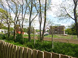 Erskine Barracks undergoing demolition | |
 Erskine Barracks Location within Wiltshire | |
| Coordinates | 51°5′13″N 01°51′5″W / 51.08694°N 1.85139°W |
| Type | Barracks |
| Site information | |
| Owner | Ministry of Defence |
| Operator | |
| Site history | |
| Built | 1949 |
| Built for | War Office |
| In use | 1949-2010 |
| Garrison information | |
| Occupants | Headquarters Land Forces |
History edit
The site, which had been farmland[1] until used for temporary army buildings during World War II, was acquired by the British Army for use as a headquarters for Southern Command in 1949.[1] The establishment was centred on Fugglestone Farmhouse[1] and an Ordnance Survey map of 1958 labels it as Fugglestone Camp.[2]
The barracks were later named after General Sir George Erskine,[3] who had been GOC Southern Command from 1955 until his retirement in 1958.[4] The site went on to become in 1968 the headquarters of Army Strategic Command, which was renamed UK Land Forces in 1972 and Land Command in 1995. On 1 April 2008 Land Command amalgamated with Headquarters Adjutant General under 'Project Hyperion' and became Land Forces.[5] Land Forces moved from Erskine Barracks to the former RAF Andover site now known as Marlborough Lines on 23 June 2010,[6] and the site became vacant.
At time, that the site covered 9.6 hectares to the north of the railway line and 3.8 hectares (less fully developed) to the south.[1] The former farmhouse had been demolished by 1968 and all standing structures were from 1950 or later.[1] In 2014 the headquarters building was described as "an impressive example of brutal modernism".[1]
Post-Army use edit
The site was sold to housebuilder Redrow in March 2013,[7] and all its buildings were demolished in 2014.[1] Besides housing, the site has Erskine House which provides 44 flats for former military personnel, and offers training for their return to civilian work.[8][9]
Legacy edit
The National Army Museum has a Bath stone fireplace salvaged during the demolition in 2001 of Bridge End House, a building of c.1900 used as an administrative block by the Army.[10]
During demolition in 2014, a photographic record of selected buildings – including the Sergeants' Mess and the Headquarters – was made by Wessex Archaeology to form a historic building record, as required by Wiltshire Council under a planning condition.[1] No archaeological features were found during a simultaneous watching brief.[1]
References edit
- ^ a b c d e f g h i Wessex Archaeology (July 2014). "Erskine Barracks, The Avenue, Wilton, Wiltshire: Historic Building Record andArchaeological Watching Brief Report" (PDF). Archaeology Data Service. Wessex Archaeology. doi:10.5284/1052624. Retrieved 24 January 2021.
- ^ "SU13 - Ordnance Survey 1:25,000 maps of Great Britain, 1945-1969". National Library of Scotland. 1958. Retrieved 24 January 2021.
- ^ "Homes Fit For Heroes". Wilton Hill & Erskine Park Community Association. Retrieved 24 January 2021.
- ^ "Sir George Watkin Eben James Erskine]". Liddell Hart Centre for Military Archives. King's College London. Archived from the original on 17 October 2013.
- ^ HQ Land Forces on the move Archived March 7, 2012, at the Wayback Machine Drumbeat, June 2008
- ^ "Andover becomes HQ Land Forces on 23 June". Andover Advertiser. 29 April 2010. Retrieved 6 April 2014.
- ^ "Redrow to develop former Salisbury barracks site". Construction Index. 29 March 2013. Retrieved 20 January 2021.
- ^ "Veteran's Village Groundbreaking". Alabaré. Retrieved 24 January 2021.
- ^ "Her Royal Highness The Countess of Wessex officially opens Wilton's Entrain Space". Entrain Space. 14 October 2019. Retrieved 24 January 2021.
- ^ "Fireplace, from Bridge End House, Erskine Barracks, Wilton, 1900". National Army Museum, London. Retrieved 24 January 2021.