


Summary
The IND Eighth Avenue Line[b] is a rapid transit line in New York City, United States, and is part of the B Division of the New York City Subway. Opened in 1932, it was the first line of the Independent Subway System (IND); as such, New Yorkers originally applied the Eighth Avenue Subway name to the entire IND system.[4][5][6]


The line runs from 207th Street in Inwood south to an interlocking south of High Street in Brooklyn Heights, including large sections under St. Nicholas Avenue, Central Park West, and Eighth Avenue. The entire length is underground, though the 207th Street Yard, which branches off near the north end, is on the surface. Flying junctions are provided with the IND Concourse Line, IND Sixth Avenue Line, and IND Queens Boulevard Line.
Most of the line has four tracks, with one local and one express track in each direction, except for the extreme north and south ends, where only the two express tracks continue. Internally, the line is chained as Line "A", with tracks A1, A3, A4, and A2 from west to east,[7] running from approximately 800 at the south end[8] to 1540 at the north end (measured in hectofeet).[9]
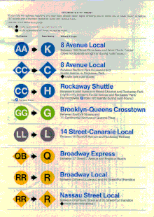
The whole line is served at all times by the A train, which runs express except during late nights. The C provides local service south of 168th Street while the A runs express. In addition, the B provides weekday local service and the D full-time express service between the Concourse Line (145th Street) and Sixth Avenue Line (59th Street–Columbus Circle) junctions, and the E runs local from the Queens Boulevard Line junction at 50th Street south to World Trade Center. The A, C, and E are colored blue on signs because they run via Eighth Avenue through Midtown Manhattan, while the B and D are orange since they use the Sixth Avenue Line through Midtown Manhattan.[10]
Extent and service edit
The following services use part or all of the Eighth Avenue Line.[11] The trunk line's bullets are colored blue:
| Time period | Section of line | |||
|---|---|---|---|---|
| rush hours, middays, and evenings |
weekends | late nights | ||
| express | local | entire line | ||
| local | no service | south of 168 St | ||
| local | between 50 St and WTC | |||
| local | no service | between 145 St and 59 St | ||
| express | between 145 St and 59 St | |||
The Eighth Avenue Line begins as a two-track subway under Broadway at 207th Street in Inwood. A flying junction just to the south brings two tracks from the 207th Street Yard between the main tracks, merging after Dyckman Street. The subway leaves Broadway to pass under Fort Tryon Park to the north end of Fort Washington Avenue, which it follows to roughly 175th Street before turning southeast under private property.[9]
The small 174th Street Yard lies under Broadway, with two tracks exiting to the south under that roadway.[9] When the George Washington Bridge was designed in the 1920s, provisions were made for a lower deck that would carry these two tracks north from the yard and across the bridge, as well as two commuter rail tracks.[12][13] However, when the lower level was added in 1962, it instead carried a roadway.
The two main tracks from Fort Washington Avenue enter Broadway near 172nd Street, curving and running underneath a public school (PS173M) at 174th Street, and other private property, and the yard tracks in a double-decker tunnel. A few blocks later, the lower tracks separate to straddle the yard tracks at 168th Street. The local/express split begins here, with the local tracks coming from the yard and the express tracks coming from Inwood. Contrary to standard practice, the two local tracks are in the center and the two express tracks are on the outside. Except during late nights, the local service (C) ends at 168th Street, reversing direction on the yard tracks; the A runs to 207th Street at all times, express except during late nights. South of 168th Street, the express (outer) tracks lower below the local tracks, forming another double-decker tunnel, this time under St. Nicholas Avenue.[9]
North of 145th Street, the lower (express) tracks rise into the center, and the three-track IND Concourse Line enters St. Nicholas Avenue below the four-track Eighth Avenue Line. 145th Street is a two-level transfer station, with two island platforms on each level. To the south, the Concourse Line tracks rise and merge with the Eighth Avenue Line, carrying the B onto the local tracks and the D onto the express tracks. The resulting four-track line continues south under St. Nicholas Avenue and Eighth Avenue (Frederick Douglass Boulevard), which becomes Central Park West at 110th Street.[9]


Most of the line under Central Park West is built on two levels with both local tracks to the west and only local stations. The two northbound tracks are above the two southbound tracks. Approaching 59th Street–Columbus Circle, where Central Park West becomes Eighth Avenue, the subway again spreads out into a single four-track level.[9]
A flying junction south of 59th Street takes B and D trains east under 53rd Street, merging with two tracks from 57th Street to become the four-track IND Sixth Avenue Line. The two-track IND Queens Boulevard Line, also in 53rd Street, curves south into a lower level of the 50th Street station, and merges to the south, taking E trains onto the local tracks. An unused southbound-only lower level at 42nd Street–Port Authority Bus Terminal was formerly accessed only from the southbound track from the Queens Boulevard Line. Plans for the 7 Subway Extension required partially demolishing the lower level to make room for the new IRT Flushing Line tracks.[9]
The four-track line continues south under Eighth Avenue to 14th Street, where it turns southeast under Greenwich Avenue and south under Sixth Avenue, above the four-track IND Sixth Avenue Line. The two-level West Fourth Street–Washington Square station allows easy transfers between the two lines. Just to the south are track connections between the local tracks of each line, not used by current normal service patterns. The Sixth Avenue Line turns east into Houston Street after passing the connections.[9]
Canal Street, under Sixth Avenue, is the last normal four-track station on the line. Crossovers in each direction, beyond the station, take C and late night A trains between the local tracks to the north and the express tracks to the south. As the subway turns from Sixth Avenue into Church Street, the southbound local track passes under the express tracks, bringing E trains to the east. At this point, a bellmouth originally intended for the never-built IND Worth Street Line is present on the east side of the tunnel.[9][14][15] It has been proposed to use this to bring Long Island Rail Road Atlantic Branch trains to Lower Manhattan as part of the Lower Manhattan-Jamaica/JFK Transportation Project.[16]
The four tracks continue south under Church Street, with two separate but connected stations at World Trade Center at the end of the local tracks and Chambers Street on the express tracks. The two express tracks turn east under Fulton Street, crossing the East River through the Cranberry Street Tunnel into Cranberry Street in Brooklyn. Cranberry Street leads to High Street, from which the line turns south into Jay Street, straddled by the two-track IND Sixth Avenue Line from the Rutgers Street Tunnel. The Eighth and Sixth Avenue Lines end, becoming the IND Fulton Street Line and IND Culver Line, at crossovers (currently unused) allowing trains to switch between the two, located between High Street and Jay Street–MetroTech. Both the A and C trains continue along the Fulton Street Line.[9]
History edit
Planning and construction edit
As early as March 1918, soon after the BMT Broadway Line opened to Times Square–42nd Street, plans were being considered for an extension of that line beyond the stubs at 57th Street–Seventh Avenue to the Upper West Side and Washington Heights via Central Park West (Eighth Avenue).[17] On August 3, 1923, the New York City Board of Estimate approved the Washington Heights Line, an extension of the Broadway Line to Washington Heights. The line was to have four tracks from Central Park West at 64th Street under Central Park West, Eighth Avenue, Saint Nicholas Avenue, and private property to 173rd Street, and two tracks under Fort Washington Avenue to 193rd Street. South of 64th Street, one two-track line would connect to the Broadway Line stubs at 57th Street, and another would continue under Eighth Avenue to 30th Street at Penn Station, with provisions to continue downtown.[18][19]
Mayor John Hylan instead wanted to build an independent subway system, operated by the city. The New York City Board of Transportation (NYCBOT) gave preliminary approval to several lines in Manhattan, including one on Eighth Avenue, on December 9, 1924. The main portion of the already-approved Washington Heights Line—the mostly-four track line north of 64th Street—was included, but was to continue north from 193rd Street to 207th Street. South of 64th Street, the plan called for four tracks in Eighth Avenue, Greenwich Avenue, the planned extension of Sixth Avenue, and Church Street. Two tracks would turn east under Fulton Street or Wall Street and under the East River to Downtown Brooklyn.[20][21]
A groundbreaking ceremony was held at St. Nicholas Avenue and 123rd Street on March 14, 1925.[22] Most of the Eighth Avenue Line was dug using a cheap cut-and-cover method, where the street above was excavated. Still, the construction of the line was difficult, as it had to go under or over several subway lines. At 59th Street–Columbus Circle, workers had to be careful to not disrupt the existing IRT Broadway–Seventh Avenue Line overhead. 42nd Street, the longest station along the line at 1,115 feet (340 m), was expected to be a major express station with large platforms, so the platforms were staggered away from each other in order to avoid going under property lines. Additionally, several workers died in cave-ins during construction.[23]
In the summer of 1926 the BOT held a public hearing and agreed upon the details of the construction of the subway line under Church Street. As part of the construction of the line, Church Street was widened from being 40 feet (12 m) wide to being 90 feet (27 m) wide to accommodate the subway underneath and was connected with a southern diagonal extension of Sixth Avenue, which was 100 feet (30 m). Had the street not been widened the construction would have cost an additional $7 million for the construction of a two-level subway structure. In January 1929, the city paid money awarded to adjacent property owners for property taken and awarded contracts for 15 feet (4.6 m)-wide sidewalks and a 60 feet (18 m)-wide roadway. The sidewalks had been 10 feet (3.0 m) wide and the roadway had been 20 feet (6.1 m) wide. New buildings were built on the west sides of Church Street. The east side of the street was not affected by the construction. $9,631,760 was awarded to 161 property owners whose property had been taken.[24] 168,888 square feet of land had to be acquired to widen Church Street between Park Place and Canal Street.[25]
In 1926 construction began on the extension of Sixth Avenue south from Carmine Street to Canal Street, to allow for the construction of the Eighth Avenue Line (which runs under the street south of Eighth Street), and to provide access to the Holland Tunnel.[26][27] The construction of the extension was completed in 1930.[28] The city condemned entire lots, displacing 10,000 people,[29] to build the extension and used leftover land for parks.
The stations on the line were built with 600 feet (180 m) long platforms, but they had provisions to lengthen them to 660 feet (200 m) to accommodate eleven-car trains.[30]: 70 Four of the express stations (at Fulton, 14th, 42nd, and 59th Streets) were built with long mezzanines so that passengers could walk the entire length of the mezzanines without having to pay a fare. It was proposed to develop the mezzanines of these four stations with shops, so that they would become retail corridors, similar to the underground mall of the under-construction Rockefeller Center.[23] The new subway required 800 cars and 1,500 staff. In June 1932, The New York Times reported that seven-car express trains would run between 168th and Chambers Streets, while five-car local trains would run between 207th and Chambers Streets. Both express and local trains would run at intervals of four to twelve minutes depending on the time of day.[31] The new IND subway line also used a five-color pattern of tiles to facilitate navigation for travelers going away from Manhattan; the colors of the tiles changed at each express station.[32]
Early operation edit

The majority of the Eighth Avenue Line, from Chambers Street north to 207th Street, was opened to the public just after midnight on September 10, 1932, after three days of operation on a normal schedule but without passengers.[33] The Cranberry Street Tunnel, extending the express tracks east under Fulton Street to Jay Street–Borough Hall in Brooklyn, was opened for the morning rush hour on February 1, 1933,[34] with the exception of the station at High Street, which opened on June 24, 1933. Initially, only the Fulton Street entrance was open; the Adams Street entrance would open later once its escalators were completed.[35] The Jay–Smith–Ninth Street Line opened on March 20, 1933, extending the line beyond Jay Street–Borough Hall.[36]
When the subway opened in 1932, express (A) and local (AA) trains served the line; expresses did not run during late nights or Sundays.[33] Expresses and late night/Sunday locals were sent south into Brooklyn on February 1, 1933,[34] and, when the IND Concourse Line opened on July 1, 1933,[37] the C was added to the express service, while all locals became CC trains to the Concourse Line, forcing A trains to run local north of 145th Street.[38] The E was added to the local tracks south of 50th Street on August 19, 1933, when the IND Queens Boulevard Line opened.[39]
The final major change came on December 15, 1940, when the IND Sixth Avenue Line opened. The AA was brought back as a non-rush hour local service, becoming the BB and switching to the Sixth Avenue Line at 59th Street–Columbus Circle during rush hours. The CC was kept only during rush hours to provide local service south past 59th Street. Additionally the C became a rush hour-only service, replaced by a full-time D over the express tracks between the Concourse and Sixth Avenue Lines.[40] This created the pattern that has remained to this day, with five services during normal hours: the A express, B part-time local via Sixth Avenue (then BB), C local (then AA and CC), D express via Sixth Avenue, and E local from Queens.
Later years edit
In 1953, the platforms were lengthened at Spring Street and Canal Street to 660 feet (200 m) to allow E trains to run eleven-car trains. The E began running eleven-car trains during rush hours on September 8, 1953. The extra train car increased the total carrying capacity by 4,000 passengers. The lengthening project cost $400,000.[41]
On March 23, 1970, southbound E trains, during rush hours, began stopping at the lower level of the 42nd Street–Port Authority Bus Terminal station.[citation needed]
On August 28, 1977, late night AA service was eliminated. The A began making local stops in Manhattan during late nights, when the AA was not running.[42][43] On May 6, 1985, the IND practice of using double letters to indicate local service was discontinued. The AA was renamed the K and rush hour CC service was renamed C.[44][45] This change was not officially reflected in schedules until May 24, 1987.[42]
On December 10, 1988, the K designation was discontinued and merged into the C, which now ran at all times except late nights.[46] The C ran from Bedford Park Boulevard to Rockaway Park during rush hours, 145th Street to Euclid Avenue during middays, and from 145th Street to World Trade Center during evenings and weekends. The A now ran express in Brooklyn during middays, and the B was extended to 168th Street during middays and early evenings.[44][47]
On May 29, 1994, weekend C service between 7 a.m. and 11 p.m. was extended to 168th Street to allow A trains to run express.[48] Beginning April 30, 1995, C service was extended to 168th Street during middays as construction on the Manhattan Bridge cut B service from Manhattan. On November 11, 1995, midday service was cut back to 145th Street after B service to 168th Street was restored.[44][49] The change was made to reduce crowding on the C and to reduce passenger confusion about the C's route.[50]
The B and the C, which both ran local along Central Park West, switched northern terminals on March 1, 1998, ending the connection between the C and the Bronx. Instead of alternating between three different terminals depending on the time of day, all C service now terminated at 168th Street.[51][52]
A report for the Lower Manhattan Development Corporation looking at the Lower Manhattan Rail Link, an idea to connect Lower Manhattan with the Long Island Rail Road and JFK International Airport, presented several alternatives that would utilize the Cranberry Street Tunnel instead of building a new East River Tunnel. These alternatives would have required that C trains be rerouted through the Rutgers Street Tunnel.[53]
In the wake of the September 11, 2001 attacks, World Trade Center station was temporarily unusable as a terminal for the E. C service was suspended until September 24, 2001. Local service along Central Park West was replaced by the A and D, and the E was extended from Canal Street to Euclid Avenue replacing C service in Brooklyn.[54][55]
On January 23, 2005, a fire at the Chambers Street signal room crippled A and C service. C service was suspended until February 2 and was replaced by the A, B, D, E, and V trains along different parts of its route. Initial assessments suggested that it would take several years to restore normal service, but the damaged equipment was replaced with available spare parts, and normal service resumed on April 21.[56]
The 2015–2019 Metropolitan Transportation Authority Capital Plan called for five of the Eighth Avenue Line's stations, along with 28 others, to undergo a complete overhaul as part of the Enhanced Station Initiative. The stations receiving renovations are 34th Street–Penn Station, 72nd Street, 86th Street, Cathedral Parkway–110th Street, and 163rd Street–Amsterdam Avenue. Updates included cellular service, Wi-Fi, USB charging stations, interactive service advisories and maps, improved signage, and improved station lighting.[57][58][59] As part of the renovations, 72nd Street was closed from May 7, 2018 to October 4, 2018,[60] and 86th Street was closed from June 4, 2018 to October 26, 2018.[61] In addition, the Cathedral Parkway–110th Street station was closed from April 9, 2018 to the week of September 2–4, 2018,[62] and 163rd Street was closed from March 12, 2018 to September 27, 2018.[63][61]
IND Worth Street Line edit

The IND Worth Street Line was a proposed major expansion of the IND Eighth Avenue Line. The line would have branched off of the line's local tracks at the intersection of Church Street and Franklin Street to the south of the Canal Street station and would have turned southeast into Worth Street. This route would have traveled in a two-track tunnel. It would have probably stopped at Foley Square (Lafayette and Centre Streets, on the north side of Federal Plaza), Chatham Square (with a possible connection to the Second Avenue Subway), Rutgers Street–East Broadway (with a connection to the IND Rutgers Street Line), and a station in the Lower East Side (possibly Pitt Street and Grand Street). This portion would have been about 1.95 miles (3.14 km) long and would have cost about $13 million. Crossing to Williamsburg, the line was to have stops at Havemeyer Street and Union Avenue, the latter of which would have had connections to the IND Crosstown Line and a major junction to the IND Houston Street Line, the IND Utica Avenue Line, and a connection to the Rockaways.[64]
In March 1930, public hearings were held by the BOT concerning the construction and planning of this line.[65] At the March 12 hearing, the project's construction was endorsed by east side civic organizations.[66] In June 1930, the Board of Estimate approved the construction of the line, and in July Chairman Delaney sent letters to 450 real estate owners outlining the planned route and requested their consent for the construction of the project, of which the Board needed 50%.[67] On August 23, 1930, bids on the construction of the connection (bellmouths) between the Eighth Avenue Line and the proposed Worth Street Line were put up for bid by the Board of Transportation. These bellmouths were constructed to allow work on the Worth Street Line to be done without interrupting service on the Eighth Avenue Line. This route was expected to the first line of the IND Second System to be built. At the time it was anticipated that the line would open a year or so after the completion of the Eighth Avenue Line under the East River to Brooklyn.[68] However, the construction of the line was delayed due to the city's lack of funding after 1932. The Board of Transportation resumed efforts to build the line after a study of existing conditions in the area was completed, and on the basis that funding would be provided from government and private sources. The plans were truncated to a three-stop crosstown line entirely within Manhattan. Stops would have been located at Foley Square, Rutgers Street, and Lewis Street. The Lewis Street stop, located in the Lower East Side, would have been the line's terminal. Construction was expected to begin in 1937 and be complete by 1944.[69] In 1938 the cost of the line was pegged by the BOT to be $16.73 million.[70]
Even though these bellmouths were never used and the line was never completed, the bellmouths are still visible south of Canal Street adjacent to the local tracks. Other provisions were built in anticipation of the construction of the line. A large open space above the platform level at the East Broadway station on the Sixth Avenue Line was intended to become a two-track station. Above the tunnel north of the Broadway station on the Crosstown Line, a six-track station shell was partially completed. This station would have provided service to the IND Worth Street and the Houston Street Lines.[71]
Station listing edit
| Station service legend | |
|---|---|
| Stops all times | |
| Stops all times except late nights | |
| Stops late nights only | |
| Stops weekdays during the day | |
| Stops rush hours in the peak direction only | |
| Time period details | |
| Station is compliant with the Americans with Disabilities Act | |
| Station is compliant with the Americans with Disabilities Act in the indicated direction only | |
| Elevator access to mezzanine only | |
| Neighborhood (approximate) |
Station | Tracks | Services | Opened | Transfers and notes | |
|---|---|---|---|---|---|---|
| Manhattan | ||||||
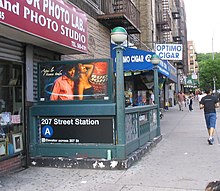
| Inwood | Inwood–207th Street | express | A |
September 10, 1932[33] | Bx12 Select Bus Service | |
| crossovers to connecting tracks to 207th Street Yard | ||||||
| Dyckman Street | express | A |
September 10, 1932[33] | |||
| connecting tracks to 207th Street Yard merge | ||||||
| Washington Heights | 190th Street | express | A |
September 10, 1932[33] | ||
| 181st Street | express | A |
September 10, 1932[33] | |||
| 175th Street | express | A |
September 10, 1932[33] | George Washington Bridge Bus Station | ||
| Local tracks begin in 174th Street Yard | ||||||
| 168th Street | all | A |
September 10, 1932[33] | IRT Broadway–Seventh Avenue Line (1 | ||
| 163rd Street–Amsterdam Avenue | local | A |
September 10, 1932[33] | |||
| 155th Street | local | A |
September 10, 1932[33] | Bx6 Select Bus Service | ||
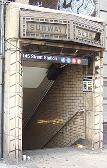
| Harlem | 145th Street | all | A |
September 10, 1932[33] | IND Concourse Line (B | |
| IND Concourse Line joins (B | ||||||
| 135th Street | local | A |
September 10, 1932[33] | |||
| 125th Street | all | A |
September 10, 1932[33] | M60 Select Bus Service to LaGuardia Airport | ||
| 116th Street | local | A |
September 10, 1932[33] | |||
| Upper West Side | Cathedral Parkway–110th Street | local | A |
September 10, 1932[33] | ||
| 103rd Street | local | A |
September 10, 1932[33] | |||
| 96th Street | local | A |
September 10, 1932[33] | |||
| 86th Street | local | A |
September 10, 1932[33] | M86 Select Bus Service | ||
| 81st Street–Museum of Natural History | local | A |
September 10, 1932[33] | M79 Select Bus Service | ||
| 72nd Street | local | A |
September 10, 1932[33] | |||
| Midtown | 59th Street–Columbus Circle | all | A |
September 10, 1932[33] | IRT Broadway–Seventh Avenue Line (1 | |
| IND Sixth Avenue Line splits (B | ||||||
| 50th Street | local | A |
September 10, 1932[33] | IND Queens Boulevard Line (E Accessible southbound only | ||
| IND Queens Boulevard Line joins (E | ||||||
| 42nd Street–Port Authority Bus Terminal | all | A |
September 10, 1932[33] | IRT Broadway–Seventh Avenue Line (1 IRT Flushing Line (7 IRT 42nd Street Shuttle (S BMT Broadway Line (N IND Sixth Avenue Line (B Port Authority Bus Terminal M34A Select Bus Service | ||
| 34th Street–Penn Station | all | A |
September 10, 1932[33] | Penn Station: Amtrak, Long Island Rail Road, and New Jersey Transit M34/M34A Select Bus Service | ||
| Chelsea | 23rd Street | local | A |
September 10, 1932[33] | M23 Select Bus Service | |
| 14th Street | all | A |
September 10, 1932[33] | BMT Canarsie Line (L | ||
| Greenwich Village | West Fourth Street–Washington Square | all | A |
September 10, 1932[33] | IND Sixth Avenue Line (B Connection to PATH at Ninth Street | |
| local crossovers to/from IND Sixth Avenue Line (no regular service) | ||||||
| Hudson Square | Spring Street | local | A |
September 10, 1932[33] | ||
| TriBeCa | Canal Street | all | A |
September 10, 1932[33] | ||
| Financial District | Chambers Street | express | A |
September 10, 1932[33] | two parts of the same station; local tracks end BMT Broadway Line (N IRT Broadway–Seventh Avenue Line (2 Connection to PATH at World Trade Center | |
| World Trade Center | local | E |
September 10, 1932[33] | |||
| Local tracks end | ||||||
| Fulton Street | express | A |
February 1, 1933[34] | formerly Broadway–Nassau Street IRT Broadway–Seventh Avenue Line (2 BMT Nassau Street Line (J IRT Lexington Avenue Line (4 Connection to PATH at World Trade Center | ||
| Brooklyn | ||||||
| continues through the Cranberry Street Tunnel | ||||||
| Brooklyn Heights | High Street | express | A |
June 24, 1933[35] | This section of line opened on February 1, 1933; the station opened later.[34] | |
| Continues as the IND Fulton Street Line (A | ||||||
Notes edit
- ^ The Metropolitan Transportation Authority considers Chambers Street and World Trade Center to be separate stations.[1] If Chambers Street-World Trade Center is considered a single station, the count drops to 30.
- ^ The line is also referred to using different names, such as the IND Central Park West Line, IND Washington Heights Line, or IND Eighth Avenue-Fulton Street Line. The line is chained to the same channel as the IND Fulton Street Line.
References edit
- ^ "Station Developers' Information". Metropolitan Transportation Authority. Retrieved June 13, 2017.
- ^ "Annual Subway Ridership (2018–2023)". Metropolitan Transportation Authority. 2023. Retrieved April 20, 2024.
- ^ "New Subway Link Opens Wednesday". New York Times. January 29, 1933. p. 3. Archived from the original on December 16, 2022. Retrieved July 22, 2018.
- ^ "Old Jamaica Farm Divided for Homes". The New York Times. October 8, 1939. p. 153. Archived from the original on June 30, 2018. Retrieved June 29, 2018.: "the property is near the Woodhaven Boulevard station of the Eighth Avenue subway"
- ^ "Delaney Assails Transit Sitdowns". The New York Times. January 31, 1943. p. 26. Archived from the original on April 29, 2014. Retrieved June 29, 2018.: "the Jamaica inspection barn of the Eighth Avenue Subway System, in Kew Gardens, Queens"
- ^ Kramer, Frederick A. (January 1, 1990). Building the Independent Subway. Quadrant Press. ISBN 9780915276509.
- ^ General Signal Arrangement, Sta. 943+00 to Sta. 971+50 (PDF) (Map) (November 15, 1968 ed.). New York City Transit Authority Maintenance of Way Department. Archived from the original (PDF) on September 26, 2007. Retrieved April 19, 2007.
- ^ Brennan, Joseph (2002). "Abandoned Stations: Court St, and Hoyt-Schermerhorn Sts platforms". Abandoned Stations. Archived from the original on January 17, 2019. Retrieved April 19, 2007.
- ^ a b c d e f g h i j Dougherty, Peter (2006) [2002]. Tracks of the New York City Subway 2006 (3rd ed.). Dougherty. OCLC 49777633 – via Google Books.
- ^ Grynbaum, Michael M. (May 10, 2010). "Take the Tomato 2 Stops to the Sunflower". City Room. Archived from the original on December 17, 2017. Retrieved November 6, 2016.
- ^ "Subway Service Guide" (PDF). Metropolitan Transportation Authority. September 2019. Retrieved September 22, 2019.
- ^ Tobin, Austin J. (May 10, 1960). "Addition to Bridge Upheld". The New York Times. p. 36. Archived from the original on June 29, 2018. Retrieved June 29, 2018.
- ^ "Across the Hudson by Rapid Transit". The New York Times. January 30, 1984. p. A16. Retrieved June 29, 2018.
- ^ "100 Miles of Subway in New City Project". The New York Times. September 16, 1929. p. 1. ISSN 0362-4331. Archived from the original on June 27, 2018. Retrieved June 29, 2018.
- ^ File No. 72, Drawing No. 58: Proposed Additional Rapid Transit Lines and Proposed Vehicular Tunnels (Map) (August 23, 1929 ed.). New York City Board of Transportation.
- ^ "Draft Long List of Alternatives" (PDF). Metropolitan Transportation Authority. October 2005. Archived from the original (PDF) on August 5, 2011. Retrieved December 26, 2013.
- ^ "Plan a New Subway on Upper West Side". The New York Times. March 3, 1918. p. 27. ISSN 0362-4331. Archived from the original on June 14, 2010. Retrieved June 29, 2018.
- ^ "Two Subway Routes Adopted by City". The New York Times. August 4, 1923. p. 9. ISSN 0362-4331. Archived from the original on June 30, 2019. Retrieved June 29, 2018.
- ^ "Plans Now Ready to Start Subways". The New York Times. March 12, 1924. p. 1. ISSN 0362-4331. Archived from the original on June 28, 2019. Retrieved June 29, 2018.
- ^ "Hylan Subway Plan Links Four Boroughs at $450,000,000 Cost". The New York Times. December 10, 1924. p. 1. ISSN 0362-4331. Archived from the original on June 14, 2018. Retrieved June 29, 2018.
- ^ Raskin, Joseph B. (2013). The Routes Not Taken: A Trip Through New York City's Unbuilt Subway System. New York, New York: Fordham University Press. doi:10.5422/fordham/9780823253692.001.0001. ISBN 978-0-82325-369-2.
- ^ "Will Break Ground Today for New Uptown Subway". The New York Times. March 14, 1925. p. 15. ISSN 0362-4331. Archived from the original on June 14, 2018. Retrieved June 29, 2018.
- ^ a b Warner, Arthur (November 22, 1931). "The City's New Underground Province; The Eighth Avenue Subway Will Be Not Only a Transit Line but a Centre for the Shopper A New Underground Province of New York The Eighth Avenue Subway Will Be a Rapid Transit Line With Innovations and Will Provide Centres for the Shoppers". The New York Times. ISSN 0362-4331. Archived from the original on May 3, 2018. Retrieved May 2, 2018.
- ^ "$9,631,760 Awarded On Church Street; Payment Made to 161 Owners for Subway and Road-Widening Improvements. Transforming Old Centre Realty Enhanced and Modern Buildings Are Replacing Ancient Structures. Realty Values Increase. To Cost $14,000,000". The New York Times. January 6, 1929. ISSN 0362-4331. Archived from the original on August 15, 2019. Retrieved June 28, 2018.
- ^ "Transit Board Land Ceded To Boroughs; New Street Areas, Valued at $10,000,000, Are in Manhattan, Brooklyn and the Bronx. Acquired In Condemnation Widening of Thoroughfares for Subways Also Has Increased Real Estate Values". The New York Times. January 28, 1932. ISSN 0362-4331. Archived from the original on June 28, 2018. Retrieved June 28, 2018.
- ^ Walsh, Kevin (April 15, 2003). "DEEP SIXTH: a walk up Avenue of the Americas - Forgotten New York". forgotten-ny.com. Archived from the original on May 15, 2018. Retrieved May 14, 2018.
- ^ Adams, Mildred (September 19, 1926). "Traffic Now Forces Huge Street Cutting; Sixth Avenue Extension to Focal Point on Canal, Street Is Perhaps the Most Extraordinary of Its Kind in the Entire History of New York City". The New York Times. ISSN 0362-4331. Archived from the original on October 23, 2019. Retrieved May 15, 2018.
- ^ "To Open 6th Av. Extension; Walker and Miller to Take Part in Ceremony Today". The New York Times. September 18, 1930. ISSN 0362-4331. Archived from the original on May 15, 2018. Retrieved May 15, 2018.
- ^ "10,000 Must Leave Condemned Houses; City's Order to Persons in Path of Sixth Av. Extension Comes as Surprise to Many. Last Day of Grace Aug. 31 Razing of Buildings In Greenwich Village Prepares Traffic Artery for Holland Tunnel". The New York Times. July 29, 1926. ISSN 0362-4331. Archived from the original on May 10, 2018. Retrieved May 15, 2018.
- ^ Transit Journal. McGraw-Hill Publishing Company, Incorporated. 1932.
- ^ Copeland, George H. (June 19, 1932). "The City's New Subway Line Promises Speed and Comfort; Innovations to Be Found in the Eighth Avenue System; How It Fits Into the Rapid Transit Scheme, and the Expected Revenues". The New York Times. ISSN 0362-4331. Archived from the original on July 1, 2022. Retrieved July 1, 2022.
- ^ "Tile Colors a Guide in the New Subway; Decoration Scheme Changes at Each Express Stop to Tell Riders Where They Are". The New York Times. August 22, 1932. ISSN 0362-4331. Archived from the original on July 1, 2022. Retrieved July 1, 2022.
- ^ a b c d e f g h i j k l m n o p q r s t u v w x y z aa ab ac ad ae "Gay Midnight Crowd Rides First Trains in New Subway". The New York Times. September 10, 1932. p. 1. ISSN 0362-4331. Archived from the original on September 12, 2012. Retrieved June 29, 2018.
- ^ a b c d "City Opens Subway to Brooklyn Today". The New York Times. February 1, 1933. p. 19. ISSN 0362-4331. Archived from the original on June 26, 2018. Retrieved June 29, 2018.
- ^ a b "Jobs are Filled on All Subway Links". The New York Times. June 25, 1933. p. 8. ISSN 0362-4331. Archived from the original on June 29, 2018. Retrieved June 29, 2018.
- ^ "City Subway Adds a New Link Today". The New York Times. March 20, 1933. p. 17. ISSN 0362-4331. Archived from the original on June 27, 2018. Retrieved June 29, 2018.
- ^ "New Bronx Subway Starts Operation". The New York Times. July 1, 1933. p. 15. ISSN 0362-4331. Archived from the original on March 26, 2020. Retrieved June 29, 2018.
- ^ Station Guide, Independent City Owned Rapid Transit Railroad (PDF) (Map). New York City Board of Transportation. c. 1937. Archived (PDF) from the original on October 23, 2012. Retrieved April 18, 2007.
- ^ "Two Subway Units Open at Midnight". The New York Times. August 18, 1933. p. 17. ISSN 0362-4331. Archived from the original on June 27, 2018. Retrieved June 29, 2018.
- ^ "6th Ave. Tube Adds Two New Services". The New York Times. December 5, 1940. p. 27. ISSN 0362-4331. Archived from the original on June 17, 2018. Retrieved June 29, 2018.
- ^ Ingalls, Leonard (August 28, 1953). "2 Subway Lines to Add Cars, Another to Speed Up Service" (PDF). New York Times. ISSN 0362-4331. Archived from the original on July 2, 2022. Retrieved January 25, 2016.
- ^ a b Johnson, Kirk (December 9, 1988). "Big Changes For Subways Are to Begin". The New York Times. ISSN 0362-4331. Archived from the original on March 8, 2021. Retrieved June 6, 2016.
- ^ "Service Adjustments on the BMT and IND Lines Effective Midnight, Saturday, August 27". New York City Transit Authority. 1977. Archived from the original on September 15, 2016. Retrieved June 9, 2016 – via Flickr.
- ^ a b c Korman, Joseph. "IND Subway Services". ERA NY Division Bulletins October and November 1968. Archived from the original on November 22, 2019. Retrieved October 7, 2018 – via thejoekorner.com.
- ^ "Hey, What's a "K" train? 1985 Brochure". New York City Transit Authority. 1985. Archived from the original on September 15, 2016. Retrieved June 17, 2016 – via Flickr.
- ^ Annual Report on ... Rapid Routes Schedules and Service Planning. New York City Transit Authority. 1989. p. 17. Archived from the original on July 31, 2018. Retrieved March 25, 2018.
- ^ "System-Wide Changes In Subway Service Effective Sunday, December 11, 1988". New York City Transit Authority. 1988. Archived from the original on September 15, 2016. Retrieved June 17, 2016 – via Flickr.
- ^ "May 1994 Subway Map". New York City Transit. May 1994. Archived from the original on April 4, 2023. Retrieved October 7, 2018 – via Flickr.
- ^ "March 1, 1998 B C Routes are switching places above 145 St". New York City Transit. March 1998. Archived from the original on January 5, 2017. Retrieved October 23, 2016 – via Flickr.
- ^ "Changes in B & C service". New York Daily News. February 24, 1998. Archived from the original on March 29, 2019. Retrieved March 29, 2019.
- ^ "March 1, 1998 B C Routes are switching places above 145 St". New York City Transit. March 1998. Archived from the original on January 5, 2017. Retrieved October 23, 2016 – via Flickr.
- ^ "The B and C routes will switch places above 145th Street beginning March 1". New York Daily News. February 23, 1998. Archived from the original on March 29, 2019. Retrieved March 29, 2019.
- ^ Lower Manhattan Development Corporation (2004). "Lower Manhattan Airport and Commuter Access Alternatives Analysis" (PDF). Archived from the original (PDF) on September 24, 2015. Retrieved March 19, 2008.
- ^ "9/11 Service Changes". Second Ave. Sagas. September 11, 2007. Archived from the original on August 2, 2019. Retrieved June 26, 2019.
- ^ "Map of 9/11 service changes". nycsubway.org. Archived from the original on June 27, 2020. Retrieved June 26, 2019.
- ^ Chan, Sewell (January 25, 2005). "2 Subway Lines Crippled by Fire; Long Repair Seen". The New York Times. ISSN 0362-4331. Archived from the original on August 12, 2014. Retrieved October 7, 2018.
- ^ Whitford, Emma (January 8, 2016). "MTA Will Completely Close 30 Subway Stations For Months-Long "Revamp"". Gothamist. Archived from the original on August 1, 2016. Retrieved July 18, 2016.
- ^ "MTAStations" (PDF). governor.ny.gov. Government of the State of New York. Archived (PDF) from the original on November 2, 2019. Retrieved July 18, 2016.
- ^ "Enhanced Station Initiative: CCM Pre-Proposal Conference" (PDF). Metropolitan Transportation Authority. October 25, 2016. p. 8 (PDF page 15). Archived (PDF) from the original on August 12, 2017. Retrieved August 11, 2017.
- ^ "72 St BC Station Reopens After Major Repairs to Steel and Concrete Structure, Functional Improvements". mta.info. Metropolitan Transportation Authority. October 4, 2018. Archived from the original on October 4, 2018. Retrieved October 4, 2018.
- ^ a b Warerkar, Tanay (February 19, 2018). "MTA will shutter 4 Upper Manhattan subway stations for repairs". Curbed NY. Archived from the original on August 1, 2019. Retrieved February 20, 2018.
- ^ "Press Release - NYC Transit - Structural Repairs & Functional Enhancements at Cathedral Pkwy-110 St Subway Station to be Completed Labor Day Weekend". MTA. August 27, 2018. Archived from the original on August 30, 2019. Retrieved August 29, 2018.
- ^ "Press Release - NYC Transit - 163 St-Amsterdam Av Station to Reopen After Structural Repairs & Functional Improvements". MTA. September 23, 2018. Archived from the original on September 4, 2019. Retrieved September 24, 2018.
- ^ "100 Miles Of Subway In New City Project; 52 Of Them In Queens; Transportation Board Gives Out Routes of Second System to Cover Four Boroughs. $438,400,000 Cost To Build Second Av. Trunk Line to Be Hub, Linking With Bronx and New River Tubes to East. Rockaways To Be Served Project's Sponsors See Network Touching All Sections Now in Need of Rapid Transit. Big Items Not in Cost Estimate. East Side Belt Line. New Subway Unit To Have 100 Miles 100 Four New Routes in Bronx. Queens Gets Most Mileage. Main Manhattan-Bronx Line. 163d St.-Lafayette Avenue Line. East-West Bronx Line. New Brooklyn Lines. To Serve Rockaway. Queens Cross Connections. For Easterly Queens". The New York Times. September 16, 1929. ISSN 0362-4331. Archived from the original on April 3, 2018. Retrieved April 2, 2018.
- ^ "Public Hearings". The New York Times. March 2, 1930. ISSN 0362-4331. Archived from the original on June 28, 2018. Retrieved June 27, 2018.
- ^ "Want Grand St. Subway.; East Side Civic Groups Approve Proposal at a Hearing". The New York Times. March 13, 1930. ISSN 0362-4331. Archived from the original on June 28, 2018. Retrieved June 27, 2018.
- ^ "Planning To Build Worth St. Subway; Transportation Board Officials Getting Sanction of Property Owners. Delaney Outlines Route. New East Side Link Will Connect With Other Rapid Transit Lines Near Church Street". The New York Times. July 27, 1930. ISSN 0362-4331. Archived from the original on June 28, 2018. Retrieved June 27, 2018.
- ^ "Push Subway Links To Aid Brooklyn; Members of Transit Board to Ask Bids on Church Street Connection on Aug. 22. B.M.T. Contract Let Board of Estimate Gets $654,000 on Defaulted 14th St. Job--Awards $2,215,000 for Land". The New York Times. July 30, 1930. ISSN 0362-4331. Archived from the original on June 28, 2018. Retrieved June 27, 2018.
- ^ "$414,518,050 Outlay For City Projects Asked By Bureaus; Additional Sums for Works Already Under Way Account for Most of the Total". The New York Times. December 16, 1937. ISSN 0362-4331. Archived from the original on June 27, 2018. Retrieved June 27, 2018.
- ^ "Transit Expansion To Cost $827,102,344; Delaney Submits Long-Range Program to Planning Board--Many Items Must Wait Early Unification Assumed Projects as Submitted Transit Expansion To Cost $827,102,344 Reply To Haskell Issued Morris Says Demand for Price on Transit Cannot Be Met Now". The New York Times. September 15, 1938. ISSN 0362-4331. Archived from the original on June 28, 2018. Retrieved June 27, 2018.
- ^ "Eighth Av. Subway Nearly Completed; Basic Construction Work From Chambers to 207th St. Done Except on Few Short Stretches. To Operate Late In 1931 Equipment, Rolling Stock and Electrical Apparatus Are Being Rapidly Provided. Report Work Done to July 31. Ten of 300 New Cars Delivered". The New York Times. August 24, 1930. ISSN 0362-4331. Archived from the original on June 28, 2018. Retrieved June 27, 2018.
External links edit
- IND 8th Avenue Line (www.nycsubway.org)
- NYCsubway.org - IND Second System
- NYCsubway.org - Roosevelt Avenue Terminal Station
- Abandoned Stations - IND Second System unfinished stations
- JoeKorNer - IND Second System (including a plan for a line to Staten Island)