


Summary
Imelda, officially the Municipality of Imelda (Cebuano: Lungsod sa Imelda; Chavacano: Municipalidad de Imelda; Tagalog: Bayan ng Imelda), is a 4th class municipality in the province of Zamboanga Sibugay, Philippines. According to the 2020 census, it has a population of 26,020 people.[3]
Imelda | |
|---|---|
| Municipality of Imelda | |
 Flag  Seal | |
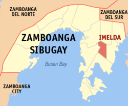 Map of Zamboanga Sibugay with Imelda highlighted | |
OpenStreetMap .mw-parser-output .locmap .od{position:absolute}.mw-parser-output .locmap .id{position:absolute;line-height:0}.mw-parser-output .locmap .l0{font-size:0;position:absolute}.mw-parser-output .locmap .pv{line-height:110%;position:absolute;text-align:center}.mw-parser-output .locmap .pl{line-height:110%;position:absolute;top:-0.75em;text-align:right}.mw-parser-output .locmap .pr{line-height:110%;position:absolute;top:-0.75em;text-align:left}.mw-parser-output .locmap .pv>div{display:inline;padding:1px}.mw-parser-output .locmap .pl>div{display:inline;padding:1px;float:right}.mw-parser-output .locmap .pr>div{display:inline;padding:1px;float:left}html.skin-theme-clientpref-night .mw-parser-output .od,html.skin-theme-clientpref-night .mw-parser-output .od .pv>div,html.skin-theme-clientpref-night .mw-parser-output .od .pl>div,html.skin-theme-clientpref-night .mw-parser-output .od .pr>div{background:#000;color:#fff}html.skin-theme-clientpref-night .mw-parser-output .locmap{filter:grayscale(0.6)}@media(prefers-color-scheme:dark){html.skin-theme-clientpref-os .mw-parser-output .locmap{filter:grayscale(0.6)}html.skin-theme-clientpref-os .mw-parser-output .od,html.skin-theme-clientpref-os .mw-parser-output .od .pv>div,html.skin-theme-clientpref-os .mw-parser-output .od .pl>div,html.skin-theme-clientpref-os .mw-parser-output .od .pr>div{background:#000;color:#fff}}  Imelda Location within the Philippines | |
| Coordinates: 7°38′34″N 122°56′05″E / 7.64275°N 122.9347°E | |
| Country | Philippines |
| Region | Zamboanga Peninsula |
| Province | Zamboanga Sibugay |
| District | 1st district |
| Founded | 11 November 1977 |
| Named for | Imelda Marcos |
| Barangays | 18 (see Barangays) |
| Government | |
| • Type | Sangguniang Bayan |
| • Mayor | Roselyn V. Silva |
| • Vice Mayor | Ruth E. Roble |
| • Representative | Wilter Y. Palma |
| • Municipal Council | Members |
| • Electorate | 16,553 voters (2022) |
| Area | |
| • Total | 255.51 km2 (98.65 sq mi) |
| Elevation | 76 m (249 ft) |
| Highest elevation | 454 m (1,490 ft) |
| Lowest elevation | 16 m (52 ft) |
| Population (2020 census)[3] | |
| • Total | 26,020 |
| • Density | 100/km2 (260/sq mi) |
| • Households | 6,074 |
| Economy | |
| • Income class | 4th municipal income class |
| • Poverty incidence | 29.28 |
| • Revenue | ₱ 129.5 million (2020) |
| • Assets | ₱ 368.6 million (2020) |
| • Expenditure | ₱ 105.3 million (2020) |
| • Liabilities | ₱ 117.5 million (2020) |
| Service provider | |
| • Electricity | Zamboanga del Sur 2 Electric Cooperative (ZAMSURECO 2) |
| Time zone | UTC+8 (PST) |
| ZIP code | 7007 |
| PSGC | 098304000 |
| IDD : area code | +63 (0)62 |
| Native languages | Subanon Cebuano Chavacano Tagalog |
The municipality was established on 11 November 1977 by virtue of Presidential Decree No. 1239 signed by Philippine President Ferdinand Marcos. It was formed from several barangays taken from the neighboring municipalities of Malangas, Siay, and Alicia and named after First Lady Imelda Marcos.[5] It is the least populous municipality in the province and the third smallest in area.
Geography edit
Barangays edit
Imelda is politically subdivided into 18 barangays. Each barangay consists of puroks while some have sitios.
- Balugo
- Bolungisan
- Baluyan
- Cana-an
- Dumpoc
- Gandiangan
- Israel (Balian Israel)
- Lower Baluran
- La Victoria
- Little Baguio
- Lumbog
- Lumpanac
- Mali Little Baguio
- Poblacion (Santa Fe)
- Pulawan (Mountain View)
- San Jose
- Santa Barbara
- Upper Baluran
Climate edit
| Climate data for Imelda, Zamboanga Sibugay | |||||||||||||
|---|---|---|---|---|---|---|---|---|---|---|---|---|---|
| Month | Jan | Feb | Mar | Apr | May | Jun | Jul | Aug | Sep | Oct | Nov | Dec | Year |
| Mean daily maximum °C (°F) | 30 (86) |
31 (88) |
31 (88) |
31 (88) |
30 (86) |
29 (84) |
28 (82) |
29 (84) |
29 (84) |
29 (84) |
29 (84) |
30 (86) |
30 (85) |
| Mean daily minimum °C (°F) | 22 (72) |
23 (73) |
23 (73) |
24 (75) |
24 (75) |
24 (75) |
24 (75) |
24 (75) |
24 (75) |
24 (75) |
24 (75) |
23 (73) |
24 (74) |
| Average precipitation mm (inches) | 61 (2.4) |
55 (2.2) |
75 (3.0) |
81 (3.2) |
145 (5.7) |
189 (7.4) |
189 (7.4) |
197 (7.8) |
162 (6.4) |
181 (7.1) |
115 (4.5) |
70 (2.8) |
1,520 (59.9) |
| Average rainy days | 16.4 | 15.7 | 19.1 | 21.5 | 26.9 | 27.1 | 26.4 | 25.0 | 24.2 | 26.8 | 23.5 | 18.7 | 271.3 |
| Source: Meteoblue[6] | |||||||||||||
Demographics edit
| Year | Pop. | ±% p.a. |
|---|---|---|
| 1980 | 5,678 | — |
| 1990 | 16,231 | +11.08% |
| 1995 | 22,760 | +6.54% |
| 2000 | 21,534 | −1.18% |
| 2007 | 24,787 | +1.96% |
| 2010 | 27,903 | +4.40% |
| 2015 | 28,018 | +0.08% |
| 2020 | 26,020 | −1.44% |
| Source: Philippine Statistics Authority[7][8][9][10] | ||
Economy edit
References edit
- ^ Municipality of Imelda | (DILG)
- ^ "2015 Census of Population, Report No. 3 – Population, Land Area, and Population Density" (PDF). Philippine Statistics Authority. Quezon City, Philippines. August 2016. ISSN 0117-1453. Archived (PDF) from the original on May 25, 2021. Retrieved July 16, 2021.
- ^ a b Census of Population (2020). "Region IX (Zamboanga Peninsula)". Total Population by Province, City, Municipality and Barangay. Philippine Statistics Authority. Retrieved 8 July 2021.
- ^ "PSA Releases the 2018 Municipal and City Level Poverty Estimates". Philippine Statistics Authority. 15 December 2021. Retrieved 22 January 2022.
- ^ "Presidential Decree No. 1239 - An Act Creating the Municipality of Imelda in the Province of Zamboanga del Sur". The LawPhil Project. Arellano Law Foundation. Retrieved 17 March 2021.
- ^ "Imelda: Average Temperatures and Rainfall". Meteoblue. Retrieved 1 May 2020.
- ^ Census of Population (2015). "Region IX (Zamboanga Peninsula)". Total Population by Province, City, Municipality and Barangay. Philippine Statistics Authority. Retrieved 20 June 2016.
- ^ Census of Population and Housing (2010). "Region IX (Zamboanga Peninsula)" (PDF). Total Population by Province, City, Municipality and Barangay. National Statistics Office. Retrieved 29 June 2016.
- ^ Censuses of Population (1903–2007). "Region IX (Zamboanga Peninsula)". Table 1. Population Enumerated in Various Censuses by Province/Highly Urbanized City: 1903 to 2007. National Statistics Office.
{{cite encyclopedia}}: CS1 maint: numeric names: authors list (link) - ^ "Province of Zamboanga Sibugay". Municipality Population Data. Local Water Utilities Administration Research Division. Retrieved 17 December 2016.
- ^ "Poverty incidence (PI):". Philippine Statistics Authority. Retrieved December 28, 2020.
- ^ "Estimation of Local Poverty in the Philippines" (PDF). Philippine Statistics Authority. 29 November 2005.
- ^ "2003 City and Municipal Level Poverty Estimates" (PDF). Philippine Statistics Authority. 23 March 2009.
- ^ "City and Municipal Level Poverty Estimates; 2006 and 2009" (PDF). Philippine Statistics Authority. 3 August 2012.
- ^ "2012 Municipal and City Level Poverty Estimates" (PDF). Philippine Statistics Authority. 31 May 2016.
- ^ "Municipal and City Level Small Area Poverty Estimates; 2009, 2012 and 2015". Philippine Statistics Authority. 10 July 2019.
- ^ "PSA Releases the 2018 Municipal and City Level Poverty Estimates". Philippine Statistics Authority. 15 December 2021. Retrieved 22 January 2022.
External links edit
- Imelda Profile at PhilAtlas.com
- Philippine Standard Geographic Code
- Philippine Census Information