
KNOWPIA
WELCOME TO KNOWPIA

Jianhe County 
Summary
Jianhe County (simplified Chinese: 剑河县; traditional Chinese: 劍河縣; pinyin: Jiànhé Xiàn) is in the southeast of Guizhou Province, China. Under the administration of Qiandongnan Prefecture, it is 294 km (183 mi) from the provincial capital of Guiyang, and 98 km (61 mi) from Kaili City, the prefectural seat.
Jianhe County
剑河县 Kienho | |
|---|---|
 Jianhe, summer 2012 | |
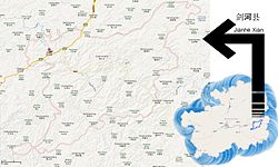 Jianhe in Guizhou, with township-level divisions | |
| Coordinates: 26°43′42″N 108°26′29″E / 26.7283°N 108.4415°E | |
| Country | China |
| Province | Guizhou |
| Autonomous prefecture | Qiandongnan |
| County seat | Gedong |
| Area | |
| • Total | 2,176 km2 (840 sq mi) |
| Population (2010) | |
| • Total | 180,544 |
| • Density | 83/km2 (210/sq mi) |
| Time zone | UTC+8 (China Standard) |
| Postal code | 556400 |
| Website | http://www.yxgz.cn/city-76-index.html |
Administration edit
Jianhe County administers one subdistrict, 11 towns, and 1 township:[1]
- Subdistrict
- Yang'asha 仰阿莎街道
- Towns
- Liuchuan 柳川镇
- Cengsong 岑松镇
- Nanjia 南加镇
- Nanming 南明镇
- Gedong 革东镇
- Panxi 磻溪镇
- Taiyong 太拥镇
- Jiuyang 久仰镇
- Nanshao 南哨镇
- Nanzhai 南寨镇
- Guanme 观么镇
- Township
- Mindong 敏洞乡
Demographics edit
Climate edit
| Climate data for Jianhe, elevation 527 m (1,729 ft), (1991–2020 normals, extremes 1981–2010) | |||||||||||||
|---|---|---|---|---|---|---|---|---|---|---|---|---|---|
| Month | Jan | Feb | Mar | Apr | May | Jun | Jul | Aug | Sep | Oct | Nov | Dec | Year |
| Record high °C (°F) | 24.8 (76.6) |
32.7 (90.9) |
34.6 (94.3) |
36.0 (96.8) |
34.9 (94.8) |
36.6 (97.9) |
38.1 (100.6) |
38.3 (100.9) |
37.7 (99.9) |
34.5 (94.1) |
30.9 (87.6) |
26.2 (79.2) |
38.3 (100.9) |
| Mean daily maximum °C (°F) | 9.5 (49.1) |
12.7 (54.9) |
17.2 (63.0) |
23.0 (73.4) |
26.6 (79.9) |
29.1 (84.4) |
31.6 (88.9) |
31.7 (89.1) |
28.3 (82.9) |
22.7 (72.9) |
18.3 (64.9) |
12.4 (54.3) |
21.9 (71.5) |
| Daily mean °C (°F) | 5.8 (42.4) |
8.3 (46.9) |
12.2 (54.0) |
17.5 (63.5) |
21.3 (70.3) |
24.3 (75.7) |
26.2 (79.2) |
25.6 (78.1) |
22.4 (72.3) |
17.6 (63.7) |
13.0 (55.4) |
7.8 (46.0) |
16.8 (62.3) |
| Mean daily minimum °C (°F) | 3.4 (38.1) |
5.4 (41.7) |
9.0 (48.2) |
13.9 (57.0) |
17.7 (63.9) |
21.2 (70.2) |
22.7 (72.9) |
22.0 (71.6) |
18.9 (66.0) |
14.6 (58.3) |
9.8 (49.6) |
4.9 (40.8) |
13.6 (56.5) |
| Record low °C (°F) | −5.0 (23.0) |
−4.7 (23.5) |
−2.2 (28.0) |
4.1 (39.4) |
7.8 (46.0) |
12.4 (54.3) |
15.5 (59.9) |
16.5 (61.7) |
11.4 (52.5) |
4.4 (39.9) |
−1.8 (28.8) |
−4.6 (23.7) |
−5.0 (23.0) |
| Average precipitation mm (inches) | 38.5 (1.52) |
36.2 (1.43) |
67.0 (2.64) |
119.7 (4.71) |
168.3 (6.63) |
206.2 (8.12) |
180.7 (7.11) |
124.5 (4.90) |
81.6 (3.21) |
83.9 (3.30) |
51.3 (2.02) |
28.0 (1.10) |
1,185.9 (46.69) |
| Average precipitation days (≥ 0.1 mm) | 13.5 | 12.2 | 15.7 | 16.0 | 16.9 | 16.7 | 14.2 | 13.8 | 10.4 | 12.4 | 9.3 | 9.7 | 160.8 |
| Average snowy days | 4.2 | 2.1 | 0.4 | 0 | 0 | 0 | 0 | 0 | 0 | 0 | 0.1 | 1.3 | 8.1 |
| Average relative humidity (%) | 79 | 77 | 78 | 79 | 81 | 83 | 80 | 81 | 81 | 82 | 80 | 77 | 80 |
| Mean monthly sunshine hours | 31.5 | 44.1 | 60.1 | 80.1 | 91.8 | 81.4 | 134.2 | 146.3 | 105.6 | 75.0 | 71.3 | 54.4 | 975.8 |
| Percent possible sunshine | 10 | 14 | 16 | 21 | 22 | 20 | 32 | 36 | 29 | 21 | 22 | 17 | 22 |
| Source: China Meteorological Administration[2][3] | |||||||||||||
See also edit
References edit
- ^ 2023年统计用区划代码和城乡划分代码:剑河县 (in Simplified Chinese). National Bureau of Statistics of China.
- ^ 中国气象数据网 – WeatherBk Data (in Simplified Chinese). China Meteorological Administration. Retrieved 28 April 2023.
- ^ 中国气象数据网 (in Simplified Chinese). China Meteorological Administration. Retrieved 28 April 2023.
External links edit
- Official website