
KNOWPIA
WELCOME TO KNOWPIA

Katsuta, Okayama 
Summary
Katsuta (勝田町, Katsuta-chō) was a town located in Katsuta District, Okayama Prefecture, Japan.
Katsuta
勝田町 | |
|---|---|
Town | |
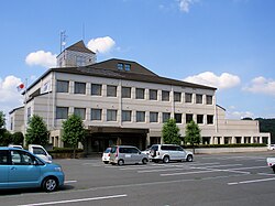 Former Katsuta town hall | |
 Katsuta Location in Japan | |
| Coordinates: 35°4′24.4″N 134°11′28.0″E / 35.073444°N 134.191111°E | |
| Country | Japan |
| Region | Chūgoku |
| Prefecture | Okayama Prefecture |
| District | Katsuta |
| Merged | March 31, 2005 (now part of Mimasaka) |
| Area | |
| • Total | 87.29 km2 (33.70 sq mi) |
| Population (2003) | |
| • Total | 3,660 |
| • Density | 41.93/km2 (108.6/sq mi) |
| Time zone | UTC+09:00 (JST) |
| Symbols | |
| Flower | Lilium |
| Tree | Cryptomeria japonica |
As of 2003, the town had an estimated population of 3,660 and a density of 41.93 persons per km2. The total area was 87.29 km2.
On March 31, 2005, Katsuta, along with the towns of Mimasaka (former), Aida, Ōhara and Sakutō, and the village of Higashiawakura (all from Aida District), was merged to create the city of Mimasaka.[1][2]
Geography edit
Adjoining municipalities edit
Education edit
- Katsuta Elementary School
- Katsuta-Higashi Elementary School
- Kajinami Elementary School
- Katsuta Junior High School
Transportation edit
Road edit
References edit
- ^ データでみる県勢: 日本国勢図会地域統計版 (in Japanese). 国勢社. 2006. p. 97.
2005 年 3 月 31 日に勝田町、大原町、東粟倉村、美作町、作東町、英田町が合併して誕生した。
- ^ 住民基本台帳人口移動報告年報 (in Japanese). 総務庁統計局. 2005. p. 147.
Katsuta-cho, Ohara-cho, Higashiawakura-son, Mimasaka-cho, Sakuto-cho and Aida-cho were incorporated into a newly established Mimasaka-shi as of March 31, 2005.
External links edit
- Official website of Mimasaka in Japanese