
KNOWPIA
WELCOME TO KNOWPIA

Kayraly 
Summary
Kayraly (Finnish: Kairala, Russian: Кайралы) is a rural locality (a Posyolok) in Kandalakshskiy District of Murmansk Oblast, Russia. The village is located beyond the Arctic circle. Its altitude is 213 metres (699 ft).
Kayraly
Кайралы | |
|---|---|
Location of Kayraly .mw-parser-output .locmap .od{position:absolute}.mw-parser-output .locmap .id{position:absolute;line-height:0}.mw-parser-output .locmap .l0{font-size:0;position:absolute}.mw-parser-output .locmap .pv{line-height:110%;position:absolute;text-align:center}.mw-parser-output .locmap .pl{line-height:110%;position:absolute;top:-0.75em;text-align:right}.mw-parser-output .locmap .pr{line-height:110%;position:absolute;top:-0.75em;text-align:left}.mw-parser-output .locmap .pv>div{display:inline;padding:1px}.mw-parser-output .locmap .pl>div{display:inline;padding:1px;float:right}.mw-parser-output .locmap .pr>div{display:inline;padding:1px;float:left}html.skin-theme-clientpref-night .mw-parser-output .od,html.skin-theme-clientpref-night .mw-parser-output .od .pv>div,html.skin-theme-clientpref-night .mw-parser-output .od .pl>div,html.skin-theme-clientpref-night .mw-parser-output .od .pr>div{background:#000;color:#fff}html.skin-theme-clientpref-night .mw-parser-output .locmap{filter:grayscale(0.6)}@media(prefers-color-scheme:dark){html.skin-theme-clientpref-os .mw-parser-output .locmap{filter:grayscale(0.6)}html.skin-theme-clientpref-os .mw-parser-output .od,html.skin-theme-clientpref-os .mw-parser-output .od .pv>div,html.skin-theme-clientpref-os .mw-parser-output .od .pl>div,html.skin-theme-clientpref-os .mw-parser-output .od .pr>div{background:#000;color:#fff}}  Kayraly Location of Kayraly 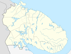 Kayraly Kayraly (Murmansk Oblast) | |
| Coordinates: 66°55′59″N 29°36′0″E / 66.93306°N 29.60000°E | |
| Country | Russia |
| Federal subject | Murmansk Oblast[1] |
| Administrative district | Kandalakshskiy District[1] |
| Population | |
| • Total | 19 |
| Time zone | UTC+3 (MSK |
| Postal code(s)[4] | 184020 |
| Dialing code(s) | +7 81533[5] |
| OKTMO ID | 47608403106 |
References edit
- ^ a b c d OKATO, Part 2. Code 47 408 803 001
- ^ Статистический сборник Численность, размещение и возрастно-половой состав населения Мурманской области. Итоги Всероссийской переписи населения. Том 1. 2012 Archived 2012-12-22 at the Wayback Machine / Федеральная служба государственной статистики, Территориальный орган Федеральной службы государственной статистики по Мурманской области. Мурманск, 2012 — 75 с.
- ^ "Об исчислении времени". Официальный интернет-портал правовой информации (in Russian). 3 June 2011. Retrieved 19 January 2019.
- ^ Russian Post. Эталонный справочник индексов объектов почтовой связи (in Russian)
- ^ Народная энциклопедия городов и регионов России «Мой Город» (in Russian)