


Summary
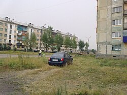
Kizel (Russian: Ки́зел) is a town in Perm Krai, Russia, located on the Kizel River (Kama's basin), 200 kilometers (120 mi) northeast of Perm, the administrative center of the krai. Population: 19,587 (2010 Russian census);[2] 23,841 (2002 Census);[7] 36,746 (1989 Soviet census);[8] 60,700 (1959).
Kizel
Кизел | |
|---|---|
 In Kizel | |
 Flag  Coat of arms | |
Location of Kizel .mw-parser-output .locmap .od{position:absolute}.mw-parser-output .locmap .id{position:absolute;line-height:0}.mw-parser-output .locmap .l0{font-size:0;position:absolute}.mw-parser-output .locmap .pv{line-height:110%;position:absolute;text-align:center}.mw-parser-output .locmap .pl{line-height:110%;position:absolute;top:-0.75em;text-align:right}.mw-parser-output .locmap .pr{line-height:110%;position:absolute;top:-0.75em;text-align:left}.mw-parser-output .locmap .pv>div{display:inline;padding:1px}.mw-parser-output .locmap .pl>div{display:inline;padding:1px;float:right}.mw-parser-output .locmap .pr>div{display:inline;padding:1px;float:left}html.skin-theme-clientpref-night .mw-parser-output .od,html.skin-theme-clientpref-night .mw-parser-output .od .pv>div,html.skin-theme-clientpref-night .mw-parser-output .od .pl>div,html.skin-theme-clientpref-night .mw-parser-output .od .pr>div{background:#000;color:#fff}html.skin-theme-clientpref-night .mw-parser-output .locmap{filter:grayscale(0.6)}@media(prefers-color-scheme:dark){html.skin-theme-clientpref-os .mw-parser-output .locmap{filter:grayscale(0.6)}html.skin-theme-clientpref-os .mw-parser-output .od,html.skin-theme-clientpref-os .mw-parser-output .od .pv>div,html.skin-theme-clientpref-os .mw-parser-output .od .pl>div,html.skin-theme-clientpref-os .mw-parser-output .od .pr>div{background:#000;color:#fff}}  Kizel Location of Kizel 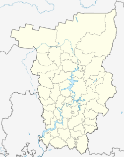 Kizel Kizel (Perm Krai) | |
| Coordinates: 59°03′N 57°40′E / 59.050°N 57.667°E | |
| Country | Russia |
| Federal subject | Perm Krai[1] |
| Founded | 1750 |
| Town status since | 1926 |
| Elevation | 330 m (1,080 ft) |
| Population | |
| • Total | 19,587 |
| • Estimate (2018)[3] | 14,883 (−24%) |
| • Subordinated to | town of krai significance of Kizel[1] |
| • Capital of | town of krai significance of Kizel[1] |
| • Municipal district | Kizelovsky Municipal District[4] |
| • Urban settlement | Kizelovskoye Urban Settlement[4] |
| • Capital of | Kizelovsky Municipal District,[4] Kizelovskoye Urban Settlement[4] |
| Time zone | UTC+5 (MSK+2 |
| Postal code(s)[6] | 618350–618353, 618355, 618362 |
| OKTMO ID | 57623101001 |
History edit
The emergence of the city is connected with the discovery of iron ore deposits along Kizel and Maly Kizel rivers in 1750. In 1762 first mine was started. In 1786 coal deposit was found.
On July 3, 1788, the dam on the Kizel River was put into operation. This date is taken as the origin of a significant settlement on the site of the modern town of Kizel.[9]
In 1789 the Kizelovsky factory was started up. In 1880, the production of coal in Kizelovsky basin made 5.3 million poods, and in 1900, 21.1 million poods. Thanks to the development of the industry in the Kama region, the Urals ranked third in the Russian Empire (after Donbas and Poland) in terms of coal production. In 1900 there were 36 active mines and adits in Kizelovsky basin. Abamelek-Lazarevs family were the biggest owners of the mines. Kizel mines belonging to them were notable for their technical level, partial mechanization and electrification.
On April 5, 1926, Kizel was transformed from a workers' settlement to a town by resolution of the Presidium of the All-Union Central Executive Committee.
The town was developing most intensively as the centre of an industrial area in 1930-the 1950s. In 1960, the peak of production was reached (12 mln tonnes), after which Kizel coal basin started to decline: in 1980 the production amounted to about 6 mln tonnes, in 1990 - 3.2 mln tonnes. The main reason for the production decline was the high cost of coal due to difficult mining and geological conditions and the inability to develop the deposits by open-pit mining due to the great depth of occurrence of coal seams.
The decline of the city's industry caused its population to shrink in the 1960s and 1980s. In the 1990s, after the collapse of the industry management system, which for decades subsidised unprofitable mines, it was decided to liquidate the mines. Coal production was finally terminated in 2000.
The post-Soviet period of Kizel's history is characterised by a prolonged industrial crisis; nevertheless, there are prospects for the development of mineral deposits other than coal in the Kizelovsky district, as well as the possibility of creating a tourist destination.
Administrative and municipal status edit
Within the framework of administrative divisions, it is, together with six rural localities, incorporated as the town of krai significance of Kizel—an administrative unit with the status equal to that of the districts.[1] As a municipal division, the town of Kizel, together with one rural locality (the crossing loop of posyolok Rasik), is incorporated as Kizelovskoye Urban Settlement within Kizelovsky Municipal District and serves as the municipal district's administrative center.[4] The remaining five rural localities are grouped into four rural settlements within Kizelovsky Municipal District.[4]
References edit
Notes edit
- ^ a b c d e Law #416-67
- ^ a b Russian Federal State Statistics Service (2011). Всероссийская перепись населения 2010 года. Том 1 [2010 All-Russian Population Census, vol. 1]. Всероссийская перепись населения 2010 года [2010 All-Russia Population Census] (in Russian). Federal State Statistics Service.
- ^ "26. Численность постоянного населения Российской Федерации по муниципальным образованиям на 1 января 2018 года". Federal State Statistics Service. Retrieved January 23, 2019.
- ^ a b c d e f Law #1981-433
- ^ "Об исчислении времени". Официальный интернет-портал правовой информации (in Russian). June 3, 2011. Retrieved January 19, 2019.
- ^ Почта России. Информационно-вычислительный центр ОАСУ РПО. (Russian Post). Поиск объектов почтовой связи (Postal Objects Search) (in Russian)
- ^ Federal State Statistics Service (May 21, 2004). Численность населения России, субъектов Российской Федерации в составе федеральных округов, районов, городских поселений, сельских населённых пунктов – районных центров и сельских населённых пунктов с населением 3 тысячи и более человек [Population of Russia, Its Federal Districts, Federal Subjects, Districts, Urban Localities, Rural Localities—Administrative Centers, and Rural Localities with Population of Over 3,000] (XLS). Всероссийская перепись населения 2002 года [All-Russia Population Census of 2002] (in Russian).
- ^ Всесоюзная перепись населения 1989 г. Численность наличного населения союзных и автономных республик, автономных областей и округов, краёв, областей, районов, городских поселений и сёл-райцентров [All Union Population Census of 1989: Present Population of Union and Autonomous Republics, Autonomous Oblasts and Okrugs, Krais, Oblasts, Districts, Urban Settlements, and Villages Serving as District Administrative Centers]. Всесоюзная перепись населения 1989 года [All-Union Population Census of 1989] (in Russian). Институт демографии Национального исследовательского университета: Высшая школа экономики [Institute of Demography at the National Research University: Higher School of Economics]. 1989 – via Demoscope Weekly.
- ^ "Народная энциклопедия "Мой город". Кизел (Пермский край)". www.mojgorod.ru. Retrieved October 1, 2021.
Sources edit
- Законодательное собрание Пермской области. Закон №416-67 от 28 февраля 1996 г. «Об административно-территориальном устройстве Пермского края», в ред. Закона №504-ПК от 9 июля 2015 г. «О внесении изменений в Закон Пермской области "Об административно-территориальном устройстве Пермского края"». Вступил в силу с момента опубликования. Опубликован: "Звезда", №38, 12 марта 1996 г. (Legislative Assembly of Perm Oblast. Law #416-67 of February 28, 1996 On the Administrative-Territorial Structure of Perm Krai, as amended by the Law #504-PK of July 9, 2015 On Amending the Law of Perm Oblast "On the Administrative-Territorial Structure of Perm Krai". Effective as of the moment of publication.).
- Законодательное собрание Пермской области. Закон №1981-433 от 27 декабря 2004 г. «Об утверждении границ и о наделении статусом муниципальных образований административной территории города Кизела Пермского края», в ред. Закона №175-ПК от 7 марта 2013 г. «О внесении изменений в отдельные Законы Пермской области, Коми-Пермяцкого автономного округа об утверждении границ и о наделении статусом муниципальных образований Пермского края». Вступил в силу через десять дней со дня официального опубликования. Опубликован: "Звезда", №2–3, 12 января 2005 г. (Legislative Assembly of Perm Oblast. Law #1981-433 of December 27, 2004 On Establishing the Borders and on Granting the Status to the Municipal Formations of the Administrative Territory of the Town of Kizel of Perm Krai, as amended by the Law #175-PK of March 7, 2013 On Amending Various Laws of Perm Oblast, Komi-Permyak Autonomous Okrug on Establishing the Borders and on Granting the Status to the Municipal Formations of Perm Krai. Effective as of the day which is ten days following the day of the official publication.).
External links edit
- Unofficial website of Kizel Archived September 22, 2008, at the Wayback Machine (in Russian)