


Summary
Krasnokamsk (Russian: Краснокамск) is a town in Perm Krai, Russia, located on the north bank of the Kama River, 35 kilometers (22 mi) west of Perm, the administrative center of the krai. Population: 51,916 (2010 Russian census);[2] 53,724 (2002 Census);[7] 57,681 (1989 Soviet census).[8]
Krasnokamsk
Краснокамск | |
|---|---|
 | |
 Flag  Coat of arms | |
Location of Krasnokamsk .mw-parser-output .locmap .od{position:absolute}.mw-parser-output .locmap .id{position:absolute;line-height:0}.mw-parser-output .locmap .l0{font-size:0;position:absolute}.mw-parser-output .locmap .pv{line-height:110%;position:absolute;text-align:center}.mw-parser-output .locmap .pl{line-height:110%;position:absolute;top:-0.75em;text-align:right}.mw-parser-output .locmap .pr{line-height:110%;position:absolute;top:-0.75em;text-align:left}.mw-parser-output .locmap .pv>div{display:inline;padding:1px}.mw-parser-output .locmap .pl>div{display:inline;padding:1px;float:right}.mw-parser-output .locmap .pr>div{display:inline;padding:1px;float:left}html.skin-theme-clientpref-night .mw-parser-output .od,html.skin-theme-clientpref-night .mw-parser-output .od .pv>div,html.skin-theme-clientpref-night .mw-parser-output .od .pl>div,html.skin-theme-clientpref-night .mw-parser-output .od .pr>div{background:#000;color:#fff}html.skin-theme-clientpref-night .mw-parser-output .locmap{filter:grayscale(0.6)}@media(prefers-color-scheme:dark){html.skin-theme-clientpref-os .mw-parser-output .locmap{filter:grayscale(0.6)}html.skin-theme-clientpref-os .mw-parser-output .od,html.skin-theme-clientpref-os .mw-parser-output .od .pv>div,html.skin-theme-clientpref-os .mw-parser-output .od .pl>div,html.skin-theme-clientpref-os .mw-parser-output .od .pr>div{background:#000;color:#fff}}  Krasnokamsk Location of Krasnokamsk 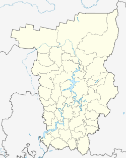 Krasnokamsk Krasnokamsk (Perm Krai) | |
| Coordinates: 58°05′N 55°41′E / 58.083°N 55.683°E | |
| Country | Russia |
| Federal subject | Perm Krai[1] |
| Founded | 1930 |
| Town status since | 1938 |
| Government | |
| • Head | Yury Chechyotkin |
| Elevation | 100 m (300 ft) |
| Population | |
| • Total | 51,916 |
| • Estimate (2018)[3] | 53,631 (+3.3%) |
| • Rank | 313th in 2010 |
| • Subordinated to | town of krai significance of Krasnokamsk[1] |
| • Capital of | town of krai significance of Krasnokamsk[1] |
| • Municipal district | Krasnokamsky Municipal District[4] |
| • Urban settlement | Krasnokamskoye Urban Settlement[4] |
| • Capital of | Krasnokamsky Municipal District,[4] Krasnokamskoye Urban Settlement[4] |
| Time zone | UTC+5 (MSK+2 |
| Postal code(s)[6] | 617060, 617062, 617064–617067, 617079 |
| Dialing code(s) | +7 34273 |
| OKTMO ID | 57627101001 |
| Website | krasnokamsk |
History edit
Foundation of the town is associated with the construction of the Kama paper mill. 1930 is considered to be the date of the foundation.[citation needed] The settlement was originally called Bumstroy (Бумстрой), but in 1933 it was renamed Krasnokamsk and was granted urban-type settlement status.[citation needed] In 1938, it was granted town status.[citation needed]
The construction of the paper mill lead to the emergence of the Zakamsk CHP and Goznak paper and printing factory. In 1942, on the basis of evacuees from Moscow Oblast enterprise was created metal grid factory.
In 1934, oil was found on the factory's territory and in 1936 the extraction of petroleum began. In 1943, an oil refinery was built. Light and food industry factories were built later.
Administrative and municipal status edit
Within the framework of administrative divisions, it is, together with the work settlement of Overyata and seventy-two rural localities, incorporated as the town of krai significance of Krasnokamsk—an administrative unit with the status equal to that of the districts.[1] As a municipal division, the town of Krasnokamsk is incorporated as Krasnokamskoye Urban Settlement within Krasnokamsky Municipal District and serves as the municipal district's administrative center.[4] The work settlement of Overyata and the seventy-two rural localities are grouped into one urban settlement and one rural settlement within Krasnokamsky Municipal District.[4]
Transportation edit
Krasnokamsk has advantageous transport position. A 9-kilometer (5.6 mi) branch line connect it with the main Perm–Moscow railway. Important highway runs through Krasnokamsk and connects Perm, Ochyor, and Igra (in the Udmurt Republic). The town is connected by bus with other destinations. During Soviet times, river transport also functioned, allowing to reach the left bank of the Kama faster.
References edit
Notes edit
- ^ a b c d e Law #416-67
- ^ a b Russian Federal State Statistics Service (2011). Всероссийская перепись населения 2010 года. Том 1 [2010 All-Russian Population Census, vol. 1]. Всероссийская перепись населения 2010 года [2010 All-Russia Population Census] (in Russian). Federal State Statistics Service.
- ^ "26. Численность постоянного населения Российской Федерации по муниципальным образованиям на 1 января 2018 года". Federal State Statistics Service. Retrieved January 23, 2019.
- ^ a b c d e f Law #1747-359
- ^ "Об исчислении времени". Официальный интернет-портал правовой информации (in Russian). June 3, 2011. Retrieved January 19, 2019.
- ^ Почта России. Информационно-вычислительный центр ОАСУ РПО. (Russian Post). Поиск объектов почтовой связи (Postal Objects Search) (in Russian)
- ^ Federal State Statistics Service (May 21, 2004). Численность населения России, субъектов Российской Федерации в составе федеральных округов, районов, городских поселений, сельских населённых пунктов – районных центров и сельских населённых пунктов с населением 3 тысячи и более человек [Population of Russia, Its Federal Districts, Federal Subjects, Districts, Urban Localities, Rural Localities—Administrative Centers, and Rural Localities with Population of Over 3,000] (XLS). Всероссийская перепись населения 2002 года [All-Russia Population Census of 2002] (in Russian).
- ^ Всесоюзная перепись населения 1989 г. Численность наличного населения союзных и автономных республик, автономных областей и округов, краёв, областей, районов, городских поселений и сёл-райцентров [All Union Population Census of 1989: Present Population of Union and Autonomous Republics, Autonomous Oblasts and Okrugs, Krais, Oblasts, Districts, Urban Settlements, and Villages Serving as District Administrative Centers]. Всесоюзная перепись населения 1989 года [All-Union Population Census of 1989] (in Russian). Институт демографии Национального исследовательского университета: Высшая школа экономики [Institute of Demography at the National Research University: Higher School of Economics]. 1989 – via Demoscope Weekly.
Sources edit
- Законодательное собрание Пермской области. Закон №416-67 от 28 февраля 1996 г. «Об административно-территориальном устройстве Пермского края», в ред. Закона №504-ПК от 9 июля 2015 г. «О внесении изменений в Закон Пермской области "Об административно-территориальном устройстве Пермского края"». Вступил в силу с момента опубликования. Опубликован: "Звезда", №38, 12 марта 1996 г. (Legislative Assembly of Perm Oblast. Law #416-67 of February 28, 1996 On the Administrative-Territorial Structure of Perm Krai, as amended by the Law #504-PK of July 9, 2015 On Amending the Law of Perm Oblast "On the Administrative-Territorial Structure of Perm Krai". Effective as of the moment of publication.).
- Законодательное собрание Пермской области. Закон №1747-359 от 10 ноября 2004 г. «Об утверждении границ и о наделении статусом муниципальных образований административной территории города Краснокамска Пермского края», в ред. Закона №273-ПК от 14 декабря 2013 г. «О внесении изменений в отдельные Законы Пермской области, Коми-Пермяцкого автономного округа, Пермского края». Вступил в силу через десять дней со дня официального опубликования. Опубликован: "Бюллетень Законодательного Собрания и администрации Пермской области", №12, I часть, 9 декабря 2004 г. (Legislative Assembly of Perm Oblast. Law #1747-359 of November 10, 2004 On Establishing the Borders and on Granting the Status to the Municipal Formations of the Administrative Territory of the Town of Krasnokamsk of Perm Krai, as amended by the Law #273-PK of December 14, 2013 On Amending Various Laws of Perm Oblast, Komi-Permyak Autonomous Okrug, Perm Krai. Effective as of the day which is ten days following the day of the official publication.).
External links edit
- Official website of Krasnokamsk (in Russian)
- Forum of Krasnokamsk (in Russian)