


Summary
Langepas (Russian: Лангепас; Khanty: Лӑңкипос, Lăŋkipos) is a town in Khanty-Mansi Autonomous Okrug, Russia. Population: 41,670 (2010 Russian census);[3] 37,182 (2002 Census);[7] 25,618 (1989 Soviet census).[8]
Langepas
Лангепас | |
|---|---|
 | |
 Flag  Coat of arms | |
Location of Langepas .mw-parser-output .locmap .od{position:absolute}.mw-parser-output .locmap .id{position:absolute;line-height:0}.mw-parser-output .locmap .l0{font-size:0;position:absolute}.mw-parser-output .locmap .pv{line-height:110%;position:absolute;text-align:center}.mw-parser-output .locmap .pl{line-height:110%;position:absolute;top:-0.75em;text-align:right}.mw-parser-output .locmap .pr{line-height:110%;position:absolute;top:-0.75em;text-align:left}.mw-parser-output .locmap .pv>div{display:inline;padding:1px}.mw-parser-output .locmap .pl>div{display:inline;padding:1px;float:right}.mw-parser-output .locmap .pr>div{display:inline;padding:1px;float:left}html.skin-theme-clientpref-night .mw-parser-output .od,html.skin-theme-clientpref-night .mw-parser-output .od .pv>div,html.skin-theme-clientpref-night .mw-parser-output .od .pl>div,html.skin-theme-clientpref-night .mw-parser-output .od .pr>div{background:#000;color:#fff}html.skin-theme-clientpref-night .mw-parser-output .locmap{filter:grayscale(0.6)}@media(prefers-color-scheme:dark){html.skin-theme-clientpref-os .mw-parser-output .locmap{filter:grayscale(0.6)}html.skin-theme-clientpref-os .mw-parser-output .od,html.skin-theme-clientpref-os .mw-parser-output .od .pv>div,html.skin-theme-clientpref-os .mw-parser-output .od .pl>div,html.skin-theme-clientpref-os .mw-parser-output .od .pr>div{background:#000;color:#fff}}  Langepas Location of Langepas 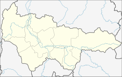 Langepas Langepas (Khanty–Mansi Autonomous Okrug) | |
| Coordinates: 61°15′N 75°10′E / 61.250°N 75.167°E | |
| Country | Russia |
| Federal subject | Khanty-Mansi Autonomous Okrug[1] |
| Founded | 1980 |
| Town status since | 1985 |
| Government | |
| • Body | Duma[2] |
| Elevation | 45 m (148 ft) |
| Population | |
| • Total | 41,670 |
| • Subordinated to | town of okrug significance of Langepas[1] |
| • Capital of | town of okrug significance of Langepas[1] |
| • Urban okrug | Langepas Urban Okrug[4] |
| • Capital of | Langepas Urban Okrug[4] |
| Time zone | UTC+5 (MSK+2 |
| Postal code(s)[6] | 628671, 628672 |
| OKTMO ID | 71872000001 |
| Website | www |
Geography edit
Langepas lies on the Kayukovskaya riverbank, 15 kilometers (9.3 mi) north of the right bank of the Ob River, close to the mouth of the Vatinsky Yogan in the Ob. The town is located 545 kilometers (339 mi) east of Khanty-Mansiysk, and 875 kilometers (544 mi) northeast of Tyumen.[9]
History edit
Langepas means "squirrel land" in the Khanty language. It was established in 1980 and granted town status in 1985.[citation needed]. It was initially built as a settlement for the staff of the Lokosovo gas processing plant.
Administrative and municipal status edit
Within the framework of administrative divisions, it is incorporated as the town of okrug significance of Langepas—an administrative unit with the status equal to that of the districts.[1] As a municipal division, the town of okrug significance of Langepas is incorporated as Langepas Urban Okrug.[4]
Economy edit
The economy of the town is based on oil and natural gas extraction as initially it was founded by Lukoil. The oil company was named after the three western American companies, which merged to form Lukoil: Langepasneftegaz, Urayneftegaz, and Kogalymneftegaz.[10]
References edit
Notes edit
- ^ a b c d e Law #43-oz
- ^ Official website of Langepas. Duma of the Town of Langepas (in Russian)
- ^ a b Russian Federal State Statistics Service (2011). Всероссийская перепись населения 2010 года. Том 1 [2010 All-Russian Population Census, vol. 1]. Всероссийская перепись населения 2010 года [2010 All-Russia Population Census] (in Russian). Federal State Statistics Service.
- ^ a b c Law #63-oz
- ^ "Об исчислении времени". Официальный интернет-портал правовой информации (in Russian). June 3, 2011. Retrieved January 19, 2019.
- ^ Почта России. Информационно-вычислительный центр ОАСУ РПО. (Russian Post). Поиск объектов почтовой связи (Postal Objects Search) (in Russian)
- ^ Federal State Statistics Service (May 21, 2004). Численность населения России, субъектов Российской Федерации в составе федеральных округов, районов, городских поселений, сельских населённых пунктов – районных центров и сельских населённых пунктов с населением 3 тысячи и более человек [Population of Russia, Its Federal Districts, Federal Subjects, Districts, Urban Localities, Rural Localities—Administrative Centers, and Rural Localities with Population of Over 3,000] (XLS). Всероссийская перепись населения 2002 года [All-Russia Population Census of 2002] (in Russian).
- ^ Всесоюзная перепись населения 1989 г. Численность наличного населения союзных и автономных республик, автономных областей и округов, краёв, областей, районов, городских поселений и сёл-райцентров [All Union Population Census of 1989: Present Population of Union and Autonomous Republics, Autonomous Oblasts and Okrugs, Krais, Oblasts, Districts, Urban Settlements, and Villages Serving as District Administrative Centers]. Всесоюзная перепись населения 1989 года [All-Union Population Census of 1989] (in Russian). Институт демографии Национального исследовательского университета: Высшая школа экономики [Institute of Demography at the National Research University: Higher School of Economics]. 1989 – via Demoscope Weekly.
- ^ "P-43_44 Topographic Chart (in Russian)". Retrieved June 25, 2022.
- ^ "OAO Lukoil - Company History"
Sources edit
- Дума Ханты-Мансийского автономного округа — Югры. Закон №43-оз от 7 июля 2004 г. «Об административно-территориальном устройстве Ханты-Мансийского автономного округа — Югры и порядке его изменения», в ред. Закона №129-оз от 9 декабря 2015 г. «Об изменениях административно-территориального устройства Ханты-Мансийского автономного округа — Югры и о внесении изменений в отдельные Законы Ханты-Мансийского автономного округа — Югры». Вступил в силу по истечении десяти дней со дня официального опубликования. Опубликован: "Новости Югры", №83, 17 июля 2004 г. (Duma of Khanty-Mansi Autonomous Okrug—Yugra. Law #43-oz of July 7, 2004 On the Administrative-Territorial Structure of Khanty-Mansi Autonomous Okrug—Yugra and on the Procedures for Its Change, as amended by the Law #129-oz of December 9, 2015 On the Changes to the Administrative-Territorial Structure of Khanty-Mansi Autonomous Okrug—Yugra and on Amending Various Laws of Khanty-Mansi Autonomous Okrug—Yugra. Effective as of the day which after ten days after the official publication date.).
- Дума Ханты-Мансийского автономного округа — Югры. Закон №63-оз от 25 ноября 2004 г. «О статусе и границах муниципальных образований Ханты-Мансийского автономного округа — Югры», в ред. Закона №129-оз от 9 декабря 2015 г. «Об изменениях административно-территориального устройства Ханты-Мансийского автономного округа — Югры и о внесении изменений в отдельные Законы Ханты-Мансийского автономного округа — Югры». Вступил в силу по истечении десяти дней со дня официального опубликования и до 1 января 2006 года применяется в целях реализации статей 84, 85 Федерального закона от 06.10.2003 №131-ФЗ. Опубликован: "Новости Югры", №143, 7 декабря 2004 г. (Duma of Khanty-Mansi Autonomous Okrug—Yugra. Law #63-oz of November 25, 2004 On the Status and Borders of the Municipal Formations of Khanty-Mansi Autonomous Okrug—Yugra, as amended by the Law #129-oz of December 9, 2015 On the Changes to the Administrative-Territorial Structure of Khanty-Mansi Autonomous Okrug—Yugra and on Amending Various Laws of Khanty-Mansi Autonomous Okrug—Yugra. Effective as of the day which after ten days after the official publication date; also in effect until January 1, 2006 in order to meet the requirements of Articles 84, 85 of the Federal Law #131-FZ of October 6, 2003.).
External links edit
- Official website of Langepas (in Russian)
- (in Russian) Informational website of Langepas