


Summary
Mehrestan County (Persian: شهرستان مهرستان), formerly known as Zaboli County (شهرستان زابلی), is in Sistan and Baluchestan province, Iran. Its capital is the city of Mehrestan, also formerly known as Zaboli.[3]
Mehrestan County
Persian: شهرستان مهرستان | |
|---|---|
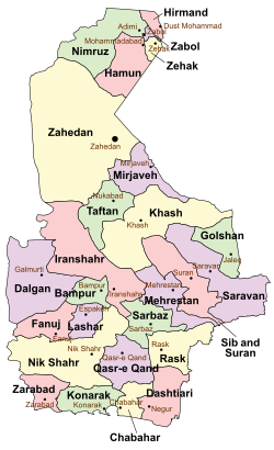 Location of Mehrestan County in Sistan and Baluchestan province (center right, purple) | |
 Location of Sistan and Baluchestan province in Iran | |
| Coordinates: 27°01′08″N 61°42′59″E / 27.01889°N 61.71639°E[1] | |
| Country | |
| Province | Sistan and Baluchestan |
| Capital | Mehrestan |
| Districts | Central, Ashar, Birk |
| Population (2016)[2] | |
| • Total | 70,579 |
| Time zone | UTC+3:30 (IRST) |
After the 2006 National Census, Zaboli District was separated from Saravan County, and Ashar District from Sarbaz County in the establishment of Zaboli County (now Mehrestan County).[4]
The census in 2011 counted 62,756 people in 14,577 households.[5] At the 2016 census, the county's population was 70,579 in 17,407 households.[2]
Administrative divisions edit
The population history and structural changes of Mehrestan County's administrative divisions over two consecutive censuses are shown in the following table. The latest census shows two districts, four rural districts, and one city.[2]
After the census, Dehi Rural District was established in the Central District and Birk Rural District was separated from the district in the establishment of Birk District.[6] The village of Ashar was elevated to the status of a city.[7]
| Administrative Divisions | 2011[5] | 2016[2] |
|---|---|---|
| Central District | 44,972 | 54,630 |
| Birk RD | 8,683 | 11,057 |
| Dehi RD1 | ||
| Zaboli RD | 26,177 | 31,328 |
| Mehrestan (city) | 10,112 | 12,245 |
| Ashar District | 17,784 | 15,949 |
| Ashar RD | 12,137 | 10,130 |
| Irafshan RD | 5,647 | 5,819 |
| Ashar (city)3 | ||
| Birk District1 | ||
| Birk RD | ||
| Birk-e Sharqi RD2 | ||
| Total | 62,756 | 70,579 |
| RD: Rural District 1Established after the 2016 census[6] 2Became a city after the 2016 census[7] | ||
References edit
- ^ OpenStreetMap contributors (14 April 2023). "Mehrestan County" (Map). OpenStreetMap. Retrieved 14 April 2023.
- ^ a b c d "Census of the Islamic Republic of Iran, 1395 (2016)". AMAR (in Persian). The Statistical Center of Iran. p. 11. Archived from the original (Excel) on 23 December 2021. Retrieved 19 December 2022.
- ^ Rahimi, Mohammad Reza (9 July 2012). "Some changes in the map of country divisions of Sistan and Baluchestan and Alborz provinces". DOLAT (in Persian). Ministry of Interior, Political and Defense Commission. Archived from the original on 9 July 2012. Retrieved 14 April 2023.
- ^ Davoudi, Parviz (29 July 1386). "The approval letter of the Ministers of the Political-Defense Commission of the Government Board regarding some changes and divisions of the country in Sistan and Baluchestan province". Lamtakam (in Persian). Ministry of Interior, Political-Defense Commission of the Government Board. Archived from the original on 30 December 2023. Retrieved 30 December 2023.
- ^ a b "Census of the Islamic Republic of Iran, 1390 (2011)". Syracuse University (in Persian). The Statistical Center of Iran. p. 11. Archived from the original (Excel) on 25 November 2022. Retrieved 19 December 2022.
- ^ a b Jahangiri, Ishaq (13 April 1400). "Letter of approval regarding country divisions in Sib and Suran and Mehrestan Counties in Sistan and Baluchestan province". Qavanin (in Persian). Ministry of Interior, Council of Ministers. Archived from the original on 14 April 2023. Retrieved 14 April 2023.
- ^ a b Fazli, Abdolreza Rahmani (21 September 2018). "Notification of the approval of the Ministry of Interior regarding the transformation of Ashar village, the capital of Ashar District of Mehrestan County, into a city". Laws and Regulations Portal of Iran (in Persian). Ministry of Interior. Archived from the original on 14 April 2023. Retrieved 14 April 2023.