
KNOWPIA
WELCOME TO KNOWPIA

Mokhsogollokh 
Summary
Mokhsogollokh (Russian: Мохсоголло́х; Yakut: Мохсоҕоллоох Moxsoğolloox) is an urban locality (an urban-type settlement) in Khangalassky District of the Sakha Republic, Russia, located on the left bank of the Lena River, 24 kilometers (15 mi) from Pokrovsk, the administrative center of the district.[2] As of the 2010 Census, its population was 6,698.[3]
Mokhsogollokh
Мохсоголлох | |
|---|---|
| Other transcription(s) | |
| • Yakut | Мохсоҕоллоох |
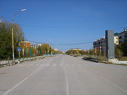 Zavodskaya Street in Mokhsogollokh | |
Location of Mokhsogollokh .mw-parser-output .locmap .od{position:absolute}.mw-parser-output .locmap .id{position:absolute;line-height:0}.mw-parser-output .locmap .l0{font-size:0;position:absolute}.mw-parser-output .locmap .pv{line-height:110%;position:absolute;text-align:center}.mw-parser-output .locmap .pl{line-height:110%;position:absolute;top:-0.75em;text-align:right}.mw-parser-output .locmap .pr{line-height:110%;position:absolute;top:-0.75em;text-align:left}.mw-parser-output .locmap .pv>div{display:inline;padding:1px}.mw-parser-output .locmap .pl>div{display:inline;padding:1px;float:right}.mw-parser-output .locmap .pr>div{display:inline;padding:1px;float:left}html.skin-theme-clientpref-night .mw-parser-output .od,html.skin-theme-clientpref-night .mw-parser-output .od .pv>div,html.skin-theme-clientpref-night .mw-parser-output .od .pl>div,html.skin-theme-clientpref-night .mw-parser-output .od .pr>div{background:#000;color:#fff}html.skin-theme-clientpref-night .mw-parser-output .locmap{filter:grayscale(0.6)}@media(prefers-color-scheme:dark){html.skin-theme-clientpref-os .mw-parser-output .locmap{filter:grayscale(0.6)}html.skin-theme-clientpref-os .mw-parser-output .od,html.skin-theme-clientpref-os .mw-parser-output .od .pv>div,html.skin-theme-clientpref-os .mw-parser-output .od .pl>div,html.skin-theme-clientpref-os .mw-parser-output .od .pr>div{background:#000;color:#fff}}  Mokhsogollokh Location of Mokhsogollokh  Mokhsogollokh Mokhsogollokh (Sakha Republic) | |
| Coordinates: 61°24′N 128°56′E / 61.400°N 128.933°E | |
| Country | Russia |
| Federal subject | Sakha Republic[2] |
| Administrative district | Khangalassky District[2] |
| Settlement | Settlement of Mokhsogollokh[2] |
| Urban-type settlement status since | 1964[2] |
| Population | |
| • Total | 6,698 |
| • Estimate (2018)[4] | 6,159 (−8%) |
| • Capital of | Settlement of Mokhsogollokh[2] |
| • Municipal district | Khangalassky Municipal District[5] |
| • Urban settlement | Mokhsogollokh Urban Settlement[5] |
| • Capital of | Mokhsogollokh Urban Settlement[5] |
| Time zone | UTC+9 (UTC+09:00 |
| Postal code(s)[7] | 678020 |
| OKTMO ID | 98644157051 |
| 2010 Census | 6,698[3] |
|---|---|
| 2002 Census | 7,181[8] |
| 1989 Census | 6,849[9] |
| 1979 Census | 4,306[10] |
History edit
Urban-type settlement status was granted to it in 1964.[2]
Administrative and municipal status edit
Within the framework of administrative divisions, the urban-type settlement of Mokhsogollokh[1] is incorporated within Khangalassky District as the Settlement of Mokhsogollokh.[2] As a municipal division, the Settlement of Mokhsogollokh is incorporated within Khangalassky Municipal District as Mokhsogollokh Urban Settlement.[5]
References edit
Notes edit
- ^ a b According to Article 7 of the Law #77-I, lower-level administrative divisions with the status of a settlement have their administrative centers in an inhabited locality with the status of an urban-type settlement. According to the Registry of the Administrative-Territorial Divisions of the Sakha Republic, Mokhsogollokh is the administrative center of the Settlement of Mokhsogollokh.
- ^ a b c d e f g h Registry of the Administrative-Territorial Divisions of the Sakha Republic
- ^ a b c Russian Federal State Statistics Service (2011). Всероссийская перепись населения 2010 года. Том 1 [2010 All-Russian Population Census, vol. 1]. Всероссийская перепись населения 2010 года [2010 All-Russia Population Census] (in Russian). Federal State Statistics Service.
- ^ "26. Численность постоянного населения Российской Федерации по муниципальным образованиям на 1 января 2018 года". Federal State Statistics Service. Retrieved January 23, 2019.
- ^ a b c d Law #173-Z 353-III
- ^ "Об исчислении времени". Официальный интернет-портал правовой информации (in Russian). June 3, 2011. Retrieved January 19, 2019.
- ^ Почта России. Информационно-вычислительный центр ОАСУ РПО. (Russian Post). Поиск объектов почтовой связи (Postal Objects Search) (in Russian)
- ^ Federal State Statistics Service (May 21, 2004). Численность населения России, субъектов Российской Федерации в составе федеральных округов, районов, городских поселений, сельских населённых пунктов – районных центров и сельских населённых пунктов с населением 3 тысячи и более человек [Population of Russia, Its Federal Districts, Federal Subjects, Districts, Urban Localities, Rural Localities—Administrative Centers, and Rural Localities with Population of Over 3,000] (XLS). Всероссийская перепись населения 2002 года [All-Russia Population Census of 2002] (in Russian).
- ^ Всесоюзная перепись населения 1989 г. Численность наличного населения союзных и автономных республик, автономных областей и округов, краёв, областей, районов, городских поселений и сёл-райцентров [All Union Population Census of 1989: Present Population of Union and Autonomous Republics, Autonomous Oblasts and Okrugs, Krais, Oblasts, Districts, Urban Settlements, and Villages Serving as District Administrative Centers]. Всесоюзная перепись населения 1989 года [All-Union Population Census of 1989] (in Russian). Институт демографии Национального исследовательского университета: Высшая школа экономики [Institute of Demography at the National Research University: Higher School of Economics]. 1989 – via Demoscope Weekly.
- ^ Всесоюзная перепись населения 1979 г. Национальный состав населения по регионам России [All Union Population Census of 1979. Ethnic composition of the population by regions of Russia] (XLS). Всесоюзная перепись населения 1979 года [All-Union Population Census of 1979] (in Russian). 1979 – via Demoscope Weekly (website of the Institute of Demographics of the State University—Higher School of Economics.
Sources edit
- Official website of the Sakha Republic. Registry of the Administrative-Territorial Divisions of the Sakha Republic. Khangalassky District. (in Russian)
- Государственное Собрание (Ил Тумэн) Республики Саха (Якутия). Закон №173-З №353-III от 30 ноября 2004 г. «Об установлении границ и о наделении статусом городского и сельского поселений муниципальных образований Республики Саха (Якутия)», в ред. Закона №1058-З №1007-IV от 25 апреля 2012 г. «О внесении изменений в Закон Республики Саха (Якутия) "Об установлении границ и о наделении статусом городского и сельского поселений муниципальных образований Республики Саха (Якутия)"». Вступил в силу со дня официального опубликования. Опубликован: "Якутия", №245, 31 декабря 2004 г. (State Assembly (Il Tumen) of the Sakha (Yakutia) Republic. Law #173-Z No. 353-III of November 30, 2004 On Establishing the Borders and on Granting the Urban and Rural Settlement Status to the Municipal Formations of the Sakha (Yakutia) Republic, as amended by the Law #1058-Z No. 1007-IV of April 25, 2012 On Amending the Law of the Sakha (Yakutia) Republic "On Establishing the Borders and on Granting the Urban and Rural Settlement Status to the Municipal Formations of the Sakha (Yakutia) Republic". Effective as of the day of the official publication.).