


Summary
National Highway 53, combination of old (NH6 Surat-Kolkata), (NH200 Bilaspur-Chandikhole) & (NH5A Chandikhole-Paradeep) is a national highway in India.[1] It connects Hajira in Gujarat and Paradeep port in Odisha. NH-53 traverses the states of Gujarat, Maharashtra, Chhattisgarh and Odisha in India.[2] The road is the part of AH46 network in India and it is officially listed as running over 1949 km (1211 mi) from Kolkata to Surat. it is also known as Surat - Kolkata Highway. It passes through Maharashtra, Chhattisgarh and Odisha states.[3]
 | ||||
|---|---|---|---|---|
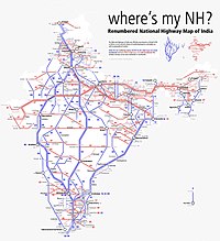
 Map of National Highway 53 in red | ||||
 NH 53 in Chhattisgarh | ||||
| Route information | ||||
| Part of | ||||
| Length | 1,795 km (1,115 mi) Bharatmala: 1,210 km (750 mi) (Dhule - Deogarh) | |||
| Major junctions | ||||
| West end | Hajira | |||
| East end | Paradeep Port | |||
| Location | ||||
| Country | India | |||
| States | Gujarat, Maharashtra, Chhattisgarh, Odisha | |||
| Highway system | ||||
| ||||
The National Highway Authority of India (NHAI) has created a Guinness World Record of constructing the longest highway stretch of 75 kilometres (km) between Amravati and Akola in the least time--105 hours and 33 minutes. The newly constructed road is part of National Highway 53.
Route edit
Route of primary national highway 53 passes through four states of India.[1][2]
Gujarat edit
Hajira, Surat, Vyara, Songadh, Uchchhal - Maharashtra border.
Maharashtra edit
Gujarat border Navapur Nandubar Dhule, Jalgaon, Malkapur, Khamgaon,Akola, Amravati,Karanja(Wardha)Nagpur, Bhandara, Tirora,Gondia, Deori
Chhattisgarh edit
Maharashtra border - Rajnandgaon, Durg, Bhilai, Raipur, Arang, Ghorari, Pithora, Saraipali - Odisha border.
Odisha edit
Chhattisgarh border - Bargarh, Sambalpur, Deogarh, Kaniah, Talcher, Kamakhyanagar, Bhuban,Sukinda, Dubri, Chandhikhol, Haridaspur, Silipur, Bhutamundai, Paradip Port.
Asian Highways edit
The stretch of National Highway 53 from Dhule in Maharashtra to Deogarh in Odisha is part of Asian Highway 46.[4]
Junctions list edit
- Gujarat

- Terminal point at Hazira port.
 NH 64 near surat
 NH 48 near Palsana
 NH 56 near Vyara
 NH 953 near Songadh
- Maharashtra

 NH 752G near Visarwadi
 NH 753B near Shewali
 NH 160H near Kusumbe
 NH 52 near Dhule
 NH 60 near Dhule
 NH 753J near Jalgaon
 NH 753F near Jalgaon
 NH 753L near Muktainagar
 NH 753A near Malkapur
 NH 161H near Nandura
 NH 753E near Khamgaon
 NH 548C near Khamgaon
 NH 548CC near Khamgaon
 NH 161G near Balapur
 NH 161 near Akola
 NH 161A near Akola
 NH 361C near Murtizapur
 NH 161E near Hiwra Budruk
 NH 353K near Nandgaon Peth
 NH 347A near Talegaon
 NH 547E near Gondkheri
 NH 353I near Nagpur
 NH 353J near Nagpur
 NH 353D near Nagpur
 NH 44 near Nagpur
 NH 247 near Gumthala
- NH 247 near Bhandara
 NH 353C near Sakoli
 NH 753 near Kohmara
 NH 543 near Deori
- Chhattisgarh

Map with spur routes edit

See also edit
References edit
- ^ a b "New Numbering of National Highways notification - Government of India" (PDF). The Gazette of India. Retrieved 27 October 2018.
- ^ a b "State-wise length of National Highways in India". Ministry of Road Transport and Highways. Retrieved 27 October 2018.
- ^ "Rationalisation of Numbering Systems of National Highways" (PDF). New Delhi: Department of Road Transport and Highways. Archived from the original (PDF) on 31 March 2012. Retrieved 3 April 2012.
- ^ "Asian Highway Database - Country wise". UNESCAP. Retrieved 21 June 2019.
External links edit
- NH 53 on OpenStreetMap