
KNOWPIA
WELCOME TO KNOWPIA

National Register of Historic Places listings in Aleutians West Census Area, Alaska 
Summary
This is a list of the National Register of Historic Places listings in Aleutians West Census Area, Alaska.

This is intended to be a complete list of the properties and districts on the National Register of Historic Places in Aleutians West Census Area, Alaska, United States. The locations of National Register properties and districts for which the latitude and longitude coordinates are included below, may be seen in a Google map.[1]
There are 15 properties and districts listed on the National Register in the census area, including 10 National Historic Landmarks.
This National Park Service list is complete through NPS recent listings posted April 19, 2024.[2]
Current listings edit
| [3] | Name on the Register[4] | Image | Date listed[5] | Location | City or town | Description |
|---|---|---|---|---|---|---|
| 1 | Adak Army Base and Adak Naval Operating Station | 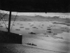 |
February 27, 1987 (#87000841) |
Adak Island 51°52′54″N 176°38′53″W / 51.88158°N 176.6481°W | Adak | The historical 47,000 acres (19,000 ha) area covers the town of Adak and most of Adak Island north of it. It is roughly bounded by Cape Adagdak, Scabbard Bay, and Shagak Bay.[4] |
| 2 | Anangula Archeological District |  |
June 2, 1978 (#78000512) |
Southern end of Anangula Island 52°59′47″N 168°54′47″W / 52.99648°N 168.91299°W | Nikolski | |
| 3 | Atka B-24D Liberator |  |
July 26, 1979 (#79000407) |
Address restricted[6] | Atka | |
| 4 | Attu Battlefield and U.S. Army and Navy Airfields on Attu |  |
February 4, 1985 (#85002729) |
Attu Island 52°53′26″N 173°04′29″E / 52.89068°N 173.07484°E | Attu Island | The historical 7,000 acres (2,800 ha) area covers the whole eastern part of Attu Island, roughly Temnac Bay to Austin Cove.[4] |
| 5 | Cape Field at Fort Glenn (Umnak Island) |  |
May 28, 1987 (#87001301) |
Umnak Island 53°22′38″N 167°53′22″W / 53.37722°N 167.88946°W | Fort Glenn | The historical 7,550 acres (3,060 ha) area covering the airfield and the naval base is roughly comprised between Otter Bight and Camp Bay.[4] |
| 6 | Chaluka Site |  |
October 15, 1966 (#66000155) |
Address restricted[6] | Nikolski | |
| 7 | Church of the Holy Ascension |  |
April 15, 1970 (#70000112) |
In Unalaska 53°52′32″N 166°32′11″W / 53.87563°N 166.53638°W | Unalaska | |
| 8 | Dutch Harbor Naval Operating Base and Fort Mears, U.S. Army |  |
February 4, 1985 (#85002733) |
Amaknak Island 53°53′17″N 166°32′31″W / 53.88793°N 166.54201°W | Unalaska | The historical 1,000 acres (400 ha) area roughly covers the central part of Amaknak Island.[4] |
| 9 | Japanese Occupation Site, Kiska Island |  |
February 4, 1985 (#85002732) |
Kiska Island 51°59′05″N 177°31′46″E / 51.984722°N 177.529444°E | Kiska Island | The historical 48,900 acres (19,800 ha) area covers almost the whole Kiska Island, with the exception of Kiska Volcano and the area south of Lief Cove and Vega Bay.[4] |
| 10 | S.S. NORTHWESTERN Shipwreck Site |  |
September 12, 1994 (#94001065) |
Captains Bay[7][8] 53°49′50″N 166°36′37″W / 53.83055°N 166.61035°W | Unalaska | Bombed by the Japanese during the World War II Battle of Dutch Harbor, the ship's remnant hulk sank at Port Levashef, at the head of Captains Bay in 1945.[7][8] |
| 11 | St. George the Great Martyr Orthodox Church | 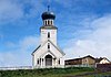 |
June 6, 1980 (#80000743) |
In St. George 56°36′07″N 169°32′52″W / 56.60181°N 169.54789°W | St. George Island | |
| 12 | St. Nicholas Church |  |
June 6, 1980 (#80000740) |
In Nikolski 52°56′18″N 168°51′42″W / 52.93835°N 168.86163°W | Nikolski | |
| 13 | Sts. Peter and Paul Church | 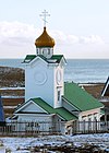 |
June 6, 1980 (#80000744) |
In St. Paul 57°07′15″N 170°16′51″W / 57.1209°N 170.28088°W | St. Paul Island | |
| 14 | Seal Island Historic District |  |
October 15, 1966 (#66000156) |
St. Paul and St. George Islands 56°54′28″N 170°02′26″W / 56.907778°N 170.040556°W | Pribilof Islands | The historical 6,970 acres (2,820 ha) district covers 106 buildings, 2 structures, 12 historic sites and 2 archeological sites distributed in St. Paul village, St. George village, and in the area of Northeast Point on St. Paul Island.[4] |
| 15 | Sitka Spruce Plantation | 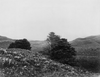 |
February 14, 1978 (#78000513) |
Along Biorka Drive, on Amaknak Island 53°53′17″N 166°32′40″W / 53.88798°N 166.54435°W | Unalaska |
See also edit
Wikimedia Commons has media related to National Register of Historic Places in Aleutians West Census Area, Alaska.
References edit
- ^ The latitude and longitude information provided in this table was derived originally from the National Register Information System, which has been found to be fairly accurate for about 99% of listings. Some locations in this table may have been corrected to current GPS standards.
- ^ National Park Service, United States Department of the Interior, "National Register of Historic Places: Weekly List Actions", retrieved April 19, 2024.
- ^ Numbers represent an alphabetical ordering by significant words. Various colorings, defined here, differentiate National Historic Landmarks and historic districts from other NRHP buildings, structures, sites or objects.
- ^ a b c d e f g "National Register Information System". National Register of Historic Places. National Park Service. April 24, 2008.
- ^ The eight-digit number below each date is the number assigned to each location in the National Register Information System database, which can be viewed by clicking the number.
- ^ a b Federal and state laws and practices restrict general public access to information regarding the specific location of this resource. In some cases, this is to protect archeological sites from vandalism, while in other cases it is restricted at the request of the owner. See: Knoerl, John; Miller, Diane; Shrimpton, Rebecca H. (1990), Guidelines for Restricting Information about Historic and Prehistoric Resources, National Register Bulletin, National Park Service, U.S. Department of the Interior, OCLC 20706997.
- ^ a b Alaska Maritime NWR Shipwreck List
- ^ a b Broderick, Francis; Burwell, Michael (2014). "Aleutian Voices - VOLUME 1, NO. 1, 2014 - S.S. NORTHWESTERN SAILING SHELTERED SEAS" (PDF). National Park Service. ISBN 978-0-98539 48-3-7. Retrieved May 4, 2017.