
KNOWPIA
WELCOME TO KNOWPIA

National Register of Historic Places listings in Lafayette County, Missouri 
Summary
This is a list of the National Register of Historic Places listings in Lafayette County, Missouri.

This is intended to be a complete list of the properties and districts on the National Register of Historic Places in Lafayette County, Missouri, United States. Latitude and longitude coordinates are provided for many National Register properties and districts; these locations may be seen together in a map.[1]
There are 32 properties and districts listed on the National Register in the county.
This National Park Service list is complete through NPS recent listings posted April 12, 2024.[2]
Current listings edit
| [3] | Name on the Register | Image | Date listed[4] | Location | City or town | Description |
|---|---|---|---|---|---|---|
| 1 | Anderson House and Lexington Battlefield |  |
June 4, 1969 (#69000110) |
Roughly bounded by 10th, 15th, Utah and Wood Sts., and Missouri Pacific RR 39°11′34″N 93°52′46″W / 39.192778°N 93.879444°W | Lexington | |
| 2 | Napoleon Buck House | November 14, 1997 (#97001431) |
0.40 mi. S of jct. of US 24 and MO 273 39°11′49″N 93°32′09″W / 39.196944°N 93.535833°W | Waverly | No longer in existence | |
| 3 | Minatree Catron House | November 14, 1997 (#97001432) |
0.1 mi W of jct. of US 24 and MO 110 39°10′49″N 93°47′55″W / 39.180278°N 93.798611°W | Lexington | ||
| 4 | John E. Cheatham House | July 8, 1993 (#93000550) |
739 MO 13 39°10′21″N 93°52′45″W / 39.1725°N 93.879167°W | Lexington | ||
| 5 | Chicago and Alton Railroad Depot at Higginsville | March 25, 1987 (#87000451) |
2109 Main St. 39°04′25″N 93°43′00″W / 39.073520°N 93.71678°W | Higginsville | ||
| 6 | Commercial Community Historic District | August 4, 1983 (#83001025) |
Roughly bounded by 8th, 13th, South, Broadway, and Main Sts. 39°11′09″N 93°52′52″W / 39.185833°N 93.881111°W | Lexington | ||
| 7 | Confederate Chapel, Cemetery and Cottage | December 16, 1981 (#81000335) |
N of Higginsville 39°05′54″N 93°43′45″W / 39.098333°N 93.729167°W | Higginsville | ||
| 8 | Cumberland Presbyterian Church |  |
November 14, 1978 (#78001665) |
112 S. 13th St. 39°11′06″N 93°52′45″W / 39.185°N 93.879167°W | Lexington | |
| 9 | James M. Dinwiddie House | November 14, 1997 (#97001430) |
0.25 mi. E of jct. of US 24 and MO 184 39°11′32″N 93°42′06″W / 39.192222°N 93.701667°W | Dover | ||
| 10 | Douglass School | March 10, 2023 (#100008715) |
215 West 16th St. 39°04′44″N 93°43′15″W / 39.0790°N 93.7208°W | Higginsville | ||
| 11 | Forest Grove Cemetery | July 18, 2022 (#100007905) |
892 Golf Rd. 39°12′03″N 93°51′54″W / 39.2009°N 93.8651°W | Lexington vicinity | ||
| 12 | Theodore Gosewisch House |  |
November 14, 1997 (#97001433) |
0.5 mi. W of jct. of MO 13 and Marshall School Rd. 39°09′28″N 93°53′30″W / 39.157778°N 93.891667°W | Lexington | |
| 13 | Alexander and Elizabeth Aull Graves House | July 8, 1993 (#93000552) |
2326 Aull Ln. 39°10′32″N 93°51′56″W / 39.175556°N 93.865556°W | Lexington | No longer in existence | |
| 14 | Hicklin Hearthstone | December 28, 1982 (#82000585) |
E of Lexington on US 24 39°11′10″N 93°49′44″W / 39.186111°N 93.828889°W | Lexington | ||
| 15 | Hicklin School | February 24, 2004 (#04000088) |
MO 24 39°11′05″N 93°49′29″W / 39.184722°N 93.824722°W | Lexington | ||
| 16 | Highland Avenue Historic District | 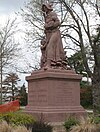 |
August 4, 1983 (#83001026) |
Roughly bounded by Highland Ave. from Rock to Bluff Sts. 39°11′04″N 93°52′30″W / 39.184444°N 93.875°W | Lexington | |
| 17 | House at 1413 Lafayette St. | March 25, 1999 (#99000379) |
1413 Lafayette St. 39°11′13″N 93°52′39″W / 39.186944°N 93.8775°W | Lexington | ||
| 18 | Houx-Hoefer-Rehkop House | March 29, 1983 (#83001027) |
1900 Walnut St. 39°04′33″N 93°43′07″W / 39.075833°N 93.718611°W | Higginsville | ||
| 19 | David John House | July 8, 1993 (#93000553) |
103 S. 23rd St. 39°11′06″N 93°51′23″W / 39.185°N 93.856389°W | Lexington | No longer in existence | |
| 20 | George Johnson House | July 8, 1993 (#93000554) |
102 S. 30th St. 39°11′07″N 93°51′16″W / 39.185278°N 93.854444°W | Lexington | ||
| 21 | Lafayette County Courthouse |  |
September 22, 1970 (#70000339) |
Public Sq. 39°11′06″N 93°52′49″W / 39.185°N 93.880278°W | Lexington | |
| 22 | Linwood Lawn | April 23, 1973 (#73001044) |
SE of Lexington off U.S. 24 39°09′55″N 93°50′54″W / 39.165278°N 93.848333°W | Lexington | ||
| 23 | Machpelah Cemetery | June 27, 2022 (#100007825) |
900 South 20th St. 39°10′40″N 93°52′22″W / 39.1777°N 93.8728°W | Lexington | ||
| 24 | Odessa Ice Cream Company Building |  |
October 3, 1996 (#96001065) |
101 W. Dryden St. 38°59′36″N 93°57′15″W / 38.993333°N 93.954167°W | Odessa | |
| 25 | Old Neighborhoods Historic District |  |
August 4, 1983 (#83001028) |
Roughly bounded by 13th, 22nd, South Sts., Forest and Washington Aves. 39°11′08″N 93°52′28″W / 39.185556°N 93.874444°W | Lexington | |
| 26 | William P. Robinson House | November 14, 1997 (#97001428) |
).2 mi. E and 0.15 mi. S of jct. of MO 107 and MO 112 39°09′41″N 93°50′24″W / 39.161389°N 93.84°W | Lexington | ||
| 27 | Thomas Shelby House | November 14, 1997 (#97001429) |
0.25 mi. E of US 24 and MO 111 39°10′47″N 93°47′09″W / 39.179722°N 93.785833°W | Lexington | Demolished(?) | |
| 28 | Spratt-Allen-Aull House | July 8, 1993 (#93000555) |
2321 Aull Ln. 39°10′30″N 93°51′57″W / 39.175°N 93.865833°W | Lexington | ||
| 29 | Thomas Talbot and Rebecca Walton Smithers Stramcke House | September 29, 1999 (#99001208) |
15834 Highway O 39°08′24″N 93°52′57″W / 39.14°N 93.8825°W | Lexington | ||
| 30 | D. W. B. and Julia Waddell Tevis House | July 8, 1993 (#93000556) |
505 S. 13th St. 39°10′43″N 93°52′43″W / 39.178611°N 93.878611°W | Lexington | ||
| 31 | Waddell House |  |
October 11, 1979 (#79001378) |
1704 South St. 39°11′02″N 93°52′29″W / 39.183889°N 93.874722°W | Lexington | |
| 32 | Wentworth Military Academy |  |
November 24, 1980 (#80002373) |
Washington Ave. and 18th St. 39°11′14″N 93°52′22″W / 39.187222°N 93.872778°W | Lexington |
See also edit
References edit
Wikimedia Commons has media related to National Register of Historic Places in Lafayette County, Missouri.
- ^ The latitude and longitude information provided in this table was derived originally from the National Register Information System, which has been found to be fairly accurate for about 99% of listings. Some locations in this table may have been corrected to current GPS standards.
- ^ National Park Service, United States Department of the Interior, "National Register of Historic Places: Weekly List Actions", retrieved April 12, 2024.
- ^ Numbers represent an alphabetical ordering by significant words. Various colorings, defined here, differentiate National Historic Landmarks and historic districts from other NRHP buildings, structures, sites or objects.
- ^ The eight-digit number below each date is the number assigned to each location in the National Register Information System database, which can be viewed by clicking the number.