
KNOWPIA
WELCOME TO KNOWPIA

National Register of Historic Places listings in Macoupin County, Illinois 
Summary
This is a list of the National Register of Historic Places listings in Macoupin County, Illinois.

This is intended to be a complete list of the properties and districts on the National Register of Historic Places in Macoupin County, Illinois, United States. Latitude and longitude coordinates are provided for many National Register properties and districts; these locations may be seen together in a map.[1]
There are 8 properties and districts listed on the National Register in the county.
This National Park Service list is complete through NPS recent listings posted April 12, 2024.[2]
Current listings edit
| [3] | Name on the Register | Image | Date listed[4] | Location | City or town | Description |
|---|---|---|---|---|---|---|
| 1 | John C. Anderson House |  |
November 5, 1992 (#92001535) |
920 W. Breckenridge St. 39°17′28″N 89°53′11″W / 39.291111°N 89.886389°W | Carlinville | |
| 2 | Carlinville Chapter House | 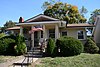 |
November 28, 1980 (#80001385) |
111 S. Charles St. 39°17′52″N 89°52′32″W / 39.297778°N 89.875556°W | Carlinville | |
| 3 | Carlinville Historic District |  |
May 17, 1976 (#76000721) |
Roughly bounded by Oak, Mulberry, Morgan, and the eastern city limits 39°16′46″N 89°52′17″W / 39.279444°N 89.871389°W | Carlinville | |
| 4 | J. L. Robinson General Store |  |
September 12, 1980 (#80001386) |
Off Illinois Route 108 39°18′32″N 90°04′44″W / 39.308968°N 90.078887°W | Hagaman | |
| 5 | Route 66, Girard to Nilwood |  |
May 23, 2002 (#99000117) |
U.S. Route 66, between Illinois Route 4 south of Girard and Illinois Route 4 39°24′45″N 89°47′16″W / 39.4125°N 89.787778°W | Nilwood | |
| 6 | Shriver Farmstead | September 29, 1980 (#80001387) |
Northwest of Virden 39°31′20″N 89°48′47″W / 39.522225°N 89.813002°W | Virden | ||
| 7 | Soulsby Service Station |  |
May 6, 2004 (#04000420) |
102 South Route 66 St. 39°04′23″N 89°44′08″W / 39.073056°N 89.735556°W | Mount Olive | |
| 8 | Union Miners Cemetery |  |
October 18, 1972 (#72000463) |
0.5 miles north of the Mount Olive city park 39°04′52″N 89°43′53″W / 39.081111°N 89.731389°W | Mount Olive |
See also edit
Wikimedia Commons has media related to National Register of Historic Places in Macoupin County, Illinois.
References edit
- ^ The latitude and longitude information provided in this table was derived originally from the National Register Information System, which has been found to be fairly accurate for about 99% of listings. Some locations in this table may have been corrected to current GPS standards.
- ^ National Park Service, United States Department of the Interior, "National Register of Historic Places: Weekly List Actions", retrieved April 12, 2024.
- ^ Numbers represent an alphabetical ordering by significant words. Various colorings, defined here, differentiate National Historic Landmarks and historic districts from other NRHP buildings, structures, sites or objects.
- ^ The eight-digit number below each date is the number assigned to each location in the National Register Information System database, which can be viewed by clicking the number.