


Summary
Perth Airport is an eastern suburb of Perth, the capital city of Western Australia. Its local government areas are the City of Belmont, the City of Swan (north) and the City of Kalamunda (east). It is located approximately 12 km east of the central business district.[2] The suburb is the home of Perth Airport, the main international airport of Perth.
| Perth Airport Perth, Western Australia | |||||||||||||||
|---|---|---|---|---|---|---|---|---|---|---|---|---|---|---|---|
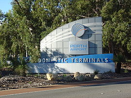 Entry signage to Perth Airport domestic terminal | |||||||||||||||
 | |||||||||||||||
| Coordinates | 31°56′38″S 115°58′05″E / 31.944°S 115.968°E | ||||||||||||||
| Population | 25 (SAL 2021)[1] | ||||||||||||||
| Established | 1997 | ||||||||||||||
| Postcode(s) | 6105 | ||||||||||||||
| Location | 12 km (7 mi) from Perth | ||||||||||||||
| LGA(s) | |||||||||||||||
| State electorate(s) | Belmont | ||||||||||||||
| Federal division(s) | Swan | ||||||||||||||
| |||||||||||||||
History edit
Perth Airport was approved as a locality name on 25 June 1984.[3] Part of the area east of Redcliffe was previously known as Newburn, a suburb that was established in 1950 and had been the site of Red Gum Forest, a small farming community from 1912. Much of the suburb of Newburn was bought by the federal government for the airport in 1970, doubling the airport's size, and Newburn is now completely subsumed into the suburb of Perth Airport. There was also a small suburb called Dunreath in the area that was subdivided as Dunreath Estate in 1931, became a Women's Auxiliary Australian Air Force training camp during World War II, and then became a hostel for post-war migrants from Mainland Europe known as "New Australians" or "Displaced persons".[4][5]
Transport edit
Bus edit
- 36 Airport Central Station to Cannington Station – serves Horrie Miller Drive[6]
- 37 Airport Central Station to Curtin University Bus Station – serves Horrie Miller Drive[7]
- 270 High Wycombe Station to Elizabeth Quay Bus Station – serves Abernethy Road[8]
- 278 High Wycombe Station to Midland Station – serves Kalamunda Road and Abernethy Road[9]
- 290 and 291 Redcliffe Station to Midland Station – serve Dunreath Drive and Fauntleroy Avenue[10][11]
- 292 Redcliffe Station to Redcliffe Station – Circular Route, serves Dunreath Drive, Fauntleroy Avenue and Snook Road[12]
- 293 Redcliffe Station to High Wycombe Station – serves Abernethy Road[13]
- 294 Foodbank Western Australia to High Wycombe Station – serves Abbott Road[14]
- 940 Redcliffe Station to Elizabeth Quay Bus Station (high frequency) – serves Dunreath Drive and Fauntleroy Avenue[15]
Rail edit
Climate edit
Perth Airport is home to a Bureau of Meteorology weather station. Perth Airport has a Mediterranean climate (Köppen climate classification Csa), like the rest of Perth. The highest recorded temperature in the Perth metropolitan region is 46.7 °C (116.1 °F), recorded at Perth Airport on 23 February 1991.
| Climate data for Perth Airport | |||||||||||||
|---|---|---|---|---|---|---|---|---|---|---|---|---|---|
| Month | Jan | Feb | Mar | Apr | May | Jun | Jul | Aug | Sep | Oct | Nov | Dec | Year |
| Record high °C (°F) | 46.0 (114.8) |
46.7 (116.1) |
43.8 (110.8) |
39.6 (103.3) |
35.3 (95.5) |
27.8 (82.0) |
25.7 (78.3) |
29.9 (85.8) |
34.5 (94.1) |
37.7 (99.9) |
41.1 (106.0) |
44.5 (112.1) |
46.7 (116.1) |
| Mean maximum °C (°F) | 41.0 (105.8) |
40.4 (104.7) |
38.6 (101.5) |
33.2 (91.8) |
28.4 (83.1) |
23.5 (74.3) |
22.1 (71.8) |
23.9 (75.0) |
27.2 (81.0) |
32.2 (90.0) |
36.2 (97.2) |
39.3 (102.7) |
42.1 (107.8) |
| Mean daily maximum °C (°F) | 31.8 (89.2) |
32.0 (89.6) |
29.7 (85.5) |
25.6 (78.1) |
21.8 (71.2) |
19.0 (66.2) |
18.0 (64.4) |
18.6 (65.5) |
20.2 (68.4) |
22.8 (73.0) |
26.1 (79.0) |
29.1 (84.4) |
24.6 (76.3) |
| Mean daily minimum °C (°F) | 17.0 (62.6) |
17.5 (63.5) |
16.0 (60.8) |
13.0 (55.4) |
10.4 (50.7) |
9.0 (48.2) |
8.0 (46.4) |
8.1 (46.6) |
8.9 (48.0) |
10.3 (50.5) |
12.8 (55.0) |
15.0 (59.0) |
12.2 (54.0) |
| Mean minimum °C (°F) | 10.4 (50.7) |
11.1 (52.0) |
8.9 (48.0) |
6.4 (43.5) |
4.4 (39.9) |
2.9 (37.2) |
2.3 (36.1) |
2.6 (36.7) |
3.4 (38.1) |
4.6 (40.3) |
6.9 (44.4) |
8.7 (47.7) |
1.2 (34.2) |
| Record low °C (°F) | 6.0 (42.8) |
5.7 (42.3) |
3.1 (37.6) |
1.2 (34.2) |
−0.4 (31.3) |
−1.3 (29.7) |
−1.0 (30.2) |
0.1 (32.2) |
−0.2 (31.6) |
1.2 (34.2) |
3.2 (37.8) |
4.8 (40.6) |
−1.3 (29.7) |
| Average rainfall mm (inches) | 10.9 (0.43) |
15.0 (0.59) |
16.2 (0.64) |
39.7 (1.56) |
97.5 (3.84) |
155.1 (6.11) |
155.3 (6.11) |
118.9 (4.68) |
72.2 (2.84) |
43.0 (1.69) |
25.4 (1.00) |
11.2 (0.44) |
762.1 (30.00) |
| Average precipitation days | 2.5 | 2.8 | 3.9 | 7.3 | 12.1 | 16.1 | 17.5 | 15.7 | 13.2 | 9.3 | 6.4 | 3.9 | 110.7 |
| Average afternoon relative humidity (%) (at 15:00) | 37 | 37 | 39 | 46 | 53 | 60 | 60 | 56 | 54 | 49 | 44 | 41 | 48 |
| Mean daily sunshine hours | 11.5 | 11.0 | 9.5 | 8.1 | 6.9 | 6.0 | 6.1 | 7.1 | 7.8 | 9.6 | 10.8 | 11.5 | 8.8 |
| Source: Bureau of Meteorology[16][17][18] Temperatures and rain data: 1944–2020; Relative humidity: 1994–2010 | |||||||||||||
References edit
- ^ Australian Bureau of Statistics (28 June 2022). "Perth Airport (suburb and locality)". Australian Census 2021 QuickStats. Retrieved 28 June 2022.
- ^ Price Regulation of Airport Services Inquiry July 2006 Archived 1 September 2007 at the Wayback Machine, 2006, Productivity Commission, Australia federal Government. (accessed 27/8/2007)
- ^ "History of metropolitan suburb names – P". Western Australian Land Information Authority. Archived from the original on 16 March 2022. Retrieved 7 September 2023.
- ^ "A History of Opportunity" (PDF). City of Belmont. Retrieved 7 September 2023.
- ^ "A City on the Move" (PDF). City of Belmont. Retrieved 7 September 2023.
- ^ "Route 36". Bus Timetable 90 (PDF). Transperth. 28 August 2023 [effective from 20 November 2023].
- ^ "Route 37". Bus Timetable 90 (PDF). Transperth. 28 August 2023 [effective from 20 November 2023].
- ^ "Route 270". Bus Timetable 108 (PDF). Transperth. 25 August 2023 [effective from 20 November 2023].
- ^ "Route 278". Bus Timetable 110 (PDF). Transperth. 12 January 2024 [effective from 4 February 2024].
- ^ "Route 290". Bus Timetable 111 (PDF). Transperth. 28 August 2023 [effective from 20 November 2023].
- ^ "Route 291". Bus Timetable 111 (PDF). Transperth. 28 August 2023 [effective from 20 November 2023].
- ^ "Route 292". Bus Timetable 111 (PDF). Transperth. 28 August 2023 [effective from 20 November 2023].
- ^ "Route 293". Bus Timetable 111 (PDF). Transperth. 28 August 2023 [effective from 20 November 2023].
- ^ "Route 294". Bus Timetable 111 (PDF). Transperth. 28 August 2023 [effective from 20 November 2023].
- ^ "Route 940". Bus Timetable 214 (PDF). Transperth. 28 August 2023 [effective from 20 November 2023].
- ^ "Climate statistics for Australian locations – Perth Airport". Bureau of Meteorology. Retrieved 15 July 2020.
- ^ "Monthly highest temperature – Perth Airport". Bureau of Meteorology. Retrieved 15 July 2020.
- ^ "Monthly lowest temperature – Perth Airport". Bureau of Meteorology. Retrieved 15 July 2020.