


Summary
Pilar, officially the Municipality of Pilar (Capiznon/Hiligaynon: Banwa sang Pilar; Tagalog: Bayan ng Pilar), is a 3rd class municipality in the province of Capiz, Philippines. According to the 2020 census, it has a population of 47,100 people.[3]
Pilar | |
|---|---|
| Municipality of Pilar | |
 Flag | |
| Etymology: Sibala | |
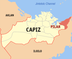 Map of Capiz with Pilar highlighted | |
OpenStreetMap .mw-parser-output .locmap .od{position:absolute}.mw-parser-output .locmap .id{position:absolute;line-height:0}.mw-parser-output .locmap .l0{font-size:0;position:absolute}.mw-parser-output .locmap .pv{line-height:110%;position:absolute;text-align:center}.mw-parser-output .locmap .pl{line-height:110%;position:absolute;top:-0.75em;text-align:right}.mw-parser-output .locmap .pr{line-height:110%;position:absolute;top:-0.75em;text-align:left}.mw-parser-output .locmap .pv>div{display:inline;padding:1px}.mw-parser-output .locmap .pl>div{display:inline;padding:1px;float:right}.mw-parser-output .locmap .pr>div{display:inline;padding:1px;float:left}html.skin-theme-clientpref-night .mw-parser-output .od,html.skin-theme-clientpref-night .mw-parser-output .od .pv>div,html.skin-theme-clientpref-night .mw-parser-output .od .pl>div,html.skin-theme-clientpref-night .mw-parser-output .od .pr>div{background:#000;color:#fff}html.skin-theme-clientpref-night .mw-parser-output .locmap{filter:grayscale(0.6)}@media(prefers-color-scheme:dark){html.skin-theme-clientpref-os .mw-parser-output .locmap{filter:grayscale(0.6)}html.skin-theme-clientpref-os .mw-parser-output .od,html.skin-theme-clientpref-os .mw-parser-output .od .pv>div,html.skin-theme-clientpref-os .mw-parser-output .od .pl>div,html.skin-theme-clientpref-os .mw-parser-output .od .pr>div{background:#000;color:#fff}}  Pilar Location within the Philippines | |
| Coordinates: 11°29′16″N 122°59′44″E / 11.4878°N 122.9956°E | |
| Country | Philippines |
| Region | Western Visayas |
| Province | Capiz |
| District | 1st district |
| Barangays | 24 (see Barangays) |
| Government | |
| • Type | Sangguniang Bayan |
| • Mayor | Arnold A. Perez |
| • Vice Mayor | Doujie-Jack B. Cantiller |
| • Representative | Emmanuel A. Billones |
| • Municipal Council | Members |
| • Electorate | 29,375 voters (2022) |
| Area | |
| • Total | 77.99 km2 (30.11 sq mi) |
| Elevation | 34 m (112 ft) |
| Highest elevation | 812 m (2,664 ft) |
| Lowest elevation | −1 m (−3 ft) |
| Population (2020 census)[3] | |
| • Total | 47,100 |
| • Density | 600/km2 (1,600/sq mi) |
| • Households | 12,254 |
| Economy | |
| • Income class | 3rd municipal income class |
| • Poverty incidence | 8.88 |
| • Revenue | ₱ 141.5 million (2020) |
| • Assets | ₱ 419.8 million (2020) |
| • Expenditure | ₱ 109.5 million (2020) |
| • Liabilities | ₱ 66.59 million (2020) |
| Service provider | |
| • Electricity | Capiz Electric Cooperative (CAPELCO) |
| Time zone | UTC+8 (PST) |
| ZIP code | 5804 |
| PSGC | 061911000 |
| IDD : area code | +63 (0)36 |
| Native languages | Capisnon Hiligaynon Tagalog |
| Website | www |
Pilar is 51 kilometres (32 mi) from Roxas City.
History edit
The coastal town sprang out from an Austronesian settlement in the early 16th century when indio natives managed to escape oppression from Spanish colonial authorities. The settlement was then known as Sibala, named after the river that ran through the coastal village. In 1570, however, the settlement was seized by Spanish forces and the guardia civil took full control of the village fortifying it with a military garrison. It later flourished into a bigger town and was renamed after its designated patron La Nuestra Señora del Pilar (Our Lady of the Pillar). In the 18th century, it adopted the (Holy Trinity) La Santisima Trinidad as its municipal patron after a wooden image of the Holy Trinity from the wreckage of a Spanish galleon ship en route from Mexico was found in the town's coastline. Augustinian friars were initially assigned to preach in the town since then until it would later receive its permanent parish priest and Roman Catholic Church.
In 1897, there had been an armed insurgency known as the Battle of Balisong during the Philippine Revolution in an attempt to overthrow Spanish authorities in the municipality led by local revolutionaries with the support of other resistance groups in Capiz, namely from the neighboring towns of Pan-ay and Pontevedra.
In 1949, the sitios and barrios of Aranguel, Culilang, Pandan, Pinamihagan, Cadoulan, Quiajo, Sangcal, Pondol, Marita, Madulano, Jabuyana, Bo-ac, Cabugcabug, Goce Badiangon, Bayuyan, Agbobolo, Cubay, Ibaca, and the sitio of Lotudlotud, which was converted into a barrio of Elizalde, were separated from the municipal jurisdiction of Pilar to form a separate town, namely President Roxas, by virtue of Republic Act No. 374.[5]
Geography edit
Barangays edit
Pilar is politically subdivided into 24 barangays. [6] Each barangay consists of puroks and some have sitios.
- Balogo
- Binaobawan
- Blasco
- Casanayan
- Cayus
- Dayhagan
- Dulangan
- Monteflor
- Natividad
- Olalo
- Poblacion
- Rosario
- San Antonio
- San Blas
- San Esteban
- San Fernando
- San Nicolas
- San Pedro
- San Ramon
- San Silvestre
- Sinamongan
- Santa Fe
- Tabun-acan
- Yating
Climate edit
| Climate data for Pilar, Capiz | |||||||||||||
|---|---|---|---|---|---|---|---|---|---|---|---|---|---|
| Month | Jan | Feb | Mar | Apr | May | Jun | Jul | Aug | Sep | Oct | Nov | Dec | Year |
| Mean daily maximum °C (°F) | 27 (81) |
28 (82) |
29 (84) |
31 (88) |
32 (90) |
31 (88) |
30 (86) |
30 (86) |
29 (84) |
29 (84) |
29 (84) |
27 (81) |
29 (85) |
| Mean daily minimum °C (°F) | 23 (73) |
23 (73) |
23 (73) |
24 (75) |
25 (77) |
25 (77) |
24 (75) |
24 (75) |
24 (75) |
24 (75) |
24 (75) |
23 (73) |
24 (75) |
| Average precipitation mm (inches) | 61 (2.4) |
39 (1.5) |
46 (1.8) |
48 (1.9) |
90 (3.5) |
144 (5.7) |
152 (6.0) |
145 (5.7) |
163 (6.4) |
160 (6.3) |
120 (4.7) |
90 (3.5) |
1,258 (49.4) |
| Average rainy days | 12.3 | 9.0 | 9.9 | 10.0 | 18.5 | 25.0 | 27.4 | 26.0 | 25.9 | 24.9 | 17.9 | 14.2 | 221 |
| Source: Meteoblue[7] | |||||||||||||
Demographics edit
| Year | Pop. | ±% p.a. |
|---|---|---|
| 1903 | 7,038 | — |
| 1918 | 11,830 | +3.52% |
| 1939 | 22,301 | +3.07% |
| 1948 | 25,720 | +1.60% |
| 1960 | 19,350 | −2.34% |
| 1970 | 24,573 | +2.42% |
| 1975 | 28,589 | +3.08% |
| 1980 | 30,104 | +1.04% |
| 1990 | 35,929 | +1.78% |
| 1995 | 36,464 | +0.28% |
| 2000 | 38,903 | +1.40% |
| 2007 | 40,912 | +0.70% |
| 2010 | 41,572 | +0.58% |
| 2015 | 45,287 | +1.64% |
| 2020 | 47,100 | +0.77% |
| Source: Philippine Statistics Authority[8][9][10][11] | ||
In the 2020 census, the population of Pilar, Capiz, was 47,100 people,[3] with a density of 600 inhabitants per square kilometre or 1,600 inhabitants per square mile.
Most of the town's population are made up by Austronesian descendants, such as Capiznon and Hiligaynon, followed by Aetas and a few of Chinese and Spanish ancestry.
Economy edit
Pilar has an income classification of third class. Development in basic infrastructure has been stagnant during the last decades. Annual income is low and poverty rates are said to be high, although the town has also seen greater years. The rural municipality is said to be rich in natural resources such as aquatic and mineral wealth. It used to be a strong seafood producer in the province and once even possessed its own sugar and mining industry.
Major agricultural produce of the town include fish, prawn, crab, rice, sugar, cattle and poultry. Other notable industries include shell craft and wood furniture.
Culture edit
Roman Catholicism combined with indigenous superstitious traditions have a strong imprint on the town's local culture.
An iconic 12-foot landmark of the Virgin Mary is visible at a mountaintop in Barangay Dulangan, built by an affluent Filipino-Chinese businessman from Roxas City. A chapel facing the figurine has been erected where occasional thanksgiving masses are held during special occasions.
The town celebrates its annual feast along with the coming of the sacred Santisima Trinidad (The Holy Trinity), an early 18th-century wooden figurine from Mexico found by local fishermen in the shores of the town during the British invasion of the Philippines in 1762. The figurine is believed to have been brought over by a galleon trading ship from the port of Acapulco, Mexico, but destroyed by British warships on its route to Luzon and was washed off to the coast of Pilar. It is on display in the altar of the town's church, the Parish of the Most Holy Trinity.
The town also has its own Baptist church, Iglesia Filipina Independiente and Iglesia ni Kristo Parish. The barangays of Dulangan and Casanayan are known to be satellite villages of the municipality.
The town is also known for its rich heritage oral folklore and supernatural practices. The Legend of the Golden Ship, a trading ship owned by deities that docks on the town's coast en route to a parallel world and the enchanted Balisong Caves inhabited by beautiful fairies but highly territorial are popular stories that have been passed down for generations.
Barangay Casanayan is home to the mummified corpse of Lola Bebe or Maria de Juan Basañes, a migrant from Cavite who married a town local but died from heart attack in 1929 only to be found fully intact in her grave several decades later. The cadaver is believed to be miraculous as it has healed many residents from illness and is preserved by family descendants for public viewing.
References edit
- ^ Municipality of Pilar | (DILG)
- ^ "2015 Census of Population, Report No. 3 – Population, Land Area, and Population Density" (PDF). Philippine Statistics Authority. Quezon City, Philippines. August 2016. ISSN 0117-1453. Archived (PDF) from the original on May 25, 2021. Retrieved July 16, 2021.
- ^ a b c Census of Population (2020). "Region VI (Western Visayas)". Total Population by Province, City, Municipality and Barangay. Philippine Statistics Authority. Retrieved 8 July 2021.
- ^ "PSA Releases the 2018 Municipal and City Level Poverty Estimates". Philippine Statistics Authority. 15 December 2021. Retrieved 22 January 2022.
- ^ "An act to create the municipality of President Roxas in the province of Capiz". LawPH.com. Retrieved 2011-04-09.
- ^ "Province: Capiz". PSGC Interactive. Quezon City, Philippines: Philippine Statistics Authority. Retrieved 12 November 2016.
- ^ "Pilar: Average Temperatures and Rainfall". Meteoblue. Retrieved 2 May 2020.
- ^ Census of Population (2015). "Region VI (Western Visayas)". Total Population by Province, City, Municipality and Barangay. Philippine Statistics Authority. Retrieved 20 June 2016.
- ^ Census of Population and Housing (2010). "Region VI (Western Visayas)" (PDF). Total Population by Province, City, Municipality and Barangay. National Statistics Office. Retrieved 29 June 2016.
- ^ Censuses of Population (1903–2007). "Region VI (Western Visayas)". Table 1. Population Enumerated in Various Censuses by Province/Highly Urbanized City: 1903 to 2007. National Statistics Office.
{{cite encyclopedia}}: CS1 maint: numeric names: authors list (link) - ^ "Province of Capiz". Municipality Population Data. Local Water Utilities Administration Research Division. Retrieved 17 December 2016.
- ^ "Poverty incidence (PI):". Philippine Statistics Authority. Retrieved December 28, 2020.
- ^ "Estimation of Local Poverty in the Philippines" (PDF). Philippine Statistics Authority. 29 November 2005.
- ^ "2003 City and Municipal Level Poverty Estimates" (PDF). Philippine Statistics Authority. 23 March 2009.
- ^ "City and Municipal Level Poverty Estimates; 2006 and 2009" (PDF). Philippine Statistics Authority. 3 August 2012.
- ^ "2012 Municipal and City Level Poverty Estimates" (PDF). Philippine Statistics Authority. 31 May 2016.
- ^ "Municipal and City Level Small Area Poverty Estimates; 2009, 2012 and 2015". Philippine Statistics Authority. 10 July 2019.
- ^ "PSA Releases the 2018 Municipal and City Level Poverty Estimates". Philippine Statistics Authority. 15 December 2021. Retrieved 22 January 2022.
External links edit
- Philippine Standard Geographic Code
- Philippine Census Information