


Summary
Pogar (Russian: Пога́р) is an Urban-type settlement in Bryansk Oblast, Russia. It is the administrative center of Pogarsky District. Population: 9,484 (2021 Census);[5] 9,990 (2010 Russian census);[1] 11,471 (2002 Census);[6] 9,959 (1989 Soviet census).[7]
Pogar
Погар | |
|---|---|
 | |
 Coat of arms | |
Location of Pogar .mw-parser-output .locmap .od{position:absolute}.mw-parser-output .locmap .id{position:absolute;line-height:0}.mw-parser-output .locmap .l0{font-size:0;position:absolute}.mw-parser-output .locmap .pv{line-height:110%;position:absolute;text-align:center}.mw-parser-output .locmap .pl{line-height:110%;position:absolute;top:-0.75em;text-align:right}.mw-parser-output .locmap .pr{line-height:110%;position:absolute;top:-0.75em;text-align:left}.mw-parser-output .locmap .pv>div{display:inline;padding:1px}.mw-parser-output .locmap .pl>div{display:inline;padding:1px;float:right}.mw-parser-output .locmap .pr>div{display:inline;padding:1px;float:left}html.skin-theme-clientpref-night .mw-parser-output .od,html.skin-theme-clientpref-night .mw-parser-output .od .pv>div,html.skin-theme-clientpref-night .mw-parser-output .od .pl>div,html.skin-theme-clientpref-night .mw-parser-output .od .pr>div{background:#000;color:#fff}html.skin-theme-clientpref-night .mw-parser-output .locmap{filter:grayscale(0.6)}@media(prefers-color-scheme:dark){html.skin-theme-clientpref-os .mw-parser-output .locmap{filter:grayscale(0.6)}html.skin-theme-clientpref-os .mw-parser-output .od,html.skin-theme-clientpref-os .mw-parser-output .od .pv>div,html.skin-theme-clientpref-os .mw-parser-output .od .pl>div,html.skin-theme-clientpref-os .mw-parser-output .od .pr>div{background:#000;color:#fff}}  Pogar Location of Pogar 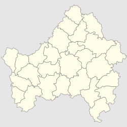 Pogar Pogar (Bryansk Oblast) | |
| Coordinates: 52°33′00″N 33°15′00″E / 52.55000°N 33.25000°E | |
| Country | Russia |
| Federal subject | Bryansk Oblast |
| Radosh, Radogosh | 1155 |
| Town status since | 1938 |
| Population | |
| • Total | 9,990 |
| • Estimate (2018)[2] | 8,483 (−15.1%) |
| • Municipal district | Pogarsky Municipal District |
| • Urban settlement | Pogarsky Urban Settlement |
| • Capital of | Pogarsky Municipal District, Pogarsky Urban Settlement |
| Time zone | UTC+3 (MSK |
| Postal code(s)[4] | 243550 |
| Dialing code(s) | +7 48349 |
| OKTMO ID | 15642151051 |
Located on Sudost River, a tributary of the Desna River, 7 km from the Pogar railway station and 128 km south-west of Bryansk, the administrative center of the region.
History edit
Pogar is one of the oldest settlements of the Russian Federation. According to archeological data, the first Slavic settlement in this place appeared in the 8th-9th centuries. In 1155 locality was first mentioned as an urban settlement Radosch later Radogosch. In the late 1230s it was ravaged by the Mongols. [2]
In the second half of the 14th century, the town passed into the possession of Lithuania. In the years 1500-1618 was an under the rule of the Russian state. In the autumn of 1534 the governor of Kiev Andrey Nemirovich Radogosch burned, but he was unable to take Starodub and Chernigov. After the destruction of Radogoscha by the Lithuanians in 1563, the population fled; On the site of the former population remained only long mound.
The exact reappearance of the town is unknown but by that time the town already bore the name of Pogar.[8] In 1618 it was captured by Poland, 1654, after joining the left-bank Ukraine to Russia as part of the Russian state. Before elimination of Catherine II regimental device autonomous Hetman of Ukraine in 1783 was part of the Starodub Regiment, which was the center of Pogarskij hundreds.
From the middle of the 17th century called "Pogar" and the Magdeburg Law. The town was famous for its fairs. Since 1781 - the county town of Novgorod-Seversky governorship, after the dissolution of which in 1796 left for the staff. Until 1929 was part of the Starodub district, where it was the parish center.
In 1910, the cigar factory merchant Shepfera was transferred to the town of Pochep. In the years 1913-1915, there was one more tobacco company - cigar factory AG Rutenberg.
In 1918, during the Austro-German occupation of Starodub, Pogar was given temporary county center status power.
On May 25, 1919, Pohar was transferred to the category of settlements of rural type (Russian: поселений сельского типа), and on July 10, 1938 it was granted an urban-type settlement status.
It is the only population center of the municipality Pogarsky urban settlement.
External links edit
- ^ a b Russian Federal State Statistics Service (2011). Всероссийская перепись населения 2010 года. Том 1 [2010 All-Russian Population Census, vol. 1]. Всероссийская перепись населения 2010 года [2010 All-Russia Population Census] (in Russian). Federal State Statistics Service.
- ^ "26. Численность постоянного населения Российской Федерации по муниципальным образованиям на 1 января 2018 года". Federal State Statistics Service. Retrieved 23 January 2019.
- ^ "Об исчислении времени". Официальный интернет-портал правовой информации (in Russian). 3 June 2011. Retrieved 19 January 2019.
- ^ Почта России. Информационно-вычислительный центр ОАСУ РПО. (Russian Post). Поиск объектов почтовой связи (Postal Objects Search) (in Russian)
- ^ Russian Federal State Statistics Service. Всероссийская перепись населения 2020 года. Том 1 [2020 All-Russian Population Census, vol. 1] (XLS) (in Russian). Federal State Statistics Service.
- ^ Federal State Statistics Service (21 May 2004). Численность населения России, субъектов Российской Федерации в составе федеральных округов, районов, городских поселений, сельских населённых пунктов – районных центров и сельских населённых пунктов с населением 3 тысячи и более человек [Population of Russia, Its Federal Districts, Federal Subjects, Districts, Urban Localities, Rural Localities—Administrative Centers, and Rural Localities with Population of Over 3,000] (XLS). Всероссийская перепись населения 2002 года [All-Russia Population Census of 2002] (in Russian).
- ^ Всесоюзная перепись населения 1989 г. Численность наличного населения союзных и автономных республик, автономных областей и округов, краёв, областей, районов, городских поселений и сёл-райцентров [All Union Population Census of 1989: Present Population of Union and Autonomous Republics, Autonomous Oblasts and Okrugs, Krais, Oblasts, Districts, Urban Settlements, and Villages Serving as District Administrative Centers]. Всесоюзная перепись населения 1989 года [All-Union Population Census of 1989] (in Russian). Институт демографии Национального исследовательского университета: Высшая школа экономики [Institute of Demography at the National Research University: Higher School of Economics]. 1989 – via Demoscope Weekly.
- ^ Энциклопедический словарь Ф. А. Брокгауза и И. А. Ефрона