


Summary
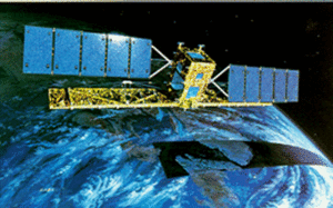
RADARSAT-1 was Canada's first commercial Earth observation satellite. It utilized synthetic aperture radar (SAR) to obtain images of the Earth's surface to manage natural resources and monitor global climate change. As of March 2013, the satellite was declared non-operational and is no longer collecting data.
 RADARSAT-1 satellite | |
| Mission type | Earth observation |
|---|---|
| Operator | Canadian Space Agency |
| COSPAR ID | 1995-059A |
| SATCAT no. | 23710 |
| Website | www |
| Mission duration | 5 years (planned) 17 years, 4 months, 24 days (achieved) |
| Spacecraft properties | |
| Bus | RADARSAT |
| Manufacturer | MDA (formerly Spar Aerospace) Ball Aerospace |
| Launch mass | 2,750 kg (6,060 lb) [1] |
| Power | 2.1 kW |
| Start of mission | |
| Launch date | 4 November 1995, 14:22 UTC |
| Rocket | Delta II 7920-10 |
| Launch site | Vandenberg, SLC-2W |
| Contractor | Boeing |
| End of mission | |
| Last contact | 29 March 2013 |
| Orbital parameters | |
| Reference system | Geocentric orbit |
| Regime | Low Earth orbit |
| Perigee altitude | 793 km (493 mi) |
| Apogee altitude | 821 km (510 mi) |
| Inclination | 98.60° |
| Period | 100.70 minutes |
Mission edit
RADARSAT-1 was launched at 14:22 UTC on 4 November 1995,[2] from Vandenberg Air Force Base in California, into a Sun-synchronous orbit (dawn-dusk) above the Earth with an altitude of 798 km (496 mi) and inclination of 98.60°.[1] Developed under the management of the Canadian Space Agency (CSA) in co-operation with Canadian provincial governments and the private sector, it provided images of the Earth for both scientific and marketing purposes. RADARSAT-1's images were useful in many fields, including agriculture, cartography, hydrology, forestry, oceanography, geology, ice and ocean monitoring, arctic surveillance, and detecting ocean oil slicks.
History edit
The Canadian Space Agency (CSA) RADARSAT-1 project was conceived in the early 1980s and included discussions with NASA.[3][4]
NASA provided the Delta II launch vehicle to launch RADARSAT-1 and access to the NASA Deep Space Network (NASA DSN) in exchange for access to its data. Estimates are that the project, excluding launch, cost CA$620 million. The Canadian federal government contributed about CA$500 million, the four participating provinces (Québec, Ontario, Saskatchewan and British Columbia) about CA$57 million, and the private sector about CA$63 million.
RADARSAT International, Inc. (RSI), a Canadian private company, was created in 1989 to process, market and distribute RADARSAT-1 data. (RADARSAT International, Inc. (RSI) was later acquired by MacDonald Dettwiler and Associates.) In 2006, RSI was rebranded MDA Geospatial Services International or MDA GSI.
Payload edit
RADARSAT-1 used a synthetic aperture radar (SAR) sensor to image the Earth at a single microwave frequency of 5.3 GHz, in the C band (wavelength of 5.6 cm).[1] The SAR support structure was designed and manufactured by Northrop Grumman Astro Aerospace and deployed to 15 m (49 ft) in length on orbit. Unlike optical satellites that sense reflected sunlight, SAR systems transmitted microwave energy towards the surface and recorded the reflections. Thus, Radarsat-1 imaged the Earth, day or night, in any atmospheric condition, such as cloud cover, rain, snow, dust or haze.
Each of RADARSAT-1's seven beam modes offered a different image resolution. The modes included Fine, which covers an area of 50 × 50 km (31 × 31 mi) (2,500 km2 (970 sq mi)) with a resolution of 10 m (33 ft); Standard, which covered an area of 100 × 100 km (62 × 62 mi) (10,000 km2 (3,900 sq mi)) and had a resolution of 30 m (98 ft); and ScanSAR wide, which covered a 500 × 500 km (310 × 310 mi) (250,000 km2 (97,000 sq mi)) area with a resolution of 100 m (330 ft). RADARSAT-1 also had the unique ability to direct its beam at different angles.[1]
Orbit edit

With an orbital period of 100.70 minutes, RADARSAT-1 circles the Earth 14 times a day.[1] The orbit path repeats every 24 days, this means that the satellite is in exactly the same location and could take the same image (same beam mode and beam position) every 24 days. This is useful for interferometry and detecting changes at that location that took place during the 24 days. Using different beam positions, a location can also be scanned every few days.
RADARSAT-1 was a right-looking satellite,[1] meaning that the microwave beam transmits and receives on the right side of the satellite, relative to its orbital path. As it descends in its orbit from the North Pole, it faces west, and when it ascends from the South Pole, it faces east. Locations could therefore be imaged from opposite sides. Combined with the different beam modes and positions, this provided users with many possible perspectives from which to image a location.
End of service edit
On 4 November 2010, RADARSAT-1 celebrated its 15-year service anniversary.[5] It outlived its planned five-year lifetime by a wide margin. Radarsat-2 was launched on 14 December 2007 from Baikonur, Kazakhstan[6]
RADARSAT-1 covered the Arctic daily, and most of Canada every 72 hours depending on instrument orientation and mode. It covered the entire Earth every 24 days.
On 29 March 2013, RADARSAT-1 experienced a technical problem. The Canadian Space Agency (CSA) assembled a team of engineers, who conducted an extensive investigation. Following numerous attempts to resolve the problem, the CSA, in consultation with its commercial data distributor MDA Geospatial Services Inc. concluded that RADARSAT-1 was no longer operational.[7]
See also edit
References edit
- ^ a b c d e f "Satellite Characteristics". Canadian Space Agency. 21 January 2011. Retrieved 20 October 2014.
- ^ "RADARSAT-1". 11 September 2006. Retrieved 20 October 2014.
- ^ Jezek, Kenneth (18 April 2019). "2006 Anniversary Edition – A Brief History of the RADARSAT-1 Antarctic Mapping Project". Alaska Satellite Facility. Retrieved 15 January 2023.
- ^ Mapping Antarctica and Greenland with Shuttle Imaging Radar: A Report. California Institute of Technology, Jet Propulsion Laboratory. September 1985. p. 18.
- ^ "Canadian satellite RADARSAT-1 celebrating 15 years of service to Canada and the world" (Press release). Canadian Space Agency. 4 November 2010. Archived from the original on 18 December 2010. Retrieved 15 November 2010.
- ^ "Soyuz rocket lifts Canadian radar satellite into space". CBC News. 14 December 2007. Retrieved 14 December 2007.
- ^ "RADARSAT-1: Seventeen Years of Technological Success" (Press release). Canadian Space Agency. 9 May 2013. Archived from the original on 24 June 2013. Retrieved 30 May 2013.
External links edit
- RADARSAT-1 from the CSA