


Summary
Roggel is a village in the Dutch province of Limburg. It is located in the municipality of Leudal.
Roggel
Rogkel | |
|---|---|
Village | |
![The Sint-Petruskerk (Roggel) [nl]](http://upload.wikimedia.org/wikipedia/commons/thumb/f/fb/Kerkroggel.jpg/250px-Kerkroggel.jpg) The Sint-Petruskerk (Roggel) | |
 Coat of arms | |
 Roggel Location in the Netherlands  Roggel Location in the province of Limburg in the Netherlands | |
| Coordinates: 51°15′45″N 5°55′25″E / 51.26250°N 5.92361°E | |
| Country | Netherlands |
| Province | Limburg |
| Municipality | Leudal |
| Area | |
| • Total | 16.04 km2 (6.19 sq mi) |
| Elevation | 29 m (95 ft) |
| Population (2021)[1] | |
| • Total | 4,295 |
| • Density | 270/km2 (690/sq mi) |
| Time zone | UTC+1 (CET) |
| • Summer (DST) | UTC+2 (CEST) |
| Postal code | 6088[1] |
| Dialing code | 0475 |
| Major roads | N279 |
History edit
The village was first mentioned in 1230 as Rogle. The etymology is unclear.[3] Roggel developed along the Roggelse Beek. It used to part of the County of Horne. Later it became it part of the Prince-Bishopric of Liège. In 1679, it became an independent heerlijkheid.[4]
The Catholic St Peter Church is a three aisled church which was built in 1477 to replace the 13th century chapel. The latest extension was in 1929. In 1944, the tower was partially blown up and rebuilt in 1946.[4]
Rogger was home to 281 people in 1840.[5] The grist mill Sint-Pieter was built in 1901. After 1953, the mill went out of service. It was sold to the municipality in 1969, and restored in 1976. The wind mill is often in service.[6]
The former municipality of Roggel merged in 1991 with Neer. The new municipality was initially named "Roggel", but changed its name to Roggel en Neer in 1993.[7] In 2007 Roggel en Neer became part of the new municipality of Leudal.[5]
Gallery edit
-
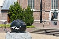 Sculpture: de Roggelse waterbol
 -
![Nijken, windmill: de Sint-Petrus [nl]](//upload.wikimedia.org/wikipedia/commons/thumb/c/c0/Nijken%2C_de_Sint_Petrusmolen_RM32694_foto2_2013-04-14_14.33.jpg/90px-Nijken%2C_de_Sint_Petrusmolen_RM32694_foto2_2013-04-14_14.33.jpg) Nijken, windmill: de Sint-Petrus
Nijken, windmill: de Sint-Petrus

![Nijken, windmill: de Sint-Petrus [nl]](http://upload.wikimedia.org/wikipedia/commons/thumb/c/c0/Nijken%2C_de_Sint_Petrusmolen_RM32694_foto2_2013-04-14_14.33.jpg/90px-Nijken%2C_de_Sint_Petrusmolen_RM32694_foto2_2013-04-14_14.33.jpg)
References edit
- ^ a b c "Kerncijfers wijken en buurten 2021". Central Bureau of Statistics. Retrieved 24 April 2022.
- ^ "Postcodetool for 6088AA". Actueel Hoogtebestand Nederland (in Dutch). Het Waterschapshuis. Retrieved 24 April 2022.
- ^ "Roggel - (geografische naam)". Etymologiebank (in Dutch). Retrieved 24 April 2022.
- ^ a b Sabine Broekhoven, & Ronald Stenvert (2003). Roggel (in Dutch). Zwolle: Waanders. ISBN 90 400 9623 6. Retrieved 24 April 2022.
- ^ a b "Roggel". Plaatsengids (in Dutch). Retrieved 24 April 2022.
- ^ "Sint-Petrus". Molen database (in Dutch). Retrieved 24 April 2022.
- ^ Ad van der Meer and Onno Boonstra, Repertorium van Nederlandse gemeenten, KNAW, 2011.
External links edit
 Media related to Roggel at Wikimedia Commons