


Summary
The Shire of Dowerin is a local government area in the Wheatbelt region of Western Australia, about 160 kilometres (100 mi) northeast of Perth, the state capital. The Shire covers an area of 1,847 square kilometres (713 sq mi) and its seat of government is the town of Dowerin.
| Shire of Dowerin Western Australia | |||||||||||||||
|---|---|---|---|---|---|---|---|---|---|---|---|---|---|---|---|
 The Dowerin Shire offices | |||||||||||||||
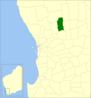 Location in Western Australia | |||||||||||||||
 | |||||||||||||||
| Population | 715 (LGA 2021)[1] | ||||||||||||||
| Established | 1911 | ||||||||||||||
| Area | 1,846.7 km2 (713.0 sq mi) | ||||||||||||||
| Shire President | Robert Trepp | ||||||||||||||
| Council seat | Dowerin | ||||||||||||||
| Region | Wheatbelt | ||||||||||||||
| State electorate(s) | Moore | ||||||||||||||
| Federal division(s) | Durack | ||||||||||||||
| Website | Shire of Dowerin | ||||||||||||||
| |||||||||||||||
History edit
On 3 November 1911, the Dowerin Road District was gazetted. On 1 July 1961, it became a shire following enactment of the Local Government Act 1960.[2]
Wards edit
Council resolved to dissolve Wards in December 2016.
Towns and localities edit
The towns and localities of the Shire of Dowerin with population and size figures based on the most recent Australian census:[3][4]
| Locality | Population | Area | Map | |||||||||||||||||||||||||||||||||||||||||||||||||||||||||||||||||
|---|---|---|---|---|---|---|---|---|---|---|---|---|---|---|---|---|---|---|---|---|---|---|---|---|---|---|---|---|---|---|---|---|---|---|---|---|---|---|---|---|---|---|---|---|---|---|---|---|---|---|---|---|---|---|---|---|---|---|---|---|---|---|---|---|---|---|---|---|
| Dowerin | 436 (SAL 2021)[5] | 292 km2 (113 sq mi) | Hindmarsh | 54 (SAL 2021)[6] | 284.6 km2 (109.9 sq mi) | Koomberkine | 54 (SAL 2021)[7] | 356.6 km2 (137.7 sq mi) | 
| |||||||||||||||||||||||||||||||||||||||||||||||||||||||||||
| Manmanning | 42 (SAL 2021)[8] | 417.2 km2 (161.1 sq mi) | Minnivale | 40 (SAL 2021)[9] | 261.4 km2 (100.9 sq mi) | Ucarty | 78 (SAL 2021)[10] | 251.1 km2 (97.0 sq mi) |
Former towns
edit
Population edit
Heritage-listed places editAs of 2023, 30 places are heritage-listed in the Shire of Dowerin,[11] of which none are on the State Register of Heritage Places.[12] References edit
External links edit
31°11′31″S 117°02′02″E / 31.192°S 117.034°E |