


Summary
The Simunjan District is a district in the Samarahan Division of Sarawak, Malaysia,[3][4] located between Serian and Sri Aman. It borders Sebuyau and Samarahan and lies approximately 51.4 kilometres (32 mi) east-south-east of the state capital Kuching.
Simunjan District | |
|---|---|
| Daerah Simunjan | |
 Seal | |
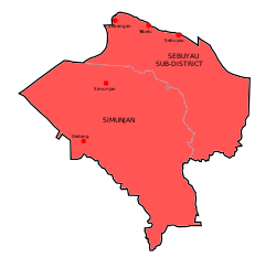 Map of Simunjan District | |
.mw-parser-output .locmap .od{position:absolute}.mw-parser-output .locmap .id{position:absolute;line-height:0}.mw-parser-output .locmap .l0{font-size:0;position:absolute}.mw-parser-output .locmap .pv{line-height:110%;position:absolute;text-align:center}.mw-parser-output .locmap .pl{line-height:110%;position:absolute;top:-0.75em;text-align:right}.mw-parser-output .locmap .pr{line-height:110%;position:absolute;top:-0.75em;text-align:left}.mw-parser-output .locmap .pv>div{display:inline;padding:1px}.mw-parser-output .locmap .pl>div{display:inline;padding:1px;float:right}.mw-parser-output .locmap .pr>div{display:inline;padding:1px;float:left}html.skin-theme-clientpref-night .mw-parser-output .od,html.skin-theme-clientpref-night .mw-parser-output .od .pv>div,html.skin-theme-clientpref-night .mw-parser-output .od .pl>div,html.skin-theme-clientpref-night .mw-parser-output .od .pr>div{background:#000;color:#fff}html.skin-theme-clientpref-night .mw-parser-output .locmap{filter:grayscale(0.6)}@media(prefers-color-scheme:dark){html.skin-theme-clientpref-os .mw-parser-output .locmap{filter:grayscale(0.6)}html.skin-theme-clientpref-os .mw-parser-output .od,html.skin-theme-clientpref-os .mw-parser-output .od .pv>div,html.skin-theme-clientpref-os .mw-parser-output .od .pl>div,html.skin-theme-clientpref-os .mw-parser-output .od .pr>div{background:#000;color:#fff}} Simunjan District Location of Simunjan District in Malaysia | |
| Coordinates: 1°22′59″N 110°45′0″E / 1.38306°N 110.75000°E | |
| Country | |
| State | |
| Division | Samarahan |
| Seat | Simunjan |
| Local area government(s) | Simunjan District Council |
| Government | |
| • District officer | Abd. Khalid B. Manap[1] |
| Area | |
| • Total | 1,370.12 km2 (529.01 sq mi) |
| Elevation | 54 m (177 ft) |
| Population (2015) | |
| • Total | 39,600 |
| • Density | 29/km2 (75/sq mi) |
| Time zone | UTC+8 (MST) |
| • Summer (DST) | UTC+8 (Not observed) |
| Postcode | 947xx - 948xx |
| Calling code | +6-082 |
| Vehicle registration plates | QC |
Most of its inhabitants are made up of the Malay and the Iban people.
Etymology edit
There are a few deviations regarding the origin of Simunjan name. The first being when a Chinese merchant went to dry tobaccos during cloudy weather. Based on this folklore, a Chinese merchant came to Simunjan on a boat known as Wangkang (Djong (ship)) to rest. While at Simunjan, he tried to dry his tobaccos in the sun, but the weather was cloudy. The local told them that his "Jan" ("tobacco" in Chinese) will be "Semun" (or "damp"); "Semunlah jan kau kelak" ("Your tobacco will get damp.") Since this encounter, the place have been known as "Simunjan."[5]
Another oral tradition speaks of Simunjan coming from the word "Semun" and "Hujan" (or "rain".) In this version, Simunjan people originated from an area known as "Ensengei" that migrated to Simunjan. Most of them worked as miners. While trying to start a match, the match was damp due to the frequent rainfall. Because this area was still unnamed, people combined "Semun" and "Hujan" to refer this place, hence "Simunjan."[5]
Based on another source, Simunjan got its name from "Burung Munjan" ("Munjan Bird.") Burung Munjan was to believe a bird native to Simunjan that was abundant within Gunung Ngeli forest. Simunjan derived from the phrase "Si Munjan" (or "The Munjan") hence its name.However, there are limited resources that provide additional details about this version, except for a few mentions from locals. A statue of Burung Munjan was erected around 1990 at Padang Sentral (Central Park) before being moved to Majlis Daerah Simunjan. It is believed that Burung Munjan went extinct due to rampant human activities in Simunjan.[6]
Famous persons edit
- Alfred Russel Wallace - spent much of 1855 collecting natural history specimens (not least, several orang-utans) while guest of the coal mine manager, as recounted in The Malay Archipelago: land of the orang-utan...
- Sapok Biki - Malaysian boxer who won a gold medal during the 1998 Commonwealth Games in Kuala Lumpur is a Simunjan native.
Climate edit
Simunjan has a tropical rainforest climate (Af) with heavy to very heavy rainfall year-round.
| Climate data for Simunjan | |||||||||||||
|---|---|---|---|---|---|---|---|---|---|---|---|---|---|
| Month | Jan | Feb | Mar | Apr | May | Jun | Jul | Aug | Sep | Oct | Nov | Dec | Year |
| Mean daily maximum °C (°F) | 29.9 (85.8) |
30.2 (86.4) |
31.1 (88.0) |
32.0 (89.6) |
32.4 (90.3) |
32.2 (90.0) |
32.1 (89.8) |
32.0 (89.6) |
31.8 (89.2) |
31.7 (89.1) |
31.4 (88.5) |
30.7 (87.3) |
31.5 (88.6) |
| Daily mean °C (°F) | 26.2 (79.2) |
26.4 (79.5) |
26.9 (80.4) |
27.4 (81.3) |
27.8 (82.0) |
27.5 (81.5) |
27.2 (81.0) |
27.2 (81.0) |
27.2 (81.0) |
27.2 (81.0) |
27.0 (80.6) |
26.6 (79.9) |
27.1 (80.7) |
| Mean daily minimum °C (°F) | 22.5 (72.5) |
22.6 (72.7) |
22.8 (73.0) |
22.9 (73.2) |
23.2 (73.8) |
22.8 (73.0) |
22.4 (72.3) |
22.5 (72.5) |
22.6 (72.7) |
22.7 (72.9) |
22.6 (72.7) |
22.5 (72.5) |
22.7 (72.8) |
| Average rainfall mm (inches) | 471 (18.5) |
358 (14.1) |
284 (11.2) |
272 (10.7) |
246 (9.7) |
188 (7.4) |
180 (7.1) |
254 (10.0) |
275 (10.8) |
308 (12.1) |
349 (13.7) |
445 (17.5) |
3,630 (142.8) |
| Source: Climate-Data.org[7] | |||||||||||||
Neighbouring settlements edit
Neighbouring settlements include:
- Kampung Sageng 0 kilometres (0.0 mi) north
- Kampung Lintang 0 kilometres (0.0 mi) north
- Kampung Sungai Jong 1.9 kilometres (1.2 mi) south
- Kampung Jagong 1.9 kilometres (1.2 mi) west
- Kampung Segunduk 2.6 kilometres (1.6 mi) southeast
- Kampung Lobang Empat 4.1 kilometres (2.5 mi) southeast
- Kampung Malanjok 5.2 kilometres (3.2 mi) southeast
- Kampung Dundong 5.6 kilometres (3.5 mi) west
- Kampung Sabang 6.7 kilometres (4.2 mi) northwest
- Kampung Lingkau 6.7 kilometres (4.2 mi) southeast
- Kampung Sungai Ba 2.0 kilometres (1.2 mi) west
References edit
- ^ Administrator. "Laman Web Rasmi Majlis Daerah Simunjan". simunjandc.sarawak.gov.my.
- ^ Administrator. "Portal Rasmi Pentadbiran Bahagian Samarahan". samarahan.sarawak.gov.my.
- ^ M. Mohizah, S. Julia and W. K. Soh (2006). A Sarawak Gazetteer (PDF). Kuala Lumpur: Sarawak Forestry Department Malaysia and Forest Research Institute Malaysia. ISBN 983-2181-86-0. OCLC 85818866. Archived from the original (PDF) on 22 July 2011. Retrieved 1 January 2011.
- ^ "Simunjan, Malaysia". Geonames. 9 August 2010. Retrieved 27 December 2010.
- ^ a b "Sejarah". Pusat Internet Pejabat Daerah Lama Simunjan. Retrieved 25 April 2021.
- ^ Chek, Abdullah (1 January 2016). "1/1/16 The eroding simunjan nan hilang". ABC Sadong. Retrieved 25 April 2021.
- ^ "Climate: Simunjan". Climate-Data.org. Retrieved 29 October 2020.
External links edit
 Simunjan travel guide from Wikivoyage