


Summary
Tando Muhammad Khan District (Sindhi: ٽنڊو محمد خان ضلعو, Urdu: ضلع ٹنڈو محمد خان) is a district in the southern part of Sindh province in Pakistan. In north of the district, Hyderabad and Tando Allahyar districts are located; Badin district lies on south and east; and West boundary is shared with Sujawal District. The Indus River flows through Northwest. Tando Muhammad Khan district comprises the three talukas of Tando Muhammad Khan (also the biggest town in the district), Bulri Shah Karim and Tando Ghulam Hyder.
Tando Muhammad Khan District
| |
|---|---|
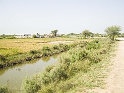 Fields in Syed Matto Shah | |
 District Tando Muhammad Khan in Sindh provincial region of Pakistan | |
| Country | |
| Province | |
| Division | Hyderabad |
| Headquarters | Tando Muhammad Khan |
| Government | |
| • Type | District Administration |
| • Deputy Commissioner | N/A |
| • District Police Officer | N/A |
| • District Health Officer | N/A |
| Area | |
| • Total | 1,423 km2 (549 sq mi) |
| Population | |
| • Total | 726,119 |
| • Density | 510/km2 (1,300/sq mi) |
| Time zone | UTC+5 (PST) |
| Number of Tehsils | 3 |
History edit
The district is named after the city of Tando Muhammad Khan, founded by Mir Muhammad Khan Shahwani Talpur. It is located at a distance of 35 km from Hyderabad on the Badin-Hyderabad National Highway.
Tando Muhammad Khan district was formed by dividing the Hyderabad district along with Matiari and Tando Allahyar districts in 2005.[2]
Demography edit
At the time of the 2017 census, Tando Muhammad Khan district had 130,966 households and a population of 677,098. Tando Muhammad Khan had a sex ratio of 939 females per 1000 males and a literacy rate of 31.96%: 41.03% for males and 22.31% for females. 142,037 (20.98%) lived in urban areas. 214,284 (31.65%) were under 10 years of age.[3] In 2023, the district had 143,956 households and a population of 726,119.[1]
Religion edit
The majority religion is Islam, with 77.53% of the population. Hinduism (including those from Scheduled Castes) is practiced by 22.25% of the population.[3]
Languages edit
At the time of the 2017 census, 94.51% of the population spoke Sindhi, 1.69% Urdu and 1.07% Punjabi as their first language.[3]
Health edit
National Institute of Cardiovascular Diseases (NICVD) opened its satellite centre in Tando Mohammad Khan, it became the 4th city to have such facility in Sindh province. Facility would provide cardiac treatment services to people of Thatta, Badin, Tharparkar and adjoining areas, as well. People of this area could not even travel to Karachi for treatment of cardiac ailments but now they could avail state of the art cardiac treatment closer to their abodes. In Sindh, around 30,000 to 40,000 children are born with congenital heart disease or with defective hearts at the time of birth, but only a few hundred of them are diagnosed and get treated while thousands remain undiagnosed due to non-availability of heart health facilities in their area. In particular, from Tando Muhammad Khan to Thatta, Badin, Tharparkar and adjoining areas, thousands of children are born with congenital heart disease but they remain undiagnosed throughout their life and eventually die without treatment.
Climate edit
The climate of the area is moderate. However. April, May and June are very hot during the day time. December and January are the coldest months with maximum and minimum temperatures of 30 °C and 10 °C respectively. Rainfall is highly erratic with an average of about 130 mm. The monsoon dominates from July to September.
Agriculture edit
70% of the district population is engaged in agriculture. Main crops grown in the district are: sugarcane, rice, wheat and cotton. Phuleli, Pinyari and Akram canal are the main source of water-reservoir for irrigation in this district. There are many rice mills operating in Tando Mohammad khan district.
According to the 2017 census of Pakistan, the population of Tando Muhammad Khan District of Sindh was 677228: 350010 male, 327202 female, and 16 transgender. Average annual growth rate was 2.31% from 1998 to 2017.
Administration edit
Tando Muhammad Khan is administratively subdivided into 3 tehsils, these are:[4]
- Bulri Shah Karim
- Tando Ghulam Hyder
- Tando Muhammad Khan
Mr. Tauqeer Muhammad Naeem, PSP is holding the working as the Senior Superintendent of Police of the District w.e.from 21-06-2018.
Education edit
District Tando Muhammad Khan is ranked at the 115th position in the education score index of the Pakistan District Education Rankings 2017 published by Alif Ailaan. The education score comprises the learning score, retention score and gender parity score. Retention is one of the biggest concerns in this district, with the relevant score being only 31.14 out of a potential 100.[5]
In the middle school infrastructure score index, which focuses on availability of basic facilities and the building condition of schools, Tando Muhammad Khan ranks 86th. The lack of electricity and drinking water in schools remain a concern in the district, along with unsatisfactory building conditions.[6]
On the TaleemDo! App, residents of several areas within Tando Muhammad Khan have complained about the quality of the syllabus and outdated textbooks.[7] In government schools, where textbooks are supposed to be provided to every child free of cost, parents have complained of being charged for these items. The debate over the medium of instruction is as relevant in Tando Muhammad Khan as other districts of Sindh, where many demand for basic education to be provided in Sindhi, rather than in Urdu or English.[8]
List of Union Councils edit
Tando Muhammad Khan District has the following 17 Union Councils:[9]
| UC Name | Population |
|---|---|
| T.M. Khan-1 | 28,085 |
| T.M. Khan-2 | 26,451 |
| T.M. Khan-3 | 27,444 |
| Lakhat | 29,853 |
| Tando Siandad | 35,054 |
| Shaikh Bhirkio | 28,543 |
| Bulri Shah Karim | 33,437 |
| Saeed Khan Lund | 30,252 |
| Allah Yar Turk | 27,022 |
| Saeed Pur | 26,514 |
| Mulla Katiar | 27,930 |
| Saeed Matto | 29,577 |
| Jhanhan Soomro | 32,096 |
| Tando Ghulam Hyder | 33,264 |
| Dando | 31,826 |
| Ghulam Shah Baghrani | 29,035 |
| Nazar Pur | 32,315 |
List of Dehs edit
The following is a list of Tando Muhammad Khan District's dehs, organised by taluka:[10]
- Tando Ghulam Hyder Taluka (54 dehs)
- Adhanki
- Ahmedani
- Ajaib Pur
- Arazi
- Bariji
- Bhanki
- Chachri
- Chak
- Chandia
- Charo
- Choubandi
- Dando
- Dauki
- Debgeri
- Doderi
- Fateh Bagh
- Gulshan
- Habach
- Jagsiyani
- Jahbgeri
- Jarki
- Jiayath
- Jio
- Jonathi
- Joon
- Jumoon Jakhro
- Karo Mehro
- Kath Bhambhen
- Khaso
- Kodario
- Kor Rahimoon
- Lakara
- Lakhi
- Lashari
- Machari
- Mahi Laghari
- Malana
- Malook Pur
- Moya
- Nazar Pur
- Noohani
- Palandi
- Parori
- Peroz Pur
- Ringyoon
- Saherki
- Samradi
- Seri
- Sethari
- Tando Ghulam Hyder
- Tali
- Thorki
- Unerki
- Vedho Chowro
- Tando Muhammad Khan Taluka (29 dehs)
- Abri
- Baberki
- Bozdar
- Burira
- Chano Katiar
- Digh
- Fatehpur
- Kari
- Khanto
- Kora
- Lakhat
- Larh
- Nango Shah
- Pad Ram Diyali
- Patghahi
- Pattar
- Ram Diyali Wasan
- Roshnai
- Samabani
- Shah Bukhari
- Sheikh Bhirkhio
- Siddiquepur
- Singh
- Soomerki
- Sutiari
- Tando Muhammad Khan
- Thari
- Vesarki
- Veseria
- Bulri Shah Karim Taluka (76 dehs)
- Abad
- Abdumehndo
- Alipur
- Allo Katiar
- Amerki
- Aripota
- Barchani
- Beharan
- Behranpur
- Bhahera
- Bhalal
- Bhanbri
- Bulri
- Chaudaro
- Chhari
- Chorki Jagir
- Dadoonki
- Deghi
- Dhandaboo
- Dhandhi
- Dhatt
- Daharki
- Din Pur
- Dodi
- Doulatpur
- Ganghyari
- Hajipur
- Heran Jagir
- Homki
- Jado Laghari
- Jalalani
- Jamerki
- Jati
- Jhok
- Kamaro
- Kandar
- Kass
- Kathor
- Katiar
- Keenjhar
- Khadho
- Khalasi
- Khalso
- Kheersar
- Khiyari
- Khokhar
- Khoski
- Kolab Rayatee
- Kumb
- Ladhan
- Loonlelo
- Meeranpur
- Nakurji
- Narki
- Pakhro
- Pakhyarki
- Pir Wah
- Qaboolpur
- Qaboolpur-II
- Qanadani
- Rain
- Rayati Shor
- Saidpur
- Sahrani
- Samejani
- Samepotani
- Sandki
- Sathiar
- Shorki
- Sonehri
- Soomerki
- Soomra
- Soorjani
- Sun
- Tikhar
- Umaid Ali Jat
References edit
- ^ a b "TABLE 1 : HOUSEHOLDS, POPULATION, HOUSEHOLD SIZE AND ANNUAL GROWTH RATE" (PDF). www.pbscensus.gov.pk. Pakistan Bureau of Statistics. 2023.
- ^ "Three new districts carved out of Hyderabad". TheDawn. 5 April 2005. Retrieved 31 July 2021.
- ^ a b c d "District Wise Results / Tables (Census - 2017)". www.pbscensus.gov.pk. Pakistan Bureau of Statistics.
- ^ DISTRICT GOVERNMENT - Tando Muhammad Khan
- ^ Alif Ailaan 2017. Pakistan District Education Rankings 2017. Islamabad: Alif Ailaan. vi-66 pp. ISBN 978-969-7624-06-5
- ^ Alif Ailaan 2018. 2013-2018 Five Years of Education Reforms in Sindh. Wins, Losses and challenges for 2018-2023. Islamabad: Alif Ailaan. vi-42 pp. ISBN 978-969-7624-08-9
- ^ "Textbooks --- the real culprit | #TaleemDo". elections.alifailaan.pk. Retrieved 2018-08-03.
- ^ "Language --- conundrum in our education | #TaleemDo". elections.alifailaan.pk. Retrieved 2018-08-03.
- ^ "Union Council wise Thematic Analysis". Department of Health, Government of Sindh. Retrieved 24 May 2021.
- ^ "List of Dehs in Sindh" (PDF). Sindh Zameen. Retrieved 22 March 2021.
Bibliography edit
http://www.ndma.gov.pk/Publications/Development%20Profile%20District%20Tando%20Muhammad%20Khan.pdf
- 1998 District census report of Hyderabad. Census publication. Vol. 59. Islamabad: Population Census Organization, Statistics Division, Government of Pakistan. 1999.
25°01′N 68°29′E / 25.017°N 68.483°E