


Summary
Tiaro (/ˈtaɪroʊ/ TY-roh) is a rural town and locality in the Fraser Coast Region, Queensland, Australia.[2][3] In the 2021 census, the locality of Tiaro had a population of 778 people.[4]
| Tiaro Queensland | |||||||||||||||
|---|---|---|---|---|---|---|---|---|---|---|---|---|---|---|---|
 Bruce Highway at Tiaro | |||||||||||||||
 Tiaro | |||||||||||||||
| Coordinates | 25°43′25″S 152°35′01″E / 25.7236°S 152.5836°E | ||||||||||||||
| Population | 472 (UCL 2021)[1] | ||||||||||||||
| Postcode(s) | 4650 | ||||||||||||||
| Area | 85.4 km2 (33.0 sq mi) | ||||||||||||||
| Time zone | AEST (UTC+10:00) | ||||||||||||||
| Location |
| ||||||||||||||
| LGA(s) | Fraser Coast Region | ||||||||||||||
| State electorate(s) | Maryborough | ||||||||||||||
| Federal division(s) | Wide Bay | ||||||||||||||
| |||||||||||||||
Geography edit
The town is on the Mary River. It is situated on the Bruce Highway 27 kilometres (17 mi) south of Maryborough and 227 kilometres (141 mi) north of the state capital, Brisbane.
The North Coast railway line enters the locality from the south-west (Netherby), passes through the town which is served by the Tiaro railway station (25°43′21″S 152°34′55″E / 25.7226°S 152.5819°E), and exits to the north (Owanyilla).[5]
Timber and farming are the predominant industries in the Tiaro area, although the town's position on Queensland's main coastal highway also brings economic benefits.
There are two neighbourhoods within the locality:
History edit

The town takes its name from the pastoral run name in the 1840s. It is believed to be a corruption of the Kabi word (Dauwabra dialect) meaning dead trees.[2]
Tiaro Provisional School opened on 4 October 1870. On 21 January 1878, it became Tiaro State School.[8]
Tiaro had one of the first butter factories in Queensland. Baron Jones built the factory near the railway station in the early 1880s and used horses to churn butter. Cheese factories were built at Tiaro in 1890 and 1894. The Tiaro Butter Factory was closed temporarily on 1 July 1897 due to a short supply of milk. The Maryborough Chronicle reported “On the whole the season has been fairly good, but the supply very short for a district like Tiaro. This, however, was principally owing to the winter last year being so severe, also the year before, when great numbers of milking cows died, and last spring being so dry”. Although the factory opened again, it struggled to make a profit.[9] The factory was later relocated to Murgon in 1913 as most of the cream suppliers came from that district.
Brown Ridge Provisional School opened on 1908. On 1 January 1909, it became Brown Ridge State School. It closed in 1922, but reopened in 1924. It closed permanently in 1925.[8] It was on the western side of Nugent Road (25°44′47″S 152°32′15″E / 25.7464°S 152.5375°E).[10][11]

The Tiaro War Memorial commemorates those who served in World War I. It was unveiled on 25 April 1921 (ANZAC Day) by Sir Thomas William Glasgow.[12][13]
The Tiaro library opened in 2006.[14]
Demographics edit
In the 2006 census, Tiaro had a population of 433.[15]
In the 2016 census, the locality of Tiaro had a population of 758 people.[16]
In the 2021 census, the locality of Tiaro had a population of 778 people.[4]
Education edit
Tiaro State School is a government primary (Prep-6) school for boys and girls at 1 Forgan Terrace (25°43′41″S 152°34′52″E / 25.7281°S 152.5811°E).[17][18] In 2017, the school had an enrolment of 31 students with 4 teachers (3 full-time equivalent) and 5 non-teaching staff (3 full-time equivalent).[19] In 2022, the school had an enrolment of 43 students.[20]
There are no secondary schools in Tiaro. The nearest government secondary schools are Maryborough State High School and Aldridge State High School, both in Maryborough to the north-east.[11]
Amenities edit
The Fraser Coast Regional Council operates a public library at Forgan Terrace.[21] Public accessible wifi is provided.[21] Current Library services and collections are provided on the Fraser Coast Regional Libraries website.[22]
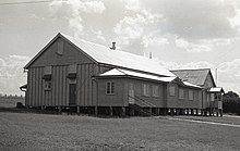
The Tiaro branch of the Queensland Country Women's Association meets at its rooms at 35 Mayne Street.[23]
Notable residents edit
- Thomas William Glasgow was born in Tiaro
See also edit
References edit
- ^ Australian Bureau of Statistics (28 June 2022). "Tiaro (urban centre and locality)". Australian Census 2021.
- ^ a b "Tiaro – town in Fraser Coast Region (entry 34492)". Queensland Place Names. Queensland Government. Retrieved 7 March 2022.
- ^ "Tiaro – locality in Fraser Coast Region (entry 50086)". Queensland Place Names. Queensland Government. Retrieved 7 March 2022.
- ^ a b Australian Bureau of Statistics (28 June 2022). "Tiaro (SAL)". 2021 Census QuickStats. Retrieved 28 February 2023.
- ^ "Railway stations and sidings - Queensland". Queensland Open Data. Queensland Government. 2 October 2020. Archived from the original on 5 October 2020. Retrieved 5 October 2020.
- ^ "Blackmount – locality unbounded in Fraser Coast Regional (entry 3062)". Queensland Place Names. Queensland Government. Retrieved 7 March 2023.
- ^ "Kooringa – locality unbounded in Fraser Coast Regional (entry 18490)". Queensland Place Names. Queensland Government. Retrieved 7 March 2023.
- ^ a b Queensland Family History Society (2010), Queensland schools past and present (Version 1.01 ed.), Queensland Family History Society, ISBN 978-1-921171-26-0
- ^ "Fraser Coast Libraries Local History Blog: The Tiaro Butter Factory". 24 May 2020. Archived from the original on 22 December 2021. Retrieved 17 June 2022.
- ^ "County of Lennox sheet 1" (Map). Queensland Government. 1921. Retrieved 13 September 2023.
- ^ a b "Queensland Globe". State of Queensland. Retrieved 13 September 2023.
- ^ "Tiaro War Memorial". Monument Australia. Archived from the original on 7 April 2014. Retrieved 6 April 2014.
- ^ "PERSONAL". The Brisbane Courier. National Library of Australia. 19 April 1921. p. 9. Archived from the original on 26 July 2020. Retrieved 6 April 2014.
- ^ "Queensland Public Library Statistical Bulletin 2016-17" (PDF). Public Libraries Connect. November 2017. Archived (PDF) from the original on 30 January 2018. Retrieved 19 January 2018.
- ^ Australian Bureau of Statistics (25 October 2007). "Tiaro (L) (Urban Centre/Locality)". 2006 Census QuickStats. Retrieved 25 July 2009.
- ^ Australian Bureau of Statistics (27 June 2017). "Tiaro (SSC)". 2016 Census QuickStats. Retrieved 20 October 2018.
- ^ "State and non-state school details". Queensland Government. 9 July 2018. Archived from the original on 21 November 2018. Retrieved 21 November 2018.
- ^ "Tiaro State School". Tiaro State School. 29 November 2020. Archived from the original on 2 March 2023. Retrieved 19 July 2023.
- ^ "ACARA School Profile 2017". Archived from the original on 22 November 2018. Retrieved 22 November 2018.
- ^ "School annual report 2022" (PDF). Tiaro State School. p. 2. Archived (PDF) from the original on 19 July 2023. Retrieved 17 July 2023.
- ^ a b "Tiaro Library". Public Libraries Connect. 27 March 2015. Archived from the original on 17 June 2022. Retrieved 19 January 2018.
- ^ "Libraries Fraser Coast regional Council". Fraser Cost Regional Council. 2018. Archived from the original on 17 June 2022. Retrieved 19 January 2018.
- ^ "Branch Locations". Queensland Country Women's Association. Archived from the original on 26 December 2018. Retrieved 26 December 2018.
External links edit
- Tiaro Shire: Queensland Places
- Town map of Tiaro, 1981
- Tiaro cemetery