
KNOWPIA
WELCOME TO KNOWPIA

Tigbao, Zamboanga del Sur 
Summary
Tigbao, officially the Municipality of Tigbao (Cebuano: Lungsod sa Tigbao; Subanen: Benwa Tigbao; Chavacano: Municipalidad de Tigbao; Tagalog: Bayan ng Tigbao), is a 5th class municipality in the province of Zamboanga del Sur, Philippines. According to the 2020 census, it has a population of 21,675 people.[3]
Tigbao | |
|---|---|
| Municipality of Tigbao | |
 Flag  Seal | |
| Motto: "Usbaw Tigbao" | |
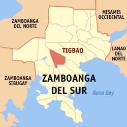 Map of Zamboanga del Sur with Tigbao highlighted | |
OpenStreetMap .mw-parser-output .locmap .od{position:absolute}.mw-parser-output .locmap .id{position:absolute;line-height:0}.mw-parser-output .locmap .l0{font-size:0;position:absolute}.mw-parser-output .locmap .pv{line-height:110%;position:absolute;text-align:center}.mw-parser-output .locmap .pl{line-height:110%;position:absolute;top:-0.75em;text-align:right}.mw-parser-output .locmap .pr{line-height:110%;position:absolute;top:-0.75em;text-align:left}.mw-parser-output .locmap .pv>div{display:inline;padding:1px}.mw-parser-output .locmap .pl>div{display:inline;padding:1px;float:right}.mw-parser-output .locmap .pr>div{display:inline;padding:1px;float:left}html.skin-theme-clientpref-night .mw-parser-output .od,html.skin-theme-clientpref-night .mw-parser-output .od .pv>div,html.skin-theme-clientpref-night .mw-parser-output .od .pl>div,html.skin-theme-clientpref-night .mw-parser-output .od .pr>div{background:#000;color:#fff}html.skin-theme-clientpref-night .mw-parser-output .locmap{filter:grayscale(0.6)}@media(prefers-color-scheme:dark){html.skin-theme-clientpref-os .mw-parser-output .locmap{filter:grayscale(0.6)}html.skin-theme-clientpref-os .mw-parser-output .od,html.skin-theme-clientpref-os .mw-parser-output .od .pv>div,html.skin-theme-clientpref-os .mw-parser-output .od .pl>div,html.skin-theme-clientpref-os .mw-parser-output .od .pr>div{background:#000;color:#fff}}  Tigbao Location within the Philippines | |
| Coordinates: 7°49′14″N 123°13′40″E / 7.82052778°N 123.22766389°E | |
| Country | Philippines |
| Region | Zamboanga Peninsula |
| Province | Zamboanga del Sur |
| District | 2nd district |
| Founded | November 8, 1991 |
| Barangays | 18 (see Barangays) |
| Government | |
| • Type | Sangguniang Bayan |
| • Mayor | Eleazar C. Carcallas |
| • Vice Mayor | Rowell P. Lalican |
| • Representative | Jeyzel Victoria C. Yu |
| • Municipal Council | Members |
| • Electorate | 13,890 voters (2022) |
| Area | |
| • Total | 120.69 km2 (46.60 sq mi) |
| Elevation | 419 m (1,375 ft) |
| Highest elevation | 1,144 m (3,753 ft) |
| Lowest elevation | 90 m (300 ft) |
| Population (2020 census)[3] | |
| • Total | 21,675 |
| • Density | 180/km2 (470/sq mi) |
| • Households | 4,769 |
| Economy | |
| • Income class | 5th municipal income class |
| • Poverty incidence | 39.46 |
| • Revenue | ₱ 103.2 million (2020) |
| • Assets | ₱ 415.1 million (2020) |
| • Expenditure | ₱ 72.75 million (2020) |
| • Liabilities | ₱ 246.4 million (2020) |
| Service provider | |
| • Electricity | Zamboanga del Sur 1 Electric Cooperative (ZAMSURECO 1) |
| Time zone | UTC+8 (PST) |
| ZIP code | 7043 |
| PSGC | 097344000 |
| IDD : area code | +63 (0)62 |
| Native languages | Subanon Cebuano Chavacano Tagalog |
| Website | www |
It was created by virtue of Republic Act No. 7162 on November 8, 1991. Tigbao was former part of Municipality of Dumalinao.[5]
Mount Timolan, the highest peak in Zamboanga del Sur, overlooks the town. The name of the town was derived from the abundance of "Tigbao" Grasses in the area.
Geography edit
Barangays edit
Tigbao is politically subdivided into 18 barangays. Each barangay consists of puroks while some have sitios.
- Begong
- Busol
- Caluma
- Diana Countryside
- Guinlin
- Lacarayan
- Lacupayan
- Libayoy
- Limas
- Longmot
- Maragang
- Mati
- Nangan-nangan
- New Tuburan
- Nilo
- Tigbao
- Timolan
- Upper Nilo
Climate edit
| Climate data for Tigbao, Zamboanga del Sur | |||||||||||||
|---|---|---|---|---|---|---|---|---|---|---|---|---|---|
| Month | Jan | Feb | Mar | Apr | May | Jun | Jul | Aug | Sep | Oct | Nov | Dec | Year |
| Mean daily maximum °C (°F) | 29 (84) |
29 (84) |
30 (86) |
30 (86) |
28 (82) |
27 (81) |
27 (81) |
26 (79) |
27 (81) |
27 (81) |
28 (82) |
28 (82) |
28 (82) |
| Mean daily minimum °C (°F) | 19 (66) |
19 (66) |
20 (68) |
21 (70) |
22 (72) |
22 (72) |
21 (70) |
21 (70) |
21 (70) |
21 (70) |
21 (70) |
20 (68) |
21 (69) |
| Average precipitation mm (inches) | 22 (0.9) |
18 (0.7) |
23 (0.9) |
24 (0.9) |
67 (2.6) |
120 (4.7) |
132 (5.2) |
156 (6.1) |
119 (4.7) |
124 (4.9) |
54 (2.1) |
24 (0.9) |
883 (34.6) |
| Average rainy days | 9.4 | 9.1 | 11.5 | 11.9 | 20.1 | 22.5 | 22.4 | 23.2 | 21.5 | 22.2 | 15.7 | 11.5 | 201 |
| Source: Meteoblue[6] | |||||||||||||
Demographics edit
| Year | Pop. | ±% p.a. |
|---|---|---|
| 1995 | 15,915 | — |
| 2000 | 16,914 | +1.31% |
| 2007 | 18,598 | +1.32% |
| 2010 | 19,300 | +1.36% |
| 2015 | 20,979 | +1.60% |
| 2020 | 21,675 | +0.64% |
| Source: Philippine Statistics Authority[7][8][9][10] | ||
Economy edit
References edit
- ^ Municipality of Tigbao | (DILG)
- ^ "2015 Census of Population, Report No. 3 – Population, Land Area, and Population Density" (PDF). Philippine Statistics Authority. Quezon City, Philippines. August 2016. ISSN 0117-1453. Archived (PDF) from the original on May 25, 2021. Retrieved July 16, 2021.
- ^ a b Census of Population (2020). "Region IX (Zamboanga Peninsula)". Total Population by Province, City, Municipality and Barangay. Philippine Statistics Authority. Retrieved 8 July 2021.
- ^ "PSA Releases the 2018 Municipal and City Level Poverty Estimates". Philippine Statistics Authority. 15 December 2021. Retrieved 22 January 2022.
- ^ "Republic Act No. 7162; An Act Creating the Municipality of Tigbao in the Province of Zamboanga del Sur". Chan Robles Virtual Law Library. 8 November 1991. Retrieved 28 January 2016.
- ^ "Tigbao: Average Temperatures and Rainfall". Meteoblue. Retrieved 1 May 2020.
- ^ Census of Population (2015). "Region IX (Zamboanga Peninsula)". Total Population by Province, City, Municipality and Barangay. Philippine Statistics Authority. Retrieved 20 June 2016.
- ^ Census of Population and Housing (2010). "Region IX (Zamboanga Peninsula)" (PDF). Total Population by Province, City, Municipality and Barangay. National Statistics Office. Retrieved 29 June 2016.
- ^ Censuses of Population (1903–2007). "Region IX (Zamboanga Peninsula)". Table 1. Population Enumerated in Various Censuses by Province/Highly Urbanized City: 1903 to 2007. National Statistics Office.
{{cite encyclopedia}}: CS1 maint: numeric names: authors list (link) - ^ "Province of Zamboanga del Sur". Municipality Population Data. Local Water Utilities Administration Research Division. Retrieved 17 December 2016.
- ^ "Poverty incidence (PI):". Philippine Statistics Authority. Retrieved December 28, 2020.
- ^ "Estimation of Local Poverty in the Philippines" (PDF). Philippine Statistics Authority. 29 November 2005.
- ^ "2003 City and Municipal Level Poverty Estimates" (PDF). Philippine Statistics Authority. 23 March 2009.
- ^ "City and Municipal Level Poverty Estimates; 2006 and 2009" (PDF). Philippine Statistics Authority. 3 August 2012.
- ^ "2012 Municipal and City Level Poverty Estimates" (PDF). Philippine Statistics Authority. 31 May 2016.
- ^ "Municipal and City Level Small Area Poverty Estimates; 2009, 2012 and 2015". Philippine Statistics Authority. 10 July 2019.
- ^ "PSA Releases the 2018 Municipal and City Level Poverty Estimates". Philippine Statistics Authority. 15 December 2021. Retrieved 22 January 2022.
External links edit
- Tigbao Profile at PhilAtlas.com
- Philippine Standard Geographic Code
- Philippine Census Information