


Summary
Trangie is a town in the Orana region of New South Wales, Australia. The town is on the Mitchell Highway 485 kilometres (301 mi) north west of the state capital Sydney. It is part of Narromine Shire local government area.[2] At the 2021 census, Trangie had a population of 768.[1] Trangie is on the Main Western railway line, New South Wales
| Trangie New South Wales | |||||||||
|---|---|---|---|---|---|---|---|---|---|
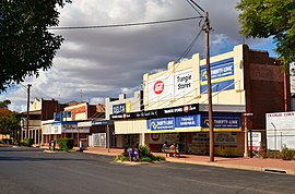 The main street of Trangie | |||||||||
 Trangie | |||||||||
| Coordinates | 32°02′0″S 147°59′0″E / 32.03333°S 147.98333°E | ||||||||
| Population | 768 (2021 census)[1] | ||||||||
| Postcode(s) | 2823 | ||||||||
| Elevation | 215 m (705 ft) | ||||||||
| Location | |||||||||
| LGA(s) | Narromine Shire | ||||||||
| State electorate(s) | Dubbo | ||||||||
| Federal division(s) | Parkes | ||||||||
| |||||||||
Economy edit
The Trangie Research Centre is "one of the largest broadacre agricultural research centres in Australia".[3]
Population edit
| Year | Pop. | ±% |
|---|---|---|
| 1966 | 932 | — |
| 1971 | 967 | +3.8% |
| 1976 | 1,016 | +5.1% |
| 1981 | 977 | −3.8% |
| 1986 | 966 | −1.1% |
| 1991 | 991 | +2.6% |
| 1996 | 951 | −4.0% |
| 2001 | 940 | −1.2% |
| 2006 | 866 | −7.9% |
| 2011 | 849 | −2.0% |
| 2016 | 774 | −8.8% |
| 2021 | 768 | −0.8% |
| Source: Australian Bureau of Statistics data.[4][5] | ||
According to the 2021 census of Population, there were 768 people in Trangie.
- Aboriginal and Torres Strait Islander people made up 21.9% of the population.
- 83.9% of people were born in Australia and 89.4% of people spoke only English at home.
- The most common responses for religion were Catholic 28.0%, Anglican 27.8% and no religion 16.0%.[1]
Climate edit
| Climate data for Trangie Research Station AWS (1922–2020); 215 m AMSL; 31.99° S, 147.95° E | |||||||||||||
|---|---|---|---|---|---|---|---|---|---|---|---|---|---|
| Month | Jan | Feb | Mar | Apr | May | Jun | Jul | Aug | Sep | Oct | Nov | Dec | Year |
| Record high °C (°F) | 46.1 (115.0) |
47.0 (116.6) |
40.9 (105.6) |
36.0 (96.8) |
29.4 (84.9) |
24.7 (76.5) |
24.0 (75.2) |
30.1 (86.2) |
38.6 (101.5) |
41.1 (106.0) |
45.0 (113.0) |
45.6 (114.1) |
47.0 (116.6) |
| Mean daily maximum °C (°F) | 33.6 (92.5) |
32.3 (90.1) |
29.4 (84.9) |
24.5 (76.1) |
19.9 (67.8) |
16.1 (61.0) |
15.4 (59.7) |
17.4 (63.3) |
21.1 (70.0) |
25.4 (77.7) |
29.0 (84.2) |
31.9 (89.4) |
24.7 (76.4) |
| Mean daily minimum °C (°F) | 18.7 (65.7) |
18.5 (65.3) |
15.8 (60.4) |
11.3 (52.3) |
7.2 (45.0) |
4.5 (40.1) |
3.2 (37.8) |
4.0 (39.2) |
6.4 (43.5) |
10.4 (50.7) |
13.8 (56.8) |
16.7 (62.1) |
10.9 (51.6) |
| Record low °C (°F) | 6.2 (43.2) |
7.2 (45.0) |
4.0 (39.2) |
−1.0 (30.2) |
−1.7 (28.9) |
−5.0 (23.0) |
−5.4 (22.3) |
−8.0 (17.6) |
−3.5 (25.7) |
0.1 (32.2) |
1.6 (34.9) |
6.2 (43.2) |
−8.0 (17.6) |
| Average precipitation mm (inches) | 53.3 (2.10) |
50.4 (1.98) |
47.3 (1.86) |
39.6 (1.56) |
36.7 (1.44) |
37.2 (1.46) |
34.3 (1.35) |
31.9 (1.26) |
32.1 (1.26) |
45.2 (1.78) |
44.6 (1.76) |
42.3 (1.67) |
494.9 (19.48) |
| Average precipitation days (≥ 0.2 mm) | 5.9 | 5.3 | 5.5 | 4.9 | 6.0 | 7.2 | 8.0 | 6.7 | 6.2 | 6.9 | 6.1 | 5.9 | 74.6 |
| Average afternoon relative humidity (%) | 33 | 36 | 37 | 41 | 50 | 58 | 57 | 49 | 44 | 33 | 33 | 29 | 42 |
| Source: Australian Bureau of Meteorology[6] | |||||||||||||
Sport edit
Trangie Magpies formerly played in the Castlereagh Cup rugby league competition. Tennis player Lesley Turner Bowrey was born here in 1942, as well as rugby league player Justin Carney.
References edit
- ^ a b c Australian Bureau of Statistics (28 June 2022). "Trangie (L) (Urban Centre/Locality)". 2021 Census QuickStats. Retrieved 22 January 2024.
- ^ ◾Atchison, J F. “The Counties of New South Wales.” The Australian Surveyor, vol. 30, no. 1, Mar. 1980, pp. 39–42.
- ^ Welcome to Narromine Shire, narromine.nsw.gov.au. Retrieved 5 September 2020.
- ^ "Statistics by Catalogue Number". Australian Bureau of Statistics. Retrieved 22 January 2024.
- ^ "Search Census data". Australian Bureau of Statistics. Retrieved 22 January 2024.
- ^ "TRANGIE RESEARCH STATION AWS". Climate statistics for Australian locations. Bureau of Meteorology. March 2013. Retrieved 11 March 2013.
External links edit
![]() Media related to Trangie, New South Wales at Wikimedia Commons
Media related to Trangie, New South Wales at Wikimedia Commons
- Photos of headstones in Trangie General Cemetery
- Trangie local Website Trangie NSW