


Summary
Uglegorsk (Russian: Углего́рск) is a coastal port town and the administrative center of Uglegorsky District in Sakhalin Oblast, Russia, located on the west coast of Sakhalin Island, 277 kilometers (172 mi) northwest of Yuzhno-Sakhalinsk, the administrative center of the oblast. Population: 10,381 (2010 Russian census);[2] 13,396 (2002 Census);[8] 18,402 (1989 Soviet census).[9]
Uglegorsk
Углегорск | |
|---|---|
 | |
 Coat of arms | |
Location of Uglegorsk .mw-parser-output .locmap .od{position:absolute}.mw-parser-output .locmap .id{position:absolute;line-height:0}.mw-parser-output .locmap .l0{font-size:0;position:absolute}.mw-parser-output .locmap .pv{line-height:110%;position:absolute;text-align:center}.mw-parser-output .locmap .pl{line-height:110%;position:absolute;top:-0.75em;text-align:right}.mw-parser-output .locmap .pr{line-height:110%;position:absolute;top:-0.75em;text-align:left}.mw-parser-output .locmap .pv>div{display:inline;padding:1px}.mw-parser-output .locmap .pl>div{display:inline;padding:1px;float:right}.mw-parser-output .locmap .pr>div{display:inline;padding:1px;float:left}html.skin-theme-clientpref-night .mw-parser-output .od,html.skin-theme-clientpref-night .mw-parser-output .od .pv>div,html.skin-theme-clientpref-night .mw-parser-output .od .pl>div,html.skin-theme-clientpref-night .mw-parser-output .od .pr>div{background:#000;color:#fff}html.skin-theme-clientpref-night .mw-parser-output .locmap{filter:grayscale(0.6)}@media(prefers-color-scheme:dark){html.skin-theme-clientpref-os .mw-parser-output .locmap{filter:grayscale(0.6)}html.skin-theme-clientpref-os .mw-parser-output .od,html.skin-theme-clientpref-os .mw-parser-output .od .pv>div,html.skin-theme-clientpref-os .mw-parser-output .od .pl>div,html.skin-theme-clientpref-os .mw-parser-output .od .pr>div{background:#000;color:#fff}}  Uglegorsk Location of Uglegorsk 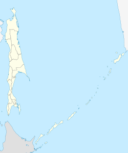 Uglegorsk Uglegorsk (Sakhalin Oblast) | |
| Coordinates: 49°04′N 142°02′E / 49.067°N 142.033°E | |
| Country | Russia |
| Federal subject | Sakhalin Oblast[1] |
| Administrative district | Uglegorsky District[1] |
| Town of district significance | Uglegorsk[1] |
| Founded | 1905 |
| Town status since | 1946 |
| Elevation | 15 m (49 ft) |
| Population | |
| • Total | 10,381 |
| • Capital of | Uglegorsky District,[1] town of district significance of Uglegorsk[1] |
| • Municipal district | Uglegorsky Municipal District[3] |
| • Urban settlement | Uglegorskoye Urban Settlement[3] |
| • Capital of | Uglegorsky Municipal District,[3] Uglegorskoye Urban Settlement[4] |
| Time zone | UTC+11 (MSK+8 |
| Postal code(s)[6] | 694920, 694923, 694929 |
| Dialing code(s) | +7 42432[7] |
| OKTMO ID | 64752000001 |
History edit
It was founded as Esutoru (恵須取), meaning "between capes" in the Ainu language, during Japanese rule in 1905.[citation needed] It came to Soviet control along with the rest of the Sakhalin Island with the defeat of Japan in World War II. For a time, Uglegorsk was put under consideration for potential sites for the new capital of Sakhalin Oblast.[10]
Town status was granted to it in 1946, along with its present name. The name Uglegorsk means 'coal mountain'.[citation needed]
Administrative and municipal status edit
Within the framework of administrative divisions, Uglegorsk serves as the administrative center of Uglegorsky District.[1] As an administrative division, it is incorporated within Uglegorsky District as the town of district significance of Uglegorsk.[1] As a municipal division, the town of district significance of Uglegorsk, together with nine rural localities in Uglegorsky District, is incorporated within Uglegorsky Municipal District as Uglegorskoye Urban Settlement.[3]
Economy edit
Bituminous coal is mined in the surrounding area, giving the town its name. Uglegorsk is also the center of an agricultural area, mainly growing potatoes and other vegetables. Paper and timber products are also produced in the town.
Climate edit
Uglegorsk has a humid continental climate (Köppen Dfb). The weather on the western side of Sakhalin tends to be drier and more settled than on the eastern side, since the winds from the combined force of the Siberian High and Aleutian Low run almost parallel to the coast with very little travel over water. Moreover, the winds from the summer low tend to lose some of their moisture over the island's mountains.
| Climate data for Uglegorsk (1939-1964) | |||||||||||||
|---|---|---|---|---|---|---|---|---|---|---|---|---|---|
| Month | Jan | Feb | Mar | Apr | May | Jun | Jul | Aug | Sep | Oct | Nov | Dec | Year |
| Record high °C (°F) | −3 (27) |
−1 (30) |
4 (39) |
11 (52) |
18 (64) |
21 (70) |
25 (77) |
25 (77) |
23 (73) |
17 (63) |
8 (46) |
1 (34) |
25 (77) |
| Mean daily maximum °C (°F) | −10.7 (12.7) |
−7.9 (17.8) |
−2.4 (27.7) |
4.6 (40.3) |
10.3 (50.5) |
14.8 (58.6) |
19.1 (66.4) |
21.1 (70.0) |
17.3 (63.1) |
9.7 (49.5) |
0.1 (32.2) |
— | 5.7 (42.3) |
| Daily mean °C (°F) | −15.4 (4.3) |
−13.7 (7.3) |
−8.1 (17.4) |
0.6 (33.1) |
7.5 (45.5) |
13.7 (56.7) |
17.2 (63.0) |
17.1 (62.8) |
12.2 (54.0) |
4.9 (40.8) |
−4.9 (23.2) |
−12.4 (9.7) |
1.6 (34.9) |
| Mean daily minimum °C (°F) | −19.4 (−2.9) |
−17.8 (0.0) |
−12 (10) |
−3.2 (26.2) |
1.8 (35.2) |
6.7 (44.1) |
11.4 (52.5) |
13.1 (55.6) |
8.3 (46.9) |
1.0 (33.8) |
−7.7 (18.1) |
−15 (5) |
−2.7 (27.1) |
| Record low °C (°F) | −37 (−35) |
−33 (−27) |
−28 (−18) |
−16 (3) |
−8 (18) |
−2 (28) |
2 (36) |
3 (37) |
−1 (30) |
−16 (3) |
−23 (−9) |
−36 (−33) |
−37 (−35) |
| Average precipitation mm (inches) | 32 (1.3) |
20 (0.8) |
25 (1.0) |
34 (1.3) |
46 (1.8) |
44 (1.7) |
71 (2.8) |
73 (2.9) |
77 (3.0) |
69 (2.7) |
59 (2.3) |
50 (2.0) |
600 (23.6) |
| Source: [11] | |||||||||||||
References edit
Notes edit
- ^ a b c d e f g h Law #25-ZO
- ^ a b Russian Federal State Statistics Service (2011). Всероссийская перепись населения 2010 года. Том 1 [2010 All-Russian Population Census, vol. 1]. Всероссийская перепись населения 2010 года [2010 All-Russia Population Census] (in Russian). Federal State Statistics Service.
- ^ a b c d Law #524
- ^ Федеральная служба государственной статистики. Федеральное агентство по технологическому регулированию и метрологии. №ОК 033-2013 1 января 2014 г. «Общероссийский классификатор территорий муниципальных образований. Код 64 652 101». (Federal State Statistics Service. Federal Agency on Technological Regulation and Metrology. #OK 033-2013 January 1, 2014 Russian Classification of Territories of Municipal Formations. Code 64 652 101. ).
- ^ "Об исчислении времени". Официальный интернет-портал правовой информации (in Russian). June 3, 2011. Retrieved January 19, 2019.
- ^ Почта России. Информационно-вычислительный центр ОАСУ РПО. (Russian Post). Поиск объектов почтовой связи (Postal Objects Search) (in Russian)
- ^ Телефонные коды Сахалина - Dialing codes of Sakhalin (in Russian)
- ^ Federal State Statistics Service (May 21, 2004). Численность населения России, субъектов Российской Федерации в составе федеральных округов, районов, городских поселений, сельских населённых пунктов – районных центров и сельских населённых пунктов с населением 3 тысячи и более человек [Population of Russia, Its Federal Districts, Federal Subjects, Districts, Urban Localities, Rural Localities—Administrative Centers, and Rural Localities with Population of Over 3,000] (XLS). Всероссийская перепись населения 2002 года [All-Russia Population Census of 2002] (in Russian).
- ^ Всесоюзная перепись населения 1989 г. Численность наличного населения союзных и автономных республик, автономных областей и округов, краёв, областей, районов, городских поселений и сёл-райцентров [All Union Population Census of 1989: Present Population of Union and Autonomous Republics, Autonomous Oblasts and Okrugs, Krais, Oblasts, Districts, Urban Settlements, and Villages Serving as District Administrative Centers]. Всесоюзная перепись населения 1989 года [All-Union Population Census of 1989] (in Russian). Институт демографии Национального исследовательского университета: Высшая школа экономики [Institute of Demography at the National Research University: Higher School of Economics]. 1989 – via Demoscope Weekly.
- ^ Tonai, Yuzuru (2015). Soviet Rule in South Sakhalin and the Japanese Community. New York: Routledge. p. 97.
- ^ "RUS SAJALINSKAYA - UGLEGORSK". Centro de Investigaciones Fitosociológicas. Retrieved November 3, 2011.
Sources edit
- Сахалинская областная Дума. Закон №25-ЗО от 23 марта 2011 г. «Об административно-территориальном устройстве Сахалинской области», в ред. Закона №62-ЗО от 27 июня 2013 г. «О внесении изменения в статью 10 Закона Сахалинской области "Об административно-территориальном устройстве Сахалинской области"». Вступил в силу 9 апреля 2011 г.. Опубликован: "Губернские ведомости", №55(3742), 29 марта 2011 г. (Sakhalin Oblast Duma. Law #25-ZO of March 23, 2011 On the Administrative-Territorial Structure of Sakhalin Oblast, as amended by the Law #62-ZO of June 27, 2013 On Amending Article 10 of the Law of Sakhalin Oblast "On the Administrative-Territorial Structure of Sakhalin Oblast". Effective as of April 9, 2011.).
- Сахалинская областная Дума. Закон №524 от 21 июля 2004 г. «О границах и статусе муниципальных образований в Сахалинской области», в ред. Закона №45-ЗО от 27 мая 2013 г. «О внесении изменения в Закон Сахалинской области "О границах и статусе муниципальных образований в Сахалинской области"». Вступил в силу 1 января 2005 г. Опубликован: "Губернские ведомости", №175–176(2111–2112), 31 июля 2004 г. (Sakhalin Oblast Duma. Law #524 of July 21, 2004 On the Borders and Status of the Municipal Formations in Sakhalin Oblast, as amended by the Law #45-ZO of May 27, 2013 On Amending the Law of Sakhalin Oblast "On the Borders and Status of the Municipal Formations in Sakhalin Oblast". Effective as of January 1, 2005.).