


Summary
Vergilov Rocks (Vergilov Kamak ver-'gi-lov 'ka-m&k) are a group of rocks off Bulgarian Beach on Hurd Peninsula in eastern Livingston Island in the South Shetland Islands, Antarctica, consisting of one main rock and two adjacent smaller ones submerging at high water.
 Vergilov Rocks from Bulgarian Beach | |
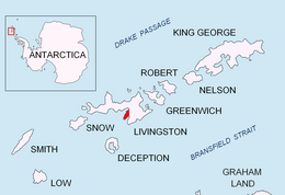 Location of Hurd Peninsula on Livingston Island in the South Shetland Islands | |
 Vergilov Rocks  Vergilov Rocks | |
| Geography | |
|---|---|
| Location | Antarctica |
| Coordinates | 62°38′24″S 60°22′12″W / 62.64000°S 60.37000°W |
| Archipelago | South Shetland Islands |
| Administration | |
| Administered under the Antarctic Treaty System | |
| Demographics | |
| Population | uninhabited |
The rocks are named after Zlatil Vergilov, a member of the 1988 Bulgarian party on Livingston Island, base commander at St. Kliment Ohridski in the 1996–99 seasons.
Location edit

The rocks are located at 62°38′24″S 60°22′12″W / 62.64000°S 60.37000°W which is 510 m (560 yd) northeast of Hespérides Point, 310 m (340 yd) west by south of Greenpeace Rock, and 100 m (110 yd) from the coast in front of the Bulgarian base (British mapping in 1968, Bulgarian mapping from a 1995-1996 topographic survey).

Maps edit
- Isla Livingston: Península Hurd. Mapa topográfico de escala 1:25000. Madrid: Servicio Geográfico del Ejército, 1991. (Map reproduced on p. 16 of the linked work)
- L.L. Ivanov. St. Kliment Ohridski Base, Livingston Island. Scale 1:1000 topographic map. Sofia: Antarctic Place-names Commission of Bulgaria, 1996. (The first Bulgarian Antarctic topographic map, in Bulgarian)
- L.L. Ivanov. Livingston Island: Central-Eastern Region. Scale 1:25000 topographic map. Sofia: Antarctic Place-names Commission of Bulgaria, 1996.
- L.L. Ivanov et al. Antarctica: Livingston Island and Greenwich Island, South Shetland Islands. Scale 1:100000 topographic map. Sofia: Antarctic Place-names Commission of Bulgaria, 2005.
- L.L. Ivanov. Antarctica: Livingston Island and Greenwich, Robert, Snow and Smith Islands. Scale 1:120000 topographic map. Troyan: Manfred Wörner Foundation, 2009. ISBN 978-954-92032-6-4
- Antarctica, South Shetland Islands, Livingston Island: Bulgarian Antarctic Base. Sheets 1 and 2. Scale 1:2000 topographic map. Geodesy, Cartography and Cadastre Agency, 2016. (in Bulgarian)
- Antarctic Digital Database (ADD). Scale 1:250000 topographic map of Antarctica. Scientific Committee on Antarctic Research (SCAR). Since 1993, regularly upgraded and updated.
- L.L. Ivanov. Antarctica: Livingston Island and Smith Island. Scale 1:100000 topographic map. Manfred Wörner Foundation, 2017. ISBN 978-619-90008-3-0
See also edit
Notes edit
References edit
- Vergilov Rocks. SCAR Composite Antarctic Gazetteer
- Bulgarian Antarctic Gazetteer. Antarctic Place-names Commission. (details in Bulgarian, basic data in English)
- Ivanov, L. General Geography and History of Livingston Island. In: Bulgarian Antarctic Research: A Synthesis. Eds. C. Pimpirev and N. Chipev. Sofia: St. Kliment Ohridski University Press, 2015. pp. 17–28. ISBN 978-954-07-3939-7
External links edit
- Vergilov Rocks. Copernix satellite image
This article includes information from the Antarctic Place-names Commission of Bulgaria which is used with permission.