


Summary
Washington Township is one of fourteen townships in Miami County, Indiana, United States. As of the 2020 census, its population was 3,365 (down from 3,493 at 2010[3]) and it contained 1,563 housing units.
Washington Township | |
|---|---|
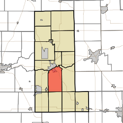 Location in Miami County | |
| Coordinates: 40°41′52″N 86°03′12″W / 40.69778°N 86.05333°W | |
| Country | |
| State | |
| County | Miami |
| Government | |
| • Type | Indiana township |
| Area | |
| • Total | 28.38 sq mi (73.5 km2) |
| • Land | 28.12 sq mi (72.8 km2) |
| • Water | 0.26 sq mi (0.7 km2) 0.92% |
| Elevation | 761 ft (232 m) |
| Population | |
| • Total | 3,365 |
| • Density | 120/sq mi (46/km2) |
| Time zone | UTC-5 (Eastern (EST)) |
| • Summer (DST) | UTC-4 (EDT) |
| ZIP codes | 46914, 46970 |
| GNIS feature ID | 454006 |
History edit
The first settler, Thomas Henton, arrived in Washington Township in 1838 and built a cabin upon a hill.[4]
Washington Township was organized in 1843.[5] It was named for President George Washington.[6]
Geography edit
According to the 2010 census, the township has a total area of 28.38 square miles (73.5 km2), of which 28.12 square miles (72.8 km2) (or 99.08%) is land and 0.26 square miles (0.67 km2) (or 0.92%) is water.[3] The Wabash River defines the township's northern border.
Cities, towns, villages edit
- Peru (southeast quarter)
Unincorporated towns edit
- Park View Heights at 40°44′29″N 86°02′59″W / 40.741431°N 86.049714°W
- South Peru at 40°44′44″N 86°03′25″W / 40.745597°N 86.056936°W
(This list is based on USGS data and may include former settlements.)
Cemeteries edit
The township contains these four cemeteries: Crider, Rankin, Salem and Sharpee.
Major highways edit
Airports and landing strips edit
- Shinn Bone Lane Airport
School districts edit
- Maconaquah School Corporation
- Peru Community Schools
Political districts edit
- Indiana's 5th congressional district
- State House District 23
- State House District 32
- State Senate District 18
References edit
- "Washington Township, Miami County, Indiana". Geographic Names Information System. United States Geological Survey, United States Department of the Interior. Retrieved September 29, 2009.
- United States Census Bureau 2008 TIGER/Line Shapefiles
- IndianaMap
- ^ "US Board on Geographic Names". United States Geological Survey. October 25, 2007. Retrieved May 9, 2017.
- ^ "Census Bureau profile: Washington Township, Miami County, Indiana". United States Census Bureau. May 2023. Retrieved April 5, 2024.
- ^ a b "Population, Housing Units, Area, and Density: 2010 - County -- County Subdivision and Place -- 2010 Census Summary File 1". United States Census. Archived from the original on February 12, 2020. Retrieved May 10, 2013.
- ^ Bodurtha, Arthur Lawrence (1914). History of Miami County, Indiana: A Narrative Account of Its Historical Progress, Its People and Its Principal Interests. Lewis Pub. pp. 149.
- ^ "History of Miami County (archived)". Miami County Tourism Office. Archived from the original on February 12, 2015. Retrieved August 22, 2015.
- ^ History of Miami County, Indiana: From the Earliest Time to the Present. Brant & Fuller. 1887. pp. 802.
External links edit
- Indiana Township Association
- United Township Association of Indiana
- City-Data.com page for Washington Township