


Summary
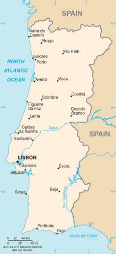
Portugal is a coastal nation in western Europe, located at the western end of the Iberian Peninsula, bordering Spain (on its northern and eastern frontiers: a total of 1,214 kilometres (754 mi)). The Portuguese territory also includes a series of archipelagos in the Atlantic Ocean (the Azores and Madeira), which are strategic islands along the North Atlantic. The extreme south is not too far from the Strait of Gibraltar, leading to the Mediterranean Sea. In total, the country occupies an area of 92,090 square kilometres (35,560 sq mi) of which 91,470 square kilometres (35,320 sq mi) is land and 620 square kilometres (240 sq mi) water.[1]
 | |
| Continent | Europe |
|---|---|
| Region | Southern Europe North Africa Iberian Peninsula Macaronesia |
| Coordinates | 39°22′13.65″N 8°8′25.13″W / 39.3704583°N 8.1403139°W |
| Area | Ranked 109th |
| • Total | 92,391 km2 (35,672 sq mi) |
| • Land | 99.55% |
| • Water | .45% |
| Coastline | 1,794 km (1,115 mi) |
| Borders | Total land borders: Portugal-Spain border (1214 km) |
| Highest point | Mount Pico (Azores) 2,351 m (7,713 ft) Torre (Iberian Peninsula) 1,993 m (6,539 ft) |
| Lowest point | Sea level (Atlantic Ocean) |
| Longest river | Tagus (275 km within Portugal) |
| Largest lake | Lake Alqueva |
| Exclusive economic zone | 1,727,408 km2 (666,956 sq mi) |
Despite these definitions, the Portugal-Spain border remains an unresolved territorial dispute between the two countries. Portugal does not recognise the border between Caia and Ribeira de Cuncos River deltas, since the beginning of the 1801 occupation of Olivenza by Spain. This territory, though under de facto Spanish occupation, remains a de jure part of Portugal, consequently no border is henceforth recognised in this area.[2]
Physical edit


Portugal is located on the western coast of the Iberian Peninsula and plateau, that divides the inland Mediterranean Sea from the Atlantic Ocean. It is located on the Atlantic coast of this plateau and crossed by several rivers which have their origin in Spain. Most of these rivers flow from east to west disgorging in the Atlantic; from north to south, the primary rivers are the Minho, Douro, Mondego, Tagus and the Guadiana.[3]
Coastline edit

The Portuguese continental shelf has an area of 28,000 square kilometres (11,000 sq mi), although its width is variable from 150 kilometres (93 mi) in the north to 25 kilometres (16 mi) in the south.[3] Its strong relief is marked by deep submarine canyons and the continuation of the main rivers. The Estremadura Spur separates the Iberian Abyssal and Tagus Abyssal Plains, while the continental slope is flanked by sea-mounts and abuts against the prominent Gorringe Bank in the south.[3] Currently, the Portuguese government claims jurisdiction to a sea depth of 200 metres (660 ft), or to the depth of exploitation.
The Portuguese coast is extensive; in addition to approximately 943 kilometres (586 mi) along the coast of continental Portugal, the archipelagos of the Azores (667 km) and Madeira (250 km) are primarily surrounded by rough cliff coastlines. Most of these landscapes alternate between rough cliffs and fine sand beaches; the region of the Algarve is recognized for its sandy beaches popular with tourists, while at the same time its coastline around Cape St. Vincent is well known for steep and forbidding cliffs. An interesting feature of the Portuguese coast is the Ria Formosa with some sandy islands and a mild and pleasant climate characterized by warm, but not very hot, summers and generally mild winters.
In contrast, the Ria de Aveiro coast (near Aveiro, referred to as "The Portuguese Venice") is formed by a delta approximately 45 kilometres (28 mi) long with a maximum width of 11 kilometres (6.8 mi), rich in fish and seabirds. Four main channels flow through several islands and islets at the mouth of the Vouga, Antuã, Boco, and Fontão Rivers. Since the 16th century, this formation of narrow headlands formed a lagoon, which allowed the formation and production of salt. It was also recognized by the Romans, whose forces exported its salt—then a precious resource—to Rome.
The Azores are sprinkled with both black-sand and boulder-lined beaches; only as a rare exception are there white-sand beaches (such as on the island of Santa Maria in Almagreira). The island of Porto Santo has one of the few extensive dune beaches in Portugal, located in the archipelago of Madeira.
Tidal gauges along the Portuguese coast have identified a 1–1.5 millimetres (0.039–0.059 in) rise in sea levels, causing large estuaries and inland deltas in some major rivers to overflow.[3]
As a result of its maritime possessions and long coastline, Portugal has an Exclusive Economic Zone of 1,727,408 km2 (666,956 sq mi). This is the third largest EEZ of all countries in the European Union and the 20th in the world. This sea-zone, over which Portugal exercises special territorial rights over the economic exploration and use of marine resources, encircles an area of 1,727,408 square kilometres (666,956 sq mi) (divided as: Continental Portugal 327,667 km2, Azores Islands 953,633 km2, Madeira Islands 446,108 km2).
Continent edit


The Portuguese territory came into existence during the history of Gondwana and became aligned with European landforms after the super-continent Pangea began its slow separation into several smaller plates. The Iberian plate was formed during the Cadomian Orogeny of the late Neoproterozoic (about 650-550 Ma), from the margins of the Gondwana continent. Through collisions and accretion a group of island arcs (that included the Central Iberian Plate, Ossa-Morena Plate, South Portuguese Plate) began to disintegrate from Gondwana (along with other European fragments). These plates never separated substantially from each other since this period.[4] By the Mesozoic, the three "Portuguese plates" were a part of the Northern France Armoric Plate until the Bay of Biscay began to separate. Following the separation of the Iberian Abyssal Plain, Iberia and Europe began to drift progressively from North America, as the Mid-Atlantic fracture zone pulled the three plates away from the larger continent. Eventually, Iberia collided with southern France attaching the region into a peninsula of Europe (during the Cenozoic). Since the late Oligocene, the Iberian plate has been moving as part of the Eurasian plate, with the boundary between Eurasia and Africa situated along the Azores–Gibraltar fracture zone.[5][6][7][8][9][10][11][12][5][13]
The Iberian peninsula, defined by its coastline, is due to a fragment of the Variscan tectonic fracture zone, the Iberian-Hesperian Massif, which occupies the west-central part of the plateau.[3] This formation is crossed by the Central System, along an east-northeast to west-southwest alignment, parallel to the European Baetic Chain (an aspect of the Alpine Chain).[3] The Central Cordillera is itself divided into two blocks, while three main river systems drain the differing geomorphological terrains:[3]
- the Northern Meseta (with a mean altitude of 800 metres (2,600 ft)) is drained by the Douro River (running east to west);
- the Southern Meseta (within a range of 200 to 900 metres (660 to 2,950 ft) altitude) is drained by the Tagus River (running east to west) from Spain, and the Guadiana River (running north to south), comprising the Lower Tagus and Sado Basins.
To the north the landscape is mountainous in the interior areas with plateaus, cut by four breakings lines that allow the development of more fertile agricultural areas.
The south down as far as the Algarve features mostly rolling plains with a climate somewhat warmer and drier than the cooler and rainier north. Other major rivers include the Douro, the Minho and the Guadiana, similar to the Tagus in that all originate in Spain. Another important river, the Mondego, originates in the Serra da Estrela (the highest mountains in mainland Portugal at 1,993 m). A full list of rivers is available in List of rivers of Portugal.
No large natural lakes exist in Continental Portugal, and the largest inland water surfaces are dam-originated reservoirs, such as the Alqueva Reservoir with 250 square kilometres (97 sq mi), the largest[citation needed] in Europe. However, there are several small freshwater lakes in Portugal, the most notable of which are located in Serra da Estrela, Lake Comprida (Lagoa Comprida) and Lake Escura (Lagoa Escura), which were formed from ancient glaciers. Pateira de Fermentelos is a small natural lake near Aveiro, it is one of the largest natural lakes in the Iberian Peninsula and is rich in wildlife. In the Azores archipelago lakes were formed in the caldera of extinct volcanoes. Lagoa do Fogo and Lagoa das Sete Cidades (two small lakes connected by a narrow way) are the most famous lakes in São Miguel Island.
Lagoons in the shores of the Atlantic exist. For instance, the Albufeira Lagoon and Óbidos Lagoon (near Foz do Arelho, Óbidos).
Archipelagos edit
In addition to continental Europe, Portugal consists of two Autonomous Regions in the Atlantic Ocean, consisting of the archipelagos of Madeira and Azores. Madeira is located on the African Tectonic Plate, and comprises the main island of Madeira, Porto Santo and the smaller Savage Islands. The Azores, which are located between the junction of the African, European and North American Plates, straddle the Mid-Atlantic Ridge. There are nine islands in this archipelago, usually divided into three groups (Western, Central and Eastern) and several smaller Formigas (rock outcroppings) located between São Miguel and Santa Maria Islands. Both island groups are volcanic in nature, with historic volcanology and seismic activity persisting to the present time. In addition, there are several submarine volcanos in the Azores (such as Dom João de Castro Bank), that have erupted historically (such as the Serrata eruption off the coast of Terceira Island). The last major volcanic event occurred in 1957-58 along the western coast of Faial Island, which formed the Capelinhos Volcano. Seismic events are common in the Azores. The Azores are occasionally subject to very strong earthquakes, as is the continental coast. Wildfires occur mostly in the summer in mainland Portugal and extreme weather in the form of strong winds and floods also occurs mainly in winter. The Azores are occasionally stricken by tropical cyclones such as Hurricane Jeanne (1998) and Hurricane Gordon (2006).
Climate edit

Most of Portugal has a hot-summer Mediterranean climate according to the Köppen climate classification: "Csa" in most of the lands south of the Tagus River, inland Douro Valley in the Norte Region, eastern Azores and the Madeira archipelago. The "Csb" warm-summer Mediterranean pattern can be found north of that same river and in Costa Vicentina in coastal Southern Portugal. Most of the Azores have a humid subtropical climate or "Cfa", while a small region in inland Alentejo has BSk or semi-arid climate. Madeira is the only region to have a tropical savanna climate or "As", and the Savage Islands are the only region to have an arid climate or "BWh". The sea surface temperatures in these islands vary from 18.5 °C (65.3 °F) in winter to 23–24 °C (73.4–75.2 °F) in the summer, occasionally reaching 26 °C (78.8 °F).
The annual average temperature in mainland Portugal varies from 12–13 °C (53.6–55.4 °F) in the mountainous interior north to 17–19 °C (62.6–66.2 °F) in the south (in general the south is warmer and drier than the north). The Madeira and Azores archipelagos have a narrower temperature range. Extreme temperatures occur in the mountains in the interior North and Centre of the country in winter, where they may fall below −10 °C (14 °F) or in rare occasions below −15 °C (5 °F), particularly in the higher peaks of Serra da Estrela, and in southeastern parts in the summer, sometimes exceeding 45 °C (113 °F). The official absolute extreme temperatures are −16 °C (3.2 °F) in Penhas da Saúde on 4 February 1954 and Miranda do Douro, and 47.4 °C (117.3 °F) in Amareleja in the Alentejo region, on 1 August 2003.[14] There are, however, unofficial records of 50.5 °C (122.9 °F) on 4 August 1881 in Riodades, São João da Pesqueira[15] and 70 °C (158.0 °F) on 6 July 1949 in Figueira da Foz in an apparent heat burst (see the Highest temperature recorded on Earth). Such temperatures are not validated since these were measured in enclosures that were much more susceptible to solar radiation and/or in enclosed gardens which tend to heat up a lot more than in the open where temperatures should be measured. There are also records of −17.5 °C (0.5 °F) from a Polytechnic Institute in Bragança, and below −20 °C (−4.0 °F) in Serra da Estrela, which have no official value since they were not recorded by IPMA. Such values are however perpetuated by weather enthusiasts who are fond of extremes. The annual average rainfall in continental Portugal varies from a bit more than 3,000 mm (118.1 in) in the mountains in the north to less than 500 mm (19.7 in) in southern parts of Alentejo, however in Macaronesia, Pico Island holds the record with over 6,250 mm (246.1 in) and the Savage Islands around 200 mm (7.9 in). Portugal as a whole is amongst the sunniest areas in Europe, with around 2300–3200 hours of sunshine a year, an average of 4-6h in winter and 10-12h in the summer. The sea surface temperature is higher in the south coast where it varies from 15.5–16 °C (59.9–60.8 °F) in January to 21–23 °C (69.8–73.4 °F) in August, occasionally reaching 25 °C (77 °F); on the west coast the sea surface temperature is around 14–16 °C (57.2–60.8 °F) in winter and 18–20 °C (64–68 °F) in the summer.[16]
| Climate data for Continental Portugal, 1971-2000 normals, 2003-present day extremes | |||||||||||||
|---|---|---|---|---|---|---|---|---|---|---|---|---|---|
| Month | Jan | Feb | Mar | Apr | May | Jun | Jul | Aug | Sep | Oct | Nov | Dec | Year |
| Record high °C (°F) | 24.5 (76.1) |
26.9 (80.4) |
31.6 (88.9) |
36.9 (98.4) |
40.0 (104.0) |
44.9 (112.8) |
47.0 (116.6) |
47.4 (117.3) |
45.0 (113.0) |
38.5 (101.3) |
29.1 (84.4) |
26.4 (79.5) |
47.4 (117.3) |
| Mean daily maximum °C (°F) | 13.1 (55.6) |
14.5 (58.1) |
17.0 (62.6) |
18.2 (64.8) |
21.0 (69.8) |
25.4 (77.7) |
28.7 (83.7) |
28.8 (83.8) |
26.3 (79.3) |
21.2 (70.2) |
16.8 (62.2) |
13.9 (57.0) |
20.4 (68.7) |
| Daily mean °C (°F) | 8.8 (47.8) |
10.0 (50.0) |
11.9 (53.4) |
13.2 (55.8) |
15.7 (60.3) |
19.4 (66.9) |
22.2 (72.0) |
22.2 (72.0) |
20.2 (68.4) |
16.2 (61.2) |
12.4 (54.3) |
10.0 (50.0) |
15.2 (59.3) |
| Mean daily minimum °C (°F) | 4.5 (40.1) |
5.6 (42.1) |
6.8 (44.2) |
8.1 (46.6) |
10.5 (50.9) |
13.5 (56.3) |
15.6 (60.1) |
15.5 (59.9) |
14.2 (57.6) |
11.2 (52.2) |
7.9 (46.2) |
6.1 (43.0) |
10.0 (49.9) |
| Record low °C (°F) | −10.2 (13.6) |
−10.2 (13.6) |
−12.9 (8.8) |
−4.8 (23.4) |
−2.2 (28.0) |
−0.9 (30.4) |
1.5 (34.7) |
2.7 (36.9) |
−0.8 (30.6) |
−3.1 (26.4) |
−10.9 (12.4) |
−9.0 (15.8) |
−12.9 (8.8) |
| Average rainfall mm (inches) | 117.3 (4.62) |
100.1 (3.94) |
61.2 (2.41) |
78.9 (3.11) |
71.2 (2.80) |
32.2 (1.27) |
13.8 (0.54) |
13.7 (0.54) |
42.1 (1.66) |
98.2 (3.87) |
109.4 (4.31) |
144.0 (5.67) |
882.1 (34.74) |
| Average relative humidity (%) | 85 | 82 | 79 | 76 | 72 | 65 | 57 | 56 | 63 | 76 | 83 | 85 | 73 |
| Source: IPMA,[17][18] Portal do Clima (Humidity)[19] | |||||||||||||
Seasons in Portugal edit
| Seasons | Meteorological | Astronomical | real feel |
|---|---|---|---|
| spring | 1 March to 31 May | 21 March to 20 June | March to May |
| summer | 1 June to 31 August | 21 June to 20 September | June to September |
| autumn | 1 September to 30 November | 21 September to 20 December | October to November |
| winter | 1 December to 28/29 February | 21 December to 20 March | December to February |
Weather phenomena recorded in previous years in Portugal edit
| Events (average annual) | Jan | Feb | Mar | Apr | May | Jun | Jul | Aug | Sep | Oct | Nov | Dec |
|---|---|---|---|---|---|---|---|---|---|---|---|---|
| Rain days | 16 | 14 | 16 | 12 | 9 | 5 | 2 | 2 | 7 | 10 | 16 | 12 |
| Snow days | 0 | 0 | 0 | 0 | 0 | 0 | 0 | 0 | 0 | 0 | 0 | 0 |
| Hail days | 0 | 0 | 0 | 0 | 0 | 0 | 0 | 0 | 0 | 0 | 0 | 0 |
| Thunderstorm days | 1 | 1 | 2 | 3 | 2 | 0 | 0 | 0 | 3 | 2 | 3 | 1 |
| Fog days | 6 | 5 | 2 | 2 | 1 | 0 | 1 | 0 | 2 | 5 | 4 | 7 |
| Tornado days* | 0 | 0 | 0 | 0 | 0 | 0 | 0 | 0 | 0 | 0 | 0 | 0 |
| Day hours | 10 | 11 | 13 | 14 | 15 | 15 | 14 | 13 | 12 | 11 | 10 | 9 |
| Daily sunny hours | 8 | 7 | 9 | 10 | 12 | 13 | 12 | 11 | 9 | 9 | 7 | 6 |
*Tornados - counted for last 5 years[20]
Whole year UV Index table for Portugal edit
Source:[21]
| Climate data for Continental Portugal | |||||||||||||
|---|---|---|---|---|---|---|---|---|---|---|---|---|---|
| Month | Jan | Feb | Mar | Apr | May | Jun | Jul | Aug | Sep | Oct | Nov | Dec | Year |
| Average ultraviolet index | 2 | 3 | 5 | 6 | 8 | 9 | 9 | 8 | 6 | 4 | 3 | 2 | 5 |
| Source: weather-atlas[22] | |||||||||||||
| Climate data for the Azores | |||||||||||||
|---|---|---|---|---|---|---|---|---|---|---|---|---|---|
| Month | Jan | Feb | Mar | Apr | May | Jun | Jul | Aug | Sep | Oct | Nov | Dec | Year |
| Average ultraviolet index | 2 | 3 | 5 | 7 | 8 | 9 | 9 | 8 | 7 | 5 | 3 | 2 | 6 |
| Source: weather-atlas[23] | |||||||||||||
| Climate data for Madeira | |||||||||||||
|---|---|---|---|---|---|---|---|---|---|---|---|---|---|
| Month | Jan | Feb | Mar | Apr | May | Jun | Jul | Aug | Sep | Oct | Nov | Dec | Year |
| Average ultraviolet index | 3 | 5 | 6 | 8 | 9 | 10 | 10 | 10 | 8 | 6 | 4 | 3 | 7 |
| Source: weather-atlas[24] | |||||||||||||
Environment edit

Environment - current issues: soil erosion; air pollution caused by industrial and vehicle emissions; water pollution, especially in coastal areas
Environment - international agreements:
party to:
Air Pollution, Biodiversity, Climate Change, Desertification, Endangered Species, Hazardous Wastes, Law of the Sea, Marine Dumping, Marine Life Conservation, Ozone Layer Protection, Ship Pollution, Tropical Timber 83, Tropical Timber 94, Wetlands
signed, but not ratified:
Air Pollution-Persistent Organic Pollutants, Air Pollution-Volatile Organic Compounds, Climate Change-Kyoto Protocol, Environmental Modification, Nuclear Test Ban
Terrain: Mountainous and hilly north of the Tagus River, rolling plains in south
Elevation extremes:
lowest point:
Atlantic Ocean 0 m
highest point:
Ponta do Pico (Pico or Pico Alto) on Ilha do Pico in the Azores 2,351 m
Natural resources: fish, forests (cork), tungsten, iron ore, uranium ore, marble, arable land, hydroelectric power
Land use:
arable land:
26%
permanent crops:
9%
permanent pastures:
9%
forests and woodland:
36%
other:
20% (1993 est.)
Irrigated land: 6,300 km2 (1993 est.)
See also edit
References edit
- ^ "Portugal". CIA - The World Factbook. Retrieved 2009-11-28.
- ^ "A questão de Olivença". olivenca.org. Retrieved 29 January 2021.
- ^ a b c d e f g Eldridge M. Moores and Rhodes Whitmore Fairbridge (1997), p.612
- ^ López-Guijarro et al. 2008.
- ^ a b Srivastava et al. 1990.
- ^ Le Pichon & Sibuet 1971.
- ^ Le Pichon, Sibuet & Francheteau 1977.
- ^ Sclater, Hellinger & Tapscott 1977.
- ^ Grimaud, S.; Boillot, G.; Collette, B.J.; Mauffret, A.; Miles, P.R.; Roberts, D.B. (January 1982). "Western extension of the Iberian-European plate boundary during the Early Cenozoic (Pyrenean) convergence: A new model". Marine Geology. 45 (1–2): 63–77. Bibcode:1982MGeol..45...63G. doi:10.1016/0025-3227(82)90180-3.
- ^ Olivet, J.L.; Auzende, J.M.; Beuzart, P. (September 1983). "Western extension of the Iberian-European plate boundary during the Early Cenozoic (Pyrenean) convergence: A new model — Comment". Marine Geology. 53 (3): 237–238. Bibcode:1983MGeol..53..237O. doi:10.1016/0025-3227(83)90078-6.
- ^ Grimaud, S.; Boillot, G.; Collette, B.J.; Mauffret, A.; Miles, P.R.; Roberts, D.B. (September 1983). "Western extension of the Iberian-European plate boundary during the Early Cenozoic (Pyrenean) convergence: A new model — Reply". Marine Geology. 53 (3): 238–239. Bibcode:1983MGeol..53..238G. doi:10.1016/0025-3227(83)90079-8.
- ^ Olivet et al. 1984.
- ^ Savostin et al. 1986.
- ^ "Instituto de Meteorologia, IP Portugal". Archived from the original on 2012-07-12. Retrieved 2018-12-06.
- ^ "World Weather Trivia Page". Archived from the original on 2012-01-26. Retrieved 2018-12-06.
- ^ "Portugal Sea temperatures". seatemperature.org. Retrieved September 28, 2020.
- ^ "Climatological bulletins (2003-2020)". Instituto de Meteorologia.
- ^ "Monotorização mensal". Instituto de Meteorologia.
- ^ "Humidade relativa do ar Período 1971-2000, Continente". IPMA. Retrieved 24 December 2020.
- ^ "The best time and weather to travel to Portugal . Travel weather and climate". hikersbay.com. Retrieved 2016-10-14.
- ^ "IPMA - IUV Geo". www.ipma.pt. Retrieved 2016-10-14.
- ^ "Climate of Lisbon". weather-atlas.com. Retrieved 8 November 2020.
- ^ "Climate of Angra do Heroísmo, Azores". weather-atlas.com. Retrieved 8 November 2020.
- ^ "Climate of Funchal, Madeira". weather-atlas.com. Retrieved 8 November 2020.
Sources edit
- Central Intelligence Agency, ed. (2010). "Portugal: CIA World Factbook". Langley, Virginia: Central Intelligence Agency. Retrieved 27 December 2010.
- Symington, Martin (2003). "Portugal". Eyewitness Travel Guide series. Dorling Kindersley Publishing. ISBN 978-0-7894-9423-8.
- Moores, Eldridge M.; Fairbridge, Rhodes Whitmore, eds. (1997). Encyclopedia of European and Asian Regional Geology. London, England: Chapman & Hall. pp. 611–619. ISBN 9780412740404.
- Le Pichon, Xavier; Sibuet, Jean-Claude (September 1971). "Western extension of boundary between European and Iberian plates during the Pyrenean orogeny". Earth and Planetary Science Letters. 12 (1): 83–88. Bibcode:1971E&PSL..12...83L. CiteSeerX 10.1.1.493.7034. doi:10.1016/0012-821X(71)90058-6.
- Olivet, Jean-Louis; Bonnin, J.; Beuzart, Paul; Auzende, Jean-Marie (1984). Cinématique de l'Atlantique Nord et Central [Kinematics of the North and Central Atlantic] (Report). Publications du C.N.E.X.O. Série "Rapports scientifiques et techniques". Vol. 54. Institut français de recherche pour l'exploitation de la mer. pp. 1–108.
- Le Pichon, Xavier; Sibuet, Jean-Claude; Francheteau, Jean (March 1977). "The fit of the continents around the North Atlantic Ocean". Tectonophysics. 38 (3–4): 169–209. Bibcode:1977Tectp..38..169L. doi:10.1016/0040-1951(77)90210-4.
- López-Guijarro, Rafael; Armendáriz, Maider; Quesada, Cecilio; Fernández-Suárez, Javier; Murphy, J. Brendan; Pin, Christian; Bellido, Felix (December 2008). "Ediacaran–Palaeozoic tectonic evolution of the Ossa Morena and Central Iberian zones (SW Iberia) as revealed by Sm–Nd isotope systematics" (PDF). Tectonophysics. 461 (1–4): 202–214. Bibcode:2008Tectp.461..202L. doi:10.1016/j.tecto.2008.06.006. S2CID 129446841.
- Savostin, Léonid A.; Sibuet, Jean-Claude; Zonenshain, Lev P.; Le Pichon, Xavier; Roulet, Marie-José (March 1986). "Kinematic evolution of the Tethys belt from the Atlantic ocean to the pamirs since the Triassic". Tectonophysics. 123 (1–4): 1–35. Bibcode:1986Tectp.123....1S. doi:10.1016/0040-1951(86)90192-7.
- Sclater, John G.; Hellinger, Steven; Tapscott, Christopher (September 1977). "The Paleobathymetry of the Atlantic Ocean from the Jurassic to the Present". The Journal of Geology. 85 (5): 509–552. Bibcode:1977JG.....85..509S. doi:10.1086/628336. S2CID 129522366.
- Seber, Dogan; Barazangi, Muawia; Ibenbrahim, Aomar; Demnati, Ahmed (February 1996). "Geophysical evidence for lithospheric delamination beneath the Alboran Sea and Rif–Betic mountains". Nature. 379 (6568): 785–790. Bibcode:1996Natur.379..785S. doi:10.1038/379785a0. hdl:1813/5287. S2CID 4332684.
- Srivastava, S. P.; Schouten, H.; Roest, W. R.; Klitgord, K. D.; Kovacs, L. C.; Verhoef, J.; Macnab, R. (April 1990). "Iberian plate kinematics: a jumping plate boundary between Eurasia and Africa". Nature. 344 (6268): 756–759. Bibcode:1990Natur.344..756S. doi:10.1038/344756a0. S2CID 4362197.
External links edit
- Visible Earth. NASA-Goddard Space Flight Center. [1]. A collection of satellite images of Portugal and the surrounding region.