
KNOWPIA
WELCOME TO KNOWPIA

Inland port 
Summary
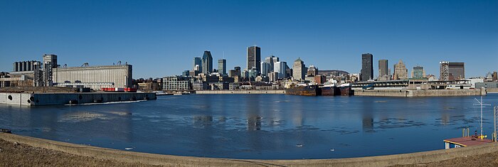
An inland port is a port on an inland waterway, such as a river, lake, or canal, which may or may not be connected to the sea. The term "inland port" is also used to refer to a dry port.

Examples edit
The United States Army Corps of Engineers publishes biannually a list of such locations and for this purpose states that "inland ports" are ports that are located on rivers and do not handle deep draft ship traffic. The list includes ports such as St. Louis, Cincinnati, Pittsburgh, Kansas City, and Memphis. A dense network of inland waterways including ports exists also in Europe (France, Germany, Poland, Russia, the United Kingdom and the Benelux countries), as well as in China and Brazil.
List of inland waterway ports edit
Africa edit
 Democratic Republic of the Congo : Port of Boma, Boma, Democratic Republic of the Congo, Congo River[1]
- Democratic Republic of the Congo : Port of Ilebo, Ilebo, Democratic Republic of the Congo, Kasai River[2]
- Democratic Republic of the Congo : Port of Matadi, Matadi, Democratic Republic of the Congo, Congo River[3]
- Democratic Republic of the Congo : Port of Kinshasa, Kinshasa, Democratic Republic of the Congo, Congo River[4]
- Democratic Republic of the Congo : Port of Kisangani, Kisangani, Democratic Republic of the Congo, Congo River[5]
 Republic of the Congo : Port of Brazzaville, Brazzaville, Republic of the Congo[6]
 Egypt : Inland port of Ismaïlia on the Suez Canal, Ismailia, Egypt[7]
 Eswatini : Mlawula Inland Port, Mlawula, eSwatini (Proposed)[8]
 Ghana : Boankra
 Kenya : Kisumu Inland Port, Kisumu, Kenya, on Lake Victoria[9]
 Morocco : Kenitra Inland Port, Kenitra, Morocco, on Sebou River[10]
 South Sudan : Juba Inland Port, Juba, South Sudan, on the White Nile River[11]
 Tanzania : Bukoba Inland Port, Bukoba, Tanzania, on Lake Victoria[12]
- Tanzania : Mwanza Inland Port, Mwanza, Tanzania, on Lake Victoria[13]
- Tanzania : Kigoma Inland Port, Kigoma, Tanzania, on Lake Tanganyika[14]
 Uganda : Bukasa Inland Port, Kira Town, Uganda, on Lake Victoria[15]
- Uganda : Jinja Inland Port, Jinja, on Lake Victoria[16]
- Uganda : Port Bell Inland Port, Port Bell, Uganda on Lake Victoria[13]
 Zambia : Mpulungu Inland Port, Mpulungu, Zambia on Lake Tanganyika[17]
Asia edit
Inland Rivers edit
Europe edit


Inland Rivers edit
|
| |||||
| Port of | Water body | Coords. | Website | Features & notes[18] | |
Germany edit | |||||
| Duisburg Inland Port | Rhine River | 51°27′N 6°45′W / 51.45°N 6.75°W | duisport.de | ||
| Dortmund Port | Dortmund–Ems Canal | 51°32′N 7°26′W / 51.53°N 7.44°W | e-port-dortmund.de | ||
United Kingdom edit | |||||
| Port of London | River Thames | 51°30′N 0°03′W / 51.50°N 0.05°W | pla.co.uk | ||
| Port of Manchester(including Manchester Docks) | River Mersey | 51°30′N 0°03′W / 51.50°N 0.05°W | pla.co.uk | Was closed in 1982; being renovated as the Atlantic Gateway | |
| Port of Bristol | River Avon | 51°30′N 2°42′E / 51.50°N 2.70°E | bristolport.co.uk | ||
| Gloucester Docks | Gloucester and Sharpness Canal | 51°52′N 2°15′E / 51.86°N 2.25°E | visitgloucester.co.uk | ||
| Goole | River Ouse and Aire and Calder Navigation | 51°52′N 2°15′E / 51.86°N 2.25°E | abports.co.uk | ||
France edit | |||||
| Autonomous Port of Paris | Seine | 48°51′N 2°21′W / 48.85°N 2.35°W | |||
| Lyon | Rhone | 45°43′N 4°50′W / 45.71°N 4.83°W | |||
 United Kingdom : Runcorn Docks, England, United Kingdom, on the Manchester Ship Canal
- United Kingdom : Weston Point Docks, England, United Kingdom, on the Manchester Ship Canal
 Austria : Harbours in Vienna, Vienna, Austria, on Danube River
 Belgium : Port of Ghent, Ghent, Belgium, on Schelde River, Leie River and Ghent–Terneuzen Canal
- Belgium : Port of Liège, Liège, Belgium, on Meuse River and Meuse Canals
 Finland : Port of Lappeenranta, Lappeenranta, South Karelia, Finland, on Lake Saimaa.[19]
 Hungary : Port of Budapest, Germany, on Danube
 Ireland : Port of Waterford, Waterford, Ireland, on River Suir
 Luxembourg : Mertert on Moselle River.
 Netherlands : North- and East channel port Nijmegen, Gelderland, Netherlands, on Waal River.
 Poland : Port of Warsaw, Poland, on Vistula
 Russia : Port of Kolomna, Moscow Oblast, Russia, on Oka River
- Russia : Port of Moscow, North River Terminal, South River Terminal, Moscow, Russia, on Moskva River and Moscow Canal
 Serbia : Port of Belgrade, Belgrade, Serbia, on Danube
 Slovakia : Port of Bratislava, Bratislava, Slovakia on Danube River
 Spain : Port of Seville, Seville, Spain, on River Guadalquivir
 Sweden : Karlstad hamn Karlstad, Värmlands län, Sweden, on Klarälven.
 Switzerland : Port of Basel, Switzerland, on Rhine.
 Ukraine : Dnipro River Port, Dnipro, Ukraine, on Dnieper.
- Ukraine : Kyiv River Port, Ukraine, on Dnieper.
North America edit
Great Lakes edit
Canada edit | |||||
| Port of / de | Prov. | Water body | Coords. | Website | Features & notes[18] |
| Oshawa | ON | Lake Ontario | 43°53′N 78°52′W / 43.89°N 78.86°W | ||
| Toronto | ON | Lake Ontario196n. mi. L[20] | 43°40′01″N 79°25′01″W / 43.667°N 79.417°W | torontoport.com | CA rank: 16 |
| Hamilton | ON | Lake Ontario | 43°16′N 79°51′W / 43.26°N 79.85°W | hamiltonport.ca | CA rank: 8 |
| Windsor | ON | Detroit River | 42°17′N 83°05′W / 42.29°N 83.09°W | portwindsor.com | CA rank: 11 |
| Sarnia | ON | St. Clair River | 42°58′01″N 82°24′00″W / 42.967°N 82.4°W | ||
| Goderich | ON | Lake Huron | 43°43′59″N 81°42′00″W / 43.733°N 81.7°W | ||
| Sault Ste. Marie | ON | Lake Superior | 46°32′N 84°21′W / 46.53°N 84.35°W | ||
| Thunder Bay | ON | Lake Superior | 48°25′N 89°17′W / 48.42°N 89.28°W | Thunder Bay Port Authority | CA rank: 9 |
| Kingston | ON | Lake Ontario / Saint Lawrence River | |||
| Nanticoke | ON | Lake Erie | |||
United States edit | |||||
| Port of | State | Water body | Coords. | Website | Features & notes[21] |
| Oswego | NY | Lake Ontario | 43°27′29″N 76°30′11″W / 43.458°N 76.503°W | ||
| Buffalo | NY | Lake Erie | 42°52′41″N 78°53′42″W / 42.878°N 78.895°W | portofbuffalo.com | US rank: 125 |
| Erie | PA | Lake Erie283n. mi. L[20] | 42°09′07″N 80°04′05″W / 42.152°N 80.068°W | ||
| Conneaut | OH | Lake Erie | 41°58′01″N 80°32′56″W / 41.967°N 80.549°W | US rank: 79 | |
| Ashtabula | OH | Lake Erie | 41°55′08″N 80°47′31″W / 41.919°N 80.792°W | US rank: 64 | |
| Fairport Harbor | OH | Lake Erie | 41°46′01″N 81°17′38″W / 41.767°N 81.294°W | US rank: 116 | |
| Cleveland | OH | Lake Erie | 41°28′44″N 81°40′19″W / 41.479°N 81.672°W | portofcleveland.com | Cleveland-Cuyahoga County Port Authority, US rank: 47 |
| Lorain | OH | Lake Erie | 41°28′55″N 82°11′42″W / 41.482°N 82.195°W | US rank: 143 | |
| Huron | OH | Lake Erie | 41°24′18″N 82°32′38″W / 41.405°N 82.544°W | US rank: 149 | |
| Sandusky | OH | Lake Erie | 41°28′12″N 82°42′43″W / 41.47°N 82.712°W | US rank: 98 | |
| Marblehead | OH | Lake Erie | 41°31′48″N 82°42′32″W / 41.53°N 82.709°W | US rank: 91 | |
| Toledo | OH | Lake Erie | 41°39′47″N 83°30′29″W / 41.663°N 83.508°W | toledoportauthority.org | Toledo-Lucas County Port Authority, US rank: 48 |
| Monroe | MI | Lake Erie | 41°54′54″N 83°23′28″W / 41.915°N 83.391°W | US rank: 96 | |
| Detroit | MI | Detroit River | 42°16′08″N 83°06′36″W / 42.269°N 83.11°W | portdetroit.com | Detroit/Wayne County Port Authority, US rank: 42 |
| Marine City | MI | St. Clair River | 42°42′54″N 82°30′07″W / 42.715°N 82.502°W | ||
| St. Clair | MI | St. Clair River | 42°49′37″N 82°29′38″W / 42.827°N 82.494°W | US rank: 57 | |
| Marysville | MI | St. Clair River | 42°49′37″N 82°28′52″W / 42.827°N 82.481°W | ||
| Alpena | MI | Lake Huron | 45°03′22″N 83°25′19″W / 45.056°N 83.422°W | US rank: 100 | |
| Stoneport Harbor | MI | Lake Huron | 45°16′52″N 83°28′12″W / 45.281°N 83.47°W | US rank: 68 | |
| Port Calcite | MI | Lake Huron | 45°23′35″N 83°46′34″W / 45.393°N 83.776°W | US rank: 73 | |
| Charlevoix | MI | Lake Michigan | 45°18′47″N 85°14′35″W / 45.313°N 85.243°W | ||
| Manistee | MI | Lake Michigan | 44°15′04″N 86°20′38″W / 44.251°N 86.344°W | ||
| Muskegon | MI | Lake Michigan | 43°11′42″N 86°21′00″W / 43.195°N 86.35°W | US rank: 117 | |
| Grand Haven | MI | Lake Michigan | 43°04′01″N 86°14′10″W / 43.067°N 86.236°W | US rank: 145 | |
| Port of Indiana-Burns Harbor | IN | Lake Michigan | 41°38′35″N 87°09′18″W / 41.643°N 87.155°W | portsofindiana.com/burns_harbor | US rank: 67 |
| Gary | IN | Lake Michigan | 41°36′43″N 87°19′30″W / 41.612°N 87.325°W | U.S. Army Corps of Engineers Huntington District | US rank: 58 |
| Buffington | IN | Lake Michigan | 41°38′42″N 87°24′58″W / 41.645°N 87.416°W | US rank: 128 | |
| Indiana Harbor | IN | Lake Michigan | 41°40′34″N 87°26′42″W / 41.676°N 87.445°W | US rank: 49 | |
| Chicago | IL | Lake Michigan | 41°53′13″N 87°38′17″W / 41.887°N 87.638°W | theportofchicago.com Archived 2016-05-03 at the Wayback Machine | US rank: 36 |
| Milwaukee | WI | Lake Michigan | 42°59′17″N 87°54′00″W / 42.988°N 87.9°W | www.port.mil.wi.us milwaukee.gov | US rank: 95 |
| Green Bay | WI | Lake Michigan | 44°30′58″N 88°01′05″W / 44.516°N 88.018°W | portofgreenbay.com | US rank: 108 |
| Escanaba | MI | Lake Michigan | 45°44′02″N 87°01′30″W / 45.734°N 87.025°W | US rank: 75 | |
| Port Inland | MI | Lake Michigan | 45°57′18″N 85°51′47″W / 45.955°N 85.863°W | US rank: 76 | |
| Port Dolomite | MI | Lake Huron | 45°59′06″N 84°16′30″W / 45.985°N 84.275°W | US rank: 83 | |
| Drummond Island | MI | St Marys River | 45°59′31″N 83°53′10″W / 45.992°N 83.886°W | US rank: 130 | |
| Marquette | MI | Lake Superior | 46°30′40″N 87°17′13″W / 46.511°N 87.287°W | US rank: 135 | |
| Presque Isle Harbor | MI | Lake Superior | 46°34′37″N 87°23′06″W / 46.577°N 87.385°W | US rank: 54 | |
| Twin Ports of Duluth-Superior | MN, WI | Lake Superior | 46°46′41″N 92°05′46″W / 46.778°N 92.096°W | duluthport.com | US rank: 18 |
| Two Harbors | MN | Lake Superior | 47°00′14″N 91°39′47″W / 47.004°N 91.663°W | US rank: 41 | |
| Silver Bay | MN | Lake Superior | 47°17′02″N 91°16′34″W / 47.284°N 91.276°W | US rank: 65 | |
| Taconite | MN | Lake Superior | 47°31′23″N 90°55′44″W / 47.523°N 90.929°W | ||
| Sault Ste. Marie | MI | St. Marys River | |||
Rivers and inland edit
Canada edit | ||||||
| Port of / de | Prov. | Water body | Coords. | Website | Features & notes[18] | |
| Port-Cartier | QC | St Lawrence River | 49°57′00″N 66°58′01″W / 49.95°N 66.967°W | qcmines.com | ||
| Baie-Comeau | QC | St Lawrence River | 49°14′20″N 68°07′44″W / 49.239°N 68.129°W | tc.gc.ca | ||
| Saguenay | QC | Saguenay River | 48°24′07″N 70°49′55″W / 48.402°N 70.832°W | portsaguenay.ca | CA rank: 18 | |
| Québec | QC | St Lawrence River | 46°48′47″N 71°13′08″W / 46.813°N 71.219°W | portquebec.ca | CA rank: 5 | |
| Trois-Rivières | QC | St Lawrence River | 46°21′N 72°33′W / 46.35°N 72.55°W | porttr.com | CA rank: 15 | |
| Montréal | QC | St Lawrence Seaway, St Lawrence River On. mi. L[20] 1000 n. mi. to deep water | 45°30′32″N 73°33′14″W / 45.509°N 73.554°W | port-montreal.com | CA rank: 4 | |
United States edit | ||||||
| Port of | State | Water body | Coords. | Website | Features & notes[21] | |
| Minneapolis | MN | upper Mississippi River, 839 mi. R[22] | 44°59′38″N 93°16′26″W / 44.994°N 93.274°W | Closed[23] | ||
| St. Paul | MN | upper Mississippi River, 839 mi. L[22] | 44°57′07″N 93°03′43″W / 44.952°N 93.062°W | US rank: 74 | ||
| Rock Island | IL | upper Mississippi River, 483 mi. L[22] | 41°29′20″N 90°34′01″W / 41.489°N 90.567°W | |||
| St. Louis and East St. Louis | MO, IL | upper Mississippi River 180 mi. R,[22] Missouri River 0 mi. R[24] | 38°34′N 90°14′W / 38.57°N 90.23°W | missouriports.org | US rank: 24 | |
| Cairo | IL | Mississippi River lower 954 mi. L,[25] upper 0 mi. L;[22] Ohio River 981 mi. R[26] | 37°00′47″N 89°10′01″W / 37.013°N 89.167°W | |||
| Memphis | TN | Mississippi River, 735 mi. L[25] | 35°10′55″N 90°03′43″W / 35.182°N 90.062°W | portofmemphis.com | US rank: 45 | |
| Helena | AR | Mississippi River, 663 mi. R[25] | 34°31′19″N 90°34′59″W / 34.522°N 90.583°W | US rank: 120 | ||
| Greenville | MS | Mississippi River, 532 mi. R[25] | 33°21′32″N 91°07′37″W / 33.359°N 91.127°W | US rank: 90 | ||
| Vicksburg | MS | Mississippi River, 436 mi. L[25] | 32°20′06″N 90°54′04″W / 32.335°N 90.901°W | US rank: 81 | ||
| Natchez | MS | Mississippi River, 363 mi. L[25] | 31°33′14″N 91°23′17″W / 31.554°N 91.388°W | |||
| Baton Rouge | LA | Mississippi River, 228 mi. R[25] | 30°25′23″N 91°11′56″W / 30.423°N 91.199°W | portgbr.com | US rank: 14 | |
| New Orleans | LA | Mississippi River, 103 mi. L[25] | 29°54′50″N 90°05′06″W / 29.914°N 90.085°W | portno.com | US rank: 7[27] | |
| Sioux City | IA | Missouri River, 732 mi. L[24] | 42°29′20″N 96°25′05″W / 42.489°N 96.418°W | [28] | ||
| Lewiston | ID | Columbia River | 46°26′02″N 116°56′06″W / 46.434°N 116.935°W | portoflewiston.com | ||
| Kansas City | MO | Missouri River, 370 mi. R[24] | 39°06′54″N 94°36′29″W / 39.115°N 94.608°W | kcportauthority.com | US rank: 52[28] | |
| Pittsburgh | PA | Allegheny, Monongahela, Ohio rivers, 0 mi.[26] | 40°26′31″N 80°00′58″W / 40.442°N 80.016°W | port.pittsburgh.pa.us | US rank: 22[28] | |
| Huntington | WV, KY, OH | Ohio River, 309 mi. L, elev. 515 ft.[26] | 38°26′02″N 82°25′12″W / 38.434°N 82.42°W | US rank: 10[28] | ||
| Cincinnati | OH | Ohio River, 472 mi. R[26] | 39°05′38″N 84°30′18″W / 39.094°N 84.505°W | US rank: 43[28] | ||
| Louisville | KY | Ohio River, 604 mi. L[26] | 38°15′50″N 85°45′40″W / 38.264°N 85.761°W | US rank: 66[28] | ||
| Port of Indiana-Jeffersonville | IN | Ohio River | portsofindiana.com/jeffersonville | |||
| Tell City Riverport | IN | Ohio River, 727 mi. R[26] | 37°56′17″N 86°46′05″W / 37.938°N 86.768°W | www.pcrailport.net | ||
| Port of Indiana-Mount Vernon | IN | Ohio River, 829 mi. R[26] | 37°55′19″N 87°52′30″W / 37.922°N 87.875°W | portsofindiana.com/mount_vernon | US rank: 69[28] | |
| Nashville | TN | Cumberland River | 36°09′54″N 86°46′30″W / 36.165°N 86.775°W | US rank: 86[28] | ||
| Chattanooga | TN | Tennessee River | 35°01′26″N 85°19′37″W / 35.024°N 85.327°W | US rank: 105[28] | ||
| Birmingport | AL | Black Warrior River – Locust Fork | ||||
| Guntersville | AL | Tennessee River | 34°22′26″N 86°17′17″W / 34.374°N 86.288°W | US rank: 110[28] | ||
| Decatur | AL | Tennessee River | 34°34′52″N 86°58′59″W / 34.581°N 86.983°W | decaturtransit.com | [28] | |
| Tuscaloosa – Northport | AL | Black Warrior River | ||||
| Montgomery | AL | Alabama River | ||||
| Tulsa | OK | Arkansas River | 36°13′05″N 95°44′24″W / 36.218°N 95.74°W | tulsaport.com Tulsa USACE: Kerr-McClellan Arkansas River Navigation System |
Kerr/McClellan Navigational Channel,[28] | |
| Shreveport-Bossier | LA | Red River | 32°30′54″N 93°44′24″W / 32.515°N 93.74°W | portsb.com | [28] | |
| Albany | NY | Hudson River | 42°38′35″N 73°44′53″W / 42.643°N 73.748°W | portofalbany.com | US rank: 63 | |
| Port Columbus | GA | Chattahoochee River | 32°27′00″N 84°58′59″W / 32.45°N 84.983°W | |||
| Port Bainbridge | GA | Lake Seminole | 30°54′18″N 84°34′16″W / 30.905°N 84.571°W | gaports.com | ||
| Walla Walla | WA | Columbia, Snake rivers | 46°03′54″N 118°19′48″W / 46.065°N 118.33°W | portwallawalla.com | ||
| Portland | OR | Columbia, Willamette rivers | 45°33′40″N 122°42′39″W / 45.561223°N 122.710922°W | portofportland.com | U.S. Rank: 28 | |
| Sacramento | CA | Sacramento River | 38°33′22″N 121°28′08″W / 38.556°N 121.469°W | portofsacramento.com | ||
| Stockton | CA | San Joaquin River | 37°57′11″N 121°18′58″W / 37.953°N 121.316°W | portofstockton.com | US rank: 111 | |
| Port of Philadelphia | PA | Delaware River | ||||
| Port of Richmond | VA | James River | [29] | |||
South America edit
 Argentina : San Lorenzo-Puerto General San Martín Port Complex, San Lorenzo and Puerto General San Martín, Santa Fe, Argentina, on Paraná River
- Argentina : Port of Rosario, Rosario, Santa Fe, Argentina, on Paraná River
- Argentina : Port of San Nicolás de los Arroyos, San Nicolás de los Arroyos, Buenos Aires (province), Argentina, on Paraná River
 Bolivia : Puerto Aguirre, Puerto Quijarro, Bolivia, on Tamengo Canal
- Bolivia : Puerto Busch, Bolivia, on Paraguay River
- Bolivia : Port of Guayaramerín, Guayaramerín, Bolivia, on Mamoré River
- Bolivia : Port of Riberalta, Riberalta, Bolivia on Madre de Dios River and Beni River
 Brazil : Port of Porto Alegre, Porto Alegre, Rio Grande do Sul, Brazil, on Guaíba Lake
- Brazil : Port of Porto Velho, Porto Velho, Rondônia, Brazil, on Madeira River
- Brazil : Port of Manaus, Manaus, Amazonas, Brazil, on Rio Negro
- Brazil : Port of Santana, Santana, Amapá, Brazil, on Amazon River
- Brazil : Port of Santarém, Santarém, Pará, Brazil, on Tapajós and Amazon rivers
 Paraguay : Port of Asunción, Asunción, Paraguay, on Paraguay River
- Paraguay : Port of Encarnación, Encarnación, Itapúa Department, Paraguay, on Paraná River
- Paraguay : Port of San Antonio, San Antonio, Central Department, Paraguay, on Paraguay River
- Paraguay : Port of Villeta, Villeta, Central Department, Paraguay, on Paraguay River
See also edit
Notes edit
- Canada ranking from Transport Canada.[18]
- Saint Lawrence Seaway distances from Seaway Handbook.[20]
- United States ranking from American Association of Port Authorities.[21]
- Upper Mississippi River distances from U.S. Army Corps of Engineers.[22]
- Lower Mississippi River distances from U.S. Army Corps of Engineers.[25]
- Ohio River distances from U.S. Army Corps of Engineers.[26]
- Missouri River distances from U.S. Army Corps of Engineers.[24]
- Mississippi Basin ports marked.[28]
- Some ports were part of the Dubai Ports World controversy.[27]
References edit
- ^ The Editors of Encyclopaedia Britannica (2018). "Boma, Democratic Republic of the Congo". Encyclopaedia Britannica. Retrieved 21 November 2018.
- ^ The Editors of Encyclopaedia Britannica (2018). "Ilebo, Democratic Republic of the Congo". Encyclopaedia Britannica. Retrieved 21 November 2018.
- ^ The Editors of Encyclopaedia Britannica (2018). "Matadi, Democratic Republic of the Congo". Encyclopaedia Britannica. Retrieved 21 November 2018.
- ^ Burke, Jason (17 January 2017). "Face-off over the Congo: the long rivalry between Kinshasa and Brazzaville". The Guardian. London. Retrieved 21 November 2018.
- ^ The Editors of Encyclopaedia Britannica (2018). "Kisangani, Democratic Republic of the Congo". Encyclopaedia Britannica. Retrieved 21 November 2018.
- ^ The Editors of Encyclopaedia Britannica (2018). "Brazzaville: National Capital, Republic of the Congo". Encyclopaedia Britannica. Retrieved 21 November 2018.
- ^ The Editors of Encyclopaedia Britannica (2018). "Ismailia, Egypt". Encyclopaedia Britannica. Retrieved 21 November 2018.
- ^ "Swaziland Plans R30 Billion Inland Port: Project Will Link Country To Ocean Via Canal Running Through Mozambique". Press Reader Quoting Sunday Tribune Newspaper. 16 August 2015. Retrieved 20 November 2018.
- ^ Olingo, Allan (20 September 2017). "New Kisumu port to operate under lease". The EastAfrican. Nairobi. Retrieved 21 November 2018.
- ^ The Editors of Encyclopaedia Britannica (2018). "Kenitra, Morocco". Encyclopaedia Britannica. Retrieved 21 November 2018.
- ^ The Editors of Encyclopaedia Britannica (2018). "Juba, National Capital, South Sudan". Encyclopaedia Britannica. Retrieved 21 November 2018.
- ^ Lonely Planet (2018). "Bukoba, Tanzania". Lonely Planet Online. Retrieved 21 November 2018.
- ^ a b Uganda Radio Network (16 November 2017). "Uganda, Tanzania to revive Port Bell-Mwanza marine route". The Observer (Uganda) Quoting Uganda Radio Network. Kampala. Retrieved 21 November 2018.
- ^ Kang'ereha, Dorcas (10 April 2018). "Tender for upgrade of Kigoma Port in Tanzania re-advertised". Nairobi: Construction Review Online.
- ^ Misairi Thembo Kahungu (15 February 2018). "Construction of Bukasa inland port starts next year". Daily Monitor. Kampala. Retrieved 21 November 2018.
- ^ Frederic Musisi, and Mark Keith Muhumuza (29 April 2016). "Tanga pipeline to take more than just oil to sea". Daily Monitor. Kampala. Retrieved 21 November 2018.
- ^ Sinyangwe, Henry (11 June 2017). "Mpulungu to handle more cargo". Zambia Daily Mail. Lusaka. Retrieved 21 November 2018.
- ^ a b c d e Marine Transportation Archived 2008-03-11 at the Wayback Machine, Table 8-17," Canada's Marine Domestic &International Traffic Handled for CPA's and Other Ports, 2003–2004" Transportation in Canada 2005, Transport Canada; domestic and foreign in megatonnes.
- ^ Official website
- ^ a b c d Distance from the Montreal start of the Saint Lawrence Seaway in nautical miles; for river sides facing down stream L=left, R=right. Seaway Handbook Archived 2006-10-29 at the Wayback Machine – Complete 2006 Edition. Also Trade Mission Brochure Archived 2019-02-21 at the Wayback Machine, Great Lakes/St. Lawrence Seaway System.
- ^ a b c Port rankings by tonnage from [AAPA website], accessed 2 Oct 2012
- ^ a b c d e f Distance up the Mississippi River from Cairo, Illinois; side of the river as one faces down river, L=left, R=right. St. Paul and Rock Island Districts, U.S. Army Corps of Engineers.
- ^ "Minneapolis moves to close Upper Harbor Terminal". 2012-04-16. Retrieved 2016-08-04.
- ^ a b c d Distance up the Missouri River from St. Louis, Missouri; side of the river as one faces down river, L=left, R=right. Kansas City District, U.S. Army Corps of Engineers.
- ^ a b c d e f g h i Distance up the Mississippi River from Head of Passes, Louisiana; side of the river as one faces down river, L=left, R=right. 1998 Mississippi River Navigation Charts, Upper Mississippi River Mile 300 to Gulf of Mexico, Mississippi Valley Division, U.S. Army Corps of Engineers. Also Index of maps by river mile 1998 Mississippi River Navigation Charts.
- ^ a b c d e f g h Distance down the Ohio River from Pittsburgh, Pennsylvania; side of the river as one faces down river, L=left, R=right. Louisville and Huntington Districts, U.S. Army Corps of Engineers.
- ^ a b Dubai Ports World controversy
- ^ a b c d e f g h i j k l m n Mississippi watershed
- ^ "Port of Richmond".