


Summary
The word city took on two meanings in New Zealand after the local government reforms of 1989. Before the reforms, a borough that had a population of 20,000 or more could be proclaimed a city.[1] The boundaries of councils tended to follow the edge of the built-up area, so there was little difference between the urban area and the local government area. In 1989, the structure of local government in New Zealand was significantly reorganised. Almost all the new district councils and city councils were much larger in land area, and they covered both urban land and the surrounding rural land. Many locations that once had a "city council" are now governed by a "district council". Since 2002, an urban area must have at least 50,000 residents to be proclaimed a city.[2]

The word city is used in a general sense to identify the urban areas of New Zealand, independent of local body boundaries. This informal usage is jealously guarded. The district government of the town of Gisborne, for example, adamantly described itself as the first "city" in the world to see the new millennium. Gisborne is governed by a "district council", though its status as a city is not generally disputed in New Zealand. Similarly, there is no "city council" in Auckland, though its status as a city is not generally disputed due to its considerable size.
Listed below are the large urban areas referred to colloquially as "cities".
Urban areas by population edit
Urban areas based on 2018 standard edit
Statistics New Zealand creates standards for statistical geographic areas that are the basis for determining population figures. Statistics New Zealand announced in 2017 that the Statistical Standard for Geographic Areas 2018 (SSGA18) would replace the New Zealand Standard Areas Classification 1992 (NZSAC92). The change impacted Wellington most, by splitting it into four urban areas, being the Wellington city and Lower Hutt city "major urban areas" and Porirua and Upper Hutt "large urban areas". As defined by SSGA18, Wellington approximately halved in size, and Lower Hutt entered the city rankings in sixth place between Tauranga and Dunedin.[3]
The table below contains all "major urban areas" (100,000 or more residents) and all "large urban areas" (30,000 to 99,999 residents).[4] The urban area that will next move from the "medium urban area" category to the "large urban area" category is Paraparaumu (30,800).
| Rank | Urban area | Population | Area (km2)[5] |
Population density (per km2) |
Image |
|---|---|---|---|---|---|
| 1 | Auckland | 1,478,800 | 605.67 | 2,441.6 | 
|
| 2 | Christchurch | 384,800 | 294.43 | 1,306.9 | 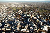
|
| 3 | Wellington | 215,200 | 112.71 | 1,909.3 | 
|
| 4 | Hamilton | 185,300 | 110.37 | 1,678.9 | 
|
| 5 | Tauranga | 161,800 | 141.91 | 1,140.2 | 
|
| 6 | Lower Hutt | 113,000 | 78.54 | 1,438.8 | 
|
| 7 | Dunedin | 106,200 | 91.16 | 1,165.0 | 
|
| 8 | Palmerston North | 82,500 | 77.05 | 1,070.7 | 
|
| 9 | Napier | 67,500 | 105.05 | 642.6 | 
|
| 10 | Hibiscus Coast | 63,400 | 48.39 | 1,310.2 | 
|
| 11 | Porirua | 60,900 | 61.19 | 995.3 | 
|
| 12 | New Plymouth | 59,600 | 74.79 | 796.9 | 
|
| 13 | Rotorua | 58,900 | 46.06 | 1,278.8 | 
|
| 14 | Whangārei | 56,900 | 63.53 | 895.6 | 
|
| 15 | Nelson | 51,900 | 54.69 | 949.0 | 
|
| 16 | Hastings | 51,500 | 26.29 | 1,958.9 | 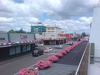
|
| 17 | Invercargill | 51,000 | 62.95 | 810.2 | 
|
| 18 | Upper Hutt | 45,400 | 51.16 | 887.4 | 
|
| 19 | Whanganui | 42,800 | 41.05 | 1,042.6 | 
|
| 20 | Gisborne | 38,200 | 37.43 | 1,020.6 | 
|
Functional urban areas (metropolitan areas) edit
Functional urban areas (FUAs) are geographic areas which represent the functional extent of major, large and medium urban areas, based on commuting patterns. Functional urban areas correspond to New Zealand's metropolitan areas.[6]
FUA populations are as at the 2018 Census.[6]
| Rank | Urban area | Population | Area (km2) |
Urban areas included |
|---|---|---|---|---|
| 1 | Auckland | 1,574,619 | 3,358.8 | Auckland, Hibiscus Coast, Pukekohe, Beachlands-Pine Harbour, Clarks Beach, Helensville, Kumeu-Huapai, Maraetai, Muriwai, Parakai, Patumāhoe, Pōkeno, Riverhead, Tuakau, Waimauku, Waiuku |
| 2 | Christchurch | 470,814 | 2,408.1 | Christchurch, Kaiapoi, Rangiora, Rolleston, Diamond Harbour, Leeston, Lincoln, Lyttelton, Pegasus, Prebbleton, West Melton, Woodend |
| 3 | Wellington | 414,033 | 1,754.9 | Wellington, Lower Hutt, Porirua, Upper Hutt, Featherston, Greytown |
| 4 | Hamilton | 198,957 | 1,412.7 | Hamilton, Ngāruawāhia |
| 5 | Tauranga | 156,096 | 790.2 | Tauranga, Ōmokoroa |
| 6 | Dunedin | 125,007 | 1,033.8 | Dunedin, Mosgiel, Brighton, Waikouaiti |
| 7 | Palmerston North | 92,004 | 978.2 | Palmerston North, Ashhurst |
| 8 | Whangārei | 84,117 | 1,433.7 | Whangarei, Hikurangi, Ngunguru, One Tree Point, Ruakākā |
| 9 | Nelson | 79,998 | 1,177.2 | Nelson, Richmond, Brightwater, Hope, Māpua, Wakefield |
| 10 | New Plymouth | 79,074 | 920.9 | New Plymouth, Inglewood, Ōakura, Waitara |
| 11 | Hastings | 75,255 | 1,160.4 | Hastings, Havelock North, Clive |
| 12 | Rotorua | 67,179 | 649.1 | Rotorua, Ngongotahā |
| 13 | Napier | 64,767 | 260.0 | Napier |
| 14 | Invercargill | 54,084 | 428.5 | Invercargill |
| 15 | Kāpiti Coast | 46,683 | 317.4 | Paraparaumu, Waikanae, Paekākāriki |
| 16 | Whanganui | 44,403 | 598.1 | Whanganui |
| 17 | Gisborne | 39,447 | 612.8 | Gisborne |
City councils edit
Populations of present-day city (and Auckland) councils edit
The populations given are the latest (June 2018)[7] Statistics New Zealand estimated resident populations.
| Rank | City council | Population | First proclaimed |
|---|---|---|---|
| 1 | Auckland | 1,618,400 | 1871 |
| 2 | Christchurch | 380,200 | 1868 |
| 3 | Wellington | 209,000 | 1870 |
| 4 | Hamilton | 165,900 | 1936 |
| 5 | Tauranga | 140,800 | 1963 |
| 6 | Dunedin | 130,500 | 1865 |
| 7 | Lower Hutt | 107,600 | 1941 |
| 8 | Palmerston North | 87,300 | 1930 |
| 9 | Napier | 64,100 | 1950 |
| 10 | Porirua | 58,200 | 1965 |
| 11 | Invercargill | 55,800 | 1930 |
| 12 | Nelson | 52,400 | 1874 |
| 13 | Upper Hutt | 45,300 | 1966 |
Many cities were reorganised into districts by the Local Government Commission in 1989 under the Local Government Act 1974, for example Timaru. Other urban areas that are no longer cities, such as Rotorua and Whangārei, have higher populations than some present cities. The most recently proclaimed city is Tauranga, which became a city, for the second time, from 1 March 2004. Christchurch (1862 and 1868) and Invercargill (1930 and 1991) have also been declared cities more than once.
Under Section 27 of the Local Government Act 2002, a district may become a city by either a "reorganisation scheme" with the Local Government Commission, or under Section 27(1) it may apply for a change in status under Schedule 3, Clause 7. The new city must have "a population of not less than 50,000 persons", be "predominantly urban" and "a distinct entity and a major centre of activity within the region" (or regions) that it is encompassed by. Existing cities are grandfathered under Schedule 2, Part 2 of the Act. The only new city council so far under this section is the Tauranga City Council, from 1 March 2004.
Previously, under Section 37L of the Local Government Act 1974, new cities could only be formed from a "reorganisation scheme". The same criteria were used. The last city to be constituted under this section was Invercargill, which was re-reorganised into a city in 1991.
In 1991, the Lower Hutt City Council became the Hutt City Council by a special Act of Parliament[8] which did not change the name of the city of Lower Hutt; the city's coat of arms still refers to the "City of Lower Hutt".[citation needed]
History of cities edit
Prior to 1876, there was no official definition of a city or uniform system of local authorities in New Zealand. There is thus some argument over which settlement was the first city in New Zealand.[9]
Letters patent edit
Traditionally in the United Kingdom (the former colonial power of New Zealand), city status is a special status granted by the monarch, usually by the issuing of letters patent. Between the 16th century and 1888, city status was associated with the presence of a diocesan cathedral. In 1841 the Diocese of New Zealand was established, based in Auckland, however no letters patent were ever issued. The Diocese of New Zealand was split in 1856 with the southern part becoming the Diocese of Christchurch. Christchurch was subsequently issued letters patent by Queen Victoria and became the "City of Christchurch".[10] Despite the formation of other dioceses in New Zealand, the only other city to be subsequently issued letters patent was Nelson in 1858.[9][11]
Electorates edit
Under the Provincial Councils Act 1851, the Governor had the right to establish electorates for provincial legislative councils.[12] On 21 May 1852, Governor George Grey proclaimed electorates for New Ulster. Although the proclamation explicitly defined Auckland as a "town" for the purpose of property franchise, it later defined the electorate "City of Auckland". This ambiguous proclamation was the first official use of the term "city" in New Zealand legislation. The electorates of New Munster were also declared a short time later on 1 June. Likewise, Wellington was described as a town for property franchise, but more ambiguously established an electorate referred in different parts of the proclamation as either "City of Wellington" or "Town of Wellington". The provinces of New Ulster and New Munster were disestablished only a month later by the New Zealand Constitution Act 1852, however, the electorates of both "City of Auckland" and "City of Wellington" were carried forward to the first nationwide election of 1853.[9]
City councils edit
The first municipal council to bear the title of "city council" was the Auckland City Council formed in 1854 by act of the Auckland Provincial Council.[13] Following the election of an anti-taxation superintendent in March 1855, William Brown, the Auckland City Council was dissolved and formally disestablished 1856.[9] A new Auckland City Council would be established in 1871, which was later was merged into Auckland Council in 2010.[14]
The Christchurch City Council was formed by an act of the Canterbury Provincial Council which received Royal assent on 31 January 1863.[15] The council has been active since and is therefore the longest continuously operating city council in New Zealand.[9][10]
A legal oddity also provides Dunedin with a minor claim to being New Zealand's oldest city. Legal disputes over the powers that the Otago Provincial Council delegated to the newly formed Dunedin City Council in 1865,[16] resulted in the central government stepping in and confirming its powers.[17] Consequently, Dunedin City Council was the first council recognised in central government law. Furthermore, the central government passed legislation in 1868 to better regulate municipal councils across the country. Dunedin was already under the provisions and was therefore unaffected. The new act brought all other "city councils" in New Zealand under the central government regulations as "borough councils". The name change, however, was only due to an oversight in the language of the act and an amendment was made in November 1868 allowing some councils to revert to using the title of "city council". As the act, and therefore the brief name change, did not apply to Dunedin, Dunedin City Council can claim to have the longest continuous use of the title "city council".[9][18]
Summary of claims as New Zealand's first city edit
| Foundation Date | City | Basis of claim |
|---|---|---|
| 1839 | Wellington | First of New Zealand's modern cities to be settled |
| 21 May 1852 | Auckland | Electorate of "City of Auckland" established |
| 6 February 1854 | Auckland | First city council established (disestablished 1856 and not re-established until 1871) |
| 31 July 1856 | Christchurch | First settlement to receive city status by letters patent |
| 31 January 1863 | Christchurch | Longest continuously operating city council (name changed to Christchurch Borough Council between May and November 1868) |
| 18 May 1865 | Dunedin | Longest continuously operating municipal council to continuously use the title "city council" |
Cities, 1877 to 1989 edit
The schedule of cities in New Zealand was brought under central government control in 1867,[18] but continued to be sporadically applied. From 1886 the definition of a city was changed to any borough with a population of 20,000 or more.[19] This value was increased to 50,000 in 1989.[9][20]
Up to October 1989, the Local Government Commission undertook reorganisations of local government. As a result, some cities were reorganised into other larger cities or changed to districts, and some of these areas are still considered cities by many New Zealanders. This is a list as at c. 1986.
- North Island
- Whangārei (1964)
- Auckland
- Auckland (1871)
- East Coast Bays
- Takapuna
- Birkenhead
- Waitemata (1974)
- Mt Albert
- Papatoetoe
- Manukau (1965)
- Papakura
- Tamaki
- Hamilton (1936)
- New Plymouth (1949)
- Tauranga (1963) (lost city status 1989, regained 2004)
- Bethlehem
- Mount Maunganui
- Papamoa
- Welcome Bay
- Rotorua (1962, merged into Rotorua District, 1979)
- Gisborne (1955)
- Napier (1950)
- Hastings (1956)
- Wanganui (1924) (merged with surrounding counties to become Whanganui District, 1989)
- Palmerston North (1930)
- Wellington
- Wellington (1870)
- Upper Hutt (1966)
- Lower Hutt (1941)
- Porirua (1965)
- South Island
- Nelson (1874)
- Christchurch (1868)
- Timaru (1948)
- Dunedin (1865)
- Invercargill (1930)
See also edit
- List of statistical areas in New Zealand
- List of functional urban areas in New Zealand
- List of towns in New Zealand
- List of cities in Oceania by population
- List of New Zealand urban areas by population
- Territorial authorities of New Zealand
- List of cities and towns in the South Island
- List of cities and towns in the South Island by population
Notes edit
- ^ Crompton, Bryan David; Williamson, Herbert (1966). "Major types of local authorities in New Zealand". In McLintock, A.H. (ed.). An Encyclopaedia of New Zealand. Retrieved 23 July 2021 – via Te Ara – the Encyclopedia of New Zealand.
- ^ "Local Government Act 2002, Schedule 3 part 16, Cities". New Zealand Legislation. New Zealand Government. Retrieved 23 July 2021.
- ^ Mitchell, Charlie (15 January 2020). "Christchurch is New Zealand's second city, deal with it". Stuff. Retrieved 20 January 2020.
- ^ Statistical Standard for Geographic Areas 2018 (PDF). Wellington: Statistics New Zealand. 2017. p. 15. ISBN 978-1-98-852841-0. Retrieved 23 July 2021.
- ^ "Urban Rural 2018 (generalised) - GIS | New Zealand | GIS Map Data Datafinder Geospatial Statistics | Stats NZ Geographic Data Service". datafinder.stats.govt.nz. Retrieved 11 August 2020.
- ^ a b "Functional urban areas – methodology and classification | Stats NZ". www.stats.govt.nz. Retrieved 18 November 2022.
- ^ "Subnational Population Estimates: At 30 June 2019". Statistics New Zealand. 22 October 2019. Retrieved 11 January 2020. For urban areas, "Subnational population estimates (UA, AU), by age and sex, at 30 June 1996, 2001, 2006–18 (2017 boundaries)". Statistics New Zealand. 23 October 2018. Retrieved 23 October 2018.
- ^ "Lower Hutt City (Name of City Council) Act 1991". Retrieved 25 February 2024.
- ^ a b c d e f g Brett, André (16 January 2020). "Claims, confusion, and status: Which city is New Zealand's oldest?". New Zealand Geographer. 76 (1): 1–9. doi:10.1111/nzg.12246.
- ^ a b "City of Christchurch European Settlement: Historical Note". Christchurch City Libraries. Retrieved 18 September 2023.
- ^ "Nelson becomes a City". The Prow. 14 May 2020. Retrieved 18 September 2023.
- ^ "Provincial Councils Act 1851". New Zealand Legislative Council. 9 July 1851.
- ^ "Auckland City Council Act". Auckland Provincial Council. 6 February 1854.
- ^ "Timeline of previous local government agencies 1862-2010" (PDF). Auckland Council. Retrieved 18 September 2023.
- ^ "Christchurch City Council Ordinance 1862". Canterbury Provincial Council. 31 January 1863.
- ^ "Otago Municipal Corporations Ordinance 1965". Otago Provincial Council. 18 May 1865.
- ^ "Otago Municipal Corporations Empowering Act 1865". Parliament of New Zealand. 30 October 1865.
- ^ a b "Municipal Corporations Act". Parliament of New Zealand. 10 October 1867.
- ^ "Municipal Corporations Act 1886". Parliament of New Zealand. 18 August 1886.
- ^ "Local Government Amendment Act (No 2) 1989". Parliament of New Zealand. 6 June 1989.
References edit
- Gordon McLauchlan (ed.), Illustrated Encyclopedia of New Zealand, The, Auckland: David Bateman, 1989 (second edition) (ISBN 1-86953-007-1) – confirmation, pre-1989 dates
External links edit
- Statistics New Zealand Subnational Population Estimates
- Tauranga status change, 2003 – specific details
- Local Government (Tauranga City Council) Order 2003 (Governor-General's Order-in-Council, 2 October 2003)
- Local Government Commission press release[permanent dead link] (PDF)
- Local Government Commission decision full text (PDF)
- Tauranga's city status returns (The New Zealand Herald, 12 August 2003)
- Local Government Online Limited site Archived 25 February 2021 at the Wayback Machine – confirmation, post-1989 council names