


Summary
The Indian state of Telangana has 33 districts, each headed by a District collector.[1]
| Districts of Telangana తెలంగాణ జిల్లాలు | |
|---|---|
 Telangana Political Map | |
| Category | Districts |
| Location | Telangana |
| Number | 33 districts |
| Populations | Mulugu – 257,744 (lowest); Hyderabad – 3,943,323 (highest) |
| Areas | Hyderabad – 217 km2 (84 sq mi) (smallest); Bhadradri Kothagudem – 7,483 km2 (2,889 sq mi) (largest) |
| Government | |
| Subdivisions | |

History edit

Telangana region of Hyderabad State consisted of 8 Districts in 1948 when it was inducted in Dominion of India; they are Hyderabad, Mahbubnagar, Medak, Nalgonda, Nizamabad, Adilabad, Karimnagar and Warangal districts.[2] Khammam district was created by bifurcation of Warangal district on 1 October 1953.[3] Andhra Pradesh was formed by merging Telangana region of Hyderabad State and Andhra state on 1 November 1956. Bhadrachalam division and Aswaraopet taluka parts was merged in Khammam district from Godavari districts for better Administration.[3] Hyderabad district was split into Hyderabad Urban District and Hyderabad Rural District on 15 August 1978. Hyderabad Urban District was made by 4 Talukas are Charminar, Golkonda, Mushirabad and Secunderabad Talukas which consist of only MCH area, Secunderabad cantonment and Osmania University. Hyderabad rural district was later renamed as Ranga Reddy District.[4]
Telangana carved out from with 10 districts from Andhra Pradesh. Seven mandals of Bhadrachalam division were given back to East Godavari district.[5][6] 21 new districts were created on 11 October 2016, which lead to 31 districts in Telangana. All districts were divided into minimum 2 to maximum 5 except Hyderabad district district which was untouched.[7] Two new districts, Mulugu and Narayanpet were created on 17 February 2019, taking the total number of districts to 33.[8]
District statistics edit
In terms of area, Bhadradri Kothagudem is the largest district with an area of 7,483 km2 (2,889 sq mi) and Hyderabad is the smallest with 217 km2 (84 sq mi). Hyderabad district is the most populated district with a population of 39,43,323 and Mulugu is the least populated with 2,94,671. Telangana consist of 74 Revenue Divisions and 594 Revenue Mandals (Tehsil).[9]
| S.No. | Name | Headquarters | Area (km2) | Population (2011 census) |
No.of mandals | Density (per km2) |
Urban (%) | Literacy (%) | Sex ratio | Map |
|---|---|---|---|---|---|---|---|---|---|---|
| 1 | Adilabad | Adilabad | 4,153 | 708,972 | 18 | 171 | 23.66 | 63.46 | 978 |
|
| 2 | Kumuram Bheem Asifabad | Asifabad | 4,878 | 515,812 | 15 | 106 | 16.86 | 56.72 | 998 | 
|
| 3 | Mancherial | Mancherial | 4,016 | 807,037 | 18 | 201 | 43.85 | 64.35 | 977 | 
|
| 4 | Nirmal | Nirmal | 3,845 | 709,418 | 19 | 185 | 21.38 | 57.77 | 1046 | 
|
| 5 | Nizamabad | Nizamabad | 4,288 | 1,571,022 | 27 | 366 | 29.58 | 64.25 | 1044 | 
|
| 6 | Jagtial | Jagtial | 2,419 | 985,417 | 18 | 407 | 22.46 | 60.26 | 1036 | 
|
| 7 | Peddapalli | Peddapalli | 2,236 | 795,332 | 14 | 356 | 38.22 | 65.52 | 992 | 
|
| 8 | Kamareddy | Kamareddy | 3,652 | 972,625 | 22 | 266 | 12.71 | 56.51 | 1033 | 
|
| 9 | Rajanna Sircilla | Sircilla | 2,019 | 552,037 | 13 | 273 | 21.17 | 62.71 | 1014 | 
|
| 10 | Karimnagar | Karimnagar | 2,128 | 1,005,711 | 16 | 473 | 30.72 | 69.16 | 993 | 
|
| 11 | Jayashankar Bhupalpally | Bhupalpally | 2,293 | 416,763 | 20 | 180 | 7.57 | 58.97 | 1009 | 
|
| 12 | Sangareddy | Sangareddy | 4,403 | 1,527,628 | 26 | 347 | 34.69 | 64.08 | 965 | 
|
| 13 | Medak | Medak | 2,786 | 767,428 | 20 | 275 | 7.67 | 56.12 | 1027 | 
|
| 14 | Siddipet | Siddipet | 3,632 | 1,012,065 | 22 | 279 | 13.74 | 61.61 | 1008 | 
|
| 15 | Jangaon | Jangaon | 2,188 | 566,376 | 13 | 259 | 12.60 | 61.60 | 997 | 
|
| 16 | Hanamkonda | Hanamkonda[10] | 1,309 | 1,080,858 | 11 | 826 | 68.51 | 76.17 | 997 | 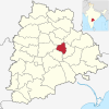
|
| 17 | Warangal | Warangal[10] | 2,175 | 718,537 | 15 | 330 | 6.99 | 61.26 | 994 | 
|
| 18 | Mulugu | Mulugu | 3,881 | 257,744 | 09 | 66 | 05 | 62.26 | 968 | 
|
| 19 | Bhadradri kothagudem | Kothagudem | 7,483 | 1,069,261 | 23 | 143 | 31.71 | 66.40 | 1008 | 
|
| 20 | Khammam | Khammam | 4,361 | 1,401,639 | 21 | 321 | 22.60 | 65.95 | 1005 | 
|
| 21 | Mahabubabad | Mahabubabad | 2,877 | 774,549 | 16 | 269 | 9.86 | 57.13 | 996 | 
|
| 22 | Suryapet | Suryapet | 3,607 | 1,099,560 | 23 | 305 | 15.56 | 64.11 | 996 | 
|
| 23 | Nalgonda | Nalgonda | 7,122 | 1,618,416 | 31 | 227 | 22.76 | 63.75 | 978 | 
|
| 24 | Yadadri Bhuvanagiri[11] | Bhuvanagiri | 3,092 | 739,448 | 16 | 239 | 16.66 | 65.2402221 | 973 | 
|
| 25 | Medchal–Malkajgiri | Shamirpet | 1,084 | 2,440,073 | 14 | 2251 | 91.40 | 82.48 | 957 | 
|
| 26 | Hyderabad | Hyderabad | 217 | 3,943,323 | 16 | 18172 | 100 | 83.25 | 954 | 
|
| 27 | Ranga Reddy | Shamshabad | 5,031 | 2,446,265 | 27 | 486 | 58.05 | 71.88 | 950 | 
|
| 28 | Vikarabad | Vikarabad | 3,386 | 927,140 | 18 | 274 | 13.48 | 57.91 | 1001 | 
|
| 29 | Narayanpet | Narayanpet | 2336 | 566,874 | 11 | 240 | 7.36 | 49.93 | 1009 | 
|
| 30 | Mahabubnagar | Mahabubnagar | 2,738 | 919,903 | 26 | 340 | 20.73 | 60.97 | 995 | 
|
| 31 | Nagarkurnool | Nagarkurnool | 6,545 | 893,308 | 22 | 142 | 10.19 | 54.38 | 968 | 
|
| 32 | Wanaparthy | Wanaparthy | 2,152 | 577,758 | 14 | 268 | 15.97 | 55.67 | 960 | 
|
| 33 | Jogulamba Gadwal | Gadwal | 2,928 | 609,990 | 12 | 208 | 10.36 | 49.87 | 972 | 
|
| Total | – | – | 112,077 | 35,003,674 | 584 | 312 | 38.88 | 66.54 | 988 | – |

See also edit
References edit
- ^ "Telangana State Portal Districts". www.telangana.gov.in. Retrieved 23 April 2019.
- ^ Yazdani, Ghulam (1937). "Hyderabad State". Atlantic Publishers & Distri – via Google Books.
- ^ a b "Know Your Corporation".
- ^ Law, Gwillim (25 September 2011). "Districts of India". Statoids. Retrieved 11 October 2011.
- ^ "The Andhra Pradesh Reorganisation (Amendment) Bill, 2014" Accessed 13 July 2014 [1]
- ^ "Protests against Centre, Andhra Pradesh in Khammam over Polavaram Bill". Deccan Chronicle, 12 July 2014. Accessed 13 July 2014. [2]
- ^ "New districts". Andhra Jyothy.com. 8 October 2016. Archived from the original on 25 December 2018. Retrieved 8 October 2016.
- ^ "Telangana gets two new districts: Narayanpet and Mulugu". The New Indian Express. Archived from the original on 4 November 2021. Retrieved 31 March 2019.
- ^ "::Know Your District - Plan Your District::". Archived from the original on 8 July 2017. Retrieved 17 December 2016.
- ^ a b "KCR renames Warangal Urban Hanamkonda; Warangal Rural becomes Warangal". NewsMeter. 21 June 2021.
- ^ "Yadadri changed to Yadadri Bhuvanagiri District". Retrieved 25 January 2017.