


Summary
Mitchell is a rural town and locality in the Maranoa Region, Queensland, Australia.[2][3] The town services the local area, a cattle and sheep farming district. In the 2021 census, the locality of Mitchell had a population of 995 people.[1]
| Mitchell Queensland | |||||||||||||||
|---|---|---|---|---|---|---|---|---|---|---|---|---|---|---|---|
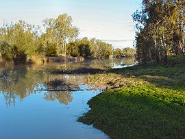 Looking downstream on the Maranoa River on the eastern side of Mitchell | |||||||||||||||
 Mitchell | |||||||||||||||
| Coordinates | 26°29′10″S 147°58′31″E / 26.4861°S 147.9752°E | ||||||||||||||
| Population | 995 (2021 census)[1] | ||||||||||||||
| • Density | 1.6504/km2 (4.2744/sq mi) | ||||||||||||||
| Established | 1864 | ||||||||||||||
| Postcode(s) | 4465 | ||||||||||||||
| Elevation | 336.3 m (1,103 ft) | ||||||||||||||
| Area | 602.9 km2 (232.8 sq mi) | ||||||||||||||
| Time zone | AEST (UTC+10:00) | ||||||||||||||
| Location |
| ||||||||||||||
| LGA(s) | Maranoa Region | ||||||||||||||
| County | Dublin | ||||||||||||||
| State electorate(s) | Warrego | ||||||||||||||
| Federal division(s) | Maranoa | ||||||||||||||
| |||||||||||||||
| |||||||||||||||
Geography edit


Mitchell is on the Warrego Highway, 587 kilometres (365 mi) west of Brisbane, 441 kilometres (274 miles) west of Toowoomba, 230 kilometres (140 miles) west of Miles, 89 kilometres (55 miles) west of Roma and 180 kilometres (110 miles) east of Charleville.[4] The Warrego Highway passes through town to form the main street, Cambridge Street. The Maranoa River flows around the northern and eastern sides of the town before eventually flowing into the Balonne River.[5]
The Western railway passes through the locality, entering from the east (Amby / Walhallow) and exiting to the west (Womalilla).[6] The locality is served by a number of railway stations, from west to east:
- Mitchell railway station, a passenger stop in the town (26°29′14″S 147°58′07″E / 26.4872°S 147.9687°E)[7]
- Booringa railway siding, now dismantled (26°29′14″S 148°00′01″E / 26.4872°S 148.0002°E)[7]
- Marbango railway station, now abandoned (26°29′20″S 148°03′42″E / 26.4888°S 148.0618°E)[7]
Mitchell Airstrip is west of the town (26°29′16″S 147°56′35″E / 26.4878°S 147.9430°E).[8] Its IATA airport code is MTQ and its ICAO airport code is YMIT.[9] It is operated by the Maranoa Regional Council and is suitable for light aircraft.[10]
History edit

Before the arrival of Europeans, the Maranoa region was occupied by the Mandandanji and Gunggari Aboriginal peoples. Based on archaeological excavations in the Mount Moffatt area, it has been deduced that the Aboriginals had lived there for around 19,500 years. Descendants of the original peoples still live in and visit the area today.
Mandandanji (also known as Mandandanyi, Mandandanjdji, Kogai) is an Australian Aboriginal language spoken by the Mandandanji people. The Mandandanji language region includes the landscape within the local government boundaries of the Maranoa Regional Council, particularly Roma, Yuleba and Surat, then east towards Chinchilla and south-west towards Mitchell and St George.[11]
The town is named after Sir Thomas Mitchell explorer and Surveyor General of New South Wales, who explored the area in 1846.[2][3]
In 1862, Edmund Morey established the property of Mitchell Downs. When the original homestead was partially destroyed by a flood in 1864, Thomas Close acquired the building's ruins and established the Mitchell Downs Hotel.
On 1 January 1865, Mitchell Downs Post Office opened and around 1878 was renamed Mitchell Post Office.[12]
Mitchell State School opened on 1 April 1876 as a primary school.[13] In 1961, it was expanded to include a secondary school.[14]
The first St Columba's Catholic Church was officially opened and blessed by Bishop Robert Dunne on Saturday 15 November 1884.[15] On Sunday 24 April 1938, the new St Columba's Catholic Church was officially opened and blessed by Monsignor McKenna of Toowoomba. It was designed by J.P. Donoghue. The timber church was built by contractor F.T. Woollam at a cost of £3000. It can seat 350 people.[16][17]
The foundation block for the first All Saints' Anglican Church in Mitchell was laid by Coadjutor Bishop Nathaniel Dawes on Wednesday 13 November 1889.[18] The church was officially opened on Tuesday 5 August 1890 by Bishop William Webber.[19][20] It was designed by architect John H. Buckeridge. It was 45 by 25 feet (13.7 m × 7.6 m) and could seat 150 people. It was built from cypress pine by Roma contractors, Allen Clell & Sons, at a cost of £274.[21] The current All Saints' Anglican Church was built in 1965. It was designed by Ford Hutton, Newell, Black, and Paulson.[22] This brick church can seat 110 people.[23]
A Wesleyan Methodist Church was opened in Mitchell in April 1894.[24] It could seat 80 people. It was built from timber at a cost of £200. Following the amalgamations of various denominations, it later became Mitchell Methodist Church and then Mitchell Uniting Church. It was at 82 Mary Street (26°29′17″S 147°58′42″E / 26.488078°S 147.9782°E). It has closed and been converted into a house.[25][26]
In 1902, after a short stand-off, bushrangers Patrick and James Kenniff were captured south of Mitchell at a location previously known as Back Creek but now known as Arrest Creek.[27] Patrick was hanged in 1903 for the murder of Constable George Doyle (who had previously served at Wyandra) and Albert Dahlke, while James was released after 12 years imprisonment and died peacefully in 1940.[28]
Long Gully Provisional School opened on 1915 on the road from Mitchell to St George; it closed in 1918.[29]
St Patrick's Catholic Primary School opened on 4 November 1923.[29][30]
Mitchell Aboriginal Provisional School opened on 1 May 1935 and was later proclaimed Mitchell Aboriginal State School. It closed on 19 November 1948.[29]
At the 2006 census, Mitchell had a population of 944.[31]
Mitchell was once the administrative centre of the Shire of Booringa local government area. Since 2008, the town is now part of the Maranoa Region.
In the March 2010 floods, the Maranoa River reached a peak of 13.4 m in the town causing an inundation of 25 houses.[32] The town experienced the worst flooding ever in 2012 when a monsoon trough hovered over central and southern Queensland and nearly inundated Charleville, 180 km (110 mi) to the west. .
In the 2011 census, the locality of Mitchell had a population of 1,311 people.[33]
In the 2016 census, the locality of Mitchell had a population of 1,031 people.[34]
In the 2021 census, the locality of Mitchell had a population of 995 people.[1]
Heritage listings edit

Mitchell has a number of heritage-listed sites, including:
- Mitchell War Memorial, Cambridge Street (26°29′21″S 147°58′18″E / 26.4892°S 147.9718°E)[35]
- Mitchell State School (1914 Building), 105 Cambridge Street[36]
- Mitchell railway station: Oxford Street (passenger station), Alice Street (goods shed used by Watco Australia and Aurizon) and Sheffield Street (station master's)[37]
Amenities edit


Mitchell is home to the Booringa Heritage Museum housed in the old Booringa Shire Council workshop building.
The Maranoa Regional Council operates a public library and the Maranoa Art Gallery at the old Maranoa Theatre building in Cambridge Street. From here it provides public WiFi by way of a high speed ISDN Internet Connection (powered through the National Broadband Network) to Brisbane.[38]
St Columba's Catholic Church is at 86 Alice Street (26°28′58″S 147°58′24″E / 26.482887°S 147.9733°E).[16]
All Saints' Anglican Church is at 118 Alice Street (26°29′08″S 147°58′28″E / 26.485611°S 147.9745°E).[23]
The Mitchell branch of the Queensland Country Women's Association has its rooms at 87 Cambridge Street.[39]
Education edit
Mitchell State School is a government primary and secondary (Prep–10) school for boys and girls at 105 Cambridge Street (26°29′19″S 147°58′17″E / 26.4885°S 147.9715°E).[40][41] In 2017, the school had an enrolment of 132 students with 16 teachers (13 full-time equivalent) and 15 non-teaching staff (10 full-time equivalent).[42] In 2018, the school had an enrolment of 137 students with 15 teachers (13 full-time equivalent) and 14 non-teaching staff (10 full-time equivalent).[43] Students come from Mitchell, Mungallala, Amby and surrounding properties.[44] Students in Years 11 and 12 are taken by bus to Roma State College in Roma.[45]
St Patrick's Primary School is a Catholic primary (Prep–6) school for boys and girls at 100 Alice Street (26°29′03″S 147°58′25″E / 26.4841°S 147.9737°E).[40][46] In 2017, the school had an enrolment of 37 students with 2 teachers and 6 non-teaching staff.[42] In 2018, the school had an enrolment of 32 students with 4 teachers (3 full-time equivalent) and 5 non-teaching staff (3 full-time equivalent).[43]
A major language revival effort has been under way in Queensland schools since St Patrick's School started teaching the Gunggari language around 2013. Since then, Mitchell State School has also started teaching Gunggari.[47][48]
Facilities edit

Facilities in Mitchell include:
- Mitchell Police Station (26°29′18″S 147°58′40″E / 26.4883°S 147.9777°E)[49]
- Mitchell Fire Station (26°29′10″S 147°58′39″E / 26.4862°S 147.9774°E)[49]
- Mitchell SES Facility (26°29′20″S 147°58′44″E / 26.4890°S 147.9789°E)[49]
- Mitchell Multipurpose Health Service, a public hospital (26°29′24″S 147°58′20″E / 26.4901°S 147.9722°E)[50]
- Mitchell Ambulance Station (26°29′15″S 147°58′31″E / 26.4875°S 147.9754°E)[49]
- Mitchell Monumental Cemetery (26°28′33″S 147°58′15″E / 26.4759°S 147.9709°E)[51]
- Mitchell Water Treatment Plant (26°29′30″S 147°59′04″E / 26.4917°S 147.9844°E)[50]
The water supply for the town comes from three bores. The depth of the bores is about 1,000 metres. The water is pumped into a large concrete water tower on the western side of the town. The water is hot when it emerges from the ground, and in the tank it is about 50 °C. Houses close to the tank, have free hot water. In fact it is necessary to cool the water before it can be used.
Media edit
Mitchell is serviced by the following radio stations based in other locations, broadcast via local transmitters:
- Radio 4ZR (Resonate Radio Network) – 104.5 FM
- ABC Local Radio – 106.1 FM
- ABC Radio National – 107.7 FM
- Vision FM – 88.0 FM
Television services are provided by the Australian Broadcasting Corporation, with channels ABC, ABC Kids/ABC TV Plus, ABC ME and ABC NEWS, transmitting to Mitchell through its relay station, ABMLQ, situated at 26°32′35″S 148°6′41″E (Mitchell Escarpment)
The Seven Network and its sister stations 7two and 7mate transmit to Mitchell through its regional affiliate, ITQ
Network Ten and its sister channels 10 Bold and 10 Peach transmit to Mitchell through its regional affiliate, CDT
The Nine Network and its sister channels 9Gem and 9GO! transmit to Mitchell through its regional affiliate, IMP
The Special Broadcasting Service and its sister channels SBS Viceland, SBS World Movies, SBS Food and NITV also transmit to Mitchell.
Climate edit
Mitchell has a humid subtropical climate with hot summers and cold winters by Queensland standards. On 15 August 1979 Mitchell recorded a minimum temperature of −9.4 °C (15.1 °F), which is the third coldest temperature ever recorded in the state.[52] Mitchell has the largest overall temperature range recorded in Australia (56.2 °C, -9.4 °C to 46.8 °C).[53] The town gets an average of 157.5 clear days annually.[54]
| Climate data for Mitchell | |||||||||||||
|---|---|---|---|---|---|---|---|---|---|---|---|---|---|
| Month | Jan | Feb | Mar | Apr | May | Jun | Jul | Aug | Sep | Oct | Nov | Dec | Year |
| Record high °C (°F) | 46.8 (116.2) |
43.0 (109.4) |
42.1 (107.8) |
36.5 (97.7) |
33.0 (91.4) |
30.2 (86.4) |
29.2 (84.6) |
36.2 (97.2) |
39.3 (102.7) |
40.8 (105.4) |
42.7 (108.9) |
46.2 (115.2) |
46.8 (116.2) |
| Mean daily maximum °C (°F) | 34.1 (93.4) |
32.9 (91.2) |
31.1 (88.0) |
27.5 (81.5) |
23.2 (73.8) |
19.7 (67.5) |
19.4 (66.9) |
21.8 (71.2) |
25.8 (78.4) |
29.4 (84.9) |
32.0 (89.6) |
33.7 (92.7) |
27.5 (81.5) |
| Mean daily minimum °C (°F) | 20.0 (68.0) |
19.5 (67.1) |
16.8 (62.2) |
11.5 (52.7) |
7.1 (44.8) |
4.3 (39.7) |
2.8 (37.0) |
3.9 (39.0) |
7.5 (45.5) |
12.3 (54.1) |
16.1 (61.0) |
18.5 (65.3) |
11.7 (53.1) |
| Record low °C (°F) | 10.1 (50.2) |
8.8 (47.8) |
4.0 (39.2) |
−0.9 (30.4) |
−6.4 (20.5) |
−6.2 (20.8) |
−6.1 (21.0) |
−9.4 (15.1) |
−3.2 (26.2) |
−1.4 (29.5) |
3.6 (38.5) |
7.5 (45.5) |
−9.4 (15.1) |
| Average rainfall mm (inches) | 81.9 (3.22) |
72.5 (2.85) |
61.3 (2.41) |
33.8 (1.33) |
32.4 (1.28) |
34.4 (1.35) |
33.1 (1.30) |
23.5 (0.93) |
26.4 (1.04) |
42.5 (1.67) |
58.2 (2.29) |
71.9 (2.83) |
571.9 (22.5) |
| Average rainy days (≥ 0.2mm) | 7.4 | 6.1 | 5.5 | 3.7 | 3.8 | 4.1 | 4.2 | 3.3 | 3.9 | 5.2 | 6.3 | 7.3 | 60.8 |
| Average relative humidity (%) | 35 | 38 | 36 | 36 | 39 | 41 | 37 | 31 | 26 | 28 | 30 | 31 | 34 |
| Source: Bureau of Meteorology[54] | |||||||||||||
Attractions edit
The Great Artesian Spa was opened in 1998 and is situated in the town's aquatic centre.[55] There are two pools of artesian water, one heated and the other designed for those who prefer a cooler experience. Both spa pools have been designed with disabled access in mind and facilities include a chairlift to allow easy access for physically disabled people.[56] The water used in the spa pools is renewed regularly and comes from the Great Artesian Basin, which is one of the largest artesian basins in the world, which underlies around one-fifth of Australia.[57] It covers a total area of more than 1,711,000 square kilometres, and has been relied upon for the town water supply since 1927.[58][59]
Other attractions include:
- Mitchell Yumba Interpretive Trail
- Neil Turner Weir
- The Kenniff Courthouse
- Kenniff Brothers Sculpture at Arrest Creek
- Major Mitchell's Campsite, 38 kilometres north of Mitchell
- Musical Cattle Grid, on the banks of the Maranoa River
There is a Visitor Information Centre located at the Great Artesian Spa complex, next door to the Mitchell Memorial Swimming Pool.
Notable people edit
- The 15th Prime Minister of Australia, Francis Forde was born in Mitchell. He is Australia's shortest serving Prime Minister, with a term lasting just eight days. He was also Australia's longest living Prime Minister, until Gough Whitlam took that mantle.[60]
- Joanne Currie Nalingu, artist[61]
See also edit
References edit
- ^ a b c Australian Bureau of Statistics (28 June 2022). "Mitchell (SSC)". 2021 Census QuickStats. Retrieved 2 April 2024.
- ^ a b "Mitchell – town in Maranoa Region (entry 22362)". Queensland Place Names. Queensland Government. Retrieved 14 August 2022.
- ^ a b "Mitchell – locality in Maranoa Region (entry 47435)". Queensland Place Names. Queensland Government. Retrieved 14 August 2022.
- ^ Queensland holidays Archived 7 June 2008 at the Wayback Machine – places to visit – outback – Queensland holidays. Retrieved 1 March 2009
- ^ Queensland natural resources and water Archived 25 July 2008 at the Wayback Machine – "Maranoa river at Mitchell". Retrieved 1 March 2009
- ^ "Queensland Globe". State of Queensland. Retrieved 23 October 2022.
- ^ a b c "Railway stations and sidings - Queensland". Queensland Open Data. Queensland Government. 2 October 2020. Archived from the original on 5 October 2020. Retrieved 5 October 2020.
- ^ "Airports - Queensland". Queensland Open Data. Queensland Government. 22 October 2020. Archived from the original on 15 November 2020. Retrieved 3 November 2020.
- ^ "Mitchell Airport - YMIT - MTQ - Airport Guide". AirportGuide. Archived from the original on 23 October 2022. Retrieved 23 October 2022.
- ^ "Airports". Maranoa Regional Council. Archived from the original on 23 October 2022. Retrieved 23 October 2022.
- ^ "Mandandanji". State Library of Queensland. 15 January 2020. Archived from the original on 4 December 2020.
- ^ Phoenix Auctions History. "Post Office List". Phoenix Auctions. Archived from the original on 18 February 2023. Retrieved 6 April 2021.
- ^ "Opening and closing dates of Queensland Schools". Queensland Government. Retrieved 18 April 2019.
- ^ "Our school". Mitchell State School. 10 February 2020. Archived from the original on 23 October 2022. Retrieved 23 October 2022.
- ^ "DR. DUNNE MITCHELL". Western Star And Roma Advertiser. No. 609. Queensland, Australia. 19 November 1884. p. 2. Archived from the original on 18 February 2023. Retrieved 23 October 2022 – via National Library of Australia.
- ^ a b Blake, Thom. "St Columba's Catholic Church (1938)". Queensland religious places database. Archived from the original on 23 October 2022. Retrieved 22 September 2022.
- ^ "New churches for Goondiwindi and Mitchell". The Catholic Advocate. Vol. XXIV, no. 1345. Queensland, Australia. 11 March 1937. p. 17. Archived from the original on 18 February 2023. Retrieved 23 October 2022 – via National Library of Australia.
- ^ "Advertising". Western Star And Roma Advertiser. No. 1122. Queensland, Australia. 13 November 1889. p. 2. Archived from the original on 18 February 2023. Retrieved 23 October 2022 – via National Library of Australia.
- ^ "Correspondence". Western Star And Roma Advertiser. No. 1193. Queensland, Australia. 26 July 1890. p. 2. Archived from the original on 18 February 2023. Retrieved 23 October 2022 – via National Library of Australia.
- ^ "Advertising". Western Star And Roma Advertiser. No. 1194. Queensland, Australia. 30 July 1890. p. 3. Archived from the original on 18 February 2023. Retrieved 23 October 2022 – via National Library of Australia.
- ^ Blake, Thom. "All Saints' Anglican Church (1890)". Queensland religious places database. Archived from the original on 23 October 2022. Retrieved 22 September 2022.
- ^ "Ford, Hutton & Newell". Digital Archive of Queensland Architecture. Archived from the original on 23 October 2022. Retrieved 23 October 2022.
- ^ a b Blake, Thom. "All Saints' Anglican Church (1965)". Queensland religious places database. Archived from the original on 23 October 2022. Retrieved 22 September 2022.
- ^ "Visit to the West". The Telegraph. No. 6, 706. Queensland, Australia. 14 April 1894. p. 5. Archived from the original on 18 February 2023. Retrieved 23 October 2022 – via National Library of Australia.
- ^ Blake, Thom. "Wesleyan Methodist Church". Queensland religious places database. Archived from the original on 23 October 2022. Retrieved 22 September 2022.
- ^ Google (23 October 2022). "Mitchell Uniting Church (former) - Streetview" (Map). Google Maps. Google. Retrieved 23 October 2022.
- ^ "Arrest Creek – watercourse in the Maranoa Region (entry 860)". Queensland Place Names. Queensland Government. Retrieved 6 May 2019.
- ^ The Kenniff centenary moot. Mitchell, Queensland. 22 June 2002.
- ^ a b c Queensland Family History Society (2010), Queensland schools past and present (Version 1.01 ed.), Queensland Family History Society, ISBN 978-1-921171-26-0
- ^ "Mitchell Convent School". The Catholic Advocate. Vol. XIII, no. 650. Queensland, Australia. 22 November 1923. p. 35. Archived from the original on 18 February 2023. Retrieved 23 October 2022 – via National Library of Australia.
- ^ Australian Bureau of Statistics (25 October 2007). "Mitchell (L) (Urban Centre/Locality)". 2006 Census QuickStats. Retrieved 13 June 2011.
- ^ "Queensland town braces for worst flood". news.com.au. News Limited. 4 February 2012. Archived from the original on 6 April 2012. Retrieved 27 April 2012.
- ^ Australian Bureau of Statistics (31 October 2012). "Mitchell (SSC)". 2011 Census QuickStats. Retrieved 4 September 2016.
- ^ Australian Bureau of Statistics (27 June 2017). "Mitchell (SSC)". 2016 Census QuickStats. Retrieved 20 October 2018.
- ^ "Mitchell War Memorial (entry 600038)". Queensland Heritage Register. Queensland Heritage Council. Retrieved 11 July 2013.
- ^ "Mitchell State School (1914 Building) (entry 601076)". Queensland Heritage Register. Queensland Heritage Council. Retrieved 11 July 2013.
- ^ "Mitchell Railway Station (entry 601077)". Queensland Heritage Register. Queensland Heritage Council. Retrieved 11 July 2013.
- ^ "Mitchell Library". Public Libraries Connect. State Library of Queensland. Archived from the original on 2 February 2017. Retrieved 29 January 2017.
- ^ "Branch locations". Queensland Country Women's Association. Archived from the original on 26 December 2018. Retrieved 26 December 2018.
- ^ a b "State and non-state school details". Queensland Government. 9 July 2018. Archived from the original on 21 November 2018. Retrieved 21 November 2018.
- ^ "Mitchell State School". Mitchell State School. 10 February 2020. Archived from the original on 20 April 2013. Retrieved 23 October 2022.
- ^ a b "ACARA School Profile 2017". Archived from the original on 22 November 2018. Retrieved 22 November 2018.
- ^ a b "ACARA School Profile 2018". Australian Curriculum, Assessment and Reporting Authority. Archived from the original on 27 August 2020. Retrieved 28 January 2020.
- ^ "Welcome to Mitchell State School". Mitchell State School. Archived from the original on 20 April 2013. Retrieved 29 January 2017.
- ^ "Roma State College". Archived from the original on 15 June 2012. Retrieved 29 November 2020.
- ^ "Home". St Patrick's School, Mitchell. Archived from the original on 9 March 2019. Retrieved 23 October 2022.
- ^ Hosier, Phoebe (26 May 2021). "An outback Queensland school leads the way to keep endangered Indigenous language alive". ABC News. Australian Broadcasting Corporation. Archived from the original on 13 February 2022. Retrieved 13 February 2022.
- ^ Moodie, Anthea (27 November 2021). "Indigenous language workshops connecting Gunggari people to culture". ABC News. Australian Broadcasting Corporation. Archived from the original on 13 February 2022. Retrieved 13 February 2022.
- ^ a b c d "Emergency services facilities - Queensland". Queensland Open Data. Queensland Government. 18 November 2020. Archived from the original on 24 November 2020. Retrieved 24 November 2020.
- ^ a b "Landmark Areas - Queensland". Queensland Open Data. Queensland Government. 18 November 2020. Archived from the original on 21 November 2020. Retrieved 21 October 2020.
- ^ "Cemetery Areas - Queensland". Queensland Open Data. Queensland Government. 12 November 2020. Archived from the original on 15 November 2020. Retrieved 12 November 2020.
- ^ "Queensland Temperature Extremes" (PDF). Bureau of Meteorology. Archived (PDF) from the original on 13 October 2016. Retrieved 26 August 2016.
- ^ Climate statistics for Mitchell Post Office, Bureau of Meteorology http://www.bom.gov.au/climate/averages/tables/cw_043020_All.shtml Archived 27 May 2021 at the Wayback Machine
- ^ a b "Mitchell Post Office". Climate statistics for Australian locations. Bureau of Meteorology. February 2013. Retrieved 3 March 2013.
- ^ "Great Artesian Spa - Attraction - Queensland". Archived from the original on 2 February 2017. Retrieved 29 January 2017.
- ^ visit Mitchell Archived 24 July 2008 at the Wayback Machine – relaxation – Great artesian spa. retrieved 1 March 2009.
- ^ "The Great Artesian Basin" (PDF). QLD Department of Environment and Resource Management. Archived from the original (PDF) on 23 September 2010. Retrieved 30 November 2011.
- ^ Queensland natural resources and water Archived 11 March 2012 at the Wayback Machine – The great artesian basin. Retrieved 1 March 2009.
- ^ Region[permanent dead link] – Booringa online – "Mitchell". Retrieved 1 March 2009.
- ^ Scaramouche. "Prime Minister – Francis Michael Forde". Archived from the original on 22 November 2010. Retrieved 30 November 2011.
- ^ Stewart, Robin (April 1994). "Joanne Currie Nalingu: Our feature artist". Social Alternatives. 13 (1) – via LGBTQ+ Source.
External links edit
- "Mitchell". Queensland Places. Centre for the Government of Queensland, University of Queensland.
- "Town map of Mitchell". Queensland Government. 1977.
- Mitchell Queensland – visitor information and website of the Booringa Action Group, a local not-for-profit organisation who supports the local community.