


Summary
Pim Island (previously Bedford Pim Island)[1] is an uninhabited island located off the eastern coast of Ellesmere Island, part of the Qikiqtaaluk Region of the Canadian territory of Nunavut. Located within the Arctic Archipelago, it is a part of the Queen Elizabeth Islands.
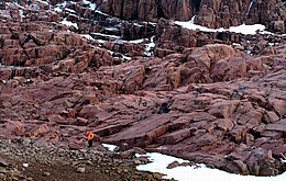 2005 photo of Pim Island | |
 Pim Island  Pim Island | |
| Geography | |
|---|---|
| Location | Northern Canada |
| Coordinates | 78°44′N 074°25′W / 78.733°N 74.417°W |
| Archipelago | Queen Elizabeth Islands Arctic Archipelago |
| Administration | |
Canada | |
| Territory | Nunavut |
| Region | Qikiqtaaluk |
| Demographics | |
| Population | Uninhabited |

Pim Island is separated from Ellesmere Island by Rice Strait, the waterway that connects Rosse Bay to the south and Buchanan Bay to the north.[2] Nares Strait is to the east. Pim Island is 6 kilometres (3.7 mi) from Cocked Hat Island.
History edit
The Adolphus Greely expedition wintered at Camp Clay in 1883,[3] and in 1884, Cape Sabine was the rescue site for Greely and the Lady Franklin Bay Expedition.[4] The island is named in honour of naval officer and barrister Bedford Pim of HMS Resolute.
References edit
- ^ Greely, A. W. (2007). Handbook of Polar Discoveries. Read Books. p. 238. ISBN 978-1-4067-6645-5.
- ^ Dieck, Herman Dieck (1885). The Marvellous Wonders of the Polar World. Philadelphia: Thompson National Pub. Co. pp. 521. OCLC 6878914.
cocked-hat rice's strait.
- ^ Dick, Lyle (2001). Muskox land: Ellesmere Island in the age of contact. University of Calgary Press. p. 281. ISBN 1-55238-050-5.
- ^ Guttridge, Leonard F. (2000-09-01). "Ghosts of Cape Sabine: the harrowing true story of the Greely expedition". Arctic Institute of North America of the University of Calgary. Retrieved 2008-04-14.
External links edit
- Pim Island in the Atlas of Canada - Toporama; Natural Resources Canada