


Summary
This is a list of the National Register of Historic Places listings in Luna County, New Mexico.

This is intended to be a complete list of the properties and districts on the National Register of Historic Places in Luna County, New Mexico, United States. Latitude and longitude coordinates are provided for many National Register properties and districts; these locations may be seen together in a map.[1]
There are 8 properties and districts listed on the National Register in the county, including 1 National Historic Landmark. All of the places within the county on the National Register are also listed on the State Register of Cultural Properties.
This National Park Service list is complete through NPS recent listings posted April 12, 2024.[2]
| Bernalillo – Catron – Chaves – Cibola – Colfax – Curry – De Baca – Doña Ana – Eddy – Grant – Guadalupe – Harding – Hidalgo – Lea – Lincoln – Los Alamos – Luna – McKinley – Mora – Otero – Quay – Rio Arriba – Roosevelt – San Juan – San Miguel – Sandoval – Santa Fe – Sierra – Socorro – Taos – Torrance – Union – Valencia |
Current listings edit
| [3] | Name on the Register[4] | Image | Date listed[5] | Location | City or town | Description |
|---|---|---|---|---|---|---|
| 1 | Deming Armory |  |
April 21, 1983 (#83001624) |
301 S. Silver Ave. 32°15′59″N 107°45′21″W / 32.266389°N 107.755833°W | Deming | Now the Deming Luna Mimbres Museum[6] |
| 2 | Downtown Deming Historic District |  |
September 25, 2013 (#13000769) |
Roughly bounded by Silver Ave., Pine, Maple & Copper Sts. 32°16′02″N 107°45′31″W / 32.26734°N 107.75852°W | Deming | |
| 3 | Seaman Field House |  |
February 20, 1990 (#90000102) |
304 Silver Ave. 32°16′00″N 107°45′27″W / 32.26653°N 107.75739°W | Deming | |
| 4 | Luna County Courthouse and Park |  |
October 5, 1977 (#77000925) |
700 S. Silver Ave. 32°17′21″N 107°45′24″W / 32.289167°N 107.756667°W | Deming | |
| 5 | Mahoney Building |  |
September 30, 1980 (#80002551) |
122 S. Gold[7] 32°16′04″N 107°45′32″W / 32.26767°N 107.75894°W | Deming | |
| 6 | Upton Site | December 9, 1980 (#80002552) |
Address Restricted | Deming | ||
| 7 | US Post Office-Deming Main |  |
February 23, 1990 (#90000139) |
201 W. Spruce St. 32°16′03″N 107°45′37″W / 32.2676°N 107.76028°W | Deming | |
| 8 | Village of Columbus and Camp Furlong | 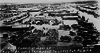 |
May 15, 1975 (#75001164) |
Portions of Columbus and Pancho Villa State Park 31°49′39″N 107°37′50″W / 31.8275°N 107.630556°W | Columbus |
See also edit
References edit
- ^ The latitude and longitude information provided in this table was derived originally from the National Register Information System, which has been found to be fairly accurate for about 99% of listings. Some locations in this table may have been corrected to current GPS standards.
- ^ National Park Service, United States Department of the Interior, "National Register of Historic Places: Weekly List Actions", retrieved April 12, 2024.
- ^ Numbers represent an alphabetical ordering by significant words. Various colorings, defined here, differentiate National Historic Landmarks and historic districts from other NRHP buildings, structures, sites or objects.
- ^ "National Register Information System". National Register of Historic Places. National Park Service. July 9, 2010.
- ^ The eight-digit number below each date is the number assigned to each location in the National Register Information System database, which can be viewed by clicking the number.
- ^ Welcome to the Deming Luna Mimbres Museum, Deming Luna Mimbres Museum, 2003. Accessed 2009-05-31.
- ^ "Walking Tour of Deming". City of Deming, New Mexico. Retrieved 2012-02-03.