


Summary
Vancouver (/vænˈkuːvər/ ⓘ van-KOO-vər) is a city on the north bank of the Columbia River in the U.S. state of Washington, located in Clark County. Founded in 1825 and incorporated in 1857, Vancouver had a population of 190,915 as of the 2020 census,[3] making it the fourth-most populous city in Washington state. Vancouver is the seat of government of Clark County and forms part of the Portland-Vancouver metropolitan area, the 25th-largest metropolitan area in the United States. Originally established in 1825 around Fort Vancouver, a fur-trading outpost, the city is located on the Washington–Oregon border along the Columbia River, directly north of Portland, and is considered a suburb of the city along with its surrounding areas.
Vancouver | |
|---|---|
 Clockwise from top: skyline of Vancouver viewed from the Oregon side of the Columbia River; House of Providence; Old Apple Tree Park; Fort Vancouver; Esther Short Park; Vancouver Barracks | |
|
Logo | |
| Motto(s): A colorful past, a bright future | |
 Location in Washington | |
| Coordinates: 45°37′52″N 122°40′18″W / 45.63111°N 122.67167°W | |
| Country | United States |
| State | Washington |
| County | Clark |
| Founded | 1825 |
| Incorporated | January 23, 1857 |
| Named for | George Vancouver |
| Government | |
| • Type | Council–manager |
| • Body | Vancouver City Council |
| • Mayor | Anne McEnerny-Ogle |
| • City manager | Eric Holmes |
| Area | |
| • City | 52.45 sq mi (135.84 km2) |
| • Land | 48.74 sq mi (126.25 km2) |
| • Water | 3.70 sq mi (9.59 km2) |
| Elevation | 184 ft (56 m) |
| Population | |
| • City | 190,915 |
| • Estimate (2022)[4] | 194,512 |
| • Rank | US: 132nd WA: 4th |
| • Density | 3,784.32/sq mi (1,461.14/km2) |
| • Urban | 2,104,238 (US: 23rd) |
| • Metro | 2,509,489 (US: 25th) |
| Demonym | Vancouverite |
| Time zone | UTC−8 (Pacific (PST)) |
| • Summer (DST) | UTC−7 (PDT) |
| ZIP codes | 98660-98666, 98668, 98682-98687 |
| Area code(s) | 360, 564 |
| FIPS code | 53-74060 |
| GNIS feature ID | 1531916[2] |
| Website | cityofvancouver.us |

Etymology edit
Vancouver shares its name with the larger city of Vancouver in southern British Columbia, Canada, approximately 300 miles (480 km) to the north. Both cities were named after British sea captain George Vancouver, but the US city is older. Vancouver, British Columbia, was incorporated 29 years after the incorporation of Vancouver, Washington, and more than 60 years after the name Vancouver was first used in reference to the historic Fort Vancouver trading post on the Columbia River. City officials have periodically suggested changing the U.S. city's name to Fort Vancouver to reduce confusion with its larger and better-known northern neighbor. Many Pacific Northwest residents distinguish between the two cities by referring to the Canadian city as "Vancouver, B.C." and the United States city as "Vancouver, Washington," or "Vancouver, USA."[5][6][7] Local nicknames include "Vantucky" (though this is often used as a derogatory term)[8][9][10][11][12] and "The 'Couv(e)".[13]
History edit
Early settlements and exploration edit
The Vancouver area was inhabited by several Native American tribes, most recently the Chinook and Klickitat nations, with permanent settlements of timber longhouses.[14] The Chinookan and Klickitat names for the area were reportedly Skit-so-to-ho and Ala-si-kas, respectively, meaning "land of the mud-turtles".[15][16] First known European contact was made by William Robert Broughton in 1792,[17][18] with approximately half of the indigenous population killed by smallpox before the Lewis and Clark Expedition arrived in the area in 1806.[14] Within another fifty years, other diseases such as measles, malaria and influenza had reduced the Chinookan population from an estimated 80,000 "to a few dozen refugees, landless, slaveless and swindled out of a treaty".[14]
19th century beginnings edit

Meriwether Lewis wrote that the Vancouver area was "the only desired situation for settlement west of the Rocky Mountains." The first permanent European settlement did not occur until 1824, when Fort Vancouver was established as a fur trading post of the Hudson's Bay Company. From that time on, the area was settled by both the US and Britain under a "joint occupation" agreement. Joint occupation led to the Oregon boundary dispute and ended on June 15, 1846, with the signing of the Oregon Treaty, which gave the United States full control of the area. Before 1845, American Henry Williamson laid out a large claim west of the Hudson's Bay Company (including part of the present-day Port of Vancouver), called Vancouver City and properly registered his claim at the U.S. courthouse in Oregon City, before leaving for California.[19]: 42 In 1848, Williamson had it surveyed and platted by Peter Crawford. In 1850, Amos Short traced over the claim of Williamson and named the town Columbia City.[20] It changed to Vancouver in 1855. The City of Vancouver was incorporated on January 23, 1857.[21]
Based on an act in the 1859–60 legislature, Vancouver was briefly the capital of Washington Territory, before capital status was returned to Olympia, Washington by a 2–1 ruling of the territory's supreme court, in accordance with Isaac Stevens' preference and concern that proximity to the border with Oregon might give some of the state's influence away to Oregon.[22][23][24]
20th century edit

The neighborhood of Sifton was the terminus of an early electric trolley operated by the Northcoast Power Company that also served nearby Orchards from 1910 until 1926. The trolleys made ten stops and ran once per hour, charging 15 cents each way. A mural in the heart of Orchards depicts the trolley and the rural character of the area at the time it was operating. The community was named after Doctor Sifton, a promoter of the trolley service.[25]
According to the archives of the Vancouver Columbian newspaper, the Orchards-Sifton route ran along Vancouver's Main Street to 26th street (renamed Fourth Plain Blvd), then from 26th to K Street and thence north to 33rd street. From there, it ran on 33rd over Burnt Bridge Creek and past the city limits. At that point the trolley became more like a regular train as it followed a cut through the wilderness. Few houses were seen between Vancouver and Orchards. The public's growing preference for motor cars in the 1920s heralded the end of the trolley.
Separated from Oregon until 1917, when the new Interstate Bridge began to replace ferries, Vancouver had three shipyards just downstream which produced ships for World War I before World War II brought an enormous economic boom. An Alcoa aluminum plant opened on September 2, 1940, using inexpensive power from the nearby New Deal hydropower turbines at Bonneville Dam. After the bombing of Pearl Harbor, Henry Kaiser opened a shipyard next to the U.S. Army base, which by 1944 employed as many as 36,000 people in a twenty-four hours a day, seven days a week production of Liberty ships, landing ship tanks, and escort carriers. This influx of shipyard workers boosted the population from 18,000 to over 80,000 in just a few months, leading to the creation of the Vancouver Housing Authority and six new residential developments: Fruit Valley, Fourth Plain Village, Bagley Downs, Ogden Meadows, Burton Homes and McLoughlin Heights. Each of these was later incorporated into the city, and are well-known neighborhoods, while the neighboring "shipyard city" of Vanport, Oregon, would be destroyed by the Memorial Day flood of 1948.[citation needed]
Vancouver has experienced conflicts with other Clark County communities because of rapid growth in the area. [citation needed] The city's first annexation more than doubled its size in 1909, with the largest annexation of 1997 adding 11,258 acres (45.56 km2) and 58,171 residents.[26] As a result of urban growth and the 1997 annexation, Vancouver is often thought of as split between two areas, [citation needed] East and West Vancouver, divided by NE Andresen Road. West Vancouver is home to downtown Vancouver and most of the more historical parts of the city, as well as recent high-density mixed-use development. East Vancouver includes the communities of Cascade Park East and West, which had populations of 6,996 and 6,956 in 1990, before annexation.
21st century edit
More than one-third of the Vancouver urban area's population lives in unincorporated urban areas north of the city limits, including the communities of Hazel Dell, Felida, Orchards and Salmon Creek. If county leaders had approved another major annexation plan in 2006, Vancouver would have passed Tacoma and Spokane to become the state's second-largest city.[27]
Military presence edit
During 1852–54, future United States President Ulysses S. Grant, then a captain in the U.S. Army, was quartermaster at what was then known as Columbia Barracks. Soon after leaving Vancouver, Grant resigned from the army and did not serve again until the outbreak of the American Civil War in 1861. Other notable generals to have served in Vancouver include George B. McClellan, Philip Sheridan, Oliver O. Howard and 1953 Nobel Peace Prize recipient George C. Marshall.[28]
Army presence in Vancouver was very strong, as the Department of the Columbia built and moved to Vancouver Barracks, the military reservation for which stretched from the river to what is currently Fourth Plain Boulevard and was the largest Army base in the region until surpassed by Fort Lewis, 120 miles (190 km) to the north. Built on the old company gardens and skirmish range, Pearson Army Field (later Pearson Field) was a key facility, and at one point the US Army Signal Corps operated the largest spruce cut-up plant in the world to provide much-needed wood for airplanes. Vancouver became the end point for two ultra-long flights from Moscow, USSR, over the North Pole. The first of these flights was performed by Valery Chkalov in 1937 on a Tupolev ANT-25RD airplane. Chkalov was originally scheduled to land at an airstrip on Swan Island in nearby Portland, Oregon, but was redirected at the last minute to Vancouver's Pearson Airfield. In June 1975, a monument was dedicated commemorating the event near State Highway 14, then moved to the north side of Pearson Field in 1987. Chkalov Drive, in east Vancouver, was named in his honor.
Geography edit

Vancouver is located just north of the Columbia River and the Oregon border, just west of where the Columbia River Gorge bisects the volcanic Cascade Range and just east of where the Willamette River enters the Columbia. The city of Vancouver is in the Western Lowlands region of Washington. When clouds do not blanket the Puget–Willamette trough formed by the Cascade and Coast Range, Mount Hood, Mount St. Helens, Mount Rainier, Mount Jefferson and Mount Adams are all visible from Vancouver.
According to the United States Census Bureau, the city has a total area of 49.86 sq mi (129.14 km2), of which 46.46 sq mi (120.33 km2) is land and 3.4 sq mi (8.81 km2) is water.[29]
Climate edit
Vancouver lies just north of Portland, Oregon, with which it shares a similar climate. Both are classified as warm-summer Mediterranean (Csb) on the Köppen climate classification, but with certain key differences. High pressures east of the Cascade Range create something of a venturi effect, leading to cold east winds down the Columbia River Gorge. Unsheltered by the Willamette Valley, Vancouver has historically seen colder temperatures, including "silver thaw" storms where freezing rain cakes limbs and power lines. Such storms can paralyze Vancouver. This occasionally freezes the river, and in 1916 cut electric power in the city for almost two weeks. Rainfall occurs frequently throughout the fall, winter, and spring, but ceases around the middle of June, with dry and warm weather lasting through September. Average annual precipitation is 42 in (1,100 mm). Heavy snowfalls are infrequent and snow often falls and doesn't stick, with major snowstorms only occurring every 2–4 years. Close proximity to the river was also a concern for flooding, before dams constricted the river, destroying features such as Celilo Falls. Periodic floods have been a nuisance, with two of the most destructive occurring in June 1894 and May 1948. The 1948 Columbia River flood almost topped the Interstate Bridge's support piers and completely destroyed nearby Vanport, Oregon. Other unusual storms include the Columbus Day Storm of 1962 and an April 5, 1972, tornado which rated F3 on the Fujita scale, striking a local school. An EF1 tornado struck on January 10, 2008, just after noon, causing moderate damage along a two-mile (3.2 km) path from Vancouver Lake to the unincorporated Hazel Dell area.[citation needed]
Because many Vancouver residents work in Portland, there is typically significant rush-hour traffic congestion on two bridges that cross the Columbia River – the Interstate Bridge and the Glenn Jackson Bridge. In 2017 there were 297,932 weekday vehicle crossings on the two bridges.[30]
| Climate data for Vancouver, Washington (1991–2020 normals, extremes 1891–present) | |||||||||||||
|---|---|---|---|---|---|---|---|---|---|---|---|---|---|
| Month | Jan | Feb | Mar | Apr | May | Jun | Jul | Aug | Sep | Oct | Nov | Dec | Year |
| Record high °F (°C) | 66 (19) |
73 (23) |
83 (28) |
90 (32) |
99 (37) |
115 (46) |
108 (42) |
105 (41) |
103 (39) |
90 (32) |
72 (22) |
65 (18) |
115 (46) |
| Mean maximum °F (°C) | 57.9 (14.4) |
60.7 (15.9) |
69.6 (20.9) |
78.4 (25.8) |
86.7 (30.4) |
91.0 (32.8) |
96.1 (35.6) |
96.8 (36.0) |
91.1 (32.8) |
77.1 (25.1) |
63.8 (17.7) |
58.3 (14.6) |
99.5 (37.5) |
| Mean daily maximum °F (°C) | 47.0 (8.3) |
51.0 (10.6) |
56.1 (13.4) |
61.2 (16.2) |
68.3 (20.2) |
73.5 (23.1) |
80.9 (27.2) |
81.6 (27.6) |
75.8 (24.3) |
63.7 (17.6) |
53.0 (11.7) |
46.5 (8.1) |
63.2 (17.3) |
| Daily mean °F (°C) | 40.7 (4.8) |
43.1 (6.2) |
47.2 (8.4) |
51.7 (10.9) |
58.3 (14.6) |
63.3 (17.4) |
69.0 (20.6) |
69.4 (20.8) |
63.9 (17.7) |
54.2 (12.3) |
46.2 (7.9) |
40.8 (4.9) |
54.0 (12.2) |
| Mean daily minimum °F (°C) | 34.4 (1.3) |
35.1 (1.7) |
38.4 (3.6) |
42.2 (5.7) |
48.2 (9.0) |
53.0 (11.7) |
57.1 (13.9) |
57.2 (14.0) |
52.0 (11.1) |
44.8 (7.1) |
39.4 (4.1) |
35.0 (1.7) |
44.7 (7.1) |
| Mean minimum °F (°C) | 22.0 (−5.6) |
22.5 (−5.3) |
27.3 (−2.6) |
31.8 (−0.1) |
36.8 (2.7) |
43.9 (6.6) |
48.3 (9.1) |
48.0 (8.9) |
41.7 (5.4) |
32.3 (0.2) |
25.9 (−3.4) |
21.4 (−5.9) |
16.8 (−8.4) |
| Record low °F (°C) | −8 (−22) |
−3 (−19) |
18 (−8) |
24 (−4) |
28 (−2) |
34 (1) |
37 (3) |
35 (2) |
28 (−2) |
21 (−6) |
6 (−14) |
−10 (−23) |
−10 (−23) |
| Average precipitation inches (mm) | 5.34 (136) |
3.77 (96) |
3.95 (100) |
2.93 (74) |
2.51 (64) |
1.61 (41) |
0.42 (11) |
0.52 (13) |
1.43 (36) |
3.41 (87) |
5.51 (140) |
6.07 (154) |
37.47 (952) |
| Average snowfall inches (cm) | 0.8 (2.0) |
1.1 (2.8) |
0.4 (1.0) |
0.0 (0.0) |
0.0 (0.0) |
0.0 (0.0) |
0.0 (0.0) |
0.0 (0.0) |
0.0 (0.0) |
0.0 (0.0) |
0.0 (0.0) |
0.5 (1.3) |
2.8 (7.1) |
| Average precipitation days (≥ 0.01 in.) | 19.9 | 15.8 | 18.0 | 17.4 | 12.6 | 9.1 | 3.7 | 3.5 | 7.1 | 14.7 | 19.1 | 20.3 | 161.2 |
| Average snowy days (≥ 0.1 in.) | 0.3 | 0.8 | 0.2 | 0.0 | 0.0 | 0.0 | 0.0 | 0.0 | 0.0 | 0.0 | 0.0 | 0.5 | 1.4 |
| Source: NOAA (snowfall and snowy days 1981-2010)[31] | |||||||||||||
Demographics edit
| Census | Pop. | Note | %± |
|---|---|---|---|
| 1880 | 1,722 | — | |
| 1890 | 3,545 | 105.9% | |
| 1900 | 3,126 | −11.8% | |
| 1910 | 9,300 | 197.5% | |
| 1920 | 12,637 | 35.9% | |
| 1930 | 15,766 | 24.8% | |
| 1940 | 18,788 | 19.2% | |
| 1950 | 41,664 | 121.8% | |
| 1960 | 32,464 | −22.1% | |
| 1970 | 41,859 | 28.9% | |
| 1980 | 42,834 | 2.3% | |
| 1990 | 46,380 | 8.3% | |
| 2000 | 143,560 | 209.5% | |
| 2010 | 161,791 | 12.7% | |
| 2020 | 190,915 | 18.0% | |
| 2022 (est.) | 194,512 | [4] | 1.9% |
| U.S. Decennial Census[32] 2020 Census[3] | |||
2020 census edit
As of the 2020 census, there were 190,915 people, and 75,663 households in the county.[3] The population density was 3,917.2/sq mi.The racial makeup of the city was 76.5% White, 2.3% African American, 0.6% Native American, 5.5% Asian, 1.6% Pacific Islander, and 9.1% from two or more races. Hispanic or Latino people of any race were 14.7% of the population.[3]
The average household size was 2.46 people.[3]
22.1% of the population were under 18, and 6.2% were under 5. 15.7% of people were older than 65. The gender makeup of the city was 50.6% female, and 49.4% male.[3]
The median household income was $67,462, but the per capita income was $36,053. 12.7% of the population was below the poverty line.[3]
The ancestry of the city is 16.1% German, 10.9% English, 9.7% Irish, 3.9% Norwegian, 2.9% Italian, 2.8% French,1.5% Polish, and 0.7% Subsaharan African.[3]
| Race / Ethnicity (NH = Non-Hispanic) | Pop 2000[33] | Pop 2010[34] | Pop 2020[35] | % 2000 | % 2010 | % 2020 |
|---|---|---|---|---|---|---|
| White alone (NH) | 117,958 | 123,347 | 126,109 | 82.17% | 76.24% | 66.06% |
| Black or African American alone (NH) | 3,482 | 4,525 | 5,914 | 2.43% | 2.80% | 3.10% |
| Native American or Alaska Native alone (NH) | 1,222 | 1,252 | 1,282 | 0.85% | 0.77% | 0.67% |
| Asian alone (NH) | 6,423 | 8,039 | 10,198 | 4.47% | 4.97% | 5.34% |
| Pacific Islander alone (NH) | 747 | 1,527 | 3,309 | 0.52% | 0.94% | 1.73% |
| Other race alone (NH) | 206 | 242 | 959 | 0.14% | 0.15% | 0.50% |
| Mixed Race or Multi-Racial (NH) | 4,487 | 6,103 | 12,603 | 3.13% | 3.77% | 6.60% |
| Hispanic or Latino (any race) | 9,035 | 16,756 | 30,541 | 6.29% | 10.36% | 16.00% |
| Total | 143,560 | 161,791 | 190,915 | 100.00% | 100.00% | 100.00% |
2010 census edit
As of the 2010 census, there were 161,791 people, 65,691 households, and 40,246 families residing in the city. The population density was 3,482.4/sq mi (1,344.6/km2). There were 70,005 housing units at an average density of 1,506.8/sq mi (581.8/km2). The racial makeup of the city was 80.9% White, 2.9% African American, 1.0% Native American, 5.0% Asian, 1.0% Pacific Islander, 4.3% from other races, and 4.8% from two or more races. Hispanic or Latino people of any race were 10.4% of the population.
There were 65,691 households, of which 31.9% had children under the age of 18 living with them, 42.6% were married couples living together, 13.2% had a female householder with no husband present, 5.5% had a male householder with no wife present, and 38.7% were non-families. 30.0% of all households were made up of individuals, and 9.9% had someone living alone who was 65 years of age or older. The average household size was 2.43 and the average family size was 3.02.
The median age in the city was 35.9 years. 24% of residents were under the age of 18; 9.4% were between the ages of 18 and 24; 28.9% were from 25 to 44; 25.3% were from 45 to 64; and 12.4% were 65 years of age or older. The gender makeup of the city was 48.8% male and 51.2% female.
2000 census edit
As of the 2000 census, there were 143,560 people, 56,628 households, and 36,298 families living in the city. The population density is 3,354.7 people per square mile (1,295.3 people/km2). There were 60,039 housing units at an average density of 1,403.0 units per square mile (541.7 units/km2). According to the 2010 US Census, The racial makeup of the city was 76.2% White, 2.9% African American, 1.0% Native American, 5.0% Asian, 1.0% Pacific Islander, and 4.80% from two or more races. Hispanic or Latino people of any race were 10.4% of the population. 16.4% were of German, 9.2% English, 8.4% Irish and 7.9% American ancestry. 89.2% spoke English, 5.1% Spanish, 3.2% Russian, 1.4% Ukrainian and 1.1% Vietnamese at home.
There were 56,628 households, out of which 33.4% had children under the age of 18 living with them, 47.3% were married couples living together, 12.1% had a female householder with no husband present, and 35.9% were non-families. 27.6% of all households were made up of individuals, and 8.3% had someone living alone who was 65 years of age or older. The average household size was 2.50 and the average family size was 3.06.
In the city, 26.7% of the population was under the age of 18, 9.8% was from 18 to 24, 32.1% from 25 to 44, 20.6% from 45 to 64, and 10.7% was 65 years of age or older. The median age was 33 years. For every 100 females, there were 96.9 males. For every 100 females age 18 and over, there were 93.8 males.
The median income for a household in the city was $41,618, and the median income for a family was $47,696. Males had a median income of $37,306 versus $26,940 for females. The per capita income for the city was $20,192. 9.4% of families and 12.2% of the population were below the poverty line, including 16.1% of those under the age of 18 and 8.2% of those 65 and older.
Economy edit

The Vancouver economy is characterized by border economics with neighboring Portland, Oregon. The state of Washington levies no individual or corporate income taxes and levies a property tax below the national average and a sales tax above the national median.[36] The State of Oregon has even lower property taxes and no sales tax but one of the highest state income taxes.[37] As a result, many Vancouver residents prefer to shop in neighboring Portland where they do not pay sales taxes,[38] then live and work in Vancouver where they do not pay state income tax (though Washington residents who work in Oregon must pay Oregon income tax.) For the same reasons, the city is popular with retirees. Conversely, the city is less favored by students and young adults.[citation needed] In 2003, 70% of workers in Vancouver worked in Clark County. There is a risk in sales tax avoidance because Washington has a use tax due on all purchases made in Oregon that are then returned to Washington. Vancouver residents "shop at their own risk" when attempting to avoid the sales tax in Washington, although the rule is rarely, if ever, enforced[citation needed] except for purchases requiring registration, such as motor vehicles.
The taxation and demographics of the area depresses the retail sector of Vancouver's economy.[citation needed] Oregon has stricter development laws to protect the timber industry;[citation needed] therefore, Vancouver tends to attract a higher proportion of the region's sprawling development. The voting base also led to rejection of extension of Portland's light-rail system into the city for several years.[citation needed] In 2013, Washington transitioned away from being a control state.
The economic history of Vancouver reflects the region. Moving from a salmon- and trade-based indigenous economy by the Chinook people, the Hudson's Bay Company pioneered extractive industries such as the fur trade and timber. Subsistence agricultural gave way to market and export crops such as apples, strawberries and prunes. Largely bypassed by the railroad in the 1880s, when the Oregon Steam Navigation company would ferry trains across the river downstream from St. Helens, Oregon to Kalama, Washington, early downtown development was focused around Washington Street (where ferries arrived), lumber and Vancouver Barracks activities such as a large spruce mill for manufacturing airplanes. A 1908 railroad swing bridge across the Columbia allowed greater industrial developments such as the Standifer Shipyard during the first world war.[39] With the Interstate Bridge and Bonneville Dam Vancouver saw an industrial boom in the 1940s, including the Kaiser shipyard and Alcoa, as well as a Boise Cascade paper mill, just west of the Interstate Bridge.[19]
As the old-growth forests were depleted and heavy industry left the United States, Vancouver's economy largely changed to high tech and service industry jobs, with many residents commuting to Portland. Vancouver contains the corporate headquarters for Nautilus, Inc., ZoomInfo, Papa Murphy's Pizza and The Holland (parent company of the Burgerville restaurant chain).[40]
The Port of Vancouver USA operates a port on the Columbia River, which separates Oregon to the south and Washington to the north. It handles over 400 ocean-going vessels annually, as well as a number of barges which ply the river and its tributaries as far as Lewiston, Idaho.
The Vancouver Energy project was a proposed crude oil transport hub in the Port of Vancouver USA. It was estimated to produce the equivalent of $1.6 billion in employment income during the terminal's construction and for its first 15 years of operation.[41] Vancouver Energy ended its bid to build the hub in February 2018 following Governor Jay Inslee's rejection of the project.[42]
In 2017, there were 4,550 employer firms.[43] 2,143 of these firms were shown to be owned by men, and 943 were shown to be owned by women. 556 of the firms were shown to be owned by minorities, and 3,234 were not shown to be owned by minorities. 241 of these firms were owned by veterans.[43]
Largest employers edit
According to the city's 2022 Comprehensive Annual Financial Report,[44] the largest employers in the city are:

| # | Employer | # of employees |
|---|---|---|
| 1 | PeaceHealth | 16,500 |
| 2 | Vancouver Public Schools | 2,957 |
| 3 | Evergreen Public Schools | 2,203 |
| 4 | Vancouver Clinic | 1,452 |
| 5 | Battle Ground Public Schools | 1,380 |
| 6 | SEH America Inc. | 867 |
| 7 | Dick Hannah Dealerships | 659 |
| 8 | Columbia Machine Inc. | 535 |
| 9 | Tapani Inc. | 500 |
| 10 | Clark County Public Transportation Benefit | 431 |
Downtown revitalization edit


In 1997, the city of Vancouver decided to dedicate the next 15–20 years to redeveloping and revitalizing the downtown core, west of I-5 and south of Evergreen Boulevard. The first projects started in the early 2000s with the construction of many tall condominium structures around Esther Short Park. The most lauded outside investment was the construction of a Hilton hotel directly across from the park.[citation needed] The Downtown redevelopment of Vancouver continued after a slowdown during the 2009–2012 recession. Numerous projects began to rise up around the city core and as of mid-2020 more than three dozen projects with mid-rise or high-rise structures were completed, under construction, or proposed.[45][46]
In 2016 the first ground was broken[47] for the $1.5 billion, 21-block redevelopment of Vancouver's waterfront at the former site of Boise Cascade Paper Mill. The site had been inaccessible to the public for more than 100 years.[citation needed] The project was planned for 3,300 residential units, and roughly 1 million square feet of office and retail space.[48] Around 15,000 people were in attendance for the official grand opening, in 2018, of the project and associated public space including Grant Street Pier, a cable-stayed viewing deck that extends out over the Columbia River.[49][50]
The Redevelopment of Terminal One master plan was approved by the city council in 2017.[51] This $500 million project will include multiple phases over several years including a seven-story AC Marriott hotel that began site preparation and construction in late 2019.[52] Future plans in the master plan called for a mixed-use complex of mid-rise buildings on four blocks and a complete rebuild of the original 100-year Terminal One dock and pier. A public open-air market is also planned.
The Columbian newspaper moved to a new seven-story office building adjacent to the Hilton in 2008. Two years later, The Columbian filed for Chapter 11 bankruptcy and the building defaulted to Bank of America. In June 2010, the City of Vancouver agreed to purchase the office building for use as a new city hall for $18.5 million, a fraction of the $41.5 million sale price the owners of The Columbian office building had been asking prior to filing for bankruptcy. In 2011, the city consolidated five separate buildings housing 300 employees into the new building, located at 415 W. 6th Street. The move saved the city approximately $1 million a year in facility lease and maintenance costs.[53]
The Fort Vancouver Regional Library District opened a new library on C Street at Evergreen Boulevard in 2011. Future plans on C Street include a new Marriott hotel and roughly 250 new condominiums.

Government edit
Vancouver relies on a council–manager form of government composed of seven city council members including a non-partisan mayor's office. The mayor and council members serve four year terms. As is common in council-manager municipal government, the council oversees legislative issues such as local ordnances, while executive and administrative leadership is carried out by a city manager hired by the council. Vancouver also serves as the seat of Clark County and its associated county manager and council.
Arts and culture edit

In the early 2000s, Vancouver began seeing a revitalization of the local arts scene and cultural events. In 2010 there was a movement among local artists to form cooperatives and meet with established local gallery owners for a monthly forum known as "Art Conversations". Many of Vancouver's art galleries are located in downtown Vancouver, and in 2014, the City Council formally designated an "Arts District" in the downtown core.[54]
The Kiggins Theatre located within the Downtown Vancouver Art District, was built in 1936 by architect Day Hillborn. It was named for J.P. Kiggins, an entrepreneur and politician who cut a swath through town in the early 20th century, serving as Vancouver's mayor for 15 non-consecutive years between 1908 and 1935. It was renovated and reopened in 2011 as an independent film and community event venue.
The Vancouver Symphony Orchestra first formed in the late 1970s. Conducted and directed by Dr. Salvadore Brotons, the Symphony regularly performs concerts.[55]
Annual events edit
Every June since 2006, the Recycled Arts Festival held in Esther Short Park has featured the work of dozens of artists whose creations are made from at least 75% reused or recycled materials, along with live music and food.[56]
Since the mid-1960s, Vancouver hosted a Fourth of July fireworks display on the grounds of Fort Vancouver National Historic Site that draws many people to the city. The display routinely ran to 45 minutes, attracted up to 60,000 visitors and was broadcast on area television, one of the largest west of the Mississippi River. Due to the death of key organizer "Mister Fireworks" Jim Larson and a poor economy, the show was not held in 2009.[57] A shorter, redesigned show debuted in 2010 and brought in approximately 35,000 people.[58] As of 2019, The Historic Trust (formerly the "Fort Vancouver National Trust"[59]) continues to organize the fireworks event.[60] The fireworks were not held in 2020 or 2021 due to COVID-19.[61]
4 Days of Aloha, also known as the Hawaiian Festival, takes place in late July in Esther Short Park, Clark College, and Fort Vancouver. Started in 2012 by "Aunty" Deva Yamashiro, a hula dancer and self-appointed cultural ambassador for Hawaii, the festival features live music, dance performances, craft workshops, and a celebration of Hawaiian food, arts, and culture.[62]
Late August features the Vancouver Wine and Jazz Festival in Esther Short Park, which brought 13,500 attendees in 2012 and which is considered the largest jazz festival in the Pacific Northwest.[63][64]
Architecture and notable buildings edit

Mother Joseph was one of the first architects in the region, and because of its relatively long history, Vancouver contains a variety of buildings.[citation needed] Homes vary from Victorians and craftsman bungalows downtown, to small wartime tract housing and ranch-styles mid-town, with rural styles and larger homes in the outer ring. In addition to the reconstructed Fort Vancouver at the Fort Vancouver National Historic Site, the city was named one of the National Register of Historic Places' "Dozen Distinctive Destinations" for 2003.[65]
Other notable buildings in Vancouver include:
- The Covington House at 4201 Main Street, a log cabin and boarding school built 1846–1848
- Officers Row, including the Grant House (first house on the Columbia Barracks) and the Queen Anne-style 1866 Marshall House
- Mother Joseph's Providence Academy, dedicated in 1873, where Evergreen Boulevard crosses Interstate 5
- The Proto-Cathedral of St. James the Greater (formerly St. James Church) saw its first Roman Catholic Mass celebrated August 16, 1885
- The Carnegie library at Sixteenth and Main, which opened on New Year's Eve 1909, to showcase its unusual electric lights; it is now the site of the Clark County Historical Museum
- The 1914 Chicago-style U.S. National Bank (now the Heritage Building) at sixth and Main
- The 1916 U.S. Post Office at 1211 Daniels Street
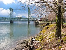
- The vertical-lift Interstate Bridge, which opened on February 14, 1917, Oregon's 58th anniversary
- The 1935 art deco telephone exchange building at Eleventh and Washington
- The 1941 Clark County Courthouse, designed by prolific local architect Day Hillborn
- Smith Tower, a round downtown apartment building for the elderly, built in 1965
- The Hilton Hotel and Vancouver Convention Center across from Esther Short Park
Many of these buildings have been repurposed. The 1867 Slocum House, an Italianate villa-style residence originally built one block south of its current location in Esther Short Park, was moved to its present location in 1966 and now houses a winery and art gallery.[66] The Carnegie Library was expanded in the 1940s, becoming the Clark County Historical Museum after a new library was built in 1963. Other buildings have been torn down for urban renewal or renovated to house professional offices for lawyers and accountants.
Education edit


Public schools edit
Vancouver has two school districts: Vancouver Public Schools and Evergreen School District.
The Vancouver Public Schools cover most of west Vancouver and has seven high schools: Hudson's Bay High School, Columbia River High School, Fort Vancouver High School, Lewis and Clark High School, Skyview High School, Vancouver School of Arts and Academics, and Vancouver iTech Preparatory (grades 6–12). It also has six middle schools: Alki Middle School, Discovery Middle School, Gaiser Middle School, Jason Lee Middle School, Thomas Jefferson Middle School, and McLoughlin Middle School.
Vancouver Public Schools' elementary schools include Sarah J. Anderson, Chinook, Eisenhower, Felida, Ben Franklin, Fruit Valley Community Learning Center, Harney, Hazel Dell, Hough, Martin Luther King, Lake Shore, Lincoln, Marshall, Minnehaha, Peter S. Ogden, Eleanor Roosevelt, Sacajawea, Salmon Creek, Truman, Walnut Grove, and Washington.
The Evergreen School District covers most of east Vancouver and has seven high schools: Evergreen High School, Mountain View High School, Henrietta Lacks Health and Bioscience High School, Heritage High School, Union High School, Legacy High School, and Cascadia Technical Academy (formerly Clark County Vocational Skills Center).[67]
The district has six middle schools: Cascade, Covington, Frontier, Pacific, Shahala, and Wy'East.
Evergreen School District's 21 elementary schools are: Burton, Burnt Bridge Creek, Columbia Valley, Crestline, Ellsworth, Emerald, Endeavour, Fircrest, Fisher's Landing, Harmony, Hearthwood, Illahee, Image, Marrion, Mill Plain, Orchards, Pioneer, Riverview, Sifton, Silver Star, Sunset, and York.
Vancouver is also home to the Washington School for the Deaf and Washington School for the Blind, and (through Evergreen School District) Home Choice Academy, for home-schoolers.
Colleges and universities edit
Media edit
Vancouver is located within the Portland media market for print, radio, and television media. It does, however, serve as the hometown for some media, including The Columbian, the Portland, Oregon newspaper The Oregonian that covers some southwest Washington news, and The Vancouver Voice which was southwest Washington's only alternative periodical for a time, and published from 2006 to 2011.
Infrastructure edit
Transportation edit

Vancouver has two interstate freeways, I-5 and I-205, both of which run north–south, across the Columbia River into Portland and toward Seattle. It also has two heavily travelled state highways within the city limits. SR 14 begins at I-5 in downtown Vancouver and makes its way east. It is a freeway all the way until Camas. SR 500 begins from I-5 at 39th Street in north Vancouver, travels east connecting with I-205, and continues east into the suburb of Orchards where the freeway terminates at Fourth Plain Boulevard, and meets with the south end of north–south-oriented 117th Ave., SR 503. A third state highway, SR 501, starts at I-5 and heads west through downtown and continues along a path that runs between the Columbia River and Vancouver Lake.
The area's mass transit system is C-Tran, the Clark County Public Transportation Benefit Area Authority, which operates 135 buses, vanpools, and paratransit vehicles. There are also a number of express routes into Portland's downtown.
There have been multiple discussions about extending Portland's Max Light Rail system into Vancouver. In 1995, Clark County voters rejected a ballot measure that would have funded a light rail extension north into Vancouver.[68] Opposition to paying for light rail was strong at that time, but slowly declined over the following several years, eventually leading Vancouver officials to begin discussing the idea again.[69][70] Meanwhile, TriMet reconstituted its planned MAX line to Vancouver as a shorter line running only within Portland, which could potentially be extended across the river and into Clark County at a later date. This extension of the MAX system opened in 2004 as the Yellow Line,[71] running as far north as the Portland Expo Center, approximately 1 mile (2 km) south of downtown Vancouver. In 2012, Vancouver voters rejected a sales tax proposal to fund light rail operations in connection with the Columbia River Crossing proposal.[72] In 2022, Interstate Bridge Replacement Program includes a new proposal for a light rail extension into downtown Vancouver.[73]
Vancouver has always been well served by rail; current freight railroads operating in Vancouver include the BNSF, Union Pacific, and the local shortline Lewis and Clark Railway. Amtrak, the national passenger rail system, provides service to Vancouver Station. The long-distance Coast Starlight and Empire Builder serve the city, as well as the regional Amtrak Cascades.
Pearson Field, located near downtown Vancouver, is the main airport serving the city. The airport is intended primarily for general aviation without any commercial air service. The nearest commercial airport is Portland International Airport (PDX).
In 2008, Vancouver passed a citywide law requiring anyone on a wheeled device such as a bicycle, skateboard, scooter or skates to wear a helmet while on any sidewalk, street, trail or other public property. Many local cyclists opposed the law as a misuse of city funds and police efforts, as well as encroachment on personal freedoms. Despite opposition from the public, the Vancouver City Council passed the measure 5–1 with then Mayor Royce Pollard saying, "...statistics be damned. I support this."[74][75]
Notable people edit
Sister cities edit
Vancouver has one sister city:[76]
Vancouver previously had a sister-city relationship with Arequipa, Peru, between 1961 and 1993, but that relationship ended.[77]
References edit
- ^ "2020 U.S. Gazetteer Files". United States Census Bureau. Retrieved July 24, 2022.
- ^ a b U.S. Geological Survey Geographic Names Information System: Vancouver, Washington
- ^ a b c d e f g h i "Explore Census Data". United States Census Bureau. Retrieved December 6, 2023.
- ^ a b "City and Town Population Totals: 2020-2022". United States Census Bureau. December 6, 2023. Retrieved December 6, 2023.
- ^ "Visit Vancouver: Tourism up, waterfront will draw". The Columbian. Archived from the original on May 15, 2018. Retrieved May 29, 2018.
- ^ "Gramor Development, Inc. Signs Major Office Tenant with Chicago Title & Fidelity National Title: Longtime Vancouver business secures 10,000+ square feet lease on second floor of Block 6 East at The Waterfront". Business Wire. February 6, 2018. Archived from the original on June 12, 2018. Retrieved May 29, 2018.
- ^ "M/V Interlink Amenity calls the Port of Vancouver USA on her maiden voyage". American Journal of Transportation. Archived from the original on June 12, 2018. Retrieved May 29, 2018.
- ^ Robison, Peter (March 29, 2012). "Fisher Lured to Washington Woods Offering Tax Haven". Bloomberg Businessweek. Archived from the original on June 25, 2015. Retrieved March 29, 2012.
- ^ "Vantucky meets Tin Pan Alley". vanvoice.com. June 1, 2009. Archived from the original on June 1, 2009. Retrieved May 10, 2012.
- ^ "Cafe offers 'Vantucky Strikes Back' T-shirts, humor along with coffee". The Oregonian. May 17, 2011. Archived from the original on October 11, 2018. Retrieved June 5, 2011.
- ^ "Portland's wacky and wonderful neighboring cities". Stumped in Stumptown. March 29, 2011. Archived from the original on March 25, 2012. Retrieved June 5, 2011.
- ^ Jayne, Greg (June 5, 2011). "Maneuver by council makes county look like Podunkville (commentary)". The Columbian. Archived from the original on July 2, 2011. Retrieved June 5, 2011.
Because part of the impact of bringing professional baseball to town would be in helping Vancouver to shed its image as Podunkville. As Vantucky. As a sleepy little burg that is a suburb of Portland.
- ^ "Welcome To The 'Couv". Wweek.com. March 21, 2007. Archived from the original on January 15, 2010. Retrieved May 10, 2012.
- ^ a b c "History of Vancouver – Early Northwest Native People". City of Vancouver. Archived from the original on May 15, 2013. Retrieved July 12, 2013.
- ^ Smith, Roxann Gess. "– Native Sons 1900". Gesswhoto.com. Archived from the original on February 26, 2020. Retrieved May 10, 2012.
- ^ Native Sons of Oregon (1901). "The Oregon Native Son". Oregon Native Son and Historical Magazine. 2. Native Son Publishing Company: 324. OCLC 7748147. Retrieved November 6, 2019.
Called by the Chinooks Skit-so-to-ho, and Ala-si-kas by the Klikitats. Its meaning is "place of mud-turtles."
- ^ "George Vancouver and William Broughton, 1792". Columbia River Images. Archived from the original on February 17, 2020. Retrieved February 14, 2020.
- ^ "Vancouver and the Columbia River - Our History, page 1". City of Vancouver Washington. Archived from the original on March 8, 2021. Retrieved February 14, 2020.
- ^ a b Jollata, Pat (2004). Images of America: Downtown Vancouver. Arcadia Publishing. ISBN 0-7385-2959-1.
- ^ Olson, Jerry (March 30, 2014). "GLO Surveyor Personal Notes" (PDF). Washington State Department of Archaeology and Historic Preservation. Archived (PDF) from the original on August 27, 2019. Retrieved August 29, 2019.
- ^ Jollota, Pat (August 7, 2009). "Vancouver – Thumbnail History". Archived from the original on October 19, 2016. Retrieved November 6, 2019.
- ^ "Single Vote Robbed Vancouver of State Capitol". The Columbian. Archived from the original on September 27, 2007. Retrieved November 18, 2007.
- ^ Oldham, Kit (January 15, 2003). "Governor Isaac Stevens selects Olympia as capital of Washington Territory on November 28, 1853". HistoryLink.org. Archived from the original on December 5, 2007. Retrieved November 18, 2007.
- ^ "Senate Resolution 8636" (PDF). Washington State Legislature. 2005. Archived from the original (PDF) on February 21, 2017. Retrieved November 6, 2019.
- ^ Meany, Edmond S. (1923). Origin of Washington geographic names. Seattle: University of Washington Press. p. 270. Archived from the original on March 8, 2021. Retrieved January 17, 2020.
- ^ "Vancouver's annexation history – Annexation – Building, Planning & Environment – City of Vancouver, Washington, USA". October 5, 2006. Archived from the original on October 5, 2006.
- ^ "Annexation Would Make Vancouver State's Second Largest City". komotv.com. December 23, 2005. Archived from the original on December 26, 2005. Retrieved May 10, 2012.
- ^ "About Vancouver's 150th Anniversary". City of Vancouver. Archived from the original on September 27, 2007. Retrieved November 18, 2007.
- ^ "US Gazetteer files 2010". United States Census Bureau. Archived from the original on January 25, 2012. Retrieved December 19, 2012.
- ^ "Columbia River Bridges". Southwest Washington Regional Transportation Council. Archived from the original on February 7, 2019. Retrieved November 6, 2019.
- ^ "NOWData - NOAA Online Weather Data". NOAA. Archived from the original on February 17, 2020. Retrieved July 22, 2020.
- ^ United States Census Bureau. "Census of Population and Housing". Retrieved June 4, 2016.
- ^ "P004: Hispanic or Latino, and Not Hispanic or Latino by Race – 2000: DEC Summary File 1 – Vancouver city, Washington". United States Census Bureau. Retrieved February 25, 2024.
- ^ "P2: Hispanic or Latino, and Not Hispanic or Latino by Race – 2010: DEC Redistricting Data (PL 94-171) – Vancouver city, Washington". United States Census Bureau. Retrieved February 25, 2024.
- ^ "P2: Hispanic or Latino, and Not Hispanic or Latino by Race – 2020: DEC Redistricting Data (PL 94-171) – Vancouver city, Washington". United States Census Bureau. Retrieved February 25, 2024.
- ^ "Tax Policy Washington". The Tax Foundation. Archived from the original on September 14, 2019. Retrieved February 10, 2014.
- ^ "Tax Policy Oregon". The Tax Foundation. Archived from the original on January 6, 2017. Retrieved February 10, 2014.
- ^ Goodman, Josh (April 18, 2012). "How Two State Tax Systems Have (and Haven't) Shaped Metro Portland". The Pew Charitable Trusts. Archived from the original on August 2, 2019. Retrieved August 1, 2019.
- ^ Middlewood, Martin (August 9, 2020). "Clark County History: S.S. Kineo at the Port of Vancouver". The Columbian. Vancouver, Washington. pp. D3. Archived from the original on April 27, 2021. Retrieved March 21, 2021.
- ^ Vancouver Business Journal Book of Lists 2007, p. 24.
- ^ Strombom, Phd., Bruce; Schatzki, Phd., Todd (September 1, 2014). "Vancouver Energy Project to Generate $2 Billion in Economic Value". The National Law Review. ANALYSIS GROUP. Archived from the original on October 11, 2018. Retrieved September 15, 2014.
- ^ Bernton, Hal (February 27, 2018). "Vancouver Energy ends bid to build nation's biggest oil-train terminal along Columbia River". Archived from the original on February 28, 2018. Retrieved November 6, 2019.
- ^ a b "U.S. Census Bureau QuickFacts: Vancouver city, Washington". www.census.gov. Retrieved April 20, 2023.
- ^ "City of Vancouver 2022 Comprehensive Annual Financial Report" (PDF). p. 189. Retrieved December 6, 2023.
- ^ "Projects | City of Vancouver Washington". www.cityofvancouver.us. Archived from the original on June 27, 2020. Retrieved June 14, 2020.
- ^ "Urban Pipeline". December 14, 2018. Archived from the original on September 26, 2020. Retrieved June 14, 2020.
- ^ Baer, April (July 17, 2016). "New Waterfront Development In Vancouver Breaks Ground". OPB. Archived from the original on June 22, 2020. Retrieved October 11, 2020.
- ^ "The Waterfront-Vancouver USA - Gramor Development | Urban Development on the waterfront | Vancouver, WA USA". Gramor. Archived from the original on April 23, 2021. Retrieved April 23, 2021.
- ^ Macuk, Anthony (September 29, 2019). "Waterfront Vancouver celebrates first anniversary of grand opening". The Columbian. Archived from the original on December 11, 2019. Retrieved October 11, 2020.
- ^ "Vancouver Waterfront Park | City of Vancouver Washington". www.cityofvancouver.us. Archived from the original on October 9, 2020. Retrieved June 14, 2020.
- ^ "Port of Vancouver USA". Port of Vancouver USA. June 20, 2017. Archived from the original on October 24, 2019. Retrieved November 6, 2019.
- ^ "AC Hotel breaks ground at Port of Vancouver's Terminal 1". The Columbian. Archived from the original on August 4, 2020. Retrieved June 14, 2020.
- ^ Allan Brettman (June 3, 2010). "City of Vancouver agrees to buy Columbian office building for $18.5 million". The Oregonian. Archived from the original on October 10, 2012. Retrieved April 20, 2012.
- ^ "Vancouver City Council Minutes – April 28, 2014" (PDF). Cityofvancouver.us. Archived from the original (PDF) on January 24, 2018. Retrieved December 3, 2016.
- ^ "Building a Legacy of Leaders through Music, Education and Community Partnerships". vancouversymphony.org. July 18, 2017. Archived from the original on November 6, 2019. Retrieved November 6, 2019.
- ^ Hewitt, Scott (June 22, 2018). "Recycling rocks at annual Recycled Arts Festival in Vancouver". Clark County Recycled Arts Festival. Archived from the original on August 2, 2019. Retrieved August 1, 2018.
- ^ Mize, Jeffrey (March 18, 2009). "Many mourn loss of Vancouver's Mr. Fireworks". The Columbian.
- ^ Damewood, Andrea (July 27, 2010). "Fourth at the Fort recovers costs, generates warm feelings". The Columbian. Archived from the original on July 30, 2010. Retrieved July 28, 2010.
- ^ "About the Historic Trust". The Historic Trust. Archived from the original on November 6, 2019. Retrieved November 6, 2019.
- ^ "Vancouver's Fireworks Spectacular 2020". Archived from the original on November 6, 2019.
- ^ Oregonian/OregonLive, Jamie Hale | The (February 3, 2021). "Fort Vancouver fireworks canceled for 2021, the second year in a row". oregonlive. Archived from the original on July 9, 2021. Retrieved July 7, 2021.
- ^ Hewitt, Scott (July 26, 2019). "Spirit of 'Aunty' lives on at Four Days of Aloha in Esther Short Park". The Columbian. Archived from the original on August 2, 2019. Retrieved August 1, 2019.
- ^ Canton, Melanie (July 25, 2011). "Annual Vancouver Wine and Jazz Festival 2011". Clark County Live. Archived from the original on January 10, 2019.
- ^ Vorenberg, Sue (August 27, 2012). "Vancouver Wine and Jazz Festival draws about 13,500 attendees". The Columbian. Archived from the original on April 14, 2019. Retrieved January 9, 2019.
- ^ "Quick Facts". SW Washington Convention and Visitors Bureau. Archived from the original on March 18, 2006. Retrieved November 18, 2007.
- ^ "EFC Home". East Fork Cellars. Archived from the original on December 4, 2008. Retrieved December 3, 2016.
- ^ "Clark County Skills Center becomes Cascadia Technical Academy | ESD 112 News". esd112news.org. Archived from the original on September 15, 2017. Retrieved September 15, 2017.
- ^ Stewart, Bill (February 8, 1995). "Clark County turns down north-south light rail". The Oregonian. p. A1.
- ^ Church, Foster (March 26, 2001). "Vancouver mayor revives discussion of light rail". The Oregonian.
- ^ Hamilton, Don (April 18, 2002). "Cities take a second look at light rail/Anti-MAX cities reconsider views". Portland Tribune. Archived from the original on January 17, 2016. Retrieved August 10, 2017.
- ^ Hamilton, Don (April 30, 2004). "Making tracks to the MAX". Portland Tribune. Archived from the original on March 31, 2012. Retrieved December 31, 2015.
- ^ Florip, Eric (November 6, 2012). "Voters soundly reject C-Tran measure". The Columbian. Archived from the original on November 10, 2012. Retrieved December 3, 2016.
- ^ Phiel, Shari (May 5, 2022). "I-5 Bridge project preferred alternative includes 1 auxiliary lane each way, light rail". The Columbian.
- ^ Maus, Jonathan (February 25, 2008). "Updated: Vancouver passes all-ages helmet law". Bikeportland.org. Archived from the original on January 10, 2019.
- ^ Mize, Jeffrey (February 26, 2008). "Vancouver city council enacts helmet law". The Columbian. Archived from the original on March 6, 2008.
- ^ "Organizations". ltgov.wa.gov. Archived from the original on November 5, 2012. Retrieved May 10, 2012.
- ^ Rice, Stephanie (May 17, 2013). "City has one sister, not sure it can handle another". The Columbian.
External links edit
- Official website
- Vancouver Chamber of Commerce official website
- Vancouver WA Tourism Office