


Summary
Cape Town[a] is the legislative capital of South Africa. It is the country's oldest city and the seat of the Parliament of South Africa.[12] It is the country's second-largest city, after Johannesburg, and the largest in the Western Cape.[13] The city is part of the City of Cape Town metropolitan municipality.
Cape Town
| |
|---|---|
|
Logo | |
| Nicknames: Mother City, Tavern of the Seas (archaic) | |
| Motto: Spes Bona (Latin for "Good Hope") | |
 Cape Town  Cape Town  Cape Town | |
| Coordinates: 33°55′31″S 18°25′26″E / 33.92528°S 18.42389°E | |
| Country | |
| Province | |
| Municipality | City of Cape Town |
| Founded | 6 April 1652 |
| Municipal government | 1839 |
| Government | |
| • Type | Metropolitan municipality |
| • Mayor | Geordin Hill-Lewis (DA) |
| • Deputy Mayor | Eddie Andrews (DA) |
| Area | |
| • Capital city (legislative branch) | 2,461 km2 (950 sq mi) |
| Highest elevation | 1,590.4 m (5,217.8 ft) |
| Lowest elevation | 0 m (0 ft) |
| Population | |
| • Rank | 13th in Africa 2nd in South Africa |
| • Urban (2011) | 433,688 |
| • Urban density | 1,083.47/km2 (2,806.2/sq mi) |
| • Metro (2022) | 4,770,313 |
| • Metro density | 1,529.68/km2 (3,961.9/sq mi) |
| Demonym | Capetonian |
| Racial makeup (2022)[6] | |
| • Black | 45.7% |
| • Coloured | 35.1% |
| • White | 16.2% |
| • Indian/Asian | 1.6% |
| First languages (2011) | |
| • Afrikaans | 34.9% |
| • Xhosa | 29.2% |
| • English | 27.8% |
| Time zone | UTC+2 (SAST) |
| Postal codes (street) | 7400–8099 |
| PO box | 7000 |
| GMP (2020) | US$121 billion[8] |
| GMP per capita (2011) | US$19,656[9] |
| Website | capetown.gov.za |


The city is known for its harbour, its natural setting in the Cape Floristic Region, and for landmarks such as Table Mountain and Cape Point. In 2014, Cape Town was named the best place in the world to visit by The New York Times[14] and similarly by The Daily Telegraph in 2016.[15]
Located on the shore of Table Bay, the City Bowl area of Cape Town is the oldest urban area in the Western Cape, with a significant cultural heritage. It was founded by the Dutch East India Company (VOC) as a supply station for Dutch ships sailing to East Africa, India, and the Far East. Jan van Riebeeck's arrival on 6 April 1652 established the VOC Cape Colony, the first permanent European settlement in South Africa. Cape Town outgrew its original purpose as the first European outpost at the Castle of Good Hope, becoming the economic and cultural hub of the Cape Colony. Until the Witwatersrand Gold Rush and the development of Johannesburg, Cape Town was the largest city in southern Africa.
The metropolitan area has a long coastline on the Atlantic Ocean, which includes False Bay, and extends to the Hottentots Holland mountains to the east. The Table Mountain National Park is within the city boundaries and there are several other nature reserves and marine-protected areas within, and adjacent to, the city, protecting the diverse terrestrial and marine natural environment.
History edit
Early period edit
The earliest known remnants of human occupation in the region were found at Peers Cave in Fish Hoek and have been dated to between 15,000 and 12,000 years old.[16]
Little is known of the history of the region's first residents, since there is no written history from the area before it was first mentioned by Portuguese explorer Bartolomeu Dias. Dias, the first European to reach the area, arrived in 1488 and named it "Cape of Storms" (Cabo das Tormentas). It was later renamed by John II of Portugal as "Cape of Good Hope" (Cabo da Boa Esperança) because of the great optimism engendered by the opening of a sea route to the Indian subcontinent and East Indies.
In 1497, Portuguese explorer Vasco da Gama recorded a sighting of the Cape of Good Hope.
In 1510, at the Battle of Salt River, the Portuguese admiral Francisco de Almeida and sixty-four of his men were killed and his party was defeated[17] by the !Uriǁ’aekua ("Goringhaiqua" in Dutch approximate spelling) using specially trained cattle[citation needed]. The !Uriǁ’aekua were one of the so-called Khoekhoe clans who inhabited the area.
In the late 16th century French, Danish, Dutch and English, but mainly Portuguese, ships regularly continued to stop over in Table Bay en route to the Indies. They traded tobacco, copper, and iron with the Khoekhoe clans of the region in exchange for fresh meat and other essential travelling provisions.
Dutch period edit


In 1652, Jan van Riebeeck and other employees of the United East India Company (Dutch: Verenigde Oost-indische Compagnie, VOC) were sent to the Cape Colony to establish a way-station for ships travelling to the Dutch East Indies, and the Fort de Goede Hoop (later replaced by the Castle of Good Hope). The settlement grew slowly during this period, as it was hard to find adequate labour. This labour shortage prompted the local authorities to import enslaved people from Indonesia and Madagascar. Many of these people are ancestors of modern-day Cape Coloured communities.[18][19]
Under Van Riebeeck and his successors, as VOC commanders and later governors at the Cape, a wide range of agricultural plants were introduced to the Cape. Some of these, including grapes, cereals, ground nuts, potatoes, apples and citrus, had a large and lasting influence on the societies and economies of the region.[20]
British period edit

With the Dutch Republic being transformed into Revolutionary France's vassal Batavian Republic, Great Britain moved to take control of Dutch colonies, including the colonial possessions of the VOC.
Britain captured Cape Town in 1795, but it was returned to the Dutch by treaty in 1803. British forces occupied the Cape again in 1806 following the Battle of Blaauwberg when the Batavian Republic allied with Britain's rival, France, during the Napoleonic Wars. Following the conclusion of the war Cape Town was permanently ceded to the United Kingdom in the Anglo-Dutch Treaty of 1814.
The city became the capital of the newly formed Cape Colony, whose territory expanded very substantially through the 1800s. With expansion came calls for greater independence from the UK, with the Cape attaining its own parliament (1854) and a locally accountable Prime Minister (1872). Suffrage was established according to the non-racial Cape Qualified Franchise.[21][22]
During the 1850s and 1860s, additional plant species were introduced from Australia by the British authorities. Notably rooikrans was introduced to stabilise the sand of the Cape Flats to allow for a road connecting the peninsula with the rest of the African continent[23] and eucalyptus was used to drain marshes.[24]
In 1859 the first railway line was built by the Cape Government Railways and a system of railways rapidly expanded in the 1870s. The discovery of diamonds in Griqualand West in 1867, and the Witwatersrand Gold Rush in 1886, prompted a flood of immigration into South Africa.[25] In 1895 the city's first public power station, the Graaff Electric Lighting Works, was opened.
Conflicts between the Boer republics in the interior and the British colonial government resulted in the Second Boer War of 1899–1902. Britain's victory in this war led to the formation of a united South Africa. From 1891 to 1901, the city's population more than doubled from 67,000 to 171,000.[26]
As the 19th century came to an end, the economic and political dominance of Cape Town in the Southern Africa region during the 19th century started to give way to the dominance of Johannesburg and Pretoria in the 20th century.[27]
South African period edit

In 1910, Britain established the Union of South Africa, which unified the Cape Colony with the two defeated Boer Republics and the British colony of Natal. Cape Town became the legislative capital of the Union, and later of the Republic of South Africa.
By the time of the 1936 census, Johannesburg had overtaken Cape Town as the largest city in the country.
In 1945 the expansion of the Cape Town foreshore was completed adding an additional 194 ha (480 acres) to the City Bowl area to the city centre.[29]
Apartheid era edit
Prior to the mid-twentieth century, Cape Town was one of the most racially integrated cities in South Africa.[30][31] In the 1948 national elections, the National Party won on a platform of apartheid (racial segregation) under the slogan of "swart gevaar" (Afrikaans for "black danger"). This led to the erosion and eventual abolition of the Cape's multiracial franchise.
In 1950, the apartheid government first introduced the Group Areas Act, which classified and segregated urban areas according to race. Formerly multi-racial suburbs of Cape Town were either purged of residents deemed unlawful by apartheid legislation, or demolished. The most infamous example of this in Cape Town was the suburb of District Six. After it was declared a whites-only area in 1965, all housing there was demolished and over 60,000 residents were forcibly removed.[32] Many of these residents were relocated to the Cape Flats.
The earliest of the Cape Flats forced removals saw the expulsion of Black South Africans to the Langa, Cape Town's first and oldest township, in line with the 1923 Native Urban Areas Act.
Under apartheid, the Cape was considered a "Coloured labour preference area", to the exclusion of "Bantus", i.e. Black Africans. The implementation of this policy was widely opposed by trade unions, civil society and opposition parties. It is notable that this policy was not advocated for by any Coloured political group, and its implementation was a unilateral decision by the apartheid government.[33] During the student-led Soweto Uprising of June 1976, school students from Langa, Gugulethu and Nyanga in Cape Town reacted to the news of the protests against Bantu Education by organising gatherings and marches of their own. A number of school buildings were burnt down and the protest action was met with forceful resistance from the police.[34][35]
Cape Town has been home to many leaders of the anti-apartheid movement. In Table Bay, 10 km (6 mi) from the city is Robben Island. This penitentiary island was the site of a maximum security prison where many famous apartheird-era political prisoners served long prison sentences. Famous prisoners include activist, lawyer and future president Nelson Mandela who served 18 of his 27 years of imprisonment on the island, as well as two other future presidents, Kgalema Motlanthe and Jacob Zuma.[36]
In one of the most famous moments marking the end of apartheid, Nelson Mandela made his first public speech since his imprisonment, from the balcony of Cape Town City Hall, hours after being released on 11 February 1990. His speech heralded the beginning of a new era for the country. The first democratic election, was held four years later, on 27 April 1994.[37][38][39]
Nobel Square in the Victoria & Alfred Waterfront features statues of South Africa's four Nobel Peace Prize winners: Albert Luthuli, Desmond Tutu, F. W. de Klerk and Nelson Mandela.[relevant? ]
Post-apartheid era edit
Cape Town faced a severe water shortage from 2015 to 2018.[40]
Since the 2010s, Cape Town and the wider Western Cape province have seen the rise of a small secessionist movement.[41] Support for parties "which have formally adopted Cape independence" was around 5% in the 2021 municipal elections.[42]
Geography and the natural environment edit


Cape Town is located at latitude 33.55° S (approximately the same as Sydney and Buenos Aires and equivalent to Casablanca and Los Angeles in the northern hemisphere) and longitude 18.25° E.
Table Mountain, with its near vertical cliffs and flat-topped summit over 1,000 m (3,300 ft) high, and with Devil's Peak and Lion's Head on either side, together form a dramatic mountainous backdrop enclosing the central area of Cape Town, the so-called City Bowl. A thin strip of cloud, known colloquially as the "tablecloth" ("Karos" in Afrikaans), sometimes forms on top of the mountain. To the immediate south of the city, the Cape Peninsula is a scenic mountainous spine jutting 40 km (25 mi) southward into the Atlantic Ocean and terminating at Cape Point.
There are over 70 peaks above 300 m (980 ft) within Cape Town's official metropolitan limits. Many of the city's suburbs lie on the large plain called the Cape Flats, which extends over 50 km (30 mi) to the east and joins the peninsula to the mainland. The Cape Town region is characterised by an extensive coastline, rugged mountain ranges, coastal plains and inland valleys.
Extent edit
The extent of Cape Town has varied considerably over time. It originated as a small settlement at the foot of Table Mountain and has grown beyond its city limits as a metropolitan area to encompass the entire Cape Peninsula to the south, the Cape Flats, the Helderberg basin and part of the Steenbras catchment area to the east, and the Tygerberg hills, Blouberg and other areas to the north. Robben Island in Table Bay is also part of Cape Town. It is bounded by the Atlantic Ocean to the west, and False Bay to the south. To the north and east, the extent is demarcated by boundaries of neighbouring municipalities within the Western Cape province.
The official boundaries of the city proper extend between the City Bowl and the Atlantic Seaboard to the east and the Southern Suburbs to the south. The City of Cape Town, the metropolitan municipality that takes its name from the city covers the Greater Cape Town metropolitan area, known as the Cape Metropole, extending beyond the city proper itself to include a number of satellite towns, suburbs and rural areas such as Milnerton, Atlantis, Bellville, Brackenfell, Durbanville, Goodwood, Gordon's Bay, Hout Bay, Kraaifontein, Kuilsrivier, Muizenberg, Simon's Town, Somerset West and Strand among others.[43][44]
The Cape Peninsula is 52 km (30 mi) long from Mouille Point in the north to Cape Point in the south,[45] with an area of about 470 km2 (180 sq mi), and it displays more topographical variety than other similar sized areas in southern Africa, and consequently spectacular scenery. There are diverse low-nutrient soils, large rocky outcrops, scree slopes, a mainly rocky coastline with embayed beaches, and considerable local variation in climatic conditions.[46] The sedimentary rocks of the Cape Supergroup, of which parts of the Graafwater and Peninsula Formations remain, were uplifted between 280 and 21S million years ago, and were largely eroded away during the Mesozoic. The region was geologically stable during the Tertiary, which has led to slow denudation of the durable sandstones. Erosion rate and drainage has been influenced by fault lines and fractures, leaving remnant steep-sided massifs like Table Mountain surrounded by flatter slopes of deposits of the eroded material overlaying the older rocks,[46]
There are two internationally notable landmarks, Table Mountain and Cape Point, at opposite ends of the Peninsula Mountain Chain, with the Cape Flats and False Bay to the east and the Atlantic Ocean to the west. The landscape is dominated by sandstone plateaux and ridges, which generally drop steeply at their margins to the surrounding debris slopes, interrupted by a major gap at the Fish Hoek–Noordhoek valley. In the south much of the area is a low sandstone plateau with sand dunes. Maximum altitude is 1113 m on Table Mountain.[46] The Cape Flats (Afrikaans: Kaapse Vlakte) is a flat, low-lying, sandy area, area to the east the Cape Peninsula, and west of the Helderberg much of which was wetland and dunes within recent history. To the north are the Tygerberg Hills and the Stellenbosch district.
The Helderberg area of Greater Cape Town, previously known as the "Hottentots-Holland" area, is mostly residential, but also a wine-producing area east of the Cape Flats, west of the Hottentots Holland mountain range and south of the Helderberg mountain, from which it gets its current name. The Helderberg consists of the previous municipalities of Somerset West, Strand, Gordons Bay and a few other towns. Industry and commerce is largely in service of the area. After the Cape Peninsula, Helderberg is the next most mountainous part of Greater Cape Town, bordered to the north and east by the highest peaks in the region along the watershed of the Helderberg and Hottentots Holland Mountains, which are part of the Cape Fold Belt with Cape Supergroup strata on a basement of Tygerberg Formation rocks intruded by part of the Stellenbosch granite pluton. The region includes the entire catchment of the Lourens and Sir Lowry's rivers, separated by the Schapenberg hill, and a small part of the catchment of the Eerste River to the west. The Helderberg is ecologically highly diverse, rivaling the Cape Peninsula, and has its own endemic ecoregions and several conservation areas.
To the east of the Hottentots Holland mountains is the valley of the Steenbras River, in which the Steenbras Dam was built as a water supply for Cape Town. The dam has been supplemented by several other dams around the western Cape, some of them considerably larger. This is almost entirely a conservation area, of high biodiversity. Bellville, Brackenfell, Durbanville, Kraaifontein, Goodwood and Parow are a few of the towns that make up the Northern Suburbs of Cape Town. In current popular culture these areas are often referred to as being beyond the "boerewors curtain," a play on the term "iron curtain."
UNESCO declared Robben Island in the Western Cape a World Heritage Site in 1999. Robben Island is located in Table Bay, some 6 km (3.7 mi) west of Bloubergstrand, a coastal suburb north of Cape Town, and stands some 30m above sea level. Robben Island has been used as a prison where people were isolated, banished, and exiled for nearly 400 years. It was also used as a leper colony, a post office, a grazing ground, a mental hospital, and an outpost.[47]

Geology edit

The Cape Peninsula is a rocky and mountainous peninsula that juts out into the Atlantic Ocean at the south-western extremity of the continent. At its tip is Cape Point and the Cape of Good Hope. The peninsula forms the west side of False Bay and the Cape Flats. On the east side are the Helderberg and Hottentots Holland mountains. The three main rock formations are the late-Precambrian Malmebury group (sedimentary and metamorphic rock), the Cape Granite suit, comprising the huge Peninsula, Kuilsrivier-Helderberg, and Stellenbosch batholiths, that were intruded into the Malmesbury Group about 630 million years ago, and the Table Mountain group sandstones that were deposited on the eroded surface of the granite and Malmesbury series basement about 450 million years ago.
The sand, silt and mud deposits were lithified by pressure and then folded during the Cape Orogeny to form the Cape Fold Belt, which extends in an arc along the western and southern coasts. The present landscape is due to prolonged erosion having carved out deep valleys, removing parts of the once continuous Table Mountain Group sandstone cover from over the Cape Flats and False Bay, and leaving high residual mountain ridges.[48]
At times the sea covered the Cape Flats and Noordhoek valley and the Cape Peninsula was then a group of islands. During glacial periods the sea level dropped to expose the bottom of False Bay to weathering and erosion, with the last major regression leaving the entire bottom of False Bay exposed. During this period an extensive system of dunes was formed on the sandy floor of False Bay. At this time the drainage outlets lay between Rocky Bank Cape Point to the west, and between Rocky Bank and Hangklip Ridge to the east, with the watershed roughly along the line of the contact zone east of Seal Island and Whittle Rock.[48][49]: Ch2
Climate edit

Cape Town has a warm Mediterranean climate (Köppen: Csb),[50][51][52] with mild, moderately wet winters and dry, warm summers. Winter, which lasts from June to September, may see large cold fronts entering for limited periods from the Atlantic Ocean with significant precipitation and strong north-westerly winds. Winter months in the city average a maximum of 18 °C (64 °F) and minimum of 8.5 °C (47 °F). Winters are snow and frost free, except on Table Mountain and on other mountain peaks, where light accumulation of snow and frost can sometimes occur.[53] Total annual rainfall in the city averages 515 mm (20.3 in) although in the Southern Suburbs, close to the mountains, rainfall is significantly higher and averages closer to 1,000 mm (39.4 in).
Summer, which lasts from December to March, is warm and dry with an average maximum of 26 °C (79 °F) and minimum of 16 °C (61 °F). The region can get uncomfortably hot when the Berg Wind, meaning "mountain wind", blows from the Karoo interior. Spring and summer generally feature a strong wind from the south-east, known locally as the south-easter or the Cape Doctor, so called because it blows air pollution away. This wind is caused by a persistent high-pressure system over the South Atlantic to the west of Cape Town, known as the South Atlantic High, which shifts latitude seasonally, following the sun, and influencing the strength of the fronts and their northward reach. Cape Town receives about 3,100 hours of sunshine per year.[54]
Water temperatures range greatly, between 10 °C (50 °F) on the Atlantic Seaboard, to over 22 °C (72 °F) in False Bay. Average annual ocean surface temperatures are between 13 °C (55 °F) on the Atlantic Seaboard (similar to Californian waters, such as San Francisco or Big Sur), and 17 °C (63 °F) in False Bay (similar to Northern Mediterranean temperatures, such as Nice or Monte Carlo).
Unlike other parts of the country the city does not have many thunderstorms, and most of those that do occur, happen around October to December and March to April.
| Climate data for Cape Town (1991–2020) | |||||||||||||
|---|---|---|---|---|---|---|---|---|---|---|---|---|---|
| Month | Jan | Feb | Mar | Apr | May | Jun | Jul | Aug | Sep | Oct | Nov | Dec | Year |
| Record high °C (°F) | 45.2 (113.4) |
38.3 (100.9) |
43.0 (109.4) |
38.6 (101.5) |
33.5 (92.3) |
29.8 (85.6) |
29.0 (84.2) |
32.0 (89.6) |
33.1 (91.6) |
37.2 (99.0) |
39.9 (103.8) |
41.4 (106.5) |
45.2 (113.4) |
| Mean daily maximum °C (°F) | 27.0 (80.6) |
27.3 (81.1) |
26.0 (78.8) |
23.6 (74.5) |
20.6 (69.1) |
18.2 (64.8) |
17.9 (64.2) |
18.0 (64.4) |
19.6 (67.3) |
22.2 (72.0) |
23.7 (74.7) |
25.8 (78.4) |
22.5 (72.5) |
| Daily mean °C (°F) | 21.8 (71.2) |
21.9 (71.4) |
20.5 (68.9) |
17.9 (64.2) |
15.4 (59.7) |
13.2 (55.8) |
12.7 (54.9) |
13.0 (55.4) |
14.5 (58.1) |
16.9 (62.4) |
18.6 (65.5) |
20.7 (69.3) |
17.3 (63.1) |
| Mean daily minimum °C (°F) | 16.6 (61.9) |
16.5 (61.7) |
15.0 (59.0) |
12.2 (54.0) |
10.2 (50.4) |
8.1 (46.6) |
7.4 (45.3) |
7.9 (46.2) |
9.4 (48.9) |
11.5 (52.7) |
13.4 (56.1) |
15.6 (60.1) |
12.0 (53.6) |
| Record low °C (°F) | 7.4 (45.3) |
6.4 (43.5) |
4.6 (40.3) |
2.4 (36.3) |
0.9 (33.6) |
−1.2 (29.8) |
−1.3 (29.7) |
−0.4 (31.3) |
0.2 (32.4) |
1.0 (33.8) |
3.9 (39.0) |
6.2 (43.2) |
−1.3 (29.7) |
| Average precipitation mm (inches) | 9.4 (0.37) |
9.6 (0.38) |
12.5 (0.49) |
40.1 (1.58) |
61.1 (2.41) |
92.3 (3.63) |
84.8 (3.34) |
72.4 (2.85) |
44.3 (1.74) |
28.4 (1.12) |
25.3 (1.00) |
12.8 (0.50) |
492.8 (19.40) |
| Average precipitation days (≥ 0.1 mm) | 1.8 | 1.8 | 2.5 | 5.0 | 7.4 | 10.1 | 9.1 | 9.3 | 6.8 | 4.2 | 4.0 | 2.6 | 64.6 |
| Average relative humidity (%) | 71 | 72 | 74 | 78 | 81 | 81 | 81 | 80 | 77 | 74 | 71 | 71 | 76 |
| Mean monthly sunshine hours | 352.3 | 304.0 | 289.7 | 240.1 | 196.7 | 175.9 | 197.0 | 206.2 | 228.4 | 283.5 | 302.8 | 338.4 | 3,115 |
| Average ultraviolet index | 12 | 11 | 8 | 5 | 3 | 2 | 2 | 4 | 6 | 8 | 10 | 12 | 7 |
| Source: NOAA (humidity 1961-1990),[54][55] South African Weather Service,[56] eNCA[57] | |||||||||||||
Climate change edit
A 2019 paper published in PLOS One estimated that under Representative Concentration Pathway 4.5, a "moderate" scenario of climate change where global warming reaches ~2.5–3 °C (4.5–5.4 °F) by 2100, the climate of Cape Town in the year 2050 would most closely resemble the current climate of Perth in Australia. The annual temperature would increase by 1.1 °C (2.0 °F), and the temperature of the coldest month by 0.3 °C (0.54 °F), while the temperature of the warmest month would be 2.3 °C (4.1 °F) higher.[58][59] According to Climate Action Tracker, the current warming trajectory appears consistent with 2.7 °C (4.9 °F), which closely matches RCP 4.5.[60]
Moreover, according to the 2022 IPCC Sixth Assessment Report, Cape Town is one of 12 major African cities (Abidjan, Alexandria, Algiers, Cape Town, Casablanca, Dakar, Dar es Salaam, Durban, Lagos, Lomé, Luanda and Maputo) which would be the most severely affected by future sea level rise. It estimates that they would collectively sustain cumulative damages of US$65 billion under RCP 4.5 and US$86.5 billion for the high-emission scenario RCP 8.5 by the year 2050. Additionally, RCP 8.5 combined with the hypothetical impact from marine ice sheet instability at high levels of warming would involve up to US$137.5 billion in damages,[clarification needed] while the additional accounting for the "low-probability, high-damage events" may increase aggregate risks to US$187 billion for the "moderate" RCP4.5, US$206 billion for RCP8.5 and US$397 billion under the high-end ice sheet instability scenario.[61] Since sea level rise would continue for about 10,000 years under every scenario of climate change, future costs of sea level rise would only increase, especially without adaptation measures.[clarification needed][62]
Hydrology edit
Sea surface temperatures edit

Cape Town's coastal water ranges from cold to mild, and the difference between the two sides of the peninsula can be dramatic. While the Atlantic Seaboard averages annual sea surface temperatures around 13 °C (55 °F), the False Bay coast is much warmer, averaging between 16 and 17 °C (61 and 63 °F) annually.[citation needed] In summer, False Bay water averages slightly over 20 °C (68 °F), with 22 °C (72 °F) an occasional high. Beaches located on the Atlantic Coast tend to have colder water due to the wind driven upwellings which contribute to the Benguela Current which originates off the Cape Peninsula, while the water at False Bay beaches may occasionally be warmer by up to 10 °C (18 °F) at the same time in summer.
In summer False Bay is thermally stratified, with a vertical temperature variation of 5 to 9˚C between the warmer surface water and cooler depths below 50 m, while in winter the water column is at nearly constant temperature at all depths. The development of a thermocline is strongest around late December and peaks in late summer to early autumn.[64]: 8 In summer the south easterly winds generate a zone of upwelling near Cape Hangklip, where surface water temperatures can be 6 to 7 °C colder than the surrounding areas, and bottom temperatures below 12 °C.[64]: 10
In the summer to early autumn (January–March), cold water upwelling near Cape Hangklip causes a strong surface temperature gradient between the south-western and north-eastern corners of the bay. In winter the surface temperature tends to be much the same everywhere. In the northern sector surface temperature varies a bit more (13 to 22 °C) than in the south (14 to 20 °C) during the year.[63]
Surface temperature variation from year to year is linked to the El Niño–Southern Oscillation. During El Niño years the South Atlantic high is shifted, reducing the south-easterly winds, so upwelling and evaporative cooling are reduced and sea surface temperatures throughout the bay are warmer, while in La Niña years there is more wind and upwelling and consequently lower temperatures. Surface water heating during El Niño increases vertical stratification. The relationship is not linear.[63] Occasionally eddies from the Agulhas current will bring warmer water and vagrant sea life carried from the south and east coasts into False Bay.
Flora and fauna edit
Located in a Conservation International biodiversity hotspot as well as the unique Cape Floristic Region, the city of Cape Town has one of the highest levels of biodiversity of any equivalent area in the world.[65][66] These protected areas are a World Heritage Site, and an estimated 2,200 species of plants are confined to Table Mountain – more than exist in the whole of the United Kingdom which has 1200 plant species and 67 endemic plant species.[67][68][69] Many of these species, including a great many types of proteas, are endemic to the mountain and can be found nowhere else.[70]
It is home to a total of 19 different vegetation types, of which several are endemic to the city and occur nowhere else in the world.[71] It is also the only habitat of hundreds of endemic species,[72] and hundreds of others which are severely restricted or threatened. This enormous species diversity is mainly because the city is uniquely located at the convergence point of several different soil types and micro-climates.[73][74]
Table Mountain has an unusually rich biodiversity. Its vegetation consists predominantly of several different types of the unique and rich Cape Fynbos. The main vegetation type is endangered Peninsula Sandstone Fynbos, but critically endangered Peninsula Granite Fynbos, Peninsula Shale Renosterveld and Afromontane forest occur in smaller portions on the mountain.
Rapid population growth and urban sprawl has covered much of these ecosystems with development. Consequently, Cape Town now has over 300 threatened plant species and 13 which are now extinct. The Cape Peninsula, which lies entirely within the city of Cape Town, has the highest concentration of threatened species of any continental area of equivalent size in the world.[75] Tiny remnant populations of critically endangered or near extinct plants sometimes survive on road sides, pavements and sports fields.[76] The remaining ecosystems are partially protected through a system of over 30 nature reserves – including the massive Table Mountain National Park.[77]
Cape Town reached first place in the 2019 iNaturalist City Nature Challenge in two out of the three categories: Most Observations, and Most Species. This was the first entry by Capetonians in this annual competition to observe and record the local biodiversity over a four-day long weekend during what is considered the worst time of the year for local observations.[78] A worldwide survey suggested that the extinction rate of endemic plants from the City of Cape Town is one of the highest in the world, at roughly three per year since 1900 – partly a consequence of the very small and localised habitats and high endemicity.[79]
Government edit
Cape Town is governed by a 231-member city council elected in a system of mixed-member proportional representation. The city is divided into 116 wards, each of which elects a councillor by first-past-the-post voting. The remaining 115 councillors are elected from party lists so that the total number of councillors for each party is proportional to the number of votes received by that party.[80][81]
In the 2021 Municipal Elections, the Democratic Alliance (DA) kept its majority, this time diminished, taking 136 seats. The African National Congress lost substantially, receiving 43 of the seats.[82][83] The Democratic Alliance candidate for the Cape Town mayoralty, Geordin Hill-Lewis was elected mayor.[84]
-
 The Old Cape Town City Hall as seen from the Grand Parade in front of the building.
 -
 The Cape Town Civic Centre, the central offices of the City of Cape Town.
 -

-
 South Africa's national parliament building is located in Cape Town.


International relations edit
Cape Town has nineteen active sister city agreements[85]
 Aachen, Germany
 Accra, Ghana
 Atlanta, United States
 Buenos Aires, Argentina
 Bujumbura, Burundi
 Dubai, United Arab Emirates
 Hangzhou, China
- Houston, United States
- Huangshan, China
 İzmir, Turkey
- Los Angeles, United States
 Malmö, Sweden
- Miami-Dade County, United States
 Monterrey, Mexico
- Munich, Germany
 Nairobi, Kenya
 Rio de Janeiro, Brazil
- Shenzhen, China
 Varna, Bulgaria
- Wuhan, China
2022 invasion of Ukraine edit

The City of Cape Town has expressed explicit support for Ukraine during the 2022 invasion of the country by Russia.[86] To show this support the City of Cape Town lit up the Old City Hall in the colours of the Ukrainian flag on 2 March 2022.[87][88] This has differentiated the city from the officially neutral foreign policy position taken by the South African national government.[87]
Demographics edit
|
| ||||||||||||||||||||||||||||||||||||||||||||||||||||||||||||||||||||||||
| Note: Census figures (1996–2011) cover figures after 1994 reflect the greater Cape Town metropolitan municipality reflecting post-1994 reforms. Sources: 1658–1904,[26] 1936,[89] 1950–1990,[90] 1996,[91] 2001, and 2011 Census;[92] 2007,[93] 2018 Census estimates.[94] | |||||||||||||||||||||||||||||||||||||||||||||||||||||||||||||||||||||||||


According to the South African National Census of 2011, the population of the City of Cape Town metropolitan municipality – an area that includes suburbs and exurbs – is 3,740,026 people. This represents an annual growth rate of 2.6% compared to the results of the previous census in 2001 which found a population of 2,892,243 people.[95] : 54 Of those residents who were asked about their first language, 35.7% spoke Afrikaans, 29.8% spoke Xhosa and 28.4% spoke English. 24.8% of the population is under the age of 15, while 5.5% is 65 or older.[95]: 64 The sex ratio is 0.96, meaning that there are slightly more women than men.[95]: 55
Of those residents aged 20 or older, 1.8% have no schooling, 8.1% have some schooling but did not finish primary school, 4.6% finished primary school but have no secondary schooling, 38.9% have some secondary schooling but did not finish Grade 12, 29.9% finished Grade 12 but have no higher education, and 16.7% have higher education. Overall, 46.6% have at least a Grade 12 education.[95]: 74 Of those aged between 5 and 25, 67.8% are attending an educational institution.[95]: 78 Amongst those aged between 15 and 65 the unemployment rate is 23.7%.[95]: 79 The average annual household income is R161,762.[95]: 88
The total number of households grew from 653,085 in 1996 to 1,068,572 in 2011, which represents an increase of 63.6%.[95]: 81 The average number of household members declined from 3,92 in 1996 to 3,50 in 2011.[96] Of those households, 78.4% are in formal structures (houses or flats), while 20.5% are in informal structures (shacks).[95]: 81 97.3% of City-supplied households have access to electricity,[97] and 94.0% of households use electricity for lighting.[95]: 84 87.3% of households have piped water to the dwelling, while 12.0% have piped water through a communal tap.[95]: 85 94.9% of households have regular refuse collection service.[95]: 86 91.4% of households have a flush toilet or chemical toilet, while 4.5% still use a bucket toilet.[95]: 87 82.1% of households have a refrigerator, 87.3% have a television and 70.1% have a radio. Only 34.0% have a landline telephone, but 91.3% have a cellphone. 37.9% have a computer, and 49.3% have access to the Internet (either through a computer or a cellphone).[95]
In 2011 over 70% of cross provincial South African migrants coming into the Western Cape settled in Cape Town; 53.64% of South African migrants into the Western Cape came from the Eastern Cape, the old Cape Colony's former native reserve, and 20.95% came from Gauteng province.[98]
According to the 2016 City of Cape Town community survey, there were 4,004,793 people in the City of Cape Town metro. Out of this population, 45.7% identified as Black African, 35.1% identified as Coloured, 16.2% identified as White and 1.6% identified as Asian.[99]
During the outbreak of the COVID-19 pandemic in South Africa, local media reported that increasing numbers of wealthy and middle-class South Africans have started moving from inland areas to coastal regions of the country, most notably Cape Town, in a phenomenon referred to as "semigration" – short for "semi-emigration"[100][101][102] Declining municipal services in the rest of the country and the South African energy crisis are other cited reasons for semigration.[103]
The city's population is expected to grow by an additional 400,000 residents between 2020 and 2025 with 76% of those new residents falling into the low-income bracket earning less than R 13,000 a month.[104]
Religion edit
In the 2015 General Household Survey 82.3% of respondents self identified as Christian, 8% as Muslim, 3.8% as following a traditional African religion and 3.1% as "nothing in particular."[105]
Most places of worship in the city are Christian churches and cathedrals:Dutch Reformed Church in South Africa (NGK), Zion Christian Church, Apostolic Faith Mission of South Africa, Assemblies of God, Baptist Union of Southern Africa (Baptist World Alliance), Methodist Church of Southern Africa (World Methodist Council), Anglican Church of Southern Africa (Anglican Communion), Presbyterian Church of Africa (World Communion of Reformed Churches), Roman Catholic Archdiocese of Cape Town (Catholic Church),[106] the Orthodox Archbishopric of Good Hope (Greek Orthodox Cathedral of St George[107]) and the Church of Jesus Christ of Latter-day Saints (LDS Church).[108] The LDS Church announced 4 April 2021[109] the construction of a temple with groundbreaking dates yet to be announced.
Islam is the city's second largest religion with a long history in Cape Town,[110] resulting in a number of mosques and other Muslim religious sites spread across the city,[111] such as the Auwal Mosque, South Africa's first mosque.
Cape Town's significant Jewish population supports a number of synagogues most notably the historic Gardens Shul, the oldest Jewish congregation in South Africa.[112] Marais Road Shul in the city's Jewish hub, Sea Point, is the largest Jewish congregation in South Africa.[113] Temple Israel (Cape Town Progressive Jewish Congregation) also has three temples in the city.[114] There is also a Chabad centre in Sea Point and a Chabad on Campus at the University of Cape Town, catering to Jewish students.[115]
Other religious sites in the city include Hindu, Buddhist and Baháʼí temples.[citation needed]
Crime edit
In recent years,[when?] the city has struggled with drugs, a surge in violent drug-related crime and more recently gang violence. In the Cape Flats alone, there were approximately 100,000 people in over 130 different gangs in 2018. While there are some alliances, this multitude and division is also cause for conflict between groups.[116] At the same time, the economy has grown due to the boom in the tourism and the real estate industries.[117] Since July 2019 widespread violent crime in poorer gang dominated areas of greater Cape Town has resulted in an ongoing military presence in these neighbourhoods.[118][119] Cape Town had the highest murder rate among large South African cities at 77 murders per 100,000 people in the period April 2018 to March 2019, with 3157 murders mostly occurring in poor townships created under the apartheid regime.[120][121] In 2022 the Mexican Council for Public Security and Criminal Justice ranked Cape Town as one of the 50 most violent cities in the world.[122]
Economy edit
| Top publicly traded companies in the Cape Town/Stellenbosch region for 2021 (ranked by market capitalisation) with Metropolitan and JSE ranks | |||||
| Metro | corporation | JSE | |||
| 1 | Naspers | 4 | |||
| 2 | Capitec | 14 | |||
| 3 | Sanlam | 20 | |||
| 4 | Shoprite | 24 | |||
| 5 | Pepkor | 30 | |||
| 6 | Clicks | 32 | |||
| 7 | Woolworths | 35 | |||
| 8 | Remgro | 37 | |||
| Source: JSE top 40[123] | |||||
The city is South Africa's second main economic centre and Africa's third main economic hub city. It serves as the regional manufacturing centre in the Western Cape. In 2019 the city's GMP of R489 billion[124] (US$33.04 billion)[125] represented 71.1% of the Western Cape's total GRP and 9.6% of South Africa's total GDP;[124] the city also accounted for 11.1%[124] of all employed people in the country and had a citywide GDP per capita of R111,364[124] (US$7,524).[125] Since the global financial crisis of 2007 the city's economic growth rate has mirrored South Africa's decline in growth whilst the population growth rate for the city has remained steady at around 2% a year.[124] Around 80% of the city's economic activity is generated by the tertiary sector of the economy with the finance, retail, real-estate, food and beverage industries being the four largest contributors to the city's economic growth rate.[124]
In 2008 the city was named as the most entrepreneurial city in South Africa, with the percentage of Capetonians pursuing business opportunities almost three times higher than the national average. Those aged between 18 and 64 were 190% more likely to pursue new business, whilst in Johannesburg, the same demographic group was only 60% more likely than the national average to pursue a new business.[126]
With the highest number of successful information technology companies in Africa, Cape Town is an important centre for the industry on the continent.[127] This includes an increasing number of companies in the space industry.[128] Growing at an annual rate of 8.5% and an estimated worth of R77 billion in 2010, nationwide the high tech industry in Cape Town is becoming increasingly important to the city's economy.[127] A number of entrepreneurship initiatives and universities hosting technology startups such as Jumo, Yoco, Aerobotics, Luno, Rain telecommunication and The Sun Exchange are located in the city.[129]

The city has the largest film industry in the Southern Hemisphere[130] generating R5 billion (US$476.19 million) in revenue and providing an estimated 6,058 direct and 2,502 indirect jobs in 2013.[131] Much of the industry is based out of the Cape Town Film Studios.
Major companies edit
Most companies headquartered in the city are insurance companies, retail groups, publishers, design houses, fashion designers, shipping companies, petrochemical companies, architects and advertising agencies.[132] Some of the most notable companies headquartered in the city are food and fashion retailer Woolworths,[133] supermarket chain Pick n Pay Stores and Shoprite,[134] New Clicks Holdings Limited, fashion retailer Foschini Group,[135] internet service provider MWEB, Mediclinic International, eTV, multinational mass media giant Naspers, and financial services giant Sanlam[136] and Old Mutual Park.[137]
Other notable companies include Belron, Ceres Fruit Juices, Coronation Fund Managers, Vida e Caffè, Capitec Bank. The city is a manufacturing base for several multinational companies including, Johnson & Johnson, GlaxoSmithKline, Levi Strauss & Co., Adidas, Bokomo Foods, Yoco and Nampak.[citation needed] Amazon Web Services maintains one of its largest facilities in the world in Cape Town with the city serving as the Africa headquarters for its parent company Amazon.[138][139]
Inequality edit
The city of Cape Town's Gini coefficient of 0.58[140] is lower than South Africa's Gini coefficient of 0.7 making it more equal than the rest of the country or any other major South Africa city although still highly unequal by international standards.[141][142] Between 2001 and 2010 the city's Gini coefficient, a measure of inequality, improved by dropping from 0.59 in 2007 to 0.57 in 2010[143] only to increase to 0.58 by 2017.[144]
Tourism edit


The Western Cape is a highly important tourist region in South Africa; the tourism industry accounts for 9.8% of the GDP of the province and employs 9.6% of the province's workforce. In 2010, over 1.5 million international tourists visited the area.[145] Cape Town is not only a popular international tourist destination in South Africa, but Africa as a whole. This is due to its mild climate, natural setting, and well-developed infrastructure. The city has several well-known natural features that attract tourists, most notably Table Mountain,[146] which forms a large part of the Table Mountain National Park and is the back end of the City Bowl. Reaching the top of the mountain can be achieved either by hiking up, or by taking the Table Mountain Cableway. Cape Point is the dramatic headland at the end of the Cape Peninsula.[147] Many tourists also drive along Chapman's Peak Drive, a narrow road that links Noordhoek with Hout Bay, for the views of the Atlantic Ocean and nearby mountains. It is possible to either drive or hike up Signal Hill for closer views of the City Bowl and Table Mountain.[148]
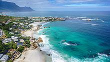
Many tourists also visit Cape Town's beaches, which are popular with local residents.[149] It is possible to visit several different beaches in the same day, each with a different setting and atmosphere. Both coasts are popular, although the beaches in affluent Clifton and elsewhere on the Atlantic Coast are better developed with restaurants and cafés, with a strip of restaurants and bars accessible to the beach at Camps Bay. The Atlantic seaboard, known as Cape Town's Riviera, is regarded as one of the most scenic routes in South Africa, along the slopes of the Twelve Apostles to the boulders and white sand beaches of Llandudno, with the route ending in Hout Bay, a diverse suburb with a fishing and recreational boating harbour near a small island with a breeding colony of African fur seals. This suburb is also accessible by road from the Constantia valley over the mountains to the northeast, and via the picturesque Chapman's Peak drive from the residential suburb Noordhoek in the Fish Hoek valley to the south-east.[150] Boulders Beach near Simon's Town is known for its colony of African penguins.[151]
The city has several notable cultural attractions. The Victoria & Alfred Waterfront, built on top of part of the docks of the Port of Cape Town, is the city's most visited tourist attraction. It is also one of the city's most popular shopping venues, with several hundred shops as well as the Two Oceans Aquarium.[152][153] The V&A also hosts the Nelson Mandela Gateway, through which ferries depart for Robben Island.[154] It is possible to take a ferry from the V&A to Hout Bay, Simon's Town and the Cape fur seal colonies on Seal and Duiker Islands. Several companies offer tours of the Cape Flats, a region of mostly Coloured & Black townships.[155]
Within the metropolitan area, the most popular areas for visitors to stay include Camps Bay, Sea Point, the V&A Waterfront, the City Bowl, Hout Bay, Constantia, Rondebosch, Newlands, and Somerset West.[156] In November 2013, Cape Town was voted the best global city in The Daily Telegraph's annual Travel Awards.[157] Cape Town offers tourists a range of air, land and sea-based adventure activities, including helicopter rides, paragliding and skydiving, snorkelling and scuba diving, boat trips, game-fishing, hiking, mountain biking and rock climbing. Surfing is popular and the city hosts the Red Bull Big Wave Africa surfing competition every year, and there is some local and international recreational scuba tourism.[158]
The City of Cape Town works closely with Cape Town Tourism to promote the city both locally and internationally. The primary focus of Cape Town Tourism is to represent Cape Town as a tourist destination.[159][160] Cape Town Tourism receives a portion of its funding from the City of Cape Town while the remainder is made up of membership fees and own-generated funds.[161] The Tristan da Cunha government owns and operates a lodging facility in Cape Town which charges discounted rates to Tristan da Cunha residents and non-resident natives.[162] Cape Town's transport system links it to the rest of South Africa; it serves as the gateway to other destinations within the province. The Cape Winelands and in particular the towns of Stellenbosch, Paarl and Franschhoek are popular day trips from the city for sightseeing and wine tasting.[163][164]
Infrastructure and services edit
Most goods are handled through the Port of Cape Town or Cape Town International Airport. Most major shipbuilding companies have offices in Cape Town.[165] The province is also a centre of energy development for the country, with the existing Koeberg nuclear power station providing energy for the Western Cape's needs.[166]
Greater Cape Town has four major commercial nodes, with Cape Town Central Business District containing the majority of job opportunities and office space.[citation needed] Century City, the Bellville/Tygervalley strip and Claremont commercial nodes are well established and contain many offices and corporate headquarters.
Health edit

- The Alexandra Hospital is a specialist mental health care hospital in Cape Town, it provides care for complex mental health issues and intellectual disability.[167]
- Groote Schuur Hospital is a large, government-funded, teaching hospital situated on the slopes of Devil's Peak. It was founded in 1938 and is famous for being the institution where the first human-to-human heart transplant took place. Groote Schuur is the chief academic hospital of the University of Cape Town's medical school, providing tertiary care and instruction in all the major branches of medicine. The hospital underwent major extension in 1984 when two new wings were added.
- The Hottentots Holland Hospital, also known as Helderberg Hospital, is a district hospital for the Helderberg basin located in Somerset West, and also serves surrounding areas in the Overberg district.
- Vergelegen Medi-clinic – Private hospital in Somerset West
Education edit


Public primary and secondary schools in Cape Town are run by the Western Cape Education Department. This provincial department is divided into seven districts; four of these are "Metropole" districts – Metropole Central, North, South, and East – which cover various areas of the metropolis.[168] There are also many private schools, both religious and secular. Cape Town has a well-developed higher system of public universities. Cape Town is served by three public universities: the University of Cape Town (UCT), the University of the Western Cape (UWC) and the Cape Peninsula University of Technology (CPUT). Stellenbosch University, while not based in the metropolitan area itself, has its main campus and administrative section 50 kilometres from the City Bowl and has additional campuses, such as the Tygerberg Faculty of Medicine and Health Sciences and the Bellville Business Park, north-west of the city in the town of Bellville.
Both the University of Cape Town and Stellenbosch University are leading universities in South Africa. This is due in large part to substantial financial contributions made to these institutions by both the public and private sector. UCT is an English-language tuition institution. It has over 21,000 students and has an MBA programme that was ranked 51st by the Financial Times in 2006.[169] It is also the top-ranked university in Africa, being the only African university to make the world's Top 200 university list at number 146.[170] Since the African National Congress has become the country's ruling party, some restructuring of Western Cape universities has taken place and as such, traditionally non-white universities have seen increased financing, which has evidently benefitted the University of the Western Cape.[171][172]
The Cape Peninsula University of Technology was formed on 1 January 2005, when two separate institutions – Cape Technikon and Peninsula Technikon – were merged. The new university offers education primarily in English, although one may take courses in any of South Africa's official languages. The institution generally awards the National Diploma. Students from the universities and high schools are involved in the South African SEDS, Students for the Exploration and Development of Space. This is the South African SEDS, and there are many SEDS branches in other countries, preparing enthusiastic students and young professionals for the growing Space industry.[citation needed] As well as the Universities, there are also several colleges in and around Cape Town. Including the College of Cape Town, False Bay College and Northlink College. Many students use NSFAS funding to help pay for tertiary education at these TVET colleges.[173] Cape Town has also become a popular study abroad destination for many international college students. Many study abroad providers offer semester, summer, short-term, and internship programs in partnership with Cape Town universities as a chance for international students to gain intercultural understanding.
Water supply edit
The Western Cape Water Supply System (WCWSS) is a complex water supply system in the Western Cape region of South Africa, comprising an inter-linked system of six main dams, pipelines, tunnels and distribution networks, and a number of minor dams, some owned and operated by the Department of Water and Sanitation and some by the City of Cape Town.[174]
Water crisis of 2017 to 2018 edit

The Cape Town water crisis of 2017 to 2018 was a period of severe water shortage in the Western Cape region, most notably affecting the City of Cape Town. While dam water levels had been declining since 2015, the Cape Town water crisis peaked during mid-2017 to mid-2018 when water levels hovered between 15 and 30 percent of total dam capacity.
In late 2017, there were first mentions of plans for "Day Zero", a shorthand reference for the day when the water level of the major dams supplying the city could fall below 13.5 percent.[175][176][177] "Day Zero" would mark the start of Level 7 water restrictions, when municipal water supplies would be largely switched off and it was envisioned that residents could have to queue for their daily ration of water. If this had occurred, it would have made the City of Cape Town the first major city in the world to run out of water.[178][179]
The city of Cape Town implemented significant water restrictions in a bid to curb water usage, and succeeded in reducing its daily water usage by more than half to around 500 million litres (130,000,000 US gal) per day in March 2018.[180] The fall in water usage led the city to postpone its estimate for "Day Zero", and strong rains starting in June 2018 led to dam levels recovering.[181] In September 2018, with dam levels close to 70 percent, the city began easing water restrictions, indicating that the worst of the water crisis was over.[182] Good rains in 2020 effectively broke the drought and resulting water shortage when dam levels reached 95 percent.[183] Concerns have been raised, however, that unsustainble demand and limited water supply could result in future drought events.[184]
Transport edit
Air edit

Cape Town International Airport serves both domestic and international flights.[185] It is the second-largest airport in South Africa and serves as a major gateway for travelers to the Cape region. Cape Town has regularly scheduled services to Southern Africa, East Africa, Mauritius, Middle East, Far East, Europe and the United States as well as eleven domestic destinations.[186] Cape Town International Airport opened a brand new central terminal building that was developed to handle an expected increase in air traffic as tourism numbers increased in the lead-up to the tournament of the 2010 FIFA World Cup.[187] Other renovations include several large new parking garages, a revamped domestic departure terminal, a new Bus Rapid Transit system station and a new double-decker road system. The airport's cargo facilities are also being expanded and several large empty lots are being developed into office space and hotels.
Cape Town is one of five internationally recognised Antarctic gateway cities with transportation connections. Since 2021, commercial flights have operated from Cape Town to Wolf's Fang Runway, Antarctica.[188] The Cape Town International Airport was among the winners of the World Travel Awards for being Africa's leading airport.[189] Cape Town International Airport is located 18 km from the Central Business District.[190]
Sea edit

Cape Town has a long tradition as a port city. The Port of Cape Town, the city's main port, is in Table Bay directly to the north of the CBD. The port is a hub for ships in the southern Atlantic: it is located along one of the busiest shipping corridors in the world, and acts as a stopover point for goods en route to or from Latin America and Asia. It is also an entry point into the South African market.[191] It is the second-busiest container port in South Africa after Durban. In 2004, it handled 3,161 ships and 9.2 million tonnes of cargo.[192]
Simon's Town Harbour on the False Bay coast of the Cape Peninsula is the main operational base of the South African Navy.
Until the 1970s the city was served by the Union Castle Line with service to the United Kingdom and St Helena.[193] The RMS St Helena provided passenger and cargo service between Cape Town and St Helena until the opening of St Helena Airport.[194]
The cargo vessel M/V Helena, under AW Shipping Management, takes a limited number of passengers,[195] between Cape Town and St Helena and Ascension Island on its voyages.[196] Multiple vessels also take passengers to and from Tristan da Cunha, inaccessible by aircraft, to and from Cape Town.[197] In addition NSB Niederelbe Schiffahrtsgesellschaft takes passengers on its cargo service to the Canary Islands and Hamburg, Germany.[195]
Rail edit

The Shosholoza Meyl is the passenger rail operations of Spoornet and operates one long-distance passenger rail services from Cape Town as of 2024: a weekly service to and from Johannesburg via Kimberley. These trains terminate at Cape Town railway station and make a stop at Bellville. Cape Town also terminates 2 luxury tourist train routes as of 2024 operated by the Ceres Rail Company, traveling from the Waterfront to Simon's Town and Grabouw respectively.
Metrorail operates a commuter rail service in Cape Town and the surrounding area. The Metrorail network consists of 96 stations throughout the suburbs and outskirts of Cape Town.
Road edit
Cape Town is the origin of three national roads. The N1 and N2 begin in the foreshore area near the City Centre and the N7, which runs North toward Namibia. The N1 runs East-North-East through Edgemead, Parow, Bellville, Brackenfell and Kraaifontein. It connects Cape Town to major cities further inland, namely Bloemfontein, Johannesburg, and Pretoria An older at-grade road, the R101, runs parallel to the N1 from Bellville. The N2 runs East-South-East through Rondebosch, Guguletu, Khayelitsha, Macassar to Somerset West. It becomes a multiple-carriageway, at-grade road from the intersection with the R44 onward. The N2 continues east along the coast, linking Cape Town to the coastal cities of Mossel Bay, George, Port Elizabeth, East London and Durban. An older at-grade road, the R102, runs parallel to the N1 initially, before veering south at Bellville, to join the N2 at Somerset West via the suburbs of Kuils River and Eerste River. The N7 originates from the N1 at Wingfield Interchange near Edgemead. It begins, initially as a highway, but becoming an at-grade road from the intersection with the M5 onward.

There are also a number of regional routes linking Cape Town with surrounding areas. The R27 originates from the N1 near the Foreshore and runs north parallel to the N7, but nearer to the coast. It passes through the suburbs of Milnerton, Table View and Bloubergstrand and links the city to the West Coast, ending at the town of Velddrif. The R44 enters the east of the metro from the north, from Stellenbosch. It connects Stellenbosch to Somerset West, then crosses the N2 to Strand and Gordon's Bay. It exits the metro heading south hugging the coast, leading to the towns of Betty's Bay and Kleinmond.
Of the three-digit routes, the R300 is an expressway linking the N1 at Brackenfell to the N2 near Mitchells Plain and the Cape Town International Airport. The R302 runs from the R102 in Bellville, heading north across the N1 through Durbanville leaving the metro to Malmesbury. The R304 enters the northern limits of the metro from Stellenbosch, running NNW before veering west to cross the N7 at Philadelphia to end at Atlantis at a junction with the R307. This R307 starts north of Koeberg from the R27 and, after meeting the R304, continues north to Darling. The R310 originates from Muizenberg and runs along the coast, to the south of Mitchell's Plain and Khayelitsha, before veering north-east, crossing the N2 west of Macassar, and exiting the metro heading to Stellenbosch.
Cape Town, like most South African cities, uses Metropolitan or "M" routes for important intra-city routes, a layer below National (N) roads and Regional (R) routes. Each city's M roads are independently numbered. Most are at-grade roads. The M3 splits from the N2 and runs to the south along the eastern slopes of Table Mountain, connecting the City Bowl with Muizenberg. Except for a section between Rondebosch and Newlands that has at-grade intersections, this route is a highway. The M5 splits from the N1 further east than the M3, and links the Cape Flats to the CBD. It is a highway as far as the interchange with the M68 at Ottery, before continuing as an at-grade road. Cape Town has the worst traffic congestion in South Africa.[198][199]
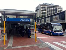
Buses edit
Golden Arrow Bus Services operates scheduled bus services in the Cape Town metropolitan area. Several companies run long-distance bus services from Cape Town to the other cities in South Africa.
MyCiTi edit
Cape Town has a public transport system in about 10% of the city, running north to south along the west coastline of the city, comprising Phase 1 of the IRT system. This is known as the MyCiTi service.[200]
MyCiTi Phase 1 includes services linking the Airport to the Cape Town inner city, as well as the following areas: Blouberg / Table View, Dunoon, Atlantis and Melkbosstrand, Milnerton, Paarden Eiland, Century City, Salt River and Walmer Estate, and all suburbs of the City Bowl and Atlantic Seaboard all the way to Llandudno and Hout Bay.[citation needed]
The MyCiTi N2 Express service consists of four routes each linking the Cape Town inner city and Khayelitsha and Mitchells Plain on the Cape Flats.[201]
The service use high floor articulated and standard size buses in dedicated busways, low floor articulated and standard size buses on the N2 Express service, and smaller 9 m (30 ft) Optare buses in suburban and inner city areas. It offers universal access through level boarding and numerous other measures, and requires cashless fare payment using the EMV compliant smart card system, called myconnect. Headway of services (i.e. the time between buses on the same route) range from three to twenty minutes in peak times to an hour in off-peak times.[citation needed]
Taxis edit

Cape Town has taxis as well as e-hailing services such as Uber. Taxis are either metered taxis or minibus taxis. Unlike many cities, metered taxis can be found at transport hubs as well as other tourist establishments, while minibus taxis can be found at taxi ranks or travelling along main streets.[202] Minibus taxis can be hailed from the road.[203]
Cape Town metered taxi cabs mostly operate in the city bowl, suburbs and Cape Town International Airport areas. Large companies that operate fleets of cabs can be reached by phone and are cheaper than the single operators that apply for hire from taxi ranks and Victoria and Alfred Waterfront. There are about one thousand meter taxis in Cape Town. Their rates vary from R8 per kilometre to about R15 per kilometre. The larger taxi companies in Cape Town are Excite Taxis, Cabnet and Intercab and single operators are reachable by cellular phone. The seven seated Toyota Avanza are the most popular with larger Taxi companies. Meter cabs are mostly used by tourists and are safer to use than minibus taxis.[citation needed]
Minibus taxis are the standard form of transport for the majority of the population who cannot afford private vehicles.[204] Although essential, these taxis are often poorly maintained and are frequently not road-worthy. These taxis make frequent unscheduled stops to pick up passengers, which can cause accidents.[205][206] With the high demand for transport by the working class of South Africa, minibus taxis are often filled over their legal passenger allowance. Minibuses are generally owned and operated in fleets.[207]
Culture edit

Cape Town is noted for its architectural heritage, with the highest density of Cape Dutch style buildings in the world. Cape Dutch style, which combines the architectural traditions of the Netherlands, Germany, France and Indonesia, is most visible in Constantia, the old government buildings in the Central Business District, and along Long Street.[208][209] The annual Cape Town Minstrel Carnival, also known by its Afrikaans name of Kaapse Klopse, is a large minstrel festival held annually on 2 January or "Tweede Nuwe Jaar" (Second New Year). Competing teams of minstrels parade in brightly coloured costumes, performing Cape Jazz, either carrying colourful umbrellas or playing an array of musical instruments. The Artscape Theatre Centre is the largest performing arts venue in Cape Town.[210] The city was named the World Design Capital for 2014 by the International Council of Societies of Industrial Design.[211]

The city also encloses the 36 hectare Kirstenbosch National Botanical Garden that contains protected natural forest and fynbos along with a variety of animals and birds. There are over 7,000 species in cultivation at Kirstenbosch, including many rare and threatened species of the Cape Floristic Region. In 2004 this Region, including Kirstenbosch, was declared a UNESCO World Heritage Site.[212]
Whale watching is popular amongst tourists: southern right whales and humpback whales are seen off the coast during the breeding season (August to November) and Bryde's whales and orca can be seen any time of the year.[213] The nearby town of Hermanus is known for its Whale Festival, but whales can also be seen in False Bay.[213] Heaviside's dolphins are endemic to the area and can be seen from the coast north of Cape Town; dusky dolphins live along the same coast and can occasionally be seen from the ferry to Robben Island.[213]
The only complete windmill in South Africa is Mostert's Mill, Mowbray. It was built in 1796 and restored in 1935 and again in 1995.
Cuisine edit

Food originating from or synonymous with Cape Town includes the savoury sweet spiced meat dish Bobotie that dates from the 17th century. The Gatsby, a sandwich filled with slap chips and other toppings, was first served in 1976 in the suburb of Athlone and is also synonymous with the city.[214] The koe'sister is a traditional Cape Malay pastry described as a cinnamon infused dumpling with a cake-like texture, finished off with a sprinkling of desiccated coconut.[215] Malva pudding (sometimes known as Cape Malva pudding) is a sticky sweet dessert often served with hot custard is also associated with the city and dates back to the 17th century.[216] A related dessert dish, Cape Brandy Pudding, is also associated with the city and surrounding region.[217] Cape Town is also the home of the South African wine industry with the first wine produced in the country being bottled in the city; a number of notable wineries still exist in the city including Groot Constantia and Klein Constantia.
Media edit

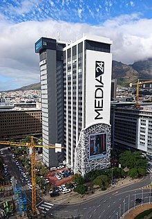
Several newspapers, magazines and printing facilities have their offices in the city. Independent News and Media publishes the major English language papers in the city, the Cape Argus and the Cape Times. Naspers, the largest media conglomerate in South Africa, publishes Die Burger, the major Afrikaans language paper.[218]
Cape Town has many local community newspapers. Some of the largest community newspapers in English are the Athlone News from Athlone, the Atlantic Sun, the Constantiaberg Bulletin from Constantiaberg, the City Vision from Bellville, the False Bay Echo from False Bay, the Helderberg Sun from Helderberg, the Plainsman from Michell's Plain, the Sentinel News from Hout Bay, the Southern Mail from the Southern Peninsula, the Southern Suburbs Tatler from the Southern Suburbs, Table Talk from Table View and Tygertalk from Tygervalley/Durbanville. Afrikaans language community newspapers include the Landbou-Burger and the Tygerburger. Vukani, based in the Cape Flats, is published in Xhosa.[219]
Cape Town is a centre for major broadcast media with several radio stations that only broadcast within the city. 94.5 Kfm (94.5 MHz FM) and Good Hope FM (94–97 MHz FM) mostly play pop music. Heart FM (104.9 MHz FM), the former P4 Radio, plays jazz and R&B, while Fine Music Radio (101.3 FM) plays classical music and jazz, and Magic Music Radio[220] (828 kHz MW) plays adult contemporary and classic rock from the '60s, '70s, '80s, '90s and '00s.[citation needed] Bush Radio is a community radio station (89.5 MHz FM). The Voice of the Cape (95.8 MHz FM) and Cape Talk (567 kHz MW) are the major talk radio stations in the city.[221] Bokradio (98.9 MHz FM) is an Afrikaans music station.[222] The University of Cape Town also runs its own radio station, UCT Radio (104.5 MHz FM).
The SABC has a small presence in the city, with satellite studios located at Sea Point. e.tv has a greater presence, with a large complex located at Longkloof Studios in Gardens. M-Net is not well represented with infrastructure within the city. Cape Town TV is a local TV station, supported by numerous organisation and focusing mostly on documentaries. Numerous productions companies and their support industries are located in the city, mostly supporting the production of overseas commercials, model shoots, TV-series and movies.[223] The local media infrastructure remains primarily in Johannesburg.
Sport and recreation edit


Cape Town's most popular sports by participation are cricket, association football, swimming, and rugby union.[224] In rugby union, Cape Town is the home of the Western Province side, who play at Cape Town Stadium and compete in the Currie Cup. In addition, Western Province players (along with some from Wellington's Boland Cavaliers) comprise the Stormers in the United Rugby Championship competition. Cape Town has also been a host city for both the 1995 Rugby World Cup and 2010 FIFA World Cup, and annually hosts the Africa leg of the World Rugby 7s.[225] It has hosted the 2023 Netball World Cup.[226]
Association football, which is mostly known as soccer in South Africa, is also popular. Two clubs from Cape Town play in the Premier Soccer League (PSL), South Africa's premier league. These teams are Cape Town Spurs F.C. and Cape Town City F.C. Cape Town was also the location of several of the matches of the 2010 FIFA World Cup including a semi-final,[227] held in South Africa. The Mother City built a new 70,000-seat stadium (Cape Town Stadium) in the Green Point area.
In cricket, the Cape Cobras represent Cape Town at the Newlands Cricket Ground. The team is the result of an amalgamation of the Western Province Cricket and Boland Cricket teams. They take part in the Supersport and Standard Bank Cup Series. The Newlands Cricket Ground regularly hosts international matches.
Cape Town has had Olympic aspirations. For example, in 1996, Cape Town was one of the five candidate cities shortlisted by the IOC to launch official candidatures to host the 2004 Summer Olympics. Although the Games ultimately went to Athens, Cape Town came in third place. There has been some speculation that Cape Town was seeking the South African Olympic Committee's nomination to be South Africa's bid city for the 2020 Summer Olympic Games.[228] That was quashed when the International Olympic Committee awarded the 2020 Games to Tokyo.
The city of Cape Town has vast experience in hosting major national and international sports events. The Cape Town Cycle Tour is the world's largest individually timed road cycling race – and the first event outside Europe to be included in the International Cycling Union's Golden Bike series. It sees over 35,000 cyclists tackling a 109 km (68 mi) route around Cape Town. The Absa Cape Epic is the largest full-service mountain bike stage race in the world. Some notable events hosted by Cape Town have included the 1995 Rugby World Cup, 2003 ICC Cricket World Cup, and World Championships in various sports such as athletics, fencing, weightlifting, hockey, cycling, canoeing, gymnastics and others. Cape Town was also a host city to the 2010 FIFA World Cup from 11 June to 11 July 2010, further enhancing its profile as a major events city. It was also one of the host cities of the 2009 Indian Premier League cricket tournament. The Mother City has also played host to the Africa leg of the annual World Rugby 7s event since 2015; for nine seasons, from 2002 until 2010, the event was staged in George in the Western Cape, before moving to Port Elizabeth for the 2011 edition, and then to Cape Town in 2015. The event usually takes place in mid-December, and is hosted at the Cape Town Stadium in Green Point.[229]
There are several golf courses in Cape Town. The Clovelly Country Club and Metropolitan Golf Club have 18 holes.[230]
The coastline of Cape Town is relatively long, and the varied exposure to weather conditions makes it fairly common for water conditions to be conducive to recreational scuba diving at some part of the city's coast. There is considerable variation in the underwater environment and regional ecology as there are dive sites on reefs and wrecks on both sides of the Cape Peninsula and False Bay, split between two coastal marine ecoregions by the Cape Peninsula, and also variable by depth zone.

False Bay is open to the south, and the prevailing open ocean swell arrives from the southwest, so the exposure varies considerably around the coastline. The inshore bathymetry near Cape Point is shallow enough for a moderate amount of refraction of long period swell, but deep enough to have less effect on short period swell, and acts as a filter to pass mainly the longer swell components to the Western shores, although they are significantly attenuated. The eastern shores get more of the open ocean spectrum, and this results in very different swell conditions between the two sides at any given time. The fetch is generally too short for southeasterly winds to produce good surf. There are more than 20 named breaks in False Bay. The north-wester can have a long fetch and can produce large waves, but they may also be associated with local wind and be very poorly sorted. The Atlantic coast is exposed to the full power of the South-westerly swell produced by the westerly winds of the southern ocean, often a long way away, so the swell has time to separate into similar wavelengths, and there are some world class big wave breaks among the named breaks of the Atlantic shore.[231][232][233]
In the 1950's the city was part of 4 editions of the famous Algiers-Cape Town Rally, during the pioneer years of trans-Africa rallying and motor exploration. The closing of the road to the newly-founded Zaire caused the city to be dropped from the traject.[234]
See also edit
- Cape Colony – British colony from 1806 to 1910
- Timeline of Cape Town – Chronological listing of notable events
- Western Cape – Province of South Africa on the south-western coast
Notes edit
References edit
- ^ Bradley van Sitters (2 August 2012). "Place Names of Pre-colonial Origin and their Use Today". humanities.uct.ac.za. University of Cape Town. Retrieved 21 November 2023.
- ^ "City of Cape Town announces new city manager". News24. 26 April 2018. Archived from the original on 15 August 2019. Retrieved 5 February 2019.
- ^ a b "Community survey 2016 – City of Cape Town" (PDF). Survey 2016. Statistics South Africa. Archived (PDF) from the original on 25 April 2021. Retrieved 16 September 2020.
- ^ "Cape Town, Main Place 199041 from Census 2011". Census 2011. Archived from the original on 31 July 2014. Retrieved 24 February 2024.
- ^ Community Survey 2016: Provincial profile: Western Cape (PDF) (Report). Statistics South Africa. 2018. p. 7.
- ^ Census 2022: Provincial profile: Western Cape (Report). Statistics South Africa. 2018. p. 7.
- ^ "StatsSA". Archived from the original on 12 August 2016.
- ^ "Richest cities in the world in 2020 by GDP". City Mayors. Archived from the original on 4 June 2020. Retrieved 19 February 2023.
- ^ "Global city GDP 2011". Brookings Institution. Archived from the original on 5 June 2013. Retrieved 18 November 2014.
- ^ withbeyond.com. "The Mother City Cape Town". Skylife. Archived from the original on 26 November 2020. Retrieved 12 October 2020.
- ^ "10 SA city nicknames, and why they're called that". News24. 4 June 2015. Archived from the original on 24 July 2022. Retrieved 24 July 2022.
- ^ "Western Cape | province, South Africa". Encyclopedia Britannica. Archived from the original on 8 May 2017. Retrieved 22 June 2017.
- ^ "Discover the 9 Provinces of South Africa and their Capital Cities". Archived from the original on 14 June 2017. Retrieved 22 June 2017.
- ^ "14 Fun Facts You Didn't Know About Cape Town – Interesting & Amusing Things about the Mother City". Cape Town Magazine. Archived from the original on 26 June 2014. Retrieved 17 June 2014.
- ^ Bruyn, Pippa de (5 February 2016). "The world's best cities". Telegraph.co.uk. Archived from the original on 5 January 2016. Retrieved 4 April 2018.
- ^ "The Antiquity of man". SouthAfrica.info. Archived from the original on 1 March 2009. Retrieved 15 June 2009.
- ^ Hamilton, Carolyn; Mbenga, Bernard; Ross, Robert, eds. (2011). "Khoesan and Immigrants". The Cambridge history of South Africa: 1885–1994. Vol. 1. Cambridge University Press. pp. 168–173. ISBN 9780521517942. OCLC 778617810.
- ^ "Cape-Slavery-Heritage " Coloured People of the Western Cape have the most Diverse Ancestry in the World :: iBlog". Cape-slavery-heritage.iblog.co.za. 1 May 2009. Retrieved 17 March 2011. [permanent dead link]
- ^ "Slavery and early colonisation, South African History Online". Sahistory.org.za. 22 September 1927. Archived from the original on 9 January 2011. Retrieved 17 March 2011.
- ^ Pooley, S. 'Jan van Riebeeck as Pioneering Explorer and Conservator of Natural Resources at the Cape of Good Hope (1652–62),' Environment and History 15 (2009): 3–33. doi:10.3197/096734009X404644
- ^ Bell, Charles. "A painting of the arrival of Jan van Riebeeck in Table Bay". Archived from the original on 30 December 2011. Retrieved 11 April 2011.
- ^ McCracken, J.L. (1967). The Cape Parliament, 1854–1910. Clarendon Press, Oxford, 1967.
- ^ Carruthers, Jane; Robin, Libby (23 March 2010). "Taxonomic imperialism in the battles for Acacia:Identity and science in South Africa and Australia". Transactions of the Royal Society of South Africa. 65 (1): 60. Bibcode:2010TRSSA..65...48C. doi:10.1080/00359191003652066. S2CID 83630585.
- ^ "A Contested Past and Present: Australian Trees in South Africa". Social Science Research Council. Archived from the original on 27 July 2020. Retrieved 12 February 2020.
- ^ Mbenga, Bernard. "New History of South Africa". Tafelberg, South Africa, 2007. Archived from the original on 22 April 2014. Retrieved 18 January 2013.
- ^ a b Worden, Nigel; van Hyningen, Elizabeth; Bickford-Smith, Vivian (1998). Cape Town: The Making of a City. Claremont, Cape Town, South Africa: David Philip Publishers. p. 212. ISBN 0-86486-435-3.
- ^ Mabin, Alan (1989). The Angry Divide-The underdevelopment of the Western Cape, 1850–1900. Cape Town: David Philip. pp. 82–94. ISBN 0-86486-116-8.
- ^ Halkett, D.J. (October 2012). "Archaeological Assessment of the Proposed Cape Town International Convention Centre 2 on Erwen 192, 245, 246 and the Remainder of Erf 192, "Salazar Square", Roggebaai, Cape Towm Foreshore" (PDF). sahra.org.za. p. 18. Archived (PDF) from the original on 29 May 2021. Retrieved 26 August 2019.
- ^ Halkett, D.J. (October 2012). "Archaeological Assessment of the Proposed Cape Town International Convention Centre 2 on Erwen 192, 245, 246 and the Remainder of Erf 192, "Salazar Square", Roggebaai, Cape Towm Foreshore" (PDF). sahra.org.za. p. 18. Archived (PDF) from the original on 29 May 2021. Retrieved 26 August 2019.
- ^ Bickford-Smith, Vivian (1995). "South African Urban History, Racial Segregation and the Unique Case of Cape Town?". Journal of Southern African Studies. 21 (1): 63–78. doi:10.1080/03057079508708433. ISSN 0305-7070. JSTOR 2637331.
- ^ Adhikari, Mohamed (2009). Burdened by race: Coloured identities in southern Africa. Cape Town: UCT Press. p. 51. ISBN 978-1-92051-660-4. Archived from the original on 20 July 2018. Retrieved 26 August 2019.
- ^ "Recalling District Six". SouthAfrica.info. 19 August 2003. Archived from the original on 6 February 2012. Retrieved 13 June 2006.
- ^ Sash, Black (3 November 1983). ""The Coloured Labour Preference Area Policy"- Paper Presented by Cape Western Region to National Conference 1983". National texts, 1955–1994. Archived from the original on 16 December 2019. Retrieved 16 December 2019.
- ^ "Cape Schools Join the Revolt – South African History Online". Archived from the original on 14 July 2014. Retrieved 16 June 2014.
- ^ "Western Cape Youth Uprising timeline 1976 – South African History Online". Archived from the original on 4 August 2014. Retrieved 16 June 2014.
- ^ "FLOTUS Travel Journal: Robben Island, An Experience We Will Never Forget". whitehouse.gov. 30 June 2013. Retrieved 10 April 2024.
- ^ "South Africa: Overcoming Apartheid". overcomingapartheid.msu.edu. Retrieved 18 March 2024.
- ^ "The South African general elections: 1994 | South African History Online". www.sahistory.org.za. Retrieved 18 March 2024.
- ^ Johnson, R.W. (1996). Launching Democracy in South Africa: The First Open Election, April 1994. New Haven: Yale University Press. ISBN 978-0300063912.
- ^ Cassim, Zaheer. "Cape Town could be the first major city in the world to run out of water". USA TODAY. Retrieved 28 March 2023.
- ^ Charles, Marvin. "Cape Independence: Lobby group says recent survey 'places intense pressure' on DA to hold referendum". News24. Archived from the original on 5 October 2021. Retrieved 12 October 2021.
- ^ "Parties which supported Western Cape independence from SA reap rewards in local government elections". iol.co.za. Archived from the original on 15 November 2021. Retrieved 15 November 2021.
- ^ "Census 2011: Metropolitan Municipality: City of Cape Town". census2011.adrianfrith.com. Retrieved 7 June 2023.
- ^ "Census 2011: Main Place: Cape Town". census2011.adrianfrith.com. Retrieved 7 June 2023.
- ^ 1:250,000 Geological Series map 3318:Cape Town (Map). Pretoria: Government Printer. 1990.
- ^ a b c Cowling, R.M.; Macdonald, Ian A. W.; Simmons, Mark (1996). "The Cape Peninsula, South Africa: Physiographical, biological and historical background to an extraordinary hot-spot of biodiversity". Biodiversity and Conservation. 5 (5): 527–550. Bibcode:1996BiCon...5..527C. doi:10.1007/BF00137608. S2CID 23314811.
- ^ "Robben Island". South African History Online. 14 July 2011. Archived from the original on 1 April 2019. Retrieved 24 July 2019.
- ^ a b Compton, John S. (2004). The Rocks & Mountains of Cape Town. Cape Town: Double Story. ISBN 978-1-919930-70-1.
- ^ Murray, Tony; Brown, Cate; Dollar, Evan; Day, Jenny; Beuster, Hans; Haskins, Candice; Boucher, Charlie; Turpie, Jane; Wood, Julia; Thompson, Martin; Lamberth, Steve; van Niekerk, Lara; Impson, Dean; Magoba, Rembu; Petersen, Chantel; Davey, Denis; Noffke, Mandy; Hay, Rowena; Hartnady, Chris; Ewart-Smith, Justine; Burger, Marius; Fairburn, Emily; Ractliffe, Geordie; Day, Liz; Luger, Mike; Lannas, Katy; Ndiitwani-Nyamande, Tovhowani (2009). Brown, Cate; Magoba, Rembu (eds.). Rivers and Wetlands of Cape Town (Part 1) (PDF). Project No: K5/1691 (Report). Water Research Commission. pp. 1–178. Archived (PDF) from the original on 16 June 2022.
- ^ Robinson, Peter J.; Henderson-Sellers, Ann (1999). Contemporary Climatology. Harlow: Pearson Education Limited. p. 123. ISBN 9780582276314.
- ^ Rohli, Robert V.; Vega, Anthony J. (2011). Climatology. Sudbury, MA: Jones & Bartlett Learning. p. 250. ISBN 9781449649548. Archived from the original on 21 November 2016. Retrieved 27 January 2016.
- ^ "Cape Point (South Africa)". Global Atmosphere Watch Station Information System (GAWSIS). Federal Office of Meteorology and Climatology MeteoSwiss. Archived from the original on 27 August 2013. Retrieved 20 May 2014.
climate zone – Csb (Warm temperate climate with dry and warm summer)
- ^ "World Weather Information Service – Cape Town". Archived from the original on 26 April 2010. Retrieved 4 May 2010.
- ^ a b "Cape Town/DF Malan Climate Normals 1961–1990". National Oceanic and Atmospheric Administration. Retrieved 8 April 2013.
- ^ "Climate Normals 1991-2020". NOAA. Retrieved 18 September 2018.
- ^ "Climate data: Cape Town". Old.weathersa.co.za. 28 October 2003. Archived from the original on 14 March 2011. Retrieved 17 March 2011.
- ^ "Hottest temperature". enca.com. Archived from the original on 20 July 2015. Retrieved 6 March 2015.
- ^ Bastin, Jean-Francois; Clark, Emily; Elliott, Thomas; Hart, Simon; van den Hoogen, Johan; Hordijk, Iris; Ma, Haozhi; Majumder, Sabiha; Manoli, Gabriele; Maschler, Julia; Mo, Lidong; Routh, Devin; Yu, Kailiang; Zohner, Constantin M.; Thomas W., Crowther (10 July 2019). "Understanding climate change from a global analysis of city analogues". PLOS ONE. 14 (7). S2 Table. Summary statistics of the global analysis of city analogues. Bibcode:2019PLoSO..1417592B. doi:10.1371/journal.pone.0217592. PMC 6619606. PMID 31291249.
- ^ "Cities of the future: visualizing climate change to inspire action". Current vs. future cities. Archived from the original on 8 January 2023. Retrieved 8 January 2023.
- ^ "The CAT Thermometer". Archived from the original on 14 April 2019. Retrieved 8 January 2023.
- ^ Trisos, C.H., I.O. Adelekan, E. Totin, A. Ayanlade, J. Efitre, A. Gemeda, K. Kalaba, C. Lennard, C. Masao, Y. Mgaya, G. Ngaruiya, D. Olago, N.P. Simpson, and S. Zakieldeen 2022: Chapter 9: Africa Archived 6 December 2022 at the Wayback Machine. In Climate Change 2022: Impacts, Adaptation and Vulnerability Archived 28 February 2022 at the Wayback Machine [H.-O. Pörtner, D.C. Roberts, M. Tignor, E.S. Poloczanska, K. Mintenbeck, A. Alegría, M. Craig, S. Langsdorf, S. Löschke, V. Möller, A. Okem, B. Rama (eds.)]. Cambridge University Press, Cambridge, United Kingdom and New York, NY, US, pp. 2043–2121
- ^ Technical Summary. In: Climate Change 2021: The Physical Science Basis. Contribution of Working Group I to the Sixth Assessment Report of the Intergovernmental Panel on Climate Change (PDF). IPCC. August 2021. p. TS14. Archived (PDF) from the original on 13 August 2021. Retrieved 12 November 2021.
- ^ a b c Pfaff, Maya C.; Logston, Renae C.; Raemaekers, Serge J. P. N.; Hermes, Juliet C.; Blamey, Laura K.; Cawthra, Hayley C.; Colenbrander, Darryl R.; Crawford, Robert J. M.; Day, Elizabeth; du Plessis, Nicole; Elwen, Simon H.; Fawcett, Sarah E.; Jury, Mark R.; Karenyi, Natasha; Kerwath, Sven E.; Kock, Alison A.; Krug, Marjolaine; Lamberth, Stephen J.; Omardien, Aaniyah; Pitcher, Grant C.; Rautenbach, Christo; Robinson, Tamara B.; Rouault, Mathieu; Ryan, Peter G.; Shillington, Frank A.; Sowman, Merle; Sparks, Conrad C.; Turpie, Jane K.; van Niekerk, Lara; Waldron, Howard N.; Yeld, Eleanor M.; Kirkman, Stephen P. (2019). "A synthesis of three decades of socio-ecological change in False Bay, South Africa: setting the scene for multidisciplinary research and management". Elementa: Science of the Anthropocene. 7 (32): 32. Bibcode:2019EleSA...7...32P. doi:10.1525/elementa.367. hdl:2263/75633. Creative Commons Attribution 4.0 International License (CC BY 4.0)
- ^ a b Coleman, Fawaaz (April 2019). The Development and Validation of a Hydrodynamic Model of False Bay (Thesis). University of Stellenbosch.
- ^ "Brochures, booklets and posters". Capetown.gov.za. Archived from the original on 23 December 2012. Retrieved 1 October 2011.
- ^ Friedman, Barbara (14 May 2021). "Cape Town recorded most sightings and species in world 2021 #CityNatureChallenge". Lifestyle. capetalk.co.za. Cape Talk 567 AM. Archived from the original on 19 May 2021. Retrieved 19 May 2021.
- ^ "Unique Biodiversity Poster" (PDF). Archived from the original (PDF) on 25 July 2012. Retrieved 6 February 2013.
- ^ Cape Town Tourism. "Vote for Table Mountain – Cape Town Tourism". Capetown.travel. Archived from the original on 12 January 2012. Retrieved 12 January 2013.
- ^ "Western Cape". Southafricaholiday.org.uk. Archived from the original on 10 December 2012. Retrieved 12 January 2013.
- ^ A.G. Rebelo, C. Boucher, N. Helme, L. Mucina, M.C. Rutherford et al. 2006. Fynbos Biome, in: L. Mucina & M.C. Rutherford (eds). The Vegetation of South Africa, Lesotho and Swaziland.
- ^ "National Spatial Biodiversity Assessment 2005 Targets". Capetown.gov.za. Archived from the original on 24 August 2013. Retrieved 24 February 2014.
- ^ "Endemic Species of the city of Cape Town" (PDF). Archived from the original (PDF) on 1 November 2011.
- ^ Lemaire, Benny; Dlodlo, Oscar; Chimphango, Samson; Stirton, Charles; Schrire, Brian; Boatwright, James S.; Honnay, Olivier; Smets, Erik; Sprent, Janet; James, Euan K.; Muasya, Abraham M. (2015). "Symbiotic diversity, specificity and distribution of rhizobia in native legumes of the Core Cape Subregion (South Africa)". FEMS Microbiology Ecology. 91 (2): 1–17. doi:10.1093/femsec/fiu024. PMID 25764552. Archived from the original on 27 April 2021. Retrieved 19 January 2021 – via Oxford Academic.
- ^ Linder, H. P. (2003). "The radiation of the Cape flora, southern Africa". Biological Reviews. 78 (4): 597–638. doi:10.1017/S1464793103006171. PMID 14700393. S2CID 43101616. Archived from the original on 29 May 2021. Retrieved 19 January 2021.
- ^ "The View from The Cape: Extinction Risk, Protected Areas, and Climate Change" (PDF). Perceval.bio.nau.edu. Archived from the original (PDF) on 25 August 2013. Retrieved 24 February 2014.
- ^ [1][dead link]
- ^ "Table Mountain National Park". nature-reserve.co.za. Archived from the original on 5 June 2012. Retrieved 9 July 2020.
- ^ "Congratulations! Cape Town claims the top spot in the international City Nature Challenge 2019". 7 May 2019. Archived from the original on 5 August 2019. Retrieved 5 August 2019.
- ^ Rebelo, Tony (12 June 2019). "And we feature again!!! Cape Town in the forefront ..." iNaturalist. Archived from the original on 5 August 2019. Retrieved 5 August 2019.
- ^ Piombo, J. (3 August 2009). Institutions, Ethnicity, and Political Mobilization in South Africa. Springer. ISBN 978-0-230-62382-8. Archived from the original on 27 April 2021. Retrieved 9 November 2020.
- ^ Anciano, Fiona; Piper, Laurence (3 October 2018). Democracy Disconnected: Participation and Governance in a City of the South. Routledge. ISBN 978-0-429-79429-2. Archived from the original on 26 April 2021. Retrieved 9 November 2020.
- ^ "IEC Results Dashboard". results.elections.org.za. Archived from the original on 8 November 2021. Retrieved 8 November 2021.
- ^ Seat Calculation Detail: City of Cape Town. Electoral Commission of South Africa [2] Archived 6 November 2021 at the Wayback Machine
- ^ "WATCH: Geordin Hill-Lewis officially becomes Cape Town's youngest mayor after council vote". iol.co.za. Archived from the original on 18 November 2021. Retrieved 18 November 2021.
- ^ "Sister cities partnership agreements". City of Cape Town. Archived from the original on 4 July 2020. Retrieved 20 March 2020.
- ^ "Cape Town mayor pledges solidarity with Ukraine". BusinessLIVE. Archived from the original on 14 May 2022. Retrieved 3 March 2022.
- ^ a b Evans, Jenni. "Cape Town City Hall's turn to get lit up for Ukraine". News24. Archived from the original on 2 March 2022. Retrieved 3 March 2022.
- ^ Plessis, Carien du (2 March 2022). "FOREIGN POLICY: DA lights up City Hall in solidarity with Ukraine, while ANC government abstains from UN vote opposing Russian invasion". Daily Maverick. Archived from the original on 16 June 2022. Retrieved 16 June 2022.
- ^ Malherbe, E.G. (1939). Official Year Book of the Union of South Africa and of Basutoland, Bechuanaland Protectorate, and Swaziland. Vol. 20. Pretoria: Union of South Africa. p. 1044.
- ^ "Population estimates for Cape Town, South Africa, 1950–2015". Mongabay.com. Archived from the original on 1 November 2014. Retrieved 23 July 2014.
- ^ "Census 96 : Community Profile". City of Cape Town. Archived from the original on 26 July 2014. Retrieved 23 July 2014.
- ^ "City of Cape Town – 2011 Census – Cape Town" (PDF). City of Cape Town. Archived from the original (PDF) on 3 December 2013. Retrieved 23 July 2014.
- ^ Small, Karen (December 2008). "Demographic and Socio-economic Trends for Cape Town: 1996 to 2007" (PDF). City of Cape Town. Archived from the original (PDF) on 3 March 2016. Retrieved 23 July 2014.
- ^ "Cape Town Population 2018 (Demographics, Maps, Graphs)". worldpopulationreview.com. 3 July 2018. Archived from the original on 3 July 2018. Retrieved 3 July 2018.
- ^ a b c d e f g h i j k l m n Census 2011 Municipal report: Western Cape (PDF). Statistics South Africa. 2012. ISBN 978-0-621-41459-2. Archived from the original (PDF) on 13 November 2015. Retrieved 30 November 2016.
- ^ State of Cape Town Report 2016 (PDF). 2016. Archived (PDF) from the original on 18 January 2021.
- ^ "Progress with housing and power" (PDF). City News. October 2019. Archived (PDF) from the original on 5 October 2021. Retrieved 9 August 2021.
- ^ Yu, Derek (20 January 2021). "South African internal migrants fare better in the job market in two regions". The Conversation. Archived from the original on 6 July 2022. Retrieved 5 June 2022.
- ^ "2016 Cape Town Community Survey" (PDF). Archived (PDF) from the original on 16 May 2021.
- ^ Staff Writer. "More Gauteng residents are semigrating to the Western Cape – here's where they are moving to". Archived from the original on 13 September 2022. Retrieved 23 January 2022.
- ^ "'Joburg is in decline, and its professionals are moving – many to Cape Town'". CapeTalk. Archived from the original on 1 June 2022. Retrieved 23 January 2022.
- ^ Buthelezi, Londiwe. "'City of Gold' sparkles no more – Joburg has become property sector's weakest link". Fin24. Archived from the original on 8 July 2022. Retrieved 23 January 2022.
- ^ Alan Winde on booming Western Cape semigration – up another 20% this year to over 120k, Biznews, 8 December 2022, archived from the original on 8 December 2022, retrieved 8 December 2022
- ^ "Cape Town expects a population boom over the next five years – with changes planned for electricity supply". Businesstech.co.za. 31 May 2022. Archived from the original on 17 June 2022. Retrieved 4 June 2022.
- ^ Farrar, Thomas J.; Falake, Khanyisane A.; Mebaley, Adriel; Moya, Mandisi D.; Rudolph, Ivor I. (2019). "A Mall Intercept Survey on Religion and Worldview in the Cape Flats of Cape Town, South Africa". Journal for the Study of Religion. 32 (1): 1–30. doi:10.17159/2413-3027/2019/v32n1a3. ISSN 1011-7601. S2CID 202175851.
- ^ "South Africa". Encyclopædia Britannica (Online ed.). Archived from the original on 29 June 2019. Retrieved 7 July 2019.
- ^ "Greek Orthodox Archbishopric website". Archived from the original on 25 January 2022. Retrieved 26 June 2022.
- ^ "Africa South Area". The Church of Jesus Christ of Latter-day Saints. Archived from the original on 19 May 2022. Retrieved 16 May 2022.
- ^ "Cape Town South Africa Temple". The Church of Jesus Christ of Latter-day Saints. Archived from the original on 25 June 2022. Retrieved 16 May 2022.
- ^ tinashe (13 January 2012). "History of Muslims in South Africa: 1652 – 1699 by Ebrahim Mahomed Mahida". South African History Online. Archived from the original on 10 January 2019. Retrieved 23 August 2019.
- ^ "Mosques – Cape Town Muslims". capetownmuslims.co.za. Archived from the original on 21 January 2019. Retrieved 23 August 2019.
- ^ Cape Town's Jewish History on Display Forward. 29 April 2013
- ^ Mandela Visits Cape Town Shul and Reassures Jews on Their Future Jewish Telegraphic Agency. 10 May 1994
- ^ Congregations South African Union for Progressive Judaism. Accessed on 6 December 2019
- ^ A first for Cape Town Cape Jewish Chronicle. 1 December 2015
- ^ "Why Cape Town's murder rate is rising". The Economist. Archived from the original on 9 October 2018. Retrieved 10 October 2018.
- ^ Jeffreys, Andrew (ed.). "Caps off to the Western Cape". The Report: South Africa 2008. Oxford Business Group. p. 159. ISBN 978-1-9023-3979-5. Archived from the original on 27 April 2021. Retrieved 23 July 2019.
- ^ "South Africa Deploys Army to Gang-Hit Cape Town" Archived 9 September 2019 at the Wayback Machine (12 July 2019). BBC News. Retrieved 17 April 2020.
- ^ "Prince Harry, Meghan Markle and Baby Archie Begin First Official Tour as a Royal Family in Cape Town". Archived from the original on 23 September 2019. Retrieved 24 September 2019.
- ^ "Municipal and district map". issafrica.org. Archived from the original on 28 November 2019. Retrieved 28 November 2019.
- ^ "Cape Town has SA's highest murder rate". iol.co.za. Archived from the original on 26 April 2021. Retrieved 20 March 2021.
- ^ McCain, Nicole. "Cape Town ranks top in SA as one of 50 most violent cities in the world". News24. Archived from the original on 1 April 2022. Retrieved 7 April 2022.
- ^ "JSE top 40". SAshares.co.za. Archived from the original on 28 February 2018. Retrieved 1 September 2021.
- ^ a b c d e f "State of Cape Town Report 2020" (PDF). City of Cape Town. June 2021. Archived (PDF) from the original on 22 February 2022. Retrieved 22 February 2022.
- ^ a b "Sars Rates Of Exchange". tools.sars.gov.za. Archived from the original on 22 February 2022. Retrieved 22 February 2022.
US$-ZAR exchange rate for 1 July 2019
- ^ "Cape Town breeds entrepreneurs: Fin24: Business". Fin24. 7 September 2008. Archived from the original on 26 January 2009. Retrieved 1 October 2011.
- ^ a b "Cape Town Leads In Information Technology". 27 March 2007. Archived from the original on 29 July 2012. Retrieved 24 February 2014.
- ^ Oni, David (15 June 2021). "Cape Town Startups Stake their Claim in the Small Satellite Industry". Space in Africa. Archived from the original on 27 August 2022. Retrieved 4 August 2022.
- ^ "Eight SA startups to look out for in 2019". Venture Burn. 28 December 2018. Archived from the original on 29 August 2019. Retrieved 19 January 2020.
- ^ "Cape Town Film Industry | IE3 Global". Archived from the original on 19 January 2022. Retrieved 31 March 2022.
- ^ "Asad and Searching for Sugarman Have Done Us Proud". Western Cape Government. Archived from the original on 27 June 2022. Retrieved 31 March 2022.
- ^ "Economic Development". City of Cape Town: Economic Statistics. City of Cape Town. Archived from the original on 16 January 2014. Retrieved 15 January 2014.
- ^ "Media Contact". Woolworths. Woolworths Holdings Limited. Archived from the original on 2 January 2014. Retrieved 15 January 2014.
- ^ EMIS. "Pick n Pay Holdings Ltd". Emerging Markets Information Service. EMIS. Archived from the original on 17 April 2014. Retrieved 15 January 2014.,
- ^ "Contact Us". Foshini Group. Foschini. Archived from the original on 16 January 2014. Retrieved 15 January 2014.
- ^ "Who We Are". Sanlam. Archived from the original on 16 January 2014. Retrieved 15 January 2014.
- ^ "Old Mutual History". Oldmutual.com. Archived from the original on 17 May 2022. Retrieved 18 April 2011.
- ^ Staff Writer. "Amazon to set up South African headquarters in R4 billion Cape Town development". Archived from the original on 20 April 2021. Retrieved 1 September 2021.
- ^ "Amazon to set up African headquarters in Cape Town". iol.co.za. Archived from the original on 21 April 2021. Retrieved 1 September 2021.
- ^ Western Cape Government (2017). "SEP Socio-Economic Profile: City of Cape Town" (PDF). westerncape.gov.za. Archived (PDF) from the original on 16 February 2019. Retrieved 16 February 2019.
- ^ "Cape Town least unequal SA city – Politics | IOL News". IOL.co.za. 4 December 2012. Archived from the original on 12 January 2014. Retrieved 24 February 2014.
- ^ "A profile of the Western Cape province: Demographics, poverty, inequality and unemployment" (PDF). Elsenburg. August 2005. Archived from the original (PDF) on 24 June 2011. Retrieved 30 January 2012.
- ^ "Regional Development Profile – City of Cape Town" (PDF). Western Cape Government. 2011. p. 23. Archived (PDF) from the original on 16 June 2022. Retrieved 4 June 2022.
- ^ Western Cape Government (2017). "SEP Socio-Economic Profile: City of Cape Town" (PDF). westerncape.gov.za. Archived (PDF) from the original on 16 February 2019.
- ^ Annual Report 2010 (PDF). Cape Town Routes Unlimited. ISBN 0-621-35496-1. Archived from the original on 15 September 2011. Retrieved 3 June 2012.
- ^ "Table Mountain Aerial Cableway". Archived from the original on 18 December 2014. Retrieved 21 April 2008.
- ^ "Cape Point". Cape Point. Archived from the original on 28 September 2011. Retrieved 1 October 2011.
- ^ "South Africa National Botanical Gardens Archived 6 October 2017 at the Wayback Machine" .Vibescout.com. Retrieved 4 October 2017
- ^ "Beaches, Cape Town, South Africa". Safarinow.com. Archived from the original on 3 September 2015. Retrieved 1 October 2011.
- ^ "Cape Town: Chapman's Peak Drive". Archived from the original on 27 July 2020. Retrieved 26 July 2020.
- ^ "The African Penguin". Simonstown.com. Archived from the original on 2 November 2013. Retrieved 24 February 2014.
- ^ "V&A Waterfront". Waterfront.co.za. Archived from the original on 9 November 2013. Retrieved 1 October 2011.
- ^ Ingrid Sinclair (30 September 2011). "Two Oceans Aquarium Cape Town, South Africa". Aquarium.co.za. Archived from the original on 28 September 2011. Retrieved 1 October 2011.
- ^ "Robben Island Museum". Robben-island.org.za. 2 May 2011. Archived from the original on 4 October 2011. Retrieved 1 October 2011.
- ^ [3] Archived 10 February 2010 at the Wayback Machine
- ^ "Cape Town Tourism Statistics". Cape Town Direct. Archived from the original on 7 November 2006.
- ^ "Telegraph Travel Awards 2013: Favourite cities". The Daily Telegraph. London. 27 November 2013. Archived from the original on 2 December 2013. Retrieved 4 December 2013.
- ^ Cape Town Tourism capetown.travel Archived 26 December 2019 at the Wayback Machine, retrieved 26 December 2019
- ^ "Tenant of the month: Cape Town Tourism". citysightseeing.co.za. Archived from the original on 4 June 2016. Retrieved 9 May 2016.
- ^ "CT Tourism celebrates tenth birthday". Fin24. Archived from the original on 4 June 2016. Retrieved 9 May 2016.
- ^ "Cape Town Tourism dealt budget cut blow". News24. Archived from the original on 20 December 2016. Retrieved 9 May 2016.
- ^ "Tristan da Cunha Accommodation". Tristan da Cunha Government & Tristan da Cunha Association. Archived from the original on 21 February 2020. Retrieved 6 January 2020.
- ^ "Cape Winelands". Tourismcapewinelands.co.za. Archived from the original on 24 September 2004. Retrieved 24 February 2014.
- ^ "The Western Cape wine lands". Winelands.co.za. Archived from the original on 14 February 2014. Retrieved 24 February 2014.
- ^ "South African Boatbuilders Business Council". Southafricanboatbuilders.co.za. Archived from the original on 6 January 2017. Retrieved 24 February 2014.
- ^ "Koeberg Power Station". eskom.co.za. Archived from the original on 13 June 2020. Retrieved 17 June 2020.
- ^ "Alexandra Hospital". Western Cape Government. Archived from the original on 5 January 2017. Retrieved 4 January 2016.
- ^ "Education Management and Development Centres (EMDCs)". Western Cape Education Department. Archived from the original on 9 April 2008. Retrieved 10 April 2008.
- ^ "Competitiveness factors". City of Cape Town. Archived from the original on 27 September 2007.
- ^ "University of cape town". Top Universities. 12 November 2009. Archived from the original on 20 February 2010. Retrieved 2 July 2010.
- ^ "Cape Town Society". CapeConnected. Archived from the original on 28 September 2009. Retrieved 14 June 2006.
- ^ "Education Cosas critical of education funding". Dispatch Online. Archived from the original on 24 December 2007.
- ^ "NSFAS Funding". AllBursaries. 24 June 2022. Archived from the original on 22 November 2021. Retrieved 24 June 2022.
- ^ Address by Mr Ronnie Kasrils, MP, minister of Water Affairs and Forestry, at the Berg Water Project signing ceremony on 15 April 2003, in Cape Town, accessed on 11 December 2009
- ^ Cassim, Zaheer (19 January 2018). "Cape Town could be the first major city in the world to run out of water". USA Today. Archived from the original on 8 May 2020. Retrieved 4 June 2022.
- ^ York, Geoffrey (8 March 2018). "Cape Town residents become 'guinea pigs for the world' with water-conservation campaign". The Globe and Mail. Archived from the original on 19 January 2021. Retrieved 4 June 2022.
- ^ Poplak, Richard (15 February 2018). "What's Actually Behind Cape Town's Water Crisis". The Atlantic. Archived from the original on 22 April 2020. Retrieved 22 February 2018.
- ^ "Day Zero, when is it, what is it and how can we avoid it". City of Cape Town. Archived from the original on 23 January 2021. Retrieved 4 June 2022.
- ^ Booysen, M.J.; Visser, M.; Burger, R. (2019). "Temporal case study of household behavioural response to Cape Town's Day Zero using smart meter data". Water Research. 149: 414–420. doi:10.31224/osf.io/6nckp. PMID 30472543. Archived from the original on 2 February 2023. Retrieved 4 June 2022.
- ^ Narrandes, Nidha (14 March 2018). "Cape Town water usage lower than ever". Cape Town etc. Archived from the original on 15 February 2021. Retrieved 4 June 2022.
- ^ Myburgh, Janine (29 June 2018). "Chamber delighted by Day-Zero's death". Cape Messenger. Archived from the original on 6 July 2018. Retrieved 29 June 2018.
- ^ Pitt, Christina (10 September 2018). "City of Cape Town relaxes water restrictions, tariffs to Level 5". News24. Archived from the original on 12 December 2018. Retrieved 10 September 2018.
- ^ "After the drought: Cape Town's gushing water". GroundUp News. 7 September 2020. Archived from the original on 4 July 2021. Retrieved 11 September 2020.
- ^ "Day Zero still looms over Cape Town". MIT Climate Portal. Retrieved 20 April 2023.
- ^ "Flights to Cape Town". capetownetc.com. Retrieved 10 December 2023.
- ^ "Cape Town International Airport". SouthAfrica.info. Archived from the original on 25 June 2006.
- ^ Jordan, Bobby (17 May 1998). "R150-million upgrade kicks off one of the biggest developments in Cape Town's history". Sunday Times. UK. Archived from the original on 4 December 2005. Retrieved 13 June 2006.
- ^ "White Desert introduces direct flights from Cape Town to Antarctica". capetownetc.com. Archived from the original on 21 February 2022. Retrieved 23 February 2022.
- ^ "Cape Town International Airport" (PDF). Cape Town Routes Unlimited. Archived from the original (PDF) on 22 September 2014.
- ^ "Distance Calculator". distancecalculator.co.za. Archived from the original on 24 July 2019. Retrieved 24 July 2019.
- ^ The Food and Beverage Market Entry Handbook: South Africa (PDF). European Union: European Union. 2020. p. 178. ISBN 978-92-9478-535-0. Archived (PDF) from the original on 8 August 2021.
- ^ "Introducing SAPO". South African Port Operations. Archived from the original on 1 August 2011.
- ^ "The last boat to St Helena". The Oldie. Archived from the original on 27 July 2020. Retrieved 6 January 2020.
- ^ Hollins, Jonathan (19 February 2018). "What it was like to sail aboard the RMS St Helena's final voyage". The Independent. Archived from the original on 26 April 2021. Retrieved 6 January 2020.
- ^ a b Trend, Nick. "10 fascinating voyages on cargo ships". The Telegraph. Archived from the original on 14 January 2020. Retrieved 6 January 2020.
- ^ "Passengers". St Helena Shipping. AW Shipping Management. Archived from the original on 31 December 2019. Retrieved 6 January 2020. – see Routes and Prices Archived 28 December 2019 at the Wayback Machine which confirms its destinations
- ^ "Cape Town – Tristan da Cunha Shipping Schedule". Tristan da Cunha Government & Tristan da Cunha Association. Archived from the original on 11 June 2020. Retrieved 6 January 2020.
- ^ "TomTom Traffic Index". Archived from the original on 1 December 2015. Retrieved 29 November 2015.
- ^ "R750 million to fight traffic in SA's most congested city". Archived from the original on 8 December 2015. Retrieved 29 November 2015.
- ^ "MyCiTi". Archived from the original on 25 December 2015. Retrieved 29 December 2015.
- ^ "MyCiTi | N2 Express services to restart on 19 February 2022". www.myciti.org.za. Retrieved 3 March 2024.
- ^ "Public transport | Transport and Public Works". www.westerncape.gov.za. Retrieved 29 May 2023.
- ^ "The best ways to get around Cape Town: cycling, walking and safety". Lonely Planet. Retrieved 29 May 2023.
- ^ "Transport". CapeTown.org. Archived from the original on 28 November 2011.
- ^ "South Africa's minibus wars: uncontrollable law-defying minibuses oust buses and trains from transit". LookSmart. Archived from the original on 3 February 2007.
- ^ "Transportation in Developing Countries: Greenhouse Gas Scenarios for South Africa". Center for Climate and Energy Solutions. Archived from the original on 23 February 2012. Retrieved 8 February 2016.
- ^ "Taxing Alternatives: Poverty Alleviation and the South African Taxi/Minibus Industry" (PDF). Enterprise Africa! Research Publications. Archived from the original (PDF) on 25 June 2008.
- ^ "Cape Dutch Architecture". Encounter South Africa. Archived from the original on 18 June 2006. Retrieved 14 June 2006.
- ^ Dewar, David; Hutton-Squire, Martin; Levy, Caren; Menidis, Philip; Uytenbogaardt, Roelof (1977). A Comparative Evaluation of Urbanism in Cape Town. University of Cape Town Press. pp. 20–98. ISBN 0-620-02535-2.
- ^ "Artscape Theatre Centre". timeout.com. Archived from the original on 31 July 2017.
- ^ "Cape Town Hosts Official WDC 2014 Signing Ceremony". World Design Capital. Archived from the original on 10 March 2013. Retrieved 4 August 2012.
- ^ "Kirstenbosch National Botanical Garden". Sanbi.org. Archived from the original on 29 September 2011. Retrieved 1 October 2011.
- ^ a b c "Cape Town Whale Watching". Afton Grove. Archived from the original on 22 April 2006.
- ^ Thompson, Andrew (30 September 2016). "Dishes You Have to Eat When in Cape Town, South Africa". Culture Trip. Archived from the original on 28 June 2022. Retrieved 4 June 2022.
- ^ "Dial-A-Koesister: Cape Town's genius answer to those sweet treat cravings". Food24. 26 January 2018. Archived from the original on 30 November 2022. Retrieved 4 June 2022.
- ^ "Malva Pudding". Cape Town Culinary Tours. 15 April 2020. Archived from the original on 27 June 2022. Retrieved 4 June 2022.
- ^ admin (23 August 2019). "Cape Brandy Pudding Recipe". Makweti. Archived from the original on 12 January 2023. Retrieved 12 January 2023.
- ^ "South Africa Newspapers". ABYZ News Links. Archived from the original on 26 February 2014. Retrieved 24 February 2014.
- ^ "South Africa Newspapers". Daily Earth. Archived from the original on 29 August 2013. Retrieved 24 February 2014.
- ^ Williams, Alan. "Magic 828 – Less Talk, More Music". Magic 828 – Less Talk More Music. Archived from the original on 2 October 2020. Retrieved 23 September 2020.
- ^ "Radio companies". BizCommunity.Com. Archived from the original on 18 January 2010. Retrieved 24 February 2014.
- ^ "98.9fm". Bok Radio. 20 June 2013. Archived from the original on 28 February 2014. Retrieved 24 February 2014.
- ^ "South African Industry News". filmmakersguide.co.za. Archived from the original on 17 February 2010. Retrieved 24 February 2014.
- ^ Woulidge, Sam (2006). Time Out: Cape Town. Time Out Publishing. pp. 127–130: Sports. ISBN 1-904978-12-6.
- ^ worldrugby.org. "Rounds and Tournaments – HSBC World Rugby Sevens Series | world.rugby/sevens-series". world.rugby. Archived from the original on 7 October 2020. Retrieved 12 October 2020.
- ^ "Cape Town to host national netball championships in December". 25 November 2021. Archived from the original on 14 January 2022. Retrieved 14 January 2022.
- ^ "SA 2010: frequent questions". southafrica.info. Archived from the original on 3 June 2007. Retrieved 26 May 2007.
- ^ South Africa Announces Bid For 2020 Summer Olympic Games Archived 13 June 2008 at the Wayback Machine, Gamesbids.com
- ^ "Stadium". HSBC Cape Town Sevens. Archived from the original on 25 November 2020. Retrieved 12 October 2020.
- ^ "Best Golf Courses in Cape Town". MoneyToday.co.za. MoneyToday. 9 July 2022. Archived from the original on 9 July 2022. Retrieved 12 July 2022.
- ^ "Melkbosstrand to Mouille Point". wavescape.co.za. Archived from the original on 6 August 2016. Retrieved 4 June 2022.
- ^ "Mouille Point to Sandy Bay". wavescape.co.za. Archived from the original on 27 September 2020. Retrieved 4 June 2022.
- ^ "Sandy Bay to Cape Point". wavescape.co.za. Archived from the original on 26 September 2020. Retrieved 4 June 2022.
- ^ The Saga of Rally Algiers - Cape Town (1951 - 1961)
External links edit
- Official website of the City of Cape Town
- Official website of the Western Cape
- Official website of Cape Town Tourism